Category:Cherry Burton
English: Cherry Burton is a village and civil parish in the East Riding of Yorkshire, England. It is situated approximately 3 miles (4.8 km) north west of the market town of Beverley and lies to the west of the B1248 road.
village in the United Kingdom  | |||||
| Upload media | |||||
| Instance of | |||||
|---|---|---|---|---|---|
| Location | East Riding of Yorkshire, Yorkshire and the Humber, England | ||||
 | |||||
Subcategories
This category has the following 6 subcategories, out of 6 total.
C
- Cherry Burton railway station (10 F)
- Cherry Burton Cricket Club (1 F)
G
- Gardham (24 F)
H
- High Gardham (21 F)
Media in category "Cherry Burton"
The following 200 files are in this category, out of 215 total.
(previous page) (next page)-
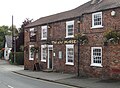 "The Bay Horse" in Cherry Burton - geograph.org.uk - 4675451.jpg 5,039 × 3,707; 5.22 MB
-
 'Snicket' in the Snow - geograph.org.uk - 1402611.jpg 640 × 482; 69 KB
-
 A bridge over the Hudson Way - geograph.org.uk - 826416.jpg 640 × 592; 360 KB
-
 A bridge over the Hudson Way - geograph.org.uk - 826449.jpg 640 × 433; 309 KB
-
 A1079 approaching the Cherry Burton junction - geograph.org.uk - 3166172.jpg 1,706 × 1,137; 364 KB
-
 A1079 at Gardham Cross Roads - geograph.org.uk - 5923774.jpg 1,024 × 734; 95 KB
-
 A1079 heading east - geograph.org.uk - 5923770.jpg 1,024 × 721; 157 KB
-
 A1079 near Furrows Farm - geograph.org.uk - 5923782.jpg 1,024 × 747; 87 KB
-
 A1079 toward Market Weighton - geograph.org.uk - 5054258.jpg 2,511 × 1,857; 1.32 MB
-
 A1079 towards Beverley - geograph.org.uk - 1861778.jpg 640 × 480; 62 KB
-
 A1079 towards Market Weighton - geograph.org.uk - 1861776.jpg 640 × 480; 65 KB
-

-
 Approach road to Bygot House Farm - geograph.org.uk - 4391088.jpg 4,608 × 3,454; 5.6 MB
-

-
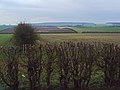
 Arable fields south of Highgate - geograph.org.uk - 5012774.jpg 4,528 × 3,346; 5.35 MB
-
 Arable fields southeast of Cherry Burton - geograph.org.uk - 1877084.jpg 2,816 × 2,112; 2.96 MB
-
 B1248 towards Beverley - geograph.org.uk - 1519270.jpg 640 × 480; 102 KB
-
 Bishop Burton Road - geograph.org.uk - 697925.jpg 640 × 469; 176 KB
-
 Bishop Burton Road, Cherry Burton - geograph.org.uk - 1422041.jpg 640 × 480; 91 KB
-
 Bishop Burton Road, Cherry Burton - geograph.org.uk - 5954187.jpg 1,024 × 826; 240 KB
-
 Bishop Burton Road, Cherry Burton - geograph.org.uk - 679592.jpg 640 × 476; 87 KB
-

-

-
 Bridge over the Hudson Way - geograph.org.uk - 683352.jpg 640 × 473; 175 KB
-

-
 Buildings at Low Gardham Farm - geograph.org.uk - 4926689.jpg 4,590 × 3,432; 5.21 MB
-
 Bygot House Farm Entrance - geograph.org.uk - 3235595.jpg 640 × 427; 234 KB
-
 C of E Primary School Cherry Burton.jpg 640 × 463; 104 KB
-
 Cherry Burton - geograph.org.uk - 5954188.jpg 1,024 × 768; 190 KB
-
 Cherry Burton - Road to Etton - geograph.org.uk - 97958.jpg 640 × 480; 116 KB
-
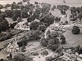 Cherry Burton c early 60s.JPG 2,430 × 1,800; 2.4 MB
-
 Cherry Burton Church - geograph.org.uk - 5954184.jpg 1,024 × 768; 151 KB
-
 Cherry Burton golf course - geograph.org.uk - 60166.jpg 640 × 480; 148 KB
-
 Cherry Burton Hall - geograph.org.uk - 4105158.jpg 1,024 × 768; 148 KB
-
 Cherry Burton Pond - geograph.org.uk - 1422066.jpg 640 × 480; 116 KB
-
 Cherry Burton Post Office - geograph.org.uk - 590220.jpg 640 × 480; 124 KB
-
 Cherry Burton UK parish locator map.svg 1,425 × 1,107; 1.68 MB
-
 Cherry Burton War Memorial - geograph.org.uk - 5461702.jpg 799 × 1,200; 520 KB
-
 Cherry Burton Wold - geograph.org.uk - 4530482.jpg 1,024 × 768; 158 KB
-
 Cherry Burton Wold - geograph.org.uk - 761404.jpg 640 × 480; 179 KB
-
 Cherry Burton Wold down to Gardham - geograph.org.uk - 4926657.jpg 3,803 × 2,709; 4.38 MB
-
-

-

-

-
 Cherry Burton-on-Sea - geograph.org.uk - 1402619.jpg 640 × 482; 121 KB
-
 Cherry Burton.jpg 640 × 480; 91 KB
-
 Cherry Sidings Picnic Area ^1 - geograph.org.uk - 2210249.jpg 800 × 600; 303 KB
-
 Cherry Sidings Picnic Area ^2 - geograph.org.uk - 2210258.jpg 800 × 600; 314 KB
-
 Close horizon - geograph.org.uk - 4845850.jpg 1,024 × 768; 132 KB
-
 Constitution Hill, Beverley - geograph.org.uk - 6233874.jpg 1,866 × 1,194; 1.24 MB
-
 Copse near the Hudson Way - geograph.org.uk - 59976.jpg 640 × 480; 120 KB
-
 Corner of a sheep field - geograph.org.uk - 2992804.jpg 3,872 × 2,592; 4.96 MB
-
 Country Lane passing Bygot House Farm - geograph.org.uk - 4391084.jpg 4,598 × 3,444; 5.88 MB
-
 Crossroads near Cherry Burton - geograph.org.uk - 2992824.jpg 3,872 × 2,592; 5.44 MB
-
 Cycle Path beside the B1248 - geograph.org.uk - 1543251.jpg 640 × 480; 98 KB
-
 Cycle Path towards Beverley - geograph.org.uk - 1543260.jpg 640 × 480; 95 KB
-
 Deepdale Plantation - geograph.org.uk - 1861777.jpg 640 × 480; 56 KB
-
 Deepdale Plantation, Bishop Burton - geograph.org.uk - 1197417.jpg 473 × 640; 167 KB
-
 Dog Kennel Lane roundabout - geograph.org.uk - 2460351.jpg 800 × 600; 150 KB
-
 Dog Kennel Lane Roundabout near Beverley - geograph.org.uk - 6233879.jpg 1,838 × 1,144; 1.05 MB
-
 Dunken Hill - geograph.org.uk - 1861772.jpg 640 × 480; 62 KB
-
 Dunken Hill Allotments - geograph.org.uk - 761381.jpg 480 × 640; 182 KB
-
 Dunkenhill Farm - geograph.org.uk - 99940.jpg 640 × 480; 138 KB
-
 Elm Drive in the Snow - geograph.org.uk - 1402606.jpg 640 × 482; 51 KB
-

-
 Entering Cherry Burton, East Yorkshire - geograph.org.uk - 2325337.jpg 800 × 600; 313 KB
-
 Entrance to Bygot House Farm - geograph.org.uk - 1422165.jpg 640 × 480; 112 KB
-
 Entrance to Cherry Burton Golf Club - geograph.org.uk - 1422088.jpg 640 × 480; 86 KB
-
 Entrance to Dunkenhill Farm - geograph.org.uk - 1422457.jpg 640 × 480; 82 KB
-
 Entrance to Leicester Lodge - geograph.org.uk - 1422082.jpg 640 × 480; 100 KB
-

-

-
 Etton Road goes over the Hudson Way - geograph.org.uk - 3940270.jpg 1,600 × 1,064; 630 KB
-
 Farmland along the Hudson Way - geograph.org.uk - 813983.jpg 640 × 478; 234 KB
-

-
 Farmland near Furrows Farm - geograph.org.uk - 1861775.jpg 640 × 480; 62 KB
-
 Farmland near Grange Farm - geograph.org.uk - 1861773.jpg 640 × 480; 45 KB
-
 Farmland north of Rootas Lane, Etton - geograph.org.uk - 5712053.jpg 1,600 × 1,065; 645 KB
-
 Field on the edge of Cherry Burton - geograph.org.uk - 4105186.jpg 1,024 × 768; 159 KB
-
 Field track down into Gardham Warren - geograph.org.uk - 4926672.jpg 4,514 × 3,326; 6.66 MB
-

-
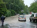
 Flooding - June 2007.JPG 2,816 × 2,120; 813 KB
-
 Footbridge on the path - geograph.org.uk - 6133259.jpg 1,024 × 768; 264 KB
-
 Footpath near Cherry Burton - geograph.org.uk - 1422510.jpg 640 × 480; 130 KB
-
 Footpath to Leconfield - geograph.org.uk - 1519285.jpg 640 × 480; 58 KB
-
 Footpath to Leconfield - geograph.org.uk - 813990.jpg 640 × 478; 246 KB
-
 Footpath to the old railway - geograph.org.uk - 4851813.jpg 1,024 × 768; 332 KB
-
 Former farmhouse, Main Street, Cherry Burton - geograph.org.uk - 4105176.jpg 1,024 × 768; 186 KB
-
 Former York to Beverley Railway - geograph.org.uk - 1519278.jpg 640 × 480; 114 KB
-
 From Rail Trail to Rose Cottage Farm - geograph.org.uk - 5347551.jpg 4,000 × 3,000; 4.28 MB
-
 Gardham Crossroads - geograph.org.uk - 3670102.jpg 640 × 427; 49 KB
-
 Gardham Crossroads A1079 - geograph.org.uk - 3166178.jpg 2,560 × 1,920; 1.76 MB
-
 Grange Farm - geograph.org.uk - 99939.jpg 640 × 480; 132 KB
-
 Highgate toward the A1079 - geograph.org.uk - 3187413.jpg 2,560 × 1,920; 1.74 MB
-
 Highgate toward the A1079 York Road - geograph.org.uk - 5012788.jpg 4,608 × 3,456; 4.35 MB
-
 Highgate towards Cherry Burton - geograph.org.uk - 2389789.jpg 800 × 600; 255 KB
-
 Highgate, Cherry Burton - geograph.org.uk - 1422475.jpg 640 × 480; 67 KB
-
 Highgate, Cherry Burton - geograph.org.uk - 4339206.jpg 640 × 427; 55 KB
-
 Highgate, Cherry Burton - geograph.org.uk - 761536.jpg 640 × 480; 211 KB
-
 Highgate, near Cherry Burton - geograph.org.uk - 761390.jpg 480 × 640; 193 KB
-
 Hudson Way (Disused Railway) - geograph.org.uk - 1543235.jpg 640 × 480; 108 KB
-
 Hudson Way crosses the B1248 - geograph.org.uk - 3940284.jpg 1,600 × 1,064; 833 KB
-
 Hudson Way near Cherry Burton - geograph.org.uk - 813981.jpg 478 × 640; 277 KB
-
 Hudson Way towards Beverley - geograph.org.uk - 3940274.jpg 1,600 × 1,064; 835 KB
-
 Hudson Way towards Beverley - geograph.org.uk - 3940281.jpg 1,600 × 1,064; 828 KB
-
 Hudson Way towards Beverley - geograph.org.uk - 3940340.jpg 1,600 × 1,064; 900 KB
-
 Hudson Way towards Beverley - geograph.org.uk - 3940347.jpg 1,600 × 1,064; 823 KB
-
 Humpback Bridge over Disused Railway - geograph.org.uk - 1543240.jpg 640 × 480; 50 KB
-

-

-

-
 Land drain near Cherry Burton - geograph.org.uk - 683456.jpg 462 × 640; 160 KB
-
 Lane from Miles Lane to the B1248 - geograph.org.uk - 4339408.jpg 640 × 427; 74 KB
-
 Leaving Cherry Burton along Highgate - geograph.org.uk - 3187404.jpg 2,560 × 1,920; 1.98 MB
-
 Low Gardham Farm - geograph.org.uk - 5842346.jpg 1,024 × 768; 184 KB
-
 Main road ahead - geograph.org.uk - 4391101.jpg 4,560 × 3,392; 4.31 MB
-

-
 Main Street, Cherry Burton - geograph.org.uk - 683337.jpg 640 × 480; 192 KB
-
 Miles Lane towards Leconfield - geograph.org.uk - 2460359.jpg 800 × 600; 204 KB
-
 Mill Farm near Etton - geograph.org.uk - 3940266.jpg 1,600 × 1,064; 430 KB
-
 Mill Farm, Etton - geograph.org.uk - 4277181.jpg 1,024 × 768; 222 KB
-
 Minor road junction - geograph.org.uk - 1422137.jpg 640 × 454; 55 KB
-
 Minor road junction from Miles Lane - geograph.org.uk - 4391063.jpg 4,608 × 3,454; 4.59 MB
-
 Minor road through Gardham Gap - geograph.org.uk - 4926636.jpg 4,608 × 3,456; 6.34 MB
-
 Minor road to Gardham - geograph.org.uk - 4926683.jpg 3,757 × 2,815; 3.78 MB
-
 Minor road to Gardham Gap and on to the A1079(T) - geograph.org.uk - 4926630.jpg 4,608 × 3,456; 6.88 MB
-
 Minor Road Towards Leconfield - geograph.org.uk - 1519271.jpg 640 × 480; 63 KB
-
 Mole hills near Dunkenhill Farm - geograph.org.uk - 4339176.jpg 640 × 427; 52 KB
-

-

-

-
 Near Bygot House Farm - geograph.org.uk - 110533.jpg 640 × 480; 128 KB
-
 New houses on the edge of Cherry Burton - geograph.org.uk - 4391159.jpg 3,879 × 2,568; 3.13 MB
-
 New Road Scheme on the B1248 - geograph.org.uk - 64056.jpg 640 × 465; 77 KB
-

-
 Old windmill at Mill Farm - geograph.org.uk - 5954189.jpg 1,024 × 768; 223 KB
-
 On Bishop Burton Road, Cherry Burton - geograph.org.uk - 4675453.jpg 4,803 × 3,495; 4.59 MB
-
 On Cherry Burton Wold - geograph.org.uk - 5682431.jpg 1,024 × 686; 189 KB
-
 Only another 3 miles to Beverley - geograph.org.uk - 2210243.jpg 800 × 600; 344 KB
-
 Park Farmhouse - geograph.org.uk - 4105183.jpg 1,024 × 768; 215 KB
-
 Parkland by the Hall, Cherry Burton - geograph.org.uk - 4339256.jpg 640 × 427; 113 KB
-
 Path to the lych gate - Cherry Burton Church - geograph.org.uk - 4675448.jpg 4,895 × 3,701; 5.03 MB
-
 Pump in Highgate, Cherry Burton - geograph.org.uk - 4339222.jpg 427 × 640; 86 KB
-
 Raventhorpe Nursery from Mile lane - geograph.org.uk - 4339404.jpg 640 × 427; 45 KB
-
 Raventhorpe Nursery, by Bygot Wood - geograph.org.uk - 4339394.jpg 640 × 427; 54 KB
-
 Rectory Barn - geograph.org.uk - 4105166.jpg 1,024 × 768; 259 KB
-

-
 Road to Cherry Burton - geograph.org.uk - 99919.jpg 640 × 480; 120 KB
-
 Road to Grange Farm - geograph.org.uk - 6260733.jpg 1,024 × 768; 172 KB
-
 Road to Leconfield - geograph.org.uk - 82190.jpg 640 × 480; 141 KB
-

-
 Rose Lane towards Rose Cottage Farm - geograph.org.uk - 5953157.jpg 1,600 × 1,064; 520 KB
-
 Safely gathered in^ - geograph.org.uk - 1422120.jpg 640 × 480; 69 KB
-
 Sewage works - geograph.org.uk - 235327.jpg 640 × 458; 113 KB
-
 Sharp bend, A1035 - geograph.org.uk - 5358624.jpg 640 × 426; 34 KB
-
 Sheep and Cherry Burton Hall - geograph.org.uk - 2992795.jpg 3,872 × 2,592; 4.4 MB
-
 Sheep grazing near Cherry Burton - geograph.org.uk - 2992799.jpg 3,872 × 2,592; 4.75 MB
-
 Sign for the Bay Horse, Cherry Burton - geograph.org.uk - 590168.jpg 640 × 480; 75 KB
-
 Silted pond - geograph.org.uk - 4845855.jpg 1,024 × 768; 363 KB
-
 South-west of Cherry Burton - geograph.org.uk - 697942.jpg 640 × 480; 188 KB
-
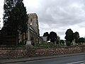
 St Michael and All Angels church, Cherry Burton - geograph.org.uk - 5783967.jpg 2,592 × 1,944; 1.42 MB
-

-
 St Michael ^ All Angels' Church, Cherry Burton - geograph.org.uk - 5467211.jpg 799 × 1,200; 235 KB
-
 Step this way^ - geograph.org.uk - 1422108.jpg 480 × 640; 135 KB
-
 Steps down to B1248 - geograph.org.uk - 5347573.jpg 3,980 × 2,974; 5.9 MB
-
 Steps up from rail trail - geograph.org.uk - 5347529.jpg 1,728 × 2,304; 2.78 MB
-
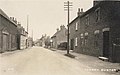
 Street Scene, Cherry Burton - geograph.org.uk - 590150.jpg 640 × 480; 84 KB
-
 The (frozen) pond in Cherry Burton - geograph.org.uk - 4339244.jpg 640 × 427; 54 KB
-
 The A1079 towards Beverley and Hull - geograph.org.uk - 2460581.jpg 800 × 600; 262 KB
-
 The A1079 towards Beverley and Hull - geograph.org.uk - 2460585.jpg 800 × 600; 175 KB
-
 The B1248 road to Cherry Burton - geograph.org.uk - 238067.jpg 640 × 480; 130 KB
-
 The Bay Horse, Cherry Burton - geograph.org.uk - 1422055.jpg 640 × 480; 75 KB
-
 The Bay Horse, Cherry Burton - geograph.org.uk - 590161.jpg 640 × 480; 100 KB
-
 The Bay Horse, Cherry Burton - geograph.org.uk - 679603.jpg 640 × 480; 84 KB
-

-
 The former Cherry Burton Train Station - geograph.org.uk - 3940319.jpg 1,600 × 1,064; 922 KB
-
 The former Cherry Burton Train Station - geograph.org.uk - 3940325.jpg 1,600 × 1,064; 888 KB
-
 The Hudson Way - geograph.org.uk - 5964336.jpg 1,024 × 768; 227 KB
-
 The Hudson Way at the B1248 - geograph.org.uk - 3940288.jpg 1,600 × 1,064; 945 KB
-
 The Hudson Way near Cherry Burton - geograph.org.uk - 1422099.jpg 480 × 640; 126 KB
-
 The Hudson Way near Cherry Burton - geograph.org.uk - 3940292.jpg 1,600 × 1,064; 854 KB
-
 The Hudson Way near Raventhorpe - geograph.org.uk - 4790188.jpg 1,024 × 768; 229 KB
-
 The Meadows, Cherry Burton - geograph.org.uk - 697909.jpg 640 × 480; 150 KB
-
 The rail bridge on Etton Road - geograph.org.uk - 2325346.jpg 800 × 600; 216 KB
-
 The Rectory Barn - Cherry Burton - geograph.org.uk - 4675449.jpg 4,979 × 3,616; 4.44 MB
-
 The view from Highgate - geograph.org.uk - 761370.jpg 640 × 480; 188 KB
-
 The Village Pond, Cherry Burton - geograph.org.uk - 698866.jpg 480 × 640; 81 KB
-

-

-
 The western edge of Wold Plantation - geograph.org.uk - 4530451.jpg 1,024 × 768; 94 KB
-
 The York to Beverley Railway, Raventhorpe - geograph.org.uk - 781562.jpg 456 × 640; 177 KB
-
 Toward Cherry Burton crossroad on B1248 - geograph.org.uk - 1877075.jpg 2,297 × 1,866; 1.88 MB
-
 Towards Parkhouse Farm - geograph.org.uk - 683501.jpg 640 × 518; 176 KB
-
 Towards Raventhorpe Village - geograph.org.uk - 813978.jpg 640 × 478; 236 KB
-
 Track to Dunkenhill Farm - geograph.org.uk - 1861771.jpg 640 × 480; 69 KB
-
 Track to Grange Farm - geograph.org.uk - 1422453.jpg 640 × 480; 74 KB
-
 Track to Grange Farm - geograph.org.uk - 1861774.jpg 640 × 480; 42 KB
-
 Track to sewage works - geograph.org.uk - 1861764.jpg 640 × 480; 62 KB
-
 Track towards Leconfield - geograph.org.uk - 826465.jpg 640 × 370; 175 KB


_(26273226982).jpg)


_-_geograph.org.uk_-_1543235.jpg)


_on_the_pond_in_Cherry_Burton_-_geograph.org.uk_-_4339246.jpg)


_-_geograph.org.uk_-_4926630.jpg)


_pond_in_Cherry_Burton_-_geograph.org.uk_-_4339244.jpg)


