Category:Chesterfield County, Virginia
Counties of Virginia: Accomack · Albemarle · Alleghany · Amelia · Amherst · Appomattox · Arlington · Augusta · Bath · Bedford · Bland · Botetourt · Brunswick · Buchanan · Buckingham · Campbell · Caroline · Carroll · Charles City · Charlotte · Chesterfield · Clarke · Craig · Culpeper · Cumberland · Dickenson · Dinwiddie · Essex · Fairfax · Fauquier · Floyd · Fluvanna · Franklin · Frederick · Giles · Gloucester · Goochland · Grayson · Greene · Greensville · Halifax · Hanover · Henrico · Henry · Highland · Isle of Wight · James City · King and Queen · King George · King William · Lancaster · Lee · Loudoun · Louisa · Lunenburg · Madison · Mathews · Mecklenburg · Middlesex · Montgomery · Nelson · New Kent · Northampton · Northumberland · Nottoway · Orange · Page · Patrick · Pittsylvania · Powhatan · Prince Edward · Prince George · Prince William · Pulaski · Rappahannock · Richmond · Roanoke · Rockbridge · Rockingham · Russell · Scott · Shenandoah · Smyth · Southampton · Spotsylvania · Stafford · Surry · Sussex · Tazewell · Warren · Washington · Westmoreland · Wise · Wythe · York
county in Virginia, United States   | |||||
| Upload media | |||||
| Instance of | |||||
|---|---|---|---|---|---|
| Named after | |||||
| Location | Virginia | ||||
| Capital | |||||
| Inception |
| ||||
| Population |
| ||||
| Area |
| ||||
| Different from | |||||
| official website | |||||
 | |||||
Subcategories
This category has the following 16 subcategories, out of 16 total.
B
C
- Chesterfield Railroad (7 F)
D
F
H
- Hatcher Island Bridge (1 F)
- Henricus Historical Park (5 F)
J
- Jones' Landing, Virginia (15 F)
M
P
R
S
Media in category "Chesterfield County, Virginia"
The following 28 files are in this category, out of 28 total.
-
 102nd Chesterfield County Fair! (20834568078).jpg 4,816 × 2,709; 21.72 MB
-
-
 Bermuda, VA, USA - panoramio (2).jpg 3,872 × 2,592; 3.25 MB
-
 Bermuda, VA, USA - panoramio (3).jpg 3,872 × 2,592; 3.45 MB
-
 Bermuda, VA, USA - panoramio (4).jpg 3,872 × 2,592; 3.93 MB
-
 Bermuda, VA, USA - panoramio.jpg 3,872 × 2,592; 3.75 MB
-
 Brighthope Railway Engine.jpg 1,024 × 691; 94 KB
-
 Catocala piatrix 94301716.jpg 2,048 × 1,369; 578 KB
-
 Chesterfield County Airport Runway.jpg 3,071 × 1,622; 905 KB
-
 Chesterfield County Airport.jpg 2,935 × 2,201; 1.54 MB
-
 Chesterfield County Board of Supervisors 2021.svg 360 × 185; 1 KB
-
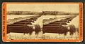
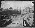 Dutch Gap Canal, James River, Va - NARA - 526202.jpg 3,000 × 2,409; 2.11 MB
-
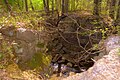
 Eastern Abutment of the Bright Hope Railroad Bridge over Swift Creek.jpg 3,648 × 2,736; 2.2 MB
-
 Grove Shaft.JPG 3,264 × 2,448; 2.93 MB
-
 Mount Nebo Baptist Church Cemetery.jpg 2,560 × 1,459; 2.16 MB
-
 Northern Chesterfield Railroads, 1837.png 2,240 × 806; 2.32 MB
-
 Penguin - panoramio (2).jpg 2,048 × 1,536; 580 KB
-
 Powhitecreek1969.jpg 1,060 × 1,057; 1.3 MB
-
-

-
 USA Chesterfield County, Virginia age pyramid.svg 520 × 600; 8 KB
-
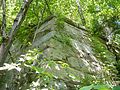
 Western Abutment of the Bridge at Falling Creek of Chesterfield Railroad.jpg 4,948 × 3,280; 3.27 MB
-
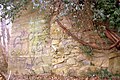
 Western Abutment of the Bright Hope Railroad Bridge over Swift Creek.jpg 3,648 × 2,736; 3.45 MB
-
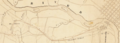
 Western Chesterfield County, Va. – 1864.jpg 3,150 × 2,035; 1.23 MB
-
 Westham Bridge - Close Up of South Pylon.jpg 4,948 × 3,280; 3.08 MB
-
 Westham Bridge - View of North Pylon from South Pylon.jpg 4,948 × 3,280; 3.6 MB
-

-
.jpg)

.jpg)
.jpg)
.jpg)


.jpg)

.jpg)


