Category:Chetwode
Cymraeg: Pentref yng ngorllewin Swydd Buckingham, Lloegr. ar y ffin â Swydd Rhydychen. Fe'i lleolir 6km (4 milltir) i'r gorllewin i Buckingham.
English: Category:Villages in Buckinghamshire
village in Aylesbury Vale, Buckinghamshire, United Kingdom Mar2006.jpg) | |||||
| Upload media | |||||
| Instance of | |||||
|---|---|---|---|---|---|
| Location | Buckinghamshire, South East England, England | ||||
 | |||||
Subcategories
This category has only the following subcategory.
Media in category "Chetwode"
The following 48 files are in this category, out of 48 total.
-
 Barn, near Chetwode - geograph.org.uk - 1045964.jpg 640 × 382; 46 KB
-
 Bernwood Jubilee Way - geograph.org.uk - 5346973.jpg 640 × 640; 107 KB
-
 Bernwood Jubilee Way - geograph.org.uk - 5346977.jpg 640 × 640; 111 KB
-

-
 Bridge over the former Great Central Railway - geograph.org.uk - 4414016.jpg 1,500 × 999; 284 KB
-
 Bridleway to Godington - geograph.org.uk - 5038627.jpg 1,600 × 1,066; 452 KB
-
 Bridleway to Godington - geograph.org.uk - 5038630.jpg 1,600 × 1,066; 355 KB
-
 Casemore Farm - geograph.org.uk - 135004.jpg 640 × 480; 94 KB
-
 Chetwode Bus Shelter^ - geograph.org.uk - 393435.jpg 640 × 427; 134 KB
-
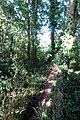 Footpath goes through the trees - geograph.org.uk - 5038603.jpg 1,066 × 1,600; 646 KB
-
 Footpath into Chetwode - geograph.org.uk - 5038620.jpg 1,066 × 1,600; 562 KB
-
 Footpath off the lane to Preston Bissett - geograph.org.uk - 5038624.jpg 1,600 × 1,066; 548 KB
-
 Footpath to Chetwode - geograph.org.uk - 2181015.jpg 640 × 480; 103 KB
-
 Footpath to Chetwode - geograph.org.uk - 4414023.jpg 1,500 × 999; 268 KB
-
 Footpath to Chetwode Grange - geograph.org.uk - 5038605.jpg 1,600 × 1,066; 547 KB
-
 Footpath to Chetwode Moats - geograph.org.uk - 5038655.jpg 1,600 × 1,066; 341 KB
-
 Footpath to Newton Purcell - geograph.org.uk - 4414017.jpg 1,500 × 999; 287 KB
-
 Footpath to Preston Bissett - geograph.org.uk - 4414019.jpg 999 × 1,500; 481 KB
-
 Lane goes over the disused railway - geograph.org.uk - 5038616.jpg 1,600 × 1,066; 527 KB
-
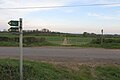
 Lane towards Tingewick - geograph.org.uk - 5216059.jpg 640 × 428; 186 KB
-
 Lane towards Tingewick - geograph.org.uk - 5216066.jpg 640 × 480; 189 KB
-
 Nearing Chetwode - geograph.org.uk - 715379.jpg 640 × 425; 73 KB
-

-
 Overgrown trackbed near Chetwode - geograph.org.uk - 4414014.jpg 1,500 × 999; 496 KB
-
 Path to Chetwode - geograph.org.uk - 5038619.jpg 1,600 × 1,066; 299 KB
-
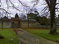
 Priory churchyard - geograph.org.uk - 5038652.jpg 1,600 × 1,066; 459 KB
-
 Road towards Tingewick - geograph.org.uk - 5216072.jpg 640 × 428; 120 KB
-
 St Mary and St Nicholas, Chetwode - geograph.org.uk - 5609223.jpg 640 × 360; 54 KB
-
 St Mary and St Nicholas, Chetwode - geograph.org.uk - 5609402.jpg 640 × 360; 57 KB
-
 St Mary ^ St Nicholas Priory Church - geograph.org.uk - 5038651.jpg 1,600 × 1,071; 345 KB
-
 Stables at Priory House - geograph.org.uk - 1045988.jpg 640 × 480; 114 KB
-
 Sunflower Cottage - geograph.org.uk - 715389.jpg 640 × 425; 69 KB
-
 The Bernwood Way crosses the road - geograph.org.uk - 4940745.jpg 1,600 × 1,066; 285 KB
-
 The road to Tingewick - geograph.org.uk - 4414021.jpg 1,500 × 999; 139 KB
-
 The road to Tingewick - geograph.org.uk - 4414024.jpg 1,500 × 999; 117 KB
-
 The road to Tingewick - geograph.org.uk - 4414026.jpg 1,500 × 999; 132 KB
-
 Towards Manthorn Farm - geograph.org.uk - 5346980.jpg 640 × 640; 91 KB
-

-
 View into the north chapel - geograph.org.uk - 5609387.jpg 640 × 360; 40 KB
-
 Farmland near Chetwode - geograph.org.uk - 136591.jpg 640 × 480; 77 KB
-
 Field of wheat near Chetwode - geograph.org.uk - 463050.jpg 640 × 480; 71 KB
-
 Former railway line at Chetwode - geograph.org.uk - 135001.jpg 640 × 480; 76 KB
-
 Heading for Chetwode - geograph.org.uk - 715368.jpg 640 × 425; 81 KB
-
 Road near Barton Hartshorn - geograph.org.uk - 393415.jpg 640 × 443; 100 KB
-
 Rosehill Farm, Chetwode - geograph.org.uk - 463053.jpg 640 × 480; 57 KB
-
 The mill stream - geograph.org.uk - 559650.jpg 640 × 480; 115 KB
-
 The Old Mill - geograph.org.uk - 398467.jpg 640 × 480; 94 KB
-


