Category:Chigwell
town and civil parish in Epping Forest, Essex, UK  | |||||
| Upload media | |||||
| Instance of | |||||
|---|---|---|---|---|---|
| Location | Epping Forest, Essex, East of England, England | ||||
| Area |
| ||||
| Said to be the same as | Chigwell (Wikimedia duplicated page, civil parish) | ||||
| official website | |||||
 | |||||
Subcategories
This category has the following 12 subcategories, out of 12 total.
C
- Chigwell Hall (1 F)
- Chigwell Meadow (6 F)
G
- Grange Court, Chigwell (1 F)
H
- Hainault Forest Country Park (53 F)
- Samuel Harsnett (6 F)
M
O
- Ye Olde Kings Head, Chigwell (4 F)
Media in category "Chigwell"
The following 200 files are in this category, out of 376 total.
(previous page) (next page)-
 'Closed' section of Pudding Lane - geograph.org.uk - 5274557.jpg 640 × 480; 151 KB
-
 A brown field - geograph.org.uk - 5274013.jpg 640 × 480; 119 KB
-
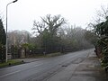
 A foggy and icy Vicarage Lane - geograph.org.uk - 5264923.jpg 4,000 × 3,000; 5.01 MB
-
 A foggy morning near Grange Hill station - geograph.org.uk - 5264460.jpg 3,285 × 2,463; 1.34 MB
-
 A foggy morning near Grange Hill station - geograph.org.uk - 5264462.jpg 3,389 × 2,541; 1.28 MB
-
 A foggy morning on the Central line near Grange Hill station - geograph.org.uk - 5264466.jpg 4,000 × 3,000; 4.65 MB
-
 A foggy morning on the Central line near Grange Hill station - geograph.org.uk - 5264467.jpg 3,531 × 2,647; 1.44 MB
-

-

-

-
 A long exposure of M11 traffic from the Chigwell Rise bridge - geograph.org.uk - 4237070.jpg 3,872 × 2,592; 1.51 MB
-

-
 A long exposure of traffic on Chigwell Rise - geograph.org.uk - 4237083.jpg 3,872 × 2,592; 2.19 MB
-
 A long exposure of traffic on Chigwell Rise ^2 - geograph.org.uk - 4237089.jpg 3,872 × 2,592; 2.65 MB
-
 A long exposure of traffic on Chigwell Rise ^3 - geograph.org.uk - 4237099.jpg 3,872 × 2,592; 1.85 MB
-
 A long exposure of traffic on Chigwell Rise ^4 - geograph.org.uk - 4237108.jpg 1,600 × 1,071; 294 KB
-
 A misty Manor Road - geograph.org.uk - 5264981.jpg 4,000 × 3,000; 4.84 MB
-
 A Nice Path Anyway - geograph.org.uk - 3944768.jpg 640 × 575; 198 KB
-
 A113 near Chigwell - geograph.org.uk - 6240885.jpg 1,024 × 768; 165 KB
-
 Abridge Road near Chigwell - geograph.org.uk - 6240889.jpg 1,024 × 768; 318 KB
-
 Abridge Road, Chigwell - geograph.org.uk - 5713309.jpg 1,960 × 1,412; 1.21 MB
-
 Abridge Road, near Abridge - geograph.org.uk - 6240907.jpg 1,024 × 768; 290 KB
-
 All Saints Churchyard, Chigwell Row - geograph.org.uk - 5504195.jpg 4,000 × 3,000; 4.92 MB
-
 All Saints, Chigwell Row - geograph.org.uk - 5504191.jpg 4,000 × 3,000; 4.6 MB
-
 Alongside Chigwell Brook - geograph.org.uk - 5274209.jpg 4,000 × 3,000; 5.19 MB
-
 Alongside High Road, Chigwell - geograph.org.uk - 5305322.jpg 4,000 × 3,000; 4.64 MB
-
 An 'anault Pond - geograph.org.uk - 2126794.jpg 640 × 429; 117 KB
-
 Autumn Colours and River Roding - geograph.org.uk - 2710822.jpg 640 × 429; 75 KB
-
 Big old house, Chigwell Row - geograph.org.uk - 4431710.jpg 1,600 × 1,188; 386 KB
-
 Boot sale site, Chigwell - geograph.org.uk - 4797479.jpg 640 × 480; 132 KB
-
 Brown field and small wood - geograph.org.uk - 5274035.jpg 640 × 480; 138 KB
-
 Brunel Road, Woodford - geograph.org.uk - 5590076.jpg 2,048 × 1,536; 1.49 MB
-
 Building site off Grange Farm Lane - geograph.org.uk - 4798415.jpg 640 × 480; 117 KB
-
 Bus stop on Roding Lane, Chigwell - geograph.org.uk - 6017763.jpg 1,920 × 1,280; 564 KB
-
 Car boot sale, Chigwell Rise - geograph.org.uk - 4190968.jpg 4,320 × 3,240; 5.68 MB
-
 Central line at Chigwell - geograph.org.uk - 2381966.jpg 4,320 × 3,240; 4.59 MB
-
 Central Line tracks at Chigwell - geograph.org.uk - 6240857.jpg 1,024 × 768; 267 KB
-
 Central Line tunnel, Grange Hill - geograph.org.uk - 3391603.jpg 640 × 480; 178 KB
-
 Central Line west of Chigwell station - geograph.org.uk - 4797455.jpg 640 × 480; 166 KB
-
 Chapel, Chigwell Row - geograph.org.uk - 3402743.jpg 640 × 480; 171 KB
-
-
 Chigwell , London Underground station platform - geograph.org.uk - 6026191.jpg 1,067 × 1,600; 357 KB
-
 Chigwell church - geograph.org.uk - 4797543.jpg 480 × 640; 121 KB
-
 Chigwell essex 1961.png 1,200 × 943; 44 KB
-
 Chigwell MMB 01 Central Line 1992 Stock.jpg 3,756 × 2,775; 3.36 MB
-
 Chigwell MMB 02 Central Line 1992 Stock.jpg 4,167 × 2,718; 3.45 MB
-
 Chigwell Park - geograph.org.uk - 2389903.jpg 640 × 480; 76 KB
-
 Chigwell Park, Chigwell - geograph.org.uk - 2381959.jpg 4,320 × 3,240; 4.72 MB
-
 Chigwell Row , former United Reformed Church - geograph.org.uk - 6053491.jpg 1,067 × 1,600; 662 KB
-
 Chigwell Row , former United Reformed Church - geograph.org.uk - 6053495.jpg 1,067 × 1,600; 528 KB
-
 Chigwell Row Wood - geograph.org.uk - 2127027.jpg 640 × 429; 80 KB
-

-
 Chigwell Row, The Three Forests Way - geograph.org.uk - 2393426.jpg 640 × 480; 86 KB
-
 Chigwell School - geograph.org.uk - 4431492.jpg 4,000 × 3,000; 2.9 MB
-
 Chigwell School - geograph.org.uk - 4797524.jpg 640 × 480; 112 KB
-
 Chigwell School - geograph.org.uk - 4797603.jpg 640 × 428; 148 KB
-
 Chigwell Station - geograph.org.uk - 6240854.jpg 1,024 × 768; 157 KB
-
 Chigwell Underground station, Essex - geograph.org.uk - 5902264.jpg 1,600 × 1,200; 489 KB
-
 Chigwell Village Sign - geograph.org.uk - 4431459.jpg 3,688 × 3,000; 2.12 MB
-
 Chigwell Water Treatment Works - geograph.org.uk - 4431663.jpg 3,952 × 2,464; 2.23 MB
-
 Chigwell, Central Line - geograph.org.uk - 2389967.jpg 640 × 480; 107 KB
-
 Chigwell, Former Grange Farm house - geograph.org.uk - 961589.jpg 640 × 480; 134 KB
-

-

-
 Chigwell, The War Memorial - geograph.org.uk - 2389076.jpg 640 × 480; 73 KB
-
 Circular reservoir near Chigwell Row - geograph.org.uk - 250864.jpg 640 × 479; 73 KB
-
 Cottages, Manor Road, Grange Hill - geograph.org.uk - 3391597.jpg 640 × 480; 201 KB
-
 Dead tree in Chigwell Row Wood - geograph.org.uk - 5185783.jpg 1,600 × 1,600; 1.53 MB
-
 Deflated sports dome - geograph.org.uk - 4332201.jpg 640 × 480; 68 KB
-
 Dickens Cottage, Chigwell - geograph.org.uk - 5713311.jpg 1,960 × 1,412; 1.1 MB
-
 Dog on Green Lane - geograph.org.uk - 4431482.jpg 3,624 × 2,588; 2.16 MB
-
 Driveway near Chigwell - geograph.org.uk - 6240881.jpg 1,024 × 768; 248 KB
-
 Dry stream in Chigwell Row Wood - geograph.org.uk - 5185779.jpg 1,600 × 989; 826 KB
-

-
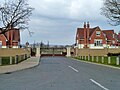
 Entrance gates near Chigwell - geograph.org.uk - 99293.jpg 640 × 480; 129 KB
-
 Entrance to Chigwell Grange - geograph.org.uk - 4798366.jpg 640 × 480; 115 KB
-
 Entrance to Repton Park - geograph.org.uk - 5264992.jpg 4,000 × 3,000; 4.42 MB
-
 Evening Light on the River Roding - geograph.org.uk - 2710828.jpg 429 × 640; 61 KB
-
 Fabulous Fungus^ - geograph.org.uk - 255723.jpg 426 × 640; 127 KB
-
 Felled tree near path junction - geograph.org.uk - 2922888.jpg 3,648 × 2,257; 4.98 MB
-
 Fencepiece Road - geograph.org.uk - 1480021.jpg 640 × 480; 91 KB
-
 Fencepiece Road, Chigwell - geograph.org.uk - 5404825.jpg 640 × 480; 100 KB
-
 Field corner pond - geograph.org.uk - 3402774.jpg 640 × 480; 185 KB
-
 Field near River Roding and M11 - geograph.org.uk - 99290.jpg 640 × 480; 64 KB
-
 Footbridge in Chigwell Row Wood - geograph.org.uk - 2127062.jpg 435 × 640; 144 KB
-
 Footbridge over Chigwell Brook - geograph.org.uk - 5274199.jpg 4,000 × 3,000; 4.81 MB
-
 Footbridge over Chigwell Brook - geograph.org.uk - 5274202.jpg 4,000 × 3,000; 4.83 MB
-
 Footbridge over River Roding - geograph.org.uk - 4800369.jpg 640 × 480; 120 KB
-
 Footpath From Marchings Farm - geograph.org.uk - 255579.jpg 532 × 800; 133 KB
-
 Footpath junction north of Chigwell Row - geograph.org.uk - 5273922.jpg 640 × 480; 182 KB
-
 Footpath marker, but footpath^ - geograph.org.uk - 5274115.jpg 640 × 480; 212 KB
-
 Footpath near Grange Hill station - geograph.org.uk - 5264944.jpg 4,000 × 3,000; 4.75 MB
-
 Footpath near Pettitts Hall - geograph.org.uk - 5274102.jpg 640 × 480; 171 KB
-

-
 Footpath north of Chigwell Row - geograph.org.uk - 5273909.jpg 640 × 480; 139 KB
-
 Footpath north of Chigwell Row - geograph.org.uk - 5273913.jpg 640 × 480; 144 KB
-

-
 Gate on Grange Farm Lane - geograph.org.uk - 4798395.jpg 640 × 480; 169 KB
-
 Grange Farm Lane - geograph.org.uk - 3947624.jpg 632 × 640; 229 KB
-
 Grange Farm Lane - geograph.org.uk - 4800271.jpg 640 × 480; 179 KB
-
 Grange Hill Underground station, Essex - geograph.org.uk - 5902411.jpg 1,600 × 1,200; 481 KB
-
 Grange Hill Underground station, Essex - geograph.org.uk - 5902425.jpg 1,600 × 1,200; 409 KB
-

-

-
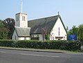 Grange Hill, St Winifred's Church - geograph.org.uk - 2391730.jpg 640 × 485; 62 KB
-

-
 Graveyard, Chigwell - geograph.org.uk - 3391526.jpg 640 × 480; 200 KB
-
 Green Lane, Chigwell - geograph.org.uk - 4431496.jpg 3,224 × 2,584; 1.63 MB
-
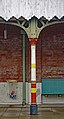
 Green phone box - geograph.org.uk - 3149619.jpg 640 × 480; 116 KB
-

-
 Hainault Forest and Common Fields - geograph.org.uk - 2923212.jpg 3,648 × 2,255; 2.05 MB
-
 Hainault Forest Country Park - geograph.org.uk - 5504165.jpg 4,000 × 3,000; 4.81 MB
-
 Hainault Forest Tree Sculpture (1) - geograph.org.uk - 2923457.jpg 2,358 × 2,358; 3.05 MB
-
 Hainault Forest Tree Sculpture (2) - geograph.org.uk - 2923464.jpg 2,736 × 3,648; 5.21 MB
-
 Hainault Forest Tree Sculpture (3) - geograph.org.uk - 2923472.jpg 2,736 × 2,736; 3.87 MB
-
 Hainault Forest Tree Sculpture (4) - geograph.org.uk - 2923476.jpg 2,180 × 2,180; 2.64 MB
-
 Hainault Forest Tree Sculpture (5) - geograph.org.uk - 2923479.jpg 1,735 × 2,314; 2.13 MB
-
 Hainault Forest Tree Sculpture (6) - geograph.org.uk - 2923481.jpg 2,602 × 3,036; 4.66 MB
-
 Hainult Forest by Lambourne Road - geograph.org.uk - 3660417.jpg 1,600 × 1,064; 319 KB
-
 Hay bales and planted trees - geograph.org.uk - 5273930.jpg 640 × 480; 111 KB
-
 Heading south on Three Forests Way - geograph.org.uk - 2923249.jpg 3,648 × 2,255; 4.99 MB
-
 Hedgerow near Pettitts Hall - geograph.org.uk - 5274142.jpg 640 × 480; 135 KB
-
 Hedgerow trees - geograph.org.uk - 5274106.jpg 640 × 480; 124 KB
-
 Hidden bungalow on Turpin's Lane, Woodford - geograph.org.uk - 5590083.jpg 2,048 × 1,536; 1.52 MB
-
 High Road, Chigwell - geograph.org.uk - 2381962.jpg 4,320 × 3,240; 4.59 MB
-
 High Road, Chigwell - geograph.org.uk - 5274215.jpg 3,903 × 2,927; 2.99 MB
-
 High Road, Chigwell - geograph.org.uk - 5305337.jpg 4,000 × 3,000; 5.11 MB
-
 High Road, Chigwell - geograph.org.uk - 5590091.jpg 2,048 × 1,536; 1.5 MB
-
 High Road, Chigwell - geograph.org.uk - 6240839.jpg 1,024 × 768; 176 KB
-
 High Road, Chigwell - geograph.org.uk - 6240842.jpg 1,024 × 768; 192 KB
-
 High Road, Chigwell - geograph.org.uk - 6240873.jpg 1,024 × 768; 198 KB
-
 High Road, Chigwell - geograph.org.uk - 92815.jpg 640 × 480; 124 KB
-
 House by Chigwell School - geograph.org.uk - 5713312.jpg 2,014 × 1,490; 958 KB
-
 House on Daleside Gardens, Chigwell - geograph.org.uk - 5595101.jpg 1,940 × 1,449; 744 KB
-
 House on High Road, Chigwell - geograph.org.uk - 5713313.jpg 2,014 × 1,490; 1.36 MB
-
 House on Manor Road - geograph.org.uk - 5264971.jpg 4,000 × 3,000; 5.11 MB
-
 House on Manor Road - geograph.org.uk - 5264978.jpg 4,000 × 3,000; 4.74 MB
-
 House on Manor Road, Chigwell - geograph.org.uk - 5590572.jpg 2,048 × 1,536; 1.46 MB
-
 House on Manor Road, Grange Hill - geograph.org.uk - 5595094.jpg 1,972 × 1,430; 823 KB
-
 House on Manor Road, Woodford - geograph.org.uk - 5590087.jpg 2,048 × 1,536; 1.45 MB
-
 House on Vicarage Road, Chigwell - geograph.org.uk - 5591680.jpg 2,014 × 1,490; 751 KB
-

-
 Houses on High Road, Chigwell - geograph.org.uk - 5595096.jpg 2,048 × 1,536; 1.5 MB
-
 Houses on Lambourne Road, Chigwell Row - geograph.org.uk - 6018454.jpg 1,822 × 1,110; 1,003 KB
-
 Impressive farm machinery - geograph.org.uk - 3402769.jpg 640 × 480; 147 KB
-
 In Chigwell cemetery - geograph.org.uk - 4797537.jpg 640 × 480; 200 KB
-
 In Hainault Forest - geograph.org.uk - 5274664.jpg 640 × 480; 214 KB
-
 Jubilee Lodge, Chigwell - geograph.org.uk - 4800263.jpg 640 × 428; 96 KB
-
 Justice 4 Henry Hicks - geograph.org.uk - 4431462.jpg 3,748 × 2,820; 3.15 MB
-
 King William IV pub, Chigwell - geograph.org.uk - 6240869.jpg 1,024 × 768; 166 KB
-
 King William IV, Chigwell - geograph.org.uk - 4797461.jpg 640 × 480; 134 KB
-

-
 Lake in Roding Valley Meadows Local Nature Reserve - geograph.org.uk - 5274229.jpg 4,000 × 3,000; 4.82 MB
-
 Lambourne Crescent, Chigwell Row - geograph.org.uk - 3475841.jpg 640 × 480; 78 KB
-
 Lambourne Road, Chigwell Row - geograph.org.uk - 3475838.jpg 640 × 480; 49 KB
-
 Lambourne Road, Chigwell Row - geograph.org.uk - 6018460.jpg 1,661 × 1,242; 1.26 MB
-
 Lambourne Road, Chigwell Row - geograph.org.uk - 6018464.jpg 1,892 × 1,236; 990 KB
-
 Lambourne Road, Grange Hill - geograph.org.uk - 5591685.jpg 2,048 × 1,536; 1.51 MB
-
 Leaves over the Roding, Roding Valley Meadows Nature Reserve - geograph.org.uk - 4203443.jpg 1,600 × 1,067; 1,012 KB
-
 Long Green, Grange Hill - geograph.org.uk - 2381982.jpg 4,320 × 3,240; 3.44 MB
-
 Looking to the light in Chigwell Row Wood - geograph.org.uk - 5185776.jpg 3,648 × 2,255; 5.42 MB
-
 Looking towards the entrance to Forest House, Vicarage Lane - geograph.org.uk - 5264933.jpg 3,861 × 2,897; 1.62 MB
-
 Love Lane at the end of Brunel Road - geograph.org.uk - 5590570.jpg 2,048 × 1,536; 1.51 MB
-
 Love Lane at the junction of Turpin's Lane - geograph.org.uk - 5590081.jpg 1,940 × 1,378; 794 KB
-
 Luxborough Lane - geograph.org.uk - 3150376.jpg 640 × 480; 157 KB
-
 Luxborough Lane crossing M11 - geograph.org.uk - 4332190.jpg 640 × 480; 49 KB
-
 M11 - Roding Lane (B170) bridge - geograph.org.uk - 4797490.jpg 640 × 480; 147 KB
-

-
 M11 at Roding Lane (B170) bridge - geograph.org.uk - 4797483.jpg 640 × 480; 143 KB
-
 M11 in Essex heading South - geograph.org.uk - 3371270.jpg 3,182 × 1,781; 1.55 MB
-
 M11 looking north - geograph.org.uk - 4800289.jpg 640 × 480; 88 KB
-
 M11 looking northeast - geograph.org.uk - 4332197.jpg 640 × 480; 46 KB
-
 M11 looking southwest - geograph.org.uk - 4332185.jpg 640 × 480; 49 KB
-
 M11 Motorway near Chigwell - geograph.org.uk - 2389804.jpg 640 × 480; 61 KB
-
 M11 near Chigwell - geograph.org.uk - 2381955.jpg 4,320 × 3,240; 3.6 MB
-
 M11 south of Roding Lane bridge - geograph.org.uk - 4797485.jpg 640 × 480; 108 KB
-
 Manford Way, Hainault - geograph.org.uk - 4797431.jpg 640 × 480; 130 KB
-
 Manitou Telehandler parked by farm track - geograph.org.uk - 5274054.jpg 640 × 480; 138 KB
-
 Manor Road at the junction of Fencepiece Road - geograph.org.uk - 5590573.jpg 2,048 × 1,536; 1.48 MB
-
 Manor Road, Chigwell - geograph.org.uk - 5590571.jpg 2,048 × 1,536; 1.52 MB
-
 Manor Road, Grange Hill - geograph.org.uk - 2381980.jpg 4,320 × 3,240; 3.78 MB
-
 Manor Road, Grange Hill - geograph.org.uk - 2381984.jpg 4,320 × 3,240; 4.58 MB
-
 Meadow by the Roding - geograph.org.uk - 3946191.jpg 800 × 599; 142 KB
-
 Meadow Way, Chigwell - geograph.org.uk - 4431466.jpg 4,000 × 3,000; 2.36 MB
-
 Meadow Way, Chigwell - geograph.org.uk - 4431469.jpg 3,904 × 2,560; 1.74 MB
-
 Millers Farmhouse, Chigwell Row - geograph.org.uk - 4431649.jpg 3,852 × 2,784; 2.27 MB
-
 Millwell Crescent, near Chigwell - geograph.org.uk - 3475823.jpg 640 × 480; 88 KB
-
 New development by High Road, Chigwell - geograph.org.uk - 5713310.jpg 2,048 × 1,536; 1.47 MB
-
 New gates, Hainault Forest Country Park - geograph.org.uk - 3402660.jpg 640 × 480; 144 KB
-

-
 No longer The Maypole, Chigwell Row - geograph.org.uk - 6018472.jpg 1,884 × 1,222; 935 KB
-
 No way in, Chigwell High Road - geograph.org.uk - 6019258.jpg 1,857 × 1,237; 1.06 MB
-
 North City Volvo, Chigwell - geograph.org.uk - 2381969.jpg 4,320 × 3,240; 3.61 MB
-
 Oak on the edge of the wood - geograph.org.uk - 2923216.jpg 3,648 × 2,736; 6.21 MB
-
 On High Road, Chigwell - geograph.org.uk - 3391519.jpg 640 × 480; 122 KB
-
 Panorama from Fencepiece Road - geograph.org.uk - 2622467.jpg 1,886 × 1,415; 515 KB
-
 Panorama from Fencepiece Road ^2 - geograph.org.uk - 2622499.jpg 2,048 × 1,536; 626 KB
-
 Parade of shops, Chigwell Row - geograph.org.uk - 3475834.jpg 640 × 480; 68 KB
-
 Park by Courtlands Drive, Chigwell - geograph.org.uk - 5591050.jpg 2,048 × 1,536; 1.54 MB
-
 Park by Courtlands Drive, Chigwell - geograph.org.uk - 5595099.jpg 2,048 × 1,536; 1.51 MB


_-_geograph.org.uk_-_2389001.jpg)
_-_geograph.org.uk_-_2389055.jpg)


_-_geograph.org.uk_-_2923457.jpg)
_-_geograph.org.uk_-_2923464.jpg)
_-_geograph.org.uk_-_2923472.jpg)
_-_geograph.org.uk_-_2923476.jpg)
_-_geograph.org.uk_-_2923479.jpg)
_-_geograph.org.uk_-_2923481.jpg)


_bridge_-_geograph.org.uk_-_4797490.jpg)

_bridge_-_geograph.org.uk_-_4797483.jpg)


