Category:China maps by U.S. Army Map Service
English: Including all maps and edited maps originally created by the US Army Map Service that include areas in China.
Subcategories
This category has the following 3 subcategories, out of 3 total.
C
M
- Manchuria AMS Topographic Maps (114 F)
Media in category "China maps by U.S. Army Map Service"
The following 55 files are in this category, out of 55 total.
-

-

-
-
 Great wall of China eastern location.jpg 800 × 490; 146 KB
-
 Index map Series L792.jpg 2,200 × 3,214; 967 KB
-

-
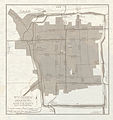
 Kiangsu Province Map 1954.jpg 5,000 × 3,765; 16.25 MB
-
 Lingqu Canal map.jpg 1,036 × 974; 1.12 MB
-
 Map China 1-250,000 Tile NH 45-14 Tingri Dzong.jpg 5,000 × 3,802; 4.75 MB
-
 Map India and Pakistan 1-250,000 Tile NG 45-2 Mount Everest.jpg 5,000 × 3,831; 5.91 MB
-
 Map India and Pakistan 1-250,000 Tile NG 45-3 Kanchenjunga.jpg 5,000 × 3,805; 6.51 MB
-
 Map India and Pakistan 1-250,000 Tile NG 45-4 Phari Dzong.jpg 5,000 × 3,815; 6.06 MB
-
 Map India and Pakistan 1-250,000 Tile NG 46-1 Tongsa Dzong.jpg 5,000 × 3,822; 4.88 MB
-
 Map India and Pakistan 1-250,000 Tile NG 46-2 Towang.jpg 5,000 × 3,777; 9.46 MB
-
 Map India and Pakistan 1-250,000 Tile NH 44-1 Chini.jpg 5,000 × 3,748; 3.53 MB
-
 Map India and Pakistan 1-250,000 Tile NH 44-5 Dehra Dun.jpg 5,000 × 3,784; 4.61 MB
-
 Map India and Pakistan 1-250,000 Tile NH 44-6 Nanda Devi.jpg 5,000 × 3,799; 4.02 MB
-
 Map India and Pakistan 1-250,000 Tile NH 45-13 Jongkha Dzong.jpg 5,000 × 3,774; 4.21 MB
-
 Map India and Pakistan 1-250,000 Tile NH 46-15 Kyimdong Dzong.jpg 5,000 × 3,800; 3.54 MB
-
 Map India and Pakistan 1-250,000 Tile NI 43-3 Mundik.jpg 5,000 × 3,804; 3.95 MB
-
 Map India and Pakistan 1-250,000 Tile NI 43-4 Chulung.jpg 5,000 × 3,791; 3.62 MB
-
 Map India and Pakistan 1-250,000 Tile NI 44-1 Tsorul Tso.jpg 5,000 × 3,785; 3.52 MB
-
 Map India and Pakistan 1-250,000 Tile NI 44-13 Tso Morari.jpg 5,000 × 3,876; 3.9 MB
-
 Map India and Pakistan 1-250,000 Tile NI 44-5 Shyok.jpg 5,000 × 3,798; 3.51 MB
-
 Map India and Pakistan 1-250,000 Tile NI 44-9 Pangong Tso.jpg 5,000 × 3,793; 3.81 MB
-
 Map India and Pakistan 1-250,000 Tile NJ 43-14 Baltit.jpg 5,000 × 3,851; 4.17 MB
-
 Map India and Pakistan 1-250,000 Tile NJ 43-15 Shimshal.jpg 5,000 × 3,790; 3.21 MB
-

-
 Nanking Map 1954.jpg 2,535 × 2,962; 6.43 MB
-
 Peiping and South Map 1954.jpg 5,000 × 3,851; 16.15 MB
-
 Peiping Map 1954.jpg 3,468 × 4,291; 14.32 MB
-
 Shainghai and East Map 1954.jpg 5,000 × 3,838; 16.06 MB
-
 Shanghai and West Map 1954.jpg 5,000 × 3,816; 18.42 MB
-
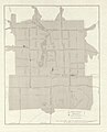
 Shanghai Map 1954.jpg 2,933 × 2,115; 5.9 MB
-
 Shantung Province and Wei Hai Wei Map 1954.jpg 5,000 × 3,805; 14.61 MB
-
-
 SooChow Map 1954.jpg 1,827 × 1,935; 3.53 MB
-

-
 Tingri Dzong map sheet name in 1955 (cropped).jpg 758 × 148; 19 KB
-
-
 Txu-oclc-10552568-ng47-14-Mangshi Region.jpg 2,104 × 1,930; 2.02 MB
-
 Txu-oclc-6535632-nf47-12-2nd-ed.jpg 5,000 × 3,774; 6.58 MB
-
 Txu-oclc-6535632-nf47-8.jpg 5,000 × 3,795; 6.25 MB
-
 Txu-oclc-6535632-nf48-5.jpg 5,000 × 3,790; 6.49 MB
-
 Txu-oclc-6612232-nk52-10.jpg 5,000 × 3,749; 6.77 MB
-
 Txu-oclc-6612232-nk52-8.jpg 5,000 × 3,769; 6.41 MB
-
 Txu-oclc-6654394-nl-44-2nd-ed.jpg 4,350 × 5,564; 6.05 MB
-
 Txu-oclc-6924198-nf47-11.jpg 5,000 × 3,777; 6.48 MB
-
 Txu-oclc-6924198-nf47-2.jpg 5,000 × 3,750; 6.12 MB
-
 USSR map NK 43-10 Andizhan.jpg 5,000 × 3,781; 4.4 MB
-
 USSR map NK 43-9 Imeni Voroshilova.jpg 5,000 × 3,784; 4.86 MB
-
 USSR map NK 44-2 I-Ning.jpg 5,000 × 3,835; 4.4 MB
-
 USSR map NL 44-10 'Tekeli.jpg 5,000 × 3,809; 4.92 MB
-
 USSR map NL 53-5 Bikin.jpg 5,000 × 3,807; 3.72 MB
-
 Victoria and Kowloon Map 1954.jpg 5,000 × 4,171; 11.74 MB
-_Map_China_1-250,000_Tile_NH_45-14_Tingri_Dzong_(cropped).jpg)
.jpg)
_(cropped).jpg)


.jpg)


.jpg)


.jpg)

.jpg)
.jpg)


.jpg)