Category:Chipperfield
English: Chipperfield is a village and civil parish in the Dacorum district of Hertfordshire, England, about 5 miles southwest of Hemel Hempstead and 5 miles north of Watford. The parish includes the hamlet of Tower Hill.
village and civil parish in the Dacorum district of Hertfordshire, England  | |||||
| Upload media | |||||
| Instance of | |||||
|---|---|---|---|---|---|
| Location | Dacorum, Hertfordshire, East of England, England | ||||
| Said to be the same as | Chipperfield (Wikimedia duplicated page, civil parish) | ||||
 | |||||
Subcategories
This category has the following 4 subcategories, out of 4 total.
Media in category "Chipperfield"
The following 70 files are in this category, out of 70 total.
-
 Access road on Chipperfield Common - geograph.org.uk - 4679302.jpg 640 × 480; 143 KB
-
 Ancient sweet chestnut tree - geograph.org.uk - 2316958.jpg 2,048 × 1,536; 1.53 MB
-
 Apostles Pond - geograph.org.uk - 2172241.jpg 640 × 480; 88 KB
-
 Barnes Lane west of Kings Langley - geograph.org.uk - 4432515.jpg 1,280 × 960; 509 KB
-
 Bulstrode Farm viewed from Tower Hill - geograph.org.uk - 3389675.jpg 4,141 × 2,761; 3.71 MB
-
 Bulstrode Farm, Chipperfield - geograph.org.uk - 3389677.jpg 4,592 × 3,056; 5.06 MB
-
 Bulstrode Lane - geograph.org.uk - 2172257.jpg 640 × 480; 78 KB
-
 Car Park on Chipperfield Common - geograph.org.uk - 2935378.jpg 1,600 × 1,200; 610 KB
-
 Chapel Croft, Chipperfield - geograph.org.uk - 1513313.jpg 480 × 640; 112 KB
-
 Chapel Croft, Chipperfield - geograph.org.uk - 4679334.jpg 640 × 480; 52 KB
-
 Chapel Croft, Chipperfield - geograph.org.uk - 4679335.jpg 640 × 480; 69 KB
-
 Chipperfield Common - geograph.org.uk - 113952.jpg 640 × 480; 169 KB
-
 Chipperfield Common - geograph.org.uk - 2936732.jpg 1,600 × 1,200; 603 KB
-
 Chipperfield Common - geograph.org.uk - 4666309.jpg 4,608 × 3,456; 3.37 MB
-
 Chipperfield Common, The pink pond - geograph.org.uk - 113968.jpg 640 × 480; 152 KB
-
 Chipperfield Garden Centre - geograph.org.uk - 5079871.jpg 2,304 × 1,728; 1.37 MB
-
 Chipperfield War Memorial - geograph.org.uk - 4679326.jpg 640 × 480; 96 KB
-
 Chipperfield, Badgerdell Wood - geograph.org.uk - 69905.jpg 640 × 480; 97 KB
-

-
 Chipperfield, Bulstrode Lane - geograph.org.uk - 109286.jpg 640 × 480; 123 KB
-
 Chipperfield, Croft Meadow - geograph.org.uk - 156583.jpg 640 × 480; 113 KB
-
 Chipperfield, Hertfordshire - geograph.org.uk - 4679320.jpg 640 × 480; 94 KB
-
-
 Chipperfield, The Boot, Tower Hill - geograph.org.uk - 109291.jpg 640 × 480; 92 KB
-
 Chipperfield, The Street - geograph.org.uk - 1513302.jpg 640 × 480; 78 KB
-

-
 Chipperfield, Windmill Hill pond - geograph.org.uk - 132203.jpg 640 × 480; 129 KB
-
 Chopped logs on the edge of the field - geograph.org.uk - 3389678.jpg 4,161 × 2,774; 4.36 MB
-
 Church and Manse - geograph.org.uk - 1513290.jpg 640 × 480; 78 KB
-
 Croft Lane - geograph.org.uk - 1513319.jpg 640 × 480; 135 KB
-
 Croft Lane, Chipperfield - geograph.org.uk - 4679329.jpg 640 × 480; 70 KB
-
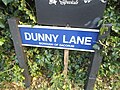 Dunny Lane sign, Chipperfield - geograph.org.uk - 5090207.jpg 2,304 × 1,728; 845 KB
-
 Eastern entrance to Chipperfield Common - geograph.org.uk - 3389679.jpg 4,497 × 2,998; 7.31 MB
-
 Field by Rucklers Lane, Kings Langley - geograph.org.uk - 4433551.jpg 1,275 × 791; 375 KB
-
 Field Near Tenements Farm - geograph.org.uk - 1513331.jpg 640 × 480; 118 KB
-
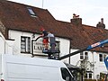 Fixing the sign at the Chipperfield Larder - geograph.org.uk - 5079838.jpg 2,304 × 1,728; 947 KB
-
 Flint Cottages, Chipperfield - geograph.org.uk - 1513257.jpg 640 × 480; 96 KB
-
 Flowerbed outside Chipperfield Garden Centre - geograph.org.uk - 5079869.jpg 2,304 × 1,728; 777 KB
-
 Flowerbeds outside Chipperfield Garden Centre - geograph.org.uk - 5079870.jpg 2,304 × 1,728; 804 KB
-
 Footpath by Tenements Farm - geograph.org.uk - 1513336.jpg 480 × 640; 139 KB
-
 Footpath Crossroads - geograph.org.uk - 2172245.jpg 640 × 480; 84 KB
-
 Footpath Off Dunny Lane - geograph.org.uk - 1513322.jpg 480 × 640; 186 KB
-
 Footpath to Rucklers Lane - geograph.org.uk - 2172252.jpg 640 × 480; 92 KB
-
 Garden Centre in Chipperfield - geograph.org.uk - 27970.jpg 640 × 479; 58 KB
-
 Geraniums outside Chipperfield Garden Centre - geograph.org.uk - 5079868.jpg 2,304 × 1,728; 815 KB
-
 Glade with Scots pine, Chipperfield Common - geograph.org.uk - 2323578.jpg 2,048 × 1,536; 909 KB
-
 Hertfordshire Way by Chipperfield Common - geograph.org.uk - 1513057.jpg 640 × 480; 137 KB
-
 It's There, Somewhere^ - geograph.org.uk - 1513345.jpg 640 × 480; 79 KB
-
 Kia garage in Chipperfield - geograph.org.uk - 5090210.jpg 2,266 × 1,676; 1.02 MB
-
 Langley Road, Chipperfield - geograph.org.uk - 4679351.jpg 640 × 480; 86 KB
-
 Megg Lane, Chipperfield - geograph.org.uk - 5079873.jpg 2,206 × 1,588; 1.84 MB
-
 Path off Langley Road, Chipperfield - geograph.org.uk - 5079872.jpg 2,304 × 1,728; 824 KB
-
 Pond on Chipperfield Common - geograph.org.uk - 3389670.jpg 4,420 × 2,947; 5.36 MB
-
 Public footpath on Chipperfield Common - geograph.org.uk - 4679311.jpg 640 × 480; 146 KB
-
 Royal Oak, Chipperfield - geograph.org.uk - 1513080.jpg 640 × 480; 134 KB
-
 Rucklers Lane at the junction of Barnes Lane - geograph.org.uk - 4431885.jpg 1,280 × 960; 557 KB
-
 Scatterdells Lane - geograph.org.uk - 1513351.jpg 640 × 480; 117 KB
-
 Scatterdells Wood - geograph.org.uk - 1513359.jpg 640 × 480; 170 KB
-
 Signs for Kings Langley and Sarratt - geograph.org.uk - 4666310.jpg 4,608 × 3,456; 4.66 MB
-
 Sunrise at Barnes Lane - geograph.org.uk - 1107937.jpg 640 × 428; 72 KB
-
 The Boot at Chipperfield, Tower Hill - geograph.org.uk - 2935270.jpg 1,600 × 1,200; 458 KB
-
 The Chipperfield Larder - geograph.org.uk - 1513296.jpg 640 × 480; 107 KB
-
 The Common, Chipperfield - geograph.org.uk - 2935363.jpg 1,600 × 1,200; 588 KB
-
 The Street, Chipperfield - geograph.org.uk - 1513279.jpg 640 × 480; 116 KB
-
 The Two Brewers Inn and a Red Telephone Box - geograph.org.uk - 3964972.jpg 3,072 × 2,304; 1.77 MB
-
 The Windmill Pub on Chipperfield Common - geograph.org.uk - 2935374.jpg 1,600 × 1,200; 587 KB
-
 Tower Hill, Chipperfield - geograph.org.uk - 2935359.jpg 1,600 × 1,200; 499 KB
-
 Tumulus in Chipperfield Woods - geograph.org.uk - 2316948.jpg 2,048 × 1,536; 1.26 MB
-
 Waymarkers Galore - geograph.org.uk - 1513062.jpg 640 × 480; 136 KB
-
 Whippendell Bottom - geograph.org.uk - 98400.jpg 640 × 480; 137 KB


