Category:Chirton
village and civil parish in Wiltshire, United Kingdom  | |||||
| Upload media | |||||
| Instance of | |||||
|---|---|---|---|---|---|
| Location | Wiltshire, South West England, England | ||||
| Different from | |||||
| official website | |||||
 | |||||
English: Chirton is a village and civil parish in the English county of Wiltshire. In the Census 2001 the parish had a population of 393.
Nederlands: Chirton is een civil parish in de unitary authority Wiltshire, in het Engelse graafschap Wiltshire. De civil parish telt
Subcategories
This category has only the following subcategory.
C
Media in category "Chirton"
The following 82 files are in this category, out of 82 total.
-
 A342 and Salisbury Plain - geograph.org.uk - 3389338.jpg 4,320 × 3,240; 4.12 MB
-
 A342 approaches Chirton - geograph.org.uk - 3454839.jpg 3,539 × 2,622; 1.14 MB
-
 A342 junction, Chirton - geograph.org.uk - 5710972.jpg 640 × 428; 96 KB
-
 A342 passes South Lodge - geograph.org.uk - 3454877.jpg 3,540 × 2,678; 1.58 MB
-
 A342 passes The Wiltshire Yeoman - geograph.org.uk - 4087922.jpg 2,480 × 2,351; 709 KB
-

-
 Bridleway by Redhorn Plantation - geograph.org.uk - 2576569.jpg 640 × 480; 110 KB
-
 Bridleway by the plantation - geograph.org.uk - 4216404.jpg 640 × 480; 170 KB
-
 Bridleway near Chirton Bottom - geograph.org.uk - 2592648.jpg 514 × 640; 117 KB
-
 Bridleway near Chirton Bottom - geograph.org.uk - 2592652.jpg 640 × 480; 100 KB
-
 Bridleway near Marden - geograph.org.uk - 2592849.jpg 473 × 640; 147 KB
-
 Bridleway near Marden - geograph.org.uk - 2592876.jpg 480 × 640; 120 KB
-
 Bridleway to Chirton - geograph.org.uk - 2577833.jpg 640 × 480; 125 KB
-
 Bridleway to Conock - geograph.org.uk - 2576627.jpg 640 × 441; 102 KB
-
 Bridleway to Conock - geograph.org.uk - 2576639.jpg 640 × 469; 104 KB
-
 Chalk scarp above Marden - geograph.org.uk - 2577818.jpg 640 × 448; 92 KB
-
 Chirton Bottom - geograph.org.uk - 2576508.jpg 640 × 459; 99 KB
-
 Chirton Bottom - geograph.org.uk - 4216402.jpg 640 × 480; 169 KB
-
 Chirton Bottom - geograph.org.uk - 846518.jpg 640 × 480; 120 KB
-
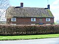
 Chirton buildings (2) (geograph 7458223).jpg 4,320 × 3,240; 4.8 MB
-
 Chirton buildings (3) (geograph 7459280).jpg 4,176 × 3,132; 2.77 MB
-
 Chirton buildings (4) (geograph 7459282).jpg 4,169 × 3,127; 2.88 MB
-
 Chirton Down from the old turnpike road - geograph.org.uk - 4154259.jpg 3,394 × 1,151; 1.5 MB
-
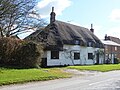
 Chirton houses (1) (geograph 7457513).jpg 4,209 × 2,368; 2.15 MB
-
 Chirton houses (2) (geograph 7457519).jpg 4,320 × 3,240; 2.53 MB
-
 Chirton houses (3) (geograph 7457526).jpg 4,270 × 3,203; 2.81 MB
-
 Chirton houses (4) (geograph 7457531).jpg 4,211 × 3,158; 3.76 MB
-
 Chirton houses (5) (geograph 7458215).jpg 4,222 × 3,167; 3.39 MB
-
 Chirton houses (6) (geograph 7458217).jpg 4,320 × 3,240; 4.15 MB
-
 Chirton houses (7) (geograph 7458224).jpg 4,215 × 3,161; 4.08 MB
-
 Chirton houses (8) (geograph 7458225).jpg 3,889 × 2,917; 2.79 MB
-
 Chirton houses (9) (geograph 7459284).jpg 4,178 × 3,133; 3.17 MB
-
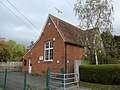
 Chirton Village Hall - geograph.org.uk - 4357509.jpg 1,600 × 1,064; 491 KB
-
 Chirton Village Hall - geograph.org.uk - 4357548.jpg 1,600 × 1,064; 515 KB
-
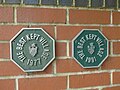 Chirton, best kept village- twice^ - geograph.org.uk - 4226114.jpg 640 × 480; 83 KB
-

-
 Downland above Chirton Bottom - geograph.org.uk - 2576459.jpg 640 × 427; 116 KB
-
 Downs above Marden - geograph.org.uk - 2577794.jpg 640 × 461; 110 KB
-
 Farmland near Patney - geograph.org.uk - 2592953.jpg 640 × 452; 84 KB
-
 Farmland north of Chirton - geograph.org.uk - 1741871.jpg 1,440 × 1,080; 903 KB
-
 Field by Redhorn Plantation - geograph.org.uk - 2576585.jpg 478 × 640; 124 KB
-
 Field edge bridleway - geograph.org.uk - 4216405.jpg 640 × 480; 158 KB
-
 Gate and path by Chirton church - geograph.org.uk - 2577461.jpg 640 × 480; 131 KB
-
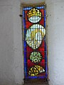
 Handle, St John the Baptist's Church - geograph.org.uk - 2459154.jpg 640 × 479; 94 KB
-
 Harvest at Chirton - geograph.org.uk - 83418.jpg 640 × 438; 77 KB
-
 Milestone, Chirton - geograph.org.uk - 952774.jpg 640 × 480; 144 KB
-
 Not quite what it seems - geograph.org.uk - 4226108.jpg 640 × 480; 157 KB
-
 Old Turnpike road across Westdown-Larkhill Impact area - geograph.org.uk - 4153016.jpg 1,600 × 1,067; 667 KB
-

-
 Rose wasp gall, Redhorn Plantation - geograph.org.uk - 2576599.jpg 525 × 640; 82 KB
-

-

-

-

-

-

-
-
 Start of bridleways - geograph.org.uk - 4216455.jpg 640 × 480; 150 KB
-
 The A342 enters Chirton - geograph.org.uk - 5710976.jpg 640 × 428; 85 KB
-
 The Malthouse - geograph.org.uk - 2592910.jpg 640 × 478; 79 KB
-
 The road to Chirton from Patney - geograph.org.uk - 1742315.jpg 1,440 × 1,080; 957 KB
-
 The Street, Chirton - geograph.org.uk - 2459113.jpg 640 × 480; 64 KB
-
 The Wiltshire Yeoman Pub - geograph.org.uk - 3389321.jpg 4,320 × 3,240; 3.61 MB
-
 The Wiltshire Yeoman, Chirton - geograph.org.uk - 952819.jpg 640 × 487; 78 KB
-
 Track in the wood - geograph.org.uk - 4216399.jpg 640 × 480; 129 KB
-
 Vale view - geograph.org.uk - 4216390.jpg 640 × 480; 164 KB
-

-
 View over Chirton Bottom - geograph.org.uk - 2576560.jpg 640 × 425; 100 KB
-
 Village school, Chirton - geograph.org.uk - 4226109.jpg 640 × 480; 105 KB
-

-
 West side of Chirton Bottom - geograph.org.uk - 2576544.jpg 640 × 480; 90 KB
-
 Wheat near Chirton - geograph.org.uk - 2592670.jpg 640 × 480; 123 KB
-
 Wheat near Marden - geograph.org.uk - 2592865.jpg 640 × 427; 69 KB
-
 White House - geograph.org.uk - 4216452.jpg 640 × 480; 163 KB
-
 White house on A342 bend - geograph.org.uk - 5710983.jpg 640 × 428; 140 KB
-

-
 Chirton - geograph.org.uk - 37469.jpg 480 × 640; 159 KB
-
 Chirton Residential - geograph.org.uk - 37473.jpg 640 × 480; 142 KB
-
 Larkhill Artillery Range - geograph.org.uk - 301330.jpg 640 × 479; 92 KB
-

-

-
 Wiltshire Yeoman, Chirton - geograph.org.uk - 37476.jpg 640 × 480; 106 KB


_(geograph_7458223).jpg)
_(geograph_7459280).jpg)
_(geograph_7459282).jpg)
_(geograph_7457513).jpg)
_(geograph_7457519).jpg)
_(geograph_7457526).jpg)
_(geograph_7457531).jpg)
_(geograph_7458215).jpg)
_(geograph_7458217).jpg)
_(geograph_7458224).jpg)
_(geograph_7458225).jpg)
_(geograph_7459284).jpg)


_-_geograph.org.uk_-_4226112.jpg)
_-_geograph.org.uk_-_4226115.jpg)
_-_geograph.org.uk_-_4226110.jpg)
_-_geograph.org.uk_-_4226113.jpg)


