Category:Cholesbury-cum-St Leonards
English: Cholesbury-cum-St Leonards is a civil parish in the Chiltern district of the English county of Buckinghamshire. It is located in the Chiltern Hills just to the north of Chesham and forms a boundary along its length with Hertfordshire.
civil parish in Buckinghamshire, England  | |||||
| Upload media | |||||
| Instance of | |||||
|---|---|---|---|---|---|
| Named after | |||||
| Location | Buckinghamshire, South East England, England | ||||
| Population |
| ||||
| official website | |||||
 | |||||
Subcategories
This category has the following 3 subcategories, out of 3 total.
Media in category "Cholesbury-cum-St Leonards"
The following 164 files are in this category, out of 164 total.
-
 Amanita citrina (False Death Cap) - immature - geograph.org.uk - 3689127.jpg 2,448 × 3,264; 2.1 MB
-
 Amanita citrina (False Death Cap) in Drayton Wood - geograph.org.uk - 3689123.jpg 3,264 × 2,448; 2.41 MB
-
 Amanita citrina - The False Death Cap - geograph.org.uk - 3677529.jpg 1,366 × 1,000; 1.03 MB
-
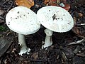
 Amanita muscaria (Fly Agaric) - immature emerging - geograph.org.uk - 3689146.jpg 2,448 × 3,264; 2.96 MB
-
 Amanita rubescens - The Blusher (probably) - geograph.org.uk - 3677660.jpg 1,175 × 1,000; 1.23 MB
-
 Another ostrich at White Hawridge Bottom - geograph.org.uk - 3962289.jpg 2,048 × 1,536; 559 KB
-
 Antique restoration workshop, Cholesbury - geograph.org.uk - 4484090.jpg 2,560 × 1,920; 2.08 MB
-
 Arrewig Lane - geograph.org.uk - 3129651.jpg 4,000 × 3,000; 2.12 MB
-
 Arrewig Lane from near Three Gates Farm - geograph.org.uk - 3877046.jpg 1,000 × 1,333; 1.25 MB
-
 Beech lined path, Drayton Wood - geograph.org.uk - 2844351.jpg 1,000 × 1,333; 2.52 MB
-
 Beech Trees in Drayton Wood - geograph.org.uk - 5951861.jpg 1,333 × 1,000; 1.66 MB
-
 Beech woodland at Cholesbury Hill Fort - geograph.org.uk - 3962309.jpg 2,048 × 1,536; 1 MB
-
 Beechwood farm and fields from Drayton Wood - geograph.org.uk - 3677869.jpg 1,333 × 1,000; 1.17 MB
-
 Belfry timbers - geograph.org.uk - 5609688.jpg 640 × 360; 46 KB
-
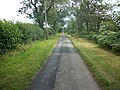
 Bottom Road - geograph.org.uk - 3139015.jpg 4,000 × 3,000; 2.57 MB
-
 Bottom Road, Buckland Common - geograph.org.uk - 6046775.jpg 1,920 × 1,280; 1.47 MB
-
 Bower Farm from Vale Road - geograph.org.uk - 5456973.jpg 5,202 × 3,465; 2.99 MB
-
 Bridleway towards Ashley Green - geograph.org.uk - 5456984.jpg 5,202 × 3,465; 4 MB
-
 Browns agricultural engineers, Chesham - geograph.org.uk - 4484745.jpg 2,560 × 1,641; 1.2 MB
-
 Buckland Common, Village Green - geograph.org.uk - 2335597.jpg 640 × 480; 160 KB
-
 Bucks County Signpost near St Leonards - geograph.org.uk - 2427056.jpg 3,072 × 2,304; 1.81 MB
-
 Byway in White Hawridge Bottom - geograph.org.uk - 6400672.jpg 800 × 450; 120 KB
-
 Chesham Road, Heath End - geograph.org.uk - 3948731.jpg 2,560 × 1,920; 2.01 MB
-
 Cholesbury Camp (1) - Shallow external ditch at SW - geograph.org.uk - 3678011.jpg 1,333 × 1,000; 1.52 MB
-
 Cholesbury Camp (10) - Northernmost section - geograph.org.uk - 3679322.jpg 1,000 × 1,333; 1.51 MB
-
 Cholesbury Camp (11) - Enclosure from NE - geograph.org.uk - 3679331.jpg 1,479 × 1,000; 1.33 MB
-
 Cholesbury Camp (12) - Paddock at southern point - geograph.org.uk - 3679347.jpg 1,333 × 1,000; 1.48 MB
-
 Cholesbury Camp (13) - St Laurence from the east - geograph.org.uk - 3679363.jpg 1,333 × 1,000; 1.48 MB
-
 Cholesbury Camp (14) - Track beside Village Hall - geograph.org.uk - 3679373.jpg 1,000 × 1,333; 1.45 MB
-
 Cholesbury Camp (2) - Outer ditch western side - geograph.org.uk - 3679208.jpg 1,000 × 1,333; 1.58 MB
-
 Cholesbury Camp (3) - Inner ditch, western side - geograph.org.uk - 3679216.jpg 1,000 × 1,333; 1.4 MB
-
 Cholesbury Camp (4) - Central embankment, west - geograph.org.uk - 3679233.jpg 1,333 × 1,000; 1.46 MB
-
 Cholesbury Camp (5) - Inner ditch, NW corner - geograph.org.uk - 3679239.jpg 1,000 × 1,333; 1.47 MB
-
 Cholesbury Camp (6) - Inner ditch, NW side - geograph.org.uk - 3679251.jpg 1,000 × 1,333; 1.53 MB
-
 Cholesbury Camp (7) - The enclosure from the north - geograph.org.uk - 3679259.jpg 1,333 × 1,000; 1.47 MB
-
 Cholesbury Camp (8) - Stile to northern footpath - geograph.org.uk - 3679294.jpg 1,333 × 1,000; 1.45 MB
-
 Cholesbury Camp (9) - Remains of small quarry (north) - geograph.org.uk - 3679313.jpg 1,333 × 1,000; 1.43 MB
-
 Cholesbury Camp - geograph.org.uk - 6400548.jpg 800 × 450; 137 KB
-
 Cholesbury Common - geograph.org.uk - 2362958.jpg 2,592 × 1,944; 3.01 MB
-
 Cholesbury Common - geograph.org.uk - 6046771.jpg 1,920 × 1,280; 911 KB
-
 Cholesbury Hill Fort - geograph.org.uk - 3962307.jpg 2,048 × 1,536; 912 KB
-
 Cholesbury Lane - geograph.org.uk - 4484083.jpg 2,486 × 1,818; 1.39 MB
-
 Cholesbury Village Hall - geograph.org.uk - 3766641.jpg 2,048 × 1,536; 556 KB
-
 Cholesbury Village Hall - geograph.org.uk - 6046773.jpg 1,886 × 1,228; 1.79 MB
-
 Cholesbury windmill - geograph.org.uk - 6039069.jpg 1,892 × 1,236; 1.29 MB
-
 Christmas Trees on Hawridge Common - geograph.org.uk - 2362919.jpg 2,592 × 1,944; 1.99 MB
-
 Clitocybe nebularis - geograph.org.uk - 3689148.jpg 1,333 × 1,000; 1.25 MB
-
 Clump of Snowdrops (Galanthus nivalis) - geograph.org.uk - 2844380.jpg 1,130 × 1,000; 1.52 MB
-
 Cock Grove - geograph.org.uk - 3139004.jpg 4,000 × 3,000; 2.72 MB
-
 Commemorative stone on Cholesbury Common - geograph.org.uk - 4014846.jpg 640 × 480; 128 KB
-
 Coprinus - deliquescing - geograph.org.uk - 3677453.jpg 1,333 × 1,000; 1.46 MB
-
 Coprinus micaceus - geograph.org.uk - 3677472.jpg 1,479 × 1,000; 1.34 MB
-
 Cottages in Cholesbury - geograph.org.uk - 4484087.jpg 2,560 × 1,868; 1.31 MB
-
 Country near Buckland Common - geograph.org.uk - 4424906.jpg 2,592 × 1,944; 1.42 MB
-
 Cricket Pavilion - geograph.org.uk - 6400544.jpg 800 × 450; 90 KB
-
 Crossroads on Buckland Common - geograph.org.uk - 6040876.jpg 1,920 × 1,280; 1.55 MB
-
 Ditch ^ Rampart Cholesbury Bronze Age Fort - geograph.org.uk - 1991801.jpg 1,440 × 960; 556 KB
-
 Drawbridge at Dundridge Manor - geograph.org.uk - 6099759.jpg 3,840 × 2,160; 4.24 MB
-
 Dry duck pond - geograph.org.uk - 1991826.jpg 1,600 × 1,200; 715 KB
-
 Earthworks at Hawridge Court - geograph.org.uk - 2071731.jpg 2,936 × 2,239; 6.77 MB
-
 Entrance to Little Passmore Farm - geograph.org.uk - 5456965.jpg 5,202 × 3,465; 4.26 MB
-
 Fairy picnic with sad fairies - geograph.org.uk - 3689159.jpg 2,446 × 2,003; 3.56 MB
-
 Farmland at Buckland Common - geograph.org.uk - 4424942.jpg 2,592 × 1,944; 1.76 MB
-
 Farmland near Buckland Common - geograph.org.uk - 4424947.jpg 2,592 × 1,944; 1.59 MB
-
 Farmland, Cholesbury - geograph.org.uk - 2813948.jpg 640 × 480; 204 KB
-
 Farmland, Cholesbury - geograph.org.uk - 2813949.jpg 640 × 480; 167 KB
-
 Field and trees - geograph.org.uk - 4014774.jpg 640 × 480; 120 KB
-
 Fields and footpath north of bend in Arrewig Lane - geograph.org.uk - 3877056.jpg 1,333 × 1,000; 1.21 MB
-
 Fields near Heath End - geograph.org.uk - 2362896.jpg 2,592 × 1,944; 1.55 MB
-
 Fly Agaric (Amanita muscaria) - Young fruiting body - geograph.org.uk - 5951868.jpg 1,000 × 1,333; 1.09 MB
-
 Fly Agaric (Amanita muscaria) group - geograph.org.uk - 3689145.jpg 3,264 × 2,448; 2.67 MB
-
 Footpath eastwards into Drayton Wood - geograph.org.uk - 3677837.jpg 1,000 × 1,333; 1.49 MB
-
 Footpath enters wood - geograph.org.uk - 1993591.jpg 2,304 × 3,456; 2.68 MB
-
 Footpath signpost and stile - geograph.org.uk - 2335587.jpg 480 × 640; 152 KB
-
 Footpath used by the Chiltern Way - geograph.org.uk - 4014876.jpg 640 × 480; 103 KB
-
 Former KX300 Telephone Kiosk at Buckland Common - geograph.org.uk - 5319179.jpg 1,944 × 2,592; 970 KB
-
 Former KX300 Telephone Kiosk at Cholesbury - geograph.org.uk - 5325856.jpg 1,944 × 2,592; 918 KB
-
 Former KX300 Telephone Kiosk at Hawridge - geograph.org.uk - 5328710.jpg 1,944 × 2,592; 982 KB
-
 Former KX300 Telephone Kiosk at St Leonards - geograph.org.uk - 5319170.jpg 1,944 × 2,592; 904 KB
-
 Full Moon pub, Cholesbury - geograph.org.uk - 3962296.jpg 2,048 × 1,536; 627 KB
-
 Fungus on mossy log (Pholiota sp. ^) - geograph.org.uk - 3677497.jpg 1,385 × 1,000; 1.51 MB
-
 Garden on Cholesbury Lane - geograph.org.uk - 4484084.jpg 2,560 × 1,920; 2.01 MB
-
 Gate near Woodlands farm - geograph.org.uk - 5457005.jpg 5,202 × 3,465; 5.42 MB
-
 Glade in Drayton Wood - geograph.org.uk - 3700161.jpg 1,000 × 1,333; 1.49 MB
-
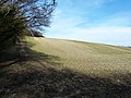
 Hawridge and Cholesbury Common - geograph.org.uk - 3138995.jpg 4,000 × 3,000; 2.52 MB
-
 Hawridge Common - geograph.org.uk - 2362910.jpg 2,592 × 1,944; 1.37 MB
-
 Hills by Chesham Road, Heath End - geograph.org.uk - 3948647.jpg 2,560 × 1,920; 1.97 MB
-
 Hog Lane near Woodfield Spring Farm - geograph.org.uk - 5457051.jpg 5,202 × 3,465; 3.78 MB
-
 Holy Pond, Cholesbury - geograph.org.uk - 3962302.jpg 2,048 × 1,536; 944 KB
-
 House on Cholesbury Lane, Buckland Common - geograph.org.uk - 6037053.jpg 1,886 × 1,228; 1.28 MB
-
 Jenkins Lane, St Leonards - geograph.org.uk - 4483495.jpg 2,554 × 1,912; 1.53 MB
-
 Junction of Vale Road and the road to Tring - geograph.org.uk - 5457015.jpg 5,202 × 3,465; 3.15 MB
-
 Junction on Chambers Green Road, Lane End - geograph.org.uk - 6037047.jpg 1,920 × 1,280; 1.47 MB
-
 Little Twye Road from Drayton Wood - geograph.org.uk - 2844334.jpg 1,333 × 1,000; 1.58 MB
-
 Lycoperdon perlatum - The Common Puffball - geograph.org.uk - 3677640.jpg 1,322 × 1,000; 1.05 MB
-
 Main road passing through Cholesbury - geograph.org.uk - 3962297.jpg 2,048 × 1,536; 579 KB
-
 Memorial gate - geograph.org.uk - 2071445.jpg 2,604 × 2,028; 1,004 KB
-
 Mycena pura (Lilac bonnet) - geograph.org.uk - 3689151.jpg 2,222 × 1,527; 2.18 MB
-
 Nascent saprotrophic fungi - geograph.org.uk - 3700341.jpg 1,073 × 1,000; 989 KB
-
 No longer the Rose ^ Crown Hawridge - geograph.org.uk - 4484747.jpg 2,560 × 1,920; 1.45 MB
-
 Nut Hazel Cross Farm at Nut Hazel Cross - geograph.org.uk - 3002557.jpg 800 × 600; 111 KB
-
 Nut Hazel Cross Farm, Chesham Vale - geograph.org.uk - 5457024.jpg 5,202 × 3,465; 3.37 MB
-
 Nut Hazel Cross Farm, face in the window - geograph.org.uk - 5457031.jpg 1,920 × 1,281; 411 KB
-
 Oak Lane - geograph.org.uk - 3137504.jpg 4,000 × 3,000; 3.21 MB
-
 Ostrich at White Hawridge Bottom - geograph.org.uk - 3962287.jpg 2,048 × 1,536; 736 KB
-
 Parrott's Lane - geograph.org.uk - 3135280.jpg 4,000 × 3,000; 2.42 MB
-
 Parrott's Lane, Buckland Common - geograph.org.uk - 4424926.jpg 2,592 × 1,944; 1.84 MB
-
 Pasture, Cholesbury - geograph.org.uk - 2813944.jpg 640 × 480; 193 KB
-
 Path heading to Hawridge Lane - geograph.org.uk - 6400682.jpg 800 × 450; 150 KB
-
 Path heading up to Brun's Farm - geograph.org.uk - 6400550.jpg 800 × 450; 123 KB
-
 Path through Drayton Wood - geograph.org.uk - 2844347.jpg 1,000 × 1,333; 2.52 MB
-
 Path to Cock Grove - geograph.org.uk - 6621692.jpg 1,024 × 576; 185 KB
-
 Path to Shire Lane from Parrott's Farm - geograph.org.uk - 2844367.jpg 1,000 × 1,333; 2.22 MB
-
 Path to St Laurence's church, Cholesbury - geograph.org.uk - 3677963.jpg 1,000 × 1,333; 1.59 MB
-
 Pews and gallery, St Leonard's - geograph.org.uk - 5609641.jpg 640 × 360; 53 KB
-
 Pholiota squarrosa (Shaggy Scalycap) - young - geograph.org.uk - 3689157.jpg 2,586 × 1,638; 2.62 MB
-
 Ploughed up footpath - geograph.org.uk - 6109588.jpg 3,840 × 2,160; 4.9 MB
-
 Pond at Shirelane Farm - geograph.org.uk - 2844370.jpg 1,333 × 1,000; 2.5 MB
-
 Pretty poisonous - geograph.org.uk - 5951866.jpg 1,000 × 1,333; 1.51 MB
-
 Pub car park on Jenkins Lane - geograph.org.uk - 4484074.jpg 2,560 × 1,839; 1.24 MB
-
 Puddingstone rocks - geograph.org.uk - 6099766.jpg 3,840 × 2,160; 4.66 MB
-
 Ray's Hill, Cholesbury - geograph.org.uk - 6039077.jpg 1,920 × 1,280; 1.05 MB
-
 Rear of cottages at Heath End - geograph.org.uk - 1998713.jpg 1,440 × 897; 446 KB
-
 Road junction in Lanes End - geograph.org.uk - 4483458.jpg 2,560 × 1,920; 1.92 MB
-
 Sandpit Hill Cottages on Cholesbury Lane - geograph.org.uk - 6039065.jpg 1,852 × 1,223; 817 KB
-
 Secluded footpath entrance, Drayton Wood - geograph.org.uk - 2844317.jpg 1,000 × 1,427; 2.32 MB
-
 Shire Lane between Haresgarden and Drayton woods - geograph.org.uk - 2844308.jpg 1,333 × 1,000; 2.31 MB
-
 Signpost at Hawridge - geograph.org.uk - 6489134.jpg 2,592 × 1,944; 1.31 MB
-
 Signpost at Hog Lane - geograph.org.uk - 5457040.jpg 5,202 × 3,465; 3.84 MB
-
 Snowdrops (Galanthus nivalis), Cholesbury Bottom - geograph.org.uk - 2844375.jpg 1,000 × 1,333; 2.28 MB
-
 Soaring beeches in Drayton Wood - geograph.org.uk - 2844356.jpg 1,333 × 1,000; 2.68 MB
-
 St Leonard's church - geograph.org.uk - 5609694.jpg 640 × 360; 61 KB
-
 St Leonard's church, St Leonards - geograph.org.uk - 4424963.jpg 2,592 × 1,944; 1.58 MB
-
 St Mary's Church, Hawridge - geograph.org.uk - 6489171.jpg 2,592 × 1,944; 1.35 MB
-
 Support for the belfry - geograph.org.uk - 5609682.jpg 360 × 640; 44 KB
-
 Swallows on a fence at Heath End - geograph.org.uk - 1998686.jpg 1,938 × 1,428; 775 KB
-
 The Black Horse Inn - geograph.org.uk - 3002568.jpg 800 × 600; 103 KB
-
 The Black Horse Inn - geograph.org.uk - 3002573.jpg 600 × 800; 125 KB
-
 The Black Horse Inn at Chesham Vale - geograph.org.uk - 5282975.jpg 800 × 401; 88 KB
-
 The Black Horse Inn, Chesham Vale - geograph.org.uk - 5456977.jpg 5,202 × 3,465; 3.79 MB
-
 The chancel of St Leonard's church - geograph.org.uk - 5609623.jpg 640 × 360; 50 KB
-
 The Chapel House, Buckland Common - geograph.org.uk - 4424933.jpg 2,592 × 1,944; 1.68 MB
-
 The Full Moon, Cholesbury - geograph.org.uk - 2362966.jpg 2,592 × 1,944; 2.09 MB
-
 The Full Moon, Cholesbury - geograph.org.uk - 4014817.jpg 640 × 480; 143 KB
-
 The White Lion Pub, Buckland Common - geograph.org.uk - 3962310.jpg 2,048 × 1,536; 571 KB
-
 Tree-surrounded pond near to Lady Grove - geograph.org.uk - 3962312.jpg 2,048 × 1,536; 877 KB
-
 Trees on Hawridge Ridge - geograph.org.uk - 2071754.jpg 864 × 452; 128 KB
-
 Tuft of fungi - probably Armillaria - geograph.org.uk - 3700364.jpg 1,333 × 1,000; 1.12 MB
-
 Vale Road before Chesham - geograph.org.uk - 4484750.jpg 2,560 × 1,920; 1.91 MB
-
 Vale Road before Chesham - geograph.org.uk - 4484751.jpg 2,560 × 1,920; 2.15 MB
-
 Vale Road, Hawridge - geograph.org.uk - 4484748.jpg 2,560 × 1,920; 1.52 MB
-
 Vale Road, Hawridge - geograph.org.uk - 4484749.jpg 2,560 × 1,920; 2 MB
-
 Valley with cornfield - geograph.org.uk - 1998659.jpg 1,080 × 810; 265 KB
-
 Victorian Post Box, Buckland Common - geograph.org.uk - 2335580.jpg 480 × 640; 107 KB
-
 View across fields towards Buckland Common - geograph.org.uk - 2844322.jpg 1,333 × 1,000; 2.04 MB
-
 View from St Leonard's "gallery" - geograph.org.uk - 5609646.jpg 640 × 360; 52 KB
-
 View of sloping field from Hawridge - geograph.org.uk - 6488019.jpg 2,592 × 1,944; 1.35 MB
-
-
 Village Hall, Cholesbury - geograph.org.uk - 3962299.jpg 2,048 × 1,536; 819 KB
-
 West from the pulpit, St Leonard's - geograph.org.uk - 5609637.jpg 640 × 360; 49 KB
-
 White Hawridge Bottom - geograph.org.uk - 3962286.jpg 2,048 × 1,536; 561 KB
-
 Wood and valley near Braziers End - geograph.org.uk - 2070097.jpg 814 × 538; 219 KB
-
 Woodlands Farm entrance - geograph.org.uk - 5456994.jpg 5,202 × 3,465; 3.33 MB
-
 Woods by Chambers Green Road, St Leonard's - geograph.org.uk - 6046762.jpg 1,920 × 1,280; 2.01 MB
_-_immature_-_geograph.org.uk_-_3689127.jpg)
_in_Drayton_Wood_-_geograph.org.uk_-_3689123.jpg)

_-_immature_emerging_-_geograph.org.uk_-_3689146.jpg)
_-_geograph.org.uk_-_3677660.jpg)


_-_Shallow_external_ditch_at_SW_-_geograph.org.uk_-_3678011.jpg)
_-_Northernmost_section_-_geograph.org.uk_-_3679322.jpg)
_-_Enclosure_from_NE_-_geograph.org.uk_-_3679331.jpg)
_-_Paddock_at_southern_point_-_geograph.org.uk_-_3679347.jpg)
_-_St_Laurence_from_the_east_-_geograph.org.uk_-_3679363.jpg)
_-_Track_beside_Village_Hall_-_geograph.org.uk_-_3679373.jpg)
_-_Outer_ditch_western_side_-_geograph.org.uk_-_3679208.jpg)
_-_Inner_ditch,_western_side_-_geograph.org.uk_-_3679216.jpg)
_-_Central_embankment,_west_-_geograph.org.uk_-_3679233.jpg)
_-_Inner_ditch,_NW_corner_-_geograph.org.uk_-_3679239.jpg)
_-_Inner_ditch,_NW_side_-_geograph.org.uk_-_3679251.jpg)
_-_The_enclosure_from_the_north_-_geograph.org.uk_-_3679259.jpg)
_-_Stile_to_northern_footpath_-_geograph.org.uk_-_3679294.jpg)
_-_Remains_of_small_quarry_(north)_-_geograph.org.uk_-_3679313.jpg)


_-_geograph.org.uk_-_2844380.jpg)


_-_Young_fruiting_body_-_geograph.org.uk_-_5951868.jpg)
_group_-_geograph.org.uk_-_3689145.jpg)


_-_geograph.org.uk_-_3677497.jpg)


_-_geograph.org.uk_-_3689151.jpg)


_-_young_-_geograph.org.uk_-_3689157.jpg)


,_Cholesbury_Bottom_-_geograph.org.uk_-_2844375.jpg)


