Category:Choorstraat 2, Utrecht
| Object location | | View all coordinates using: OpenStreetMap |
|---|
 | |||||
| Upload media | |||||
| Instance of | |||||
|---|---|---|---|---|---|
| Location | Utrecht, Netherlands | ||||
| Street address |
| ||||
| Located on street | |||||
| Architect | |||||
| Heritage designation |
| ||||
| Inception |
| ||||
 | |||||
|
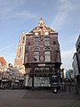
This is a category about rijksmonument number 514256
|
| Address |
|
Media in category "Choorstraat 2, Utrecht"
The following 9 files are in this category, out of 9 total.
-
 Choorstraat 2-1.JPG 1,944 × 2,592; 1.94 MB
-
 Choorstraat 2-3.JPG 1,944 × 2,592; 1.97 MB
-
 Choorstraat 2-5.JPG 1,944 × 2,592; 1.95 MB
-
 Choorstraat 2.JPG 3,456 × 5,184; 6.95 MB
-
 Dom Tower, Domplein, seen from Stadhuisbrug, Utrecht 02.jpg 4,000 × 6,000; 1.44 MB
-
 Dom Tower, Domplein, seen from Stadhuisbrug, Utrecht 03.jpg 6,000 × 4,000; 1.6 MB
-

-
 Overzicht achtergevels winkelpanden - Utrecht - 20343447 - RCE.jpg 783 × 1,200; 213 KB
-
 Overzicht voorgevels winkelpanden - Utrecht - 20343446 - RCE.jpg 783 × 1,200; 207 KB


