Category:Choorstraat 50, Delft
| Object location | | View all coordinates using: OpenStreetMap |
|---|
 | |||||
| Upload media | |||||
| Instance of |
| ||||
|---|---|---|---|---|---|
| Location | Delft, South Holland, Netherlands | ||||
| Street address |
| ||||
| Located on street | |||||
| Heritage designation |
| ||||
 | |||||
|
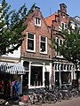
This is a category about rijksmonument number 11761
|
| Address |
|
Media in category "Choorstraat 50, Delft"
The following 5 files are in this category, out of 5 total.
-
 Delft - Choorstraat 50-52.jpg 1,944 × 2,592; 1.93 MB
-
 Gevels - Delft - 20050831 - RCE.jpg 806 × 1,200; 196 KB
-
 Overzicht - Delft - 20050829 - RCE.jpg 1,185 × 1,200; 297 KB
-
 Overzicht - Delft - 20050830 - RCE.jpg 1,184 × 1,200; 318 KB
-
 Overzicht hoek Dertienhuizen - Delft - 20050821 - RCE.jpg 1,191 × 1,200; 373 KB


