Category:Christian & Missionary Alliance Sun Kei Secondary School
| Object location | | View all coordinates using: OpenStreetMap |
|---|
secondary school in Hong Kong  | |||||
| Upload media | |||||
| Instance of | |||||
|---|---|---|---|---|---|
| Location | Sai Kung District, New Territories, Hong Kong, PRC | ||||
| Inception |
| ||||
| official website | |||||
 | |||||
Media in category "Christian & Missionary Alliance Sun Kei Secondary School"
The following 25 files are in this category, out of 25 total.
-
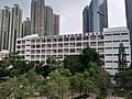
 2021年7月-王華湘中學及宣基中學.jpg 5,664 × 4,248; 6.65 MB
-
 2021年9月-宣中正立面.jpg 5,664 × 4,248; 6.41 MB
-
 2021年9月-王華湘及宣中.jpg 3,221 × 2,391; 1.41 MB
-
 2022年5月-天晉、王華湘中學及宣基中學.jpg 9,248 × 6,936; 18.13 MB
-
 2022年5月-宣基中學.jpg 9,248 × 6,936; 23.08 MB
-
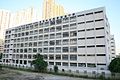
 2022年7月-宣基中學B.jpg 9,248 × 6,936; 17.95 MB
-
 2022年7月-宣基中學正門.jpg 8,343 × 6,258; 7.94 MB
-
 2022年9月-宣基中學A.jpg 4,000 × 2,250; 4.06 MB
-
 2022年9月-宣基中學B.jpg 4,000 × 2,250; 4.11 MB
-
 Beverly Garden.jpg 1,600 × 1,200; 604 KB
-
 C. & M. A. Sun Kei Secondary School.jpg 3,500 × 2,333; 4.99 MB
-
 Chi Lin Buddhist Primary School.jpg 3,684 × 2,247; 4.47 MB
-

-

-

-

-
 HK TSO 將軍澳 Tseung Kwan Tong Ming Street Tong Yin Street March 2022 SS2 16.jpg 4,000 × 3,000; 5.61 MB
-
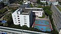
 TKO cy Photos 22.jpg 4,608 × 3,456; 1.54 MB
-
 TKO cy Photos 23.jpg 4,608 × 3,456; 1.13 MB
-
 Tong Ming Street Park 2016.jpg 2,112 × 3,168; 5.15 MB
-
 Tong Ming Street Park Overview 201301.jpg 1,704 × 2,272; 3.67 MB
-
 Tong Ming Street Park Overview 201305.jpg 2,245 × 1,670; 3.58 MB
-
 Tong Ming Street Park Playground 201305.jpg 2,272 × 1,704; 3.53 MB
-
 Tseung Kwan O Town Centre 201405.jpg 2,656 × 1,768; 2.99 MB
-
 Tseung Kwan O Town Centre.jpg 1,600 × 1,200; 519 KB


