Category:Church in Hohen Mistorf
| Object location | | View all coordinates using: OpenStreetMap |
|---|
church building in Alt Sührkow, Germany  | |||||
| Upload media | |||||
| Instance of | |||||
|---|---|---|---|---|---|
| Location | Q115533693, Alt Sührkow, Rostock District, Mecklenburg-Western Pomerania, Germany | ||||
| Heritage designation | |||||
 | |||||
Media in category "Church in Hohen Mistorf"
The following 8 files are in this category, out of 8 total.
-
 Hohen Mistorf Kirche 2009-09-08 093.jpg 1,536 × 2,048; 2.33 MB
-
 Hohen Mistorf Kirche 2009-09-08 097.jpg 2,048 × 1,536; 1.15 MB
-
 Hohen Mistorf Kirche Altar 2009-09-08 094.jpg 1,536 × 2,048; 872 KB
-
 Hohen Mistorf Kirche Kanzel 2009-09-08 096.jpg 1,536 × 2,048; 793 KB
-
 Hohen Mistorf Kirche Orgel 2009-09-08 095.jpg 2,048 × 1,536; 741 KB
-
 HohenMistorfKircheGrabplatte.jpg 4,896 × 3,672; 3.55 MB
-
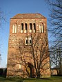 Kirche Hohen Mistorf Westansicht im Winter.jpg 2,448 × 3,264; 2.4 MB
-
 Kirche in Hohen Mistorf.JPG 800 × 600; 390 KB


