Category:Church in Sucleia
| Object location | | View all coordinates using: OpenStreetMap |
|---|
  | |||||
| Upload media | |||||
| Instance of | |||||
|---|---|---|---|---|---|
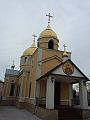
| Location | Sukleya, Administrative-Territorial Units of the Left Bank of the Dniester, Moldova | ||||
| Diocese | |||||
| Date of official closure |
| ||||
 | |||||
|
This category contains files which illustrate a cultural heritage monument in Moldova, ID MD-SL-At-N-1337
|
Media in category "Church in Sucleia"
The following 3 files are in this category, out of 3 total.
-
 Cerkiew Dymitra Sołuńskiego Sucleia wnętrze.jpg 720 × 678; 99 KB
-
 Cerkiew św. Dymitra Sucleia.jpg 720 × 960; 68 KB
-
 Sucleia post office church and Sverdlov.jpg 3,264 × 1,840; 1.63 MB
