Category:Church of the Assumption (Kirchdorf am Inn, Upper Austria)
| Object location | | View all coordinates using: OpenStreetMap |
|---|
parish church with cemetery in Kirchdorf am Inn, Austria _-_Kirche.JPG) _01_Blick_zum_Chor.jpg) | |||||
| Upload media | |||||
| Instance of | |||||
|---|---|---|---|---|---|
| Named after | |||||
| Location | Kirchdorf am Inn, Ried District, Upper Austria, Austria | ||||
| Street address |
| ||||
| Heritage designation | |||||
 | |||||
Subcategories
This category has the following 2 subcategories, out of 2 total.
Media in category "Church of the Assumption (Kirchdorf am Inn, Upper Austria)"
The following 11 files are in this category, out of 11 total.
-
 Kirchdorf am Inn (OÖ) - Kirche.JPG 2,100 × 3,150; 5 MB
-
 Kirchdorf am Inn - Pfarrkirche Mariä Himmelfahrt - Ölberg - 01.jpg 4,000 × 3,000; 3.54 MB
-
 Kirche Mariä Himmelfahrt (Kirchdorf am Inn, OÖ) 01 Ansicht von Süden.jpg 3,752 × 5,253; 10.77 MB
-
 Kirche Mariä Himmelfahrt (Kirchdorf am Inn, OÖ) 02 Ansicht von Westen.jpg 5,499 × 3,093; 13.61 MB
-
 Kirche Mariä Himmelfahrt (Kirchdorf am Inn, OÖ) 03 Ansicht von Nordosten.jpg 6,019 × 3,385; 11.78 MB
-
 Kirche Mariä Himmelfahrt (Kirchdorf am Inn, OÖ) 04 Lourdeskapelle Ansicht von Westen.jpg 7,208 × 4,055; 19.29 MB
-
 Kirche Mariä Himmelfahrt (Kirchdorf am Inn, OÖ) 05 Lourdeskapelle Ansicht von Südosten.jpg 6,350 × 4,536; 20.16 MB
-
 Kirche Mariä Himmelfahrt (Kirchdorf am Inn, OÖ) 06 Sonnenuhr und Kruzifix Südseite Turm.jpg 3,372 × 5,995; 19.02 MB
-
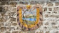 Kirche Mariä Himmelfahrt (Kirchdorf am Inn, OÖ) 07 Sonnenuhr Südseite Turm.jpg 4,978 × 2,800; 14 MB
-
 Kirche Mariä Himmelfahrt (Kirchdorf am Inn, OÖ) 08 Kriegerdenkmale mit Hl. Georg.jpg 5,509 × 3,935; 19.9 MB
-
 Kirche Mariä Himmelfahrt (Kirchdorf am Inn, OÖ) 09 Portal im Vorzeichen.jpg 4,177 × 6,469; 21.04 MB

_01_Ansicht_von_S%C3%BCden.jpg)
_02_Ansicht_von_Westen.jpg)
_03_Ansicht_von_Nordosten.jpg)
_04_Lourdeskapelle_Ansicht_von_Westen.jpg)
_05_Lourdeskapelle_Ansicht_von_S%C3%BCdosten.jpg)
_06_Sonnenuhr_und_Kruzifix_S%C3%BCdseite_Turm.jpg)
_07_Sonnenuhr_S%C3%BCdseite_Turm.jpg)
_08_Kriegerdenkmale_mit_Hl._Georg.jpg)
_09_Portal_im_Vorzeichen.jpg)