Category:Church of the Holy Name of the Virgin Mary in Aukštoji Panemunė
| Object location | | View all coordinates using: OpenStreetMap |
|---|
church building in Lithuania .JPG) | |||||
| Upload media | |||||
| Instance of | |||||
|---|---|---|---|---|---|
| Location | Kaunas, Kaunas City Municipality, Lithuania | ||||
 | |||||
Media in category "Church of the Holy Name of the Virgin Mary in Aukštoji Panemunė"
The following 9 files are in this category, out of 9 total.
-
 A. Panemunės bažnyčia, apsidė.JPG 5,184 × 3,888; 3.39 MB
-
 A. Panemunės bažnyčia.JPG 5,184 × 3,888; 3.45 MB
-
 A.Panemunes baznycia 2006-07-23.JPG 800 × 600; 602 KB
-
 Altorius, Panemunės bažnyčia, Kaunas.JPG 3,787 × 5,075; 3.42 MB
-
 Interjeras. Panemunės bažnyčia.JPG 5,184 × 3,888; 4.51 MB
-
 Panemunė, buvusi varpinė.JPG 5,184 × 3,888; 5.23 MB
-
 Panemunės bažnyčia (Kaune).JPG 5,184 × 3,888; 5.51 MB
-
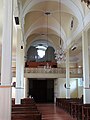 Panemunės bažnyčia, Kaunas. Vaizdas į vargonus.JPG 3,888 × 5,184; 5.33 MB
-
 Panemunės bažnyčia, vargonai.JPG 5,184 × 3,888; 4.41 MB


