Category:Cimetière de La Madeleine d'Amiens
| Object location | | View all coordinates using: OpenStreetMap |
|---|
|
This building is en partie classé, en partie inscrit au titre des monuments historiques de la France. It is indexed in the base Mérimée, a database of architectural heritage maintained by the French Ministry of Culture, under the reference PA00116047
|
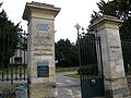
cemetery located in Somme, in France _2.jpg) | |||||
| Upload media | |||||
| Instance of | |||||
|---|---|---|---|---|---|
| Location | Amiens, arrondissement of Amiens, Somme, Hauts-de-France, Metropolitan France, France | ||||
| Street address |
| ||||
| Heritage designation |
| ||||
 | |||||
Subcategories
This category has the following 22 subcategories, out of 22 total.
B
C
D
G
M
Media in category "Cimetière de La Madeleine d'Amiens"
The following 78 files are in this category, out of 78 total.
-
 Amiens cimetière de la Madeleine (entrée) 2.jpg 2,816 × 2,112; 3.46 MB
-
 Amiens cimetière de la Madeleine (table d'orientation) 1.jpg 2,816 × 2,112; 4.73 MB
-
 Cimetière de la Madeleine (Amiens) (15).jpg 2,988 × 5,312; 5.61 MB
-
 Cimetière de la Madeleine (Amiens) (2).jpg 2,988 × 5,312; 5.64 MB
-
 Cimetière de la Madeleine (Amiens) (40).jpg 2,988 × 5,312; 7.56 MB
-
 Cimetière de la Madeleine (Amiens) (4).jpg 5,312 × 2,988; 9.52 MB
-
 Cimetière de la Madeleine (Amiens) (12).jpg 5,312 × 2,988; 6.88 MB
-
 Cimetière de la Madeleine (Amiens) (27).jpg 5,312 × 2,988; 7.81 MB
-
 Cimetière de la Madeleine (Amiens) (38).jpg 5,312 × 2,988; 5.96 MB
-
 Cimetière de la Madeleine (Amiens) (39).jpg 5,312 × 2,988; 6.13 MB
-
 Cimetière de la Madeleine (Amiens) (41).jpg 5,312 × 2,988; 7.91 MB
-
 Cimetière de la Madeleine (Amiens) (5).jpg 5,312 × 2,988; 7.91 MB
-
 Cimetière de la Madeleine (Amiens) (7).jpg 5,312 × 2,988; 5.37 MB
-
 Cimetière de la Madeleine (Amiens) (8).jpg 2,988 × 5,312; 6.36 MB
-
 Cimetière de la Madeleine (Amiens) (9).jpg 5,312 × 2,988; 6.16 MB
-
 Cimetière de la Madeleine (Amiens) (3).jpg 5,312 × 2,988; 5.31 MB
-
 Cimetière de la Madeleine (Amiens) (23).jpg 5,312 × 2,988; 7.6 MB
-
 Cimetière de la Madeleine (Amiens) (1).jpg 5,312 × 2,988; 5.76 MB
-
 Amiens allée des passiflores depuis tombe Jules Verne (cimetière de la Madeleine) 14a.jpg 2,337 × 1,679; 3.54 MB
-
 Amiens allée des passiflores depuis tombe Jules Verne (cimetière de la Madeleine) 14b.jpg 1,694 × 1,217; 1.93 MB
-
 Amiens allée des passiflores depuis tombe Jules Verne (cimetière de la Madeleine) 19b.jpg 2,352 × 1,812; 3.57 MB
-
 Amiens chapelle funéraire en pierre fragile (cimetière de la Madeleine) 1.jpg 2,112 × 2,816; 4.56 MB
-
 Amiens chapelle funéraire en pierre fragile (cimetière de la Madeleine) 1b.jpg 1,214 × 1,624; 1.46 MB
-
 Amiens chapelle funéraire en pierre fragile (cimetière de la Madeleine) 1d.jpg 1,053 × 827; 833 KB
-
 Amiens cimetière de la Madeleine (arbre entrée) 3.jpg 2,816 × 2,112; 4.18 MB
-
 Amiens cimetière de la Madeleine (arbre entrée) 3a.jpg 1,695 × 2,109; 2.79 MB
-
 Amiens cimetière de la Madeleine (chapelle funéraire néo-gothique) fronton 1.jpg 2,112 × 2,816; 2.12 MB
-
 Amiens cimetière de la Madeleine (chapelle funéraire néo-gothique) fronton 1a.jpg 1,506 × 2,107; 1.48 MB
-

-
 Amiens cimetière de la Madeleine (chapelle funéraire néo-gothique) fronton 2.jpg 2,112 × 2,816; 2.75 MB
-
 Amiens cimetière de la Madeleine (chapelle funéraire néo-gothique) fronton 2a.jpg 1,542 × 2,218; 1.49 MB
-

-
 Amiens cimetière de la Madeleine (tombe Leroux et environs) 1.jpg 2,816 × 2,112; 4.97 MB
-
 Amiens cimetière de la Madeleine (tombe Leroux et environs) 1a.jpg 2,258 × 1,742; 3.69 MB
-
 Amiens cimetière de la Madeleine (tombe Leroux et environs) 1b.jpg 2,158 × 1,620; 3.3 MB
-
 Amiens cimetière de la Madeleine (tombe Leroux et environs) 1e.jpg 652 × 720; 469 KB
-
 Amiens cimetière de la Madeleine (tombe Leroux et environs) 1f.jpg 1,036 × 1,502; 1.47 MB
-
 Amiens tombe avec fût de pierre (cimetière de la Madeleine) 1.jpg 2,112 × 2,816; 4.96 MB
-
 Cimetière de La Madeleine d'Amiens, tombe Beaucousin d'Hautefeuille 01.jpg 2,130 × 3,350; 1.23 MB
-
-
 Cimetière de la Madeleine d'Amiens tombe Carpentier-Riquier 01.jpg 2,988 × 5,312; 5.77 MB
-
 Cimetière de La Madeleine d'Amiens, tombe de la famille Caumartin 01.jpg 2,368 × 4,208; 3.03 MB
-
 Chabat - Les Tombeaux modernes - 1890 - Planche 04.jpg 3,507 × 4,960; 2.33 MB
-
 Cimetière de La Madeleine d'Amiens, tombe Choquart-Gransir 01.jpg 2,368 × 4,208; 3.26 MB
-
 Cimetière de la Madeleine d'Amiens, tombe d'Albert Dauphin 01.jpg 5,312 × 2,988; 7.98 MB
-
 Cimetière de La Madeleine d'Amiens, tombe de la famille Delaporte 01.jpg 2,368 × 4,208; 3.9 MB
-

-
 Cimetière de la Madeleine d'Amiens tombe de la famille Depas 01.jpg 2,988 × 5,312; 7.28 MB
-
 Cimetière de La Madeleine d'Amiens, tombe de Michelle Devisse 01.jpg 4,208 × 2,368; 4.73 MB
-
 Cimetière de La Madeleine d'Amiens, tombe de Michelle Devisse 02.jpg 4,208 × 2,368; 4.18 MB
-
 Cimetière de la Madeleine d'Amiens, tombe de la famille Douchet 01.jpg 2,988 × 5,312; 5.41 MB
-
 Cimetière de La Madeleine d'Amiens, tombe d'Abraham Fatton 01.jpg 2,287 × 4,063; 2.38 MB
-
 Cimetière de La Madeleine d'Amiens, tombe d'Abraham Fatton 02.jpg 2,037 × 2,219; 1,017 KB
-
 Cimetière de La Madeleine d'Amiens, tombe d'Augustin Guidon 01.jpg 2,237 × 3,973; 1.86 MB
-
 Cimetière de La Madeleine d'Amiens, tombe d'Augustin Guidon 02.jpg 1,514 × 3,009; 950 KB
-
 Cimetière de La Madeleine d'Amiens, tombe d'Augustin Guidon 03.jpg 582 × 1,007; 258 KB
-
 Cimetière de La Madeleine d'Amiens, tombe de Léon Lamare 01.jpg 2,368 × 4,208; 5.09 MB
-
 Cimetière de La Madeleine d'Amiens, tombe de Léon Lamare 02.jpg 1,485 × 1,631; 936 KB
-
 Cimetière de La Madeleine d'Amiens, tombe d'Alexandre Lapostolle 01.jpg 2,988 × 5,312; 8.35 MB
-
 Cimetière de La Madeleine d'Amiens, tombe de Léon Lecat 01.jpg 2,368 × 4,208; 4.81 MB
-
 Amiens cimetière de la Madeleine (tombe Leroux et environs) 1c.jpg 1,627 × 1,215; 1.82 MB
-
 Amiens cimetière de la Madeleine (tombe Leroux et environs) 1d.jpg 1,253 × 859; 977 KB
-
 Amiens cimetière de la Madeleine (tombe de Zaïre Leroy avec croix de fer forgé) 1.jpg 2,112 × 2,816; 5.16 MB
-
 Amiens cimetière de la Madeleine (tombe Zaïre LEROY avec croix de fer forgé) 2.jpg 2,056 × 2,773; 6.21 MB
-

-
 Cimetière de la Madeleine d'Amiens, tombe d'Amédée Maintenay 01.jpg 2,988 × 5,312; 7.19 MB
-
 Cimetière de La Madeleine d'Amiens, tombe de la famille Polart 01.jpg 2,988 × 5,312; 5.34 MB
-
 Cimetière de la Madeleine d'Amiens, tombe d'Emile Ricquier 01.jpg 2,988 × 5,312; 4.85 MB
-
 Cimetière de La Madeleine d'Amiens, tombe Tattegrain-Thuillier 01.jpg 2,158 × 3,012; 2.12 MB
-
 Cimetière de La Madeleine d'Amiens, tombe Tattegrain-Thuillier 02.jpg 2,319 × 2,494; 1.6 MB
-
 Cimetière de La Madeleine d'Amiens, tombe Thuillez 01.jpg 2,368 × 4,208; 4.14 MB
-
 Cimetière de La Madeleine d'Amiens, tombe Thuillez 02.jpg 2,244 × 3,754; 1.89 MB
-
 Cimetière de la Madeleine d'Amiens, tombe de Louis Thuillier 01.jpg 2,988 × 5,312; 8.19 MB
-
 Cimetière de La Madeleine d'Amiens, tombe Trépagne-Sarrazin 01.jpg 2,368 × 4,208; 3.9 MB
-
 Cimetière de La Madeleine d'Amiens, tombe Trépagne-Sarrazin 02.jpg 2,261 × 4,017; 2.41 MB
-
 Cimetière de La Madeleine d'Amiens, tombe Trépagne-Sarrazin 03.jpg 2,368 × 4,208; 3.01 MB
-
 Cimetière de la Madeleine d'Amiens tombe des Ursulines 01.jpg 5,312 × 2,988; 8.52 MB
-
 Amiens cimetière de la Madeleine (tombe Viellard) 1.jpg 2,771 × 2,058; 4.92 MB
_1.jpg)
_(15).jpg)
_(2).jpg)
_(40).jpg)
_(4).jpg)
_(12).jpg)
_(27).jpg)
_(38).jpg)
_(39).jpg)
_(41).jpg)
_(5).jpg)
_(7).jpg)
_(8).jpg)
_(9).jpg)
_(3).jpg)
_(23).jpg)
_(1).jpg)
_14a.jpg)
_14b.jpg)
_19b.jpg)
_1.jpg)
_1b.jpg)
_1d.jpg)
_3.jpg)
_3a.jpg)
_fronton_1.jpg)
_fronton_1a.jpg)
_fronton_1b.jpg)
_fronton_2.jpg)
_fronton_2a.jpg)
_fronton_2b.jpg)
_1.jpg)
_1a.jpg)
_1b.jpg)
_1e.jpg)
_1f.jpg)
_1.jpg)


_(14587712140).jpg)


_1c.jpg)
_1d.jpg)
_1.jpg)
_2.jpg)
_(14587745548).jpg)


_1.jpg)