Category:Cincinnati Bike Map
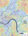
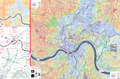
English: Portions and photographs of the Cincinnati Bike Map, a comprehensive cycling map of Cincinnati, Ohio, based on OpenStreetMap data and published in 2014.
This image was created with QGIS.
This image was created with Inkscape by Nate Wessel .
Media in category "Cincinnati Bike Map"
The following 9 files are in this category, out of 9 total.
-
 Cincinnati Bike Map - Indexed Color Version.png 14,117 × 9,305; 18.72 MB
-
 Cincinnati Bike Map East Side.png 7,204 × 9,303; 38.55 MB
-
 Cincinnati Bike Map Full Color.png 14,148 × 9,304; 69.65 MB
-
 Cincinnati Bike Map Legend.png 1,198 × 910; 152 KB
-
 Cincinnati Bike Map West Side.png 7,210 × 9,303; 31.67 MB
-
 Cincinnati Bike Maps 01.jpg 3,364 × 2,444; 4 MB
-
 Cincinnati Bike Maps 02.jpg 3,668 × 2,592; 4.37 MB
-
 Cincinnati Bike Maps 03.jpg 2,548 × 2,996; 3.58 MB
-
 Cincinnati Bike Maps 04.jpg 3,872 × 2,592; 4.38 MB


