Category:City Wall (Székesfehérvár)
English: City Wall with multiple lcations
Magyar: Várfalak a középkori romkert és a püspöki palota kertje mögött, a Várkörút vonalában a Városház tértől a Lakatos utcáig; Bástya u. 3. kertjében; Jókai u. 2. udvarában, Piac tér környéke, Ady Endre u. 9-11.
|
This is a category about a monument in Hungary. Identifier: 3911 |
| Object location | | View all coordinates using: OpenStreetMap |
|---|
Subcategories
This category has only the following subcategory.
P
Media in category "City Wall (Székesfehérvár)"
The following 14 files are in this category, out of 14 total.
-
-

-

-

-

-

-

-

-

-

-

-
 Székesfehérvár várfal.jpg 2,048 × 1,152; 1.25 MB
-

-

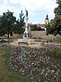
_Memorial_Column._Jen%C5%91_Bory_work,_1972._At_back_the_City_Wall_remains_Listed_ID_3911_%26_the_Catedral%27s_tower_Listed_ID_3806._-_Piac_Square,_V%C3%A1rfal_Park,_Downtown,_Sz%C3%A9kesfeh%C3%A9rv%C3%A1r,_Hungary.JPG)

_to_Proh%C3%A1szka_monument._Listed_3911._-_Proh%C3%A1szka_Grove,_V%C3%A1rk%C3%B6r%C3%BAt,_Downtown,_Sz%C3%A9kesfeh%C3%A9rv%C3%A1r.JPG)


_section_connected_to_the_City_Gate,_at_V%C3%A1rk%C3%B6r%C3%BAt._Listed_ID_3911._Old_Town,_now_cca_the_Downtown_defended_from_east_by_this_section._Natural_carved_stones._-_V%C3%A1rk%C3%B6r%C3%BAt,_Sz%C3%A9kesfeh%C3%A9rv%C3%A1r.JPG)
_%27City_of_St._Stephen%27s_in_memory_of_bishop_Ottokar%27._Stairway_to_City_Wall._Listed_ID_3911._-_Lakatos_Street_and_V%C3%A1rk%C3%B6r%C3%BAt_corner,_Downtown,_Sz%C3%A9kesfeh%C3%A9rv%C3%A1r,_Fej%C3%A9r_county,_Hungary.JPG)