Category:Clapton, Gloucestershire
English: Clapton is a civil parish in the Cotswold district, in the county of Gloucestershire, England.
civil parish in Cotswold, Gloucestershire, England | |||||
| Upload media | |||||
| Instance of | |||||
|---|---|---|---|---|---|
| Location | Cotswold, Gloucestershire, South West England, England | ||||
| Population |
| ||||
 | |||||
Subcategories
This category has the following 2 subcategories, out of 2 total.
C
Media in category "Clapton, Gloucestershire"
The following 56 files are in this category, out of 56 total.
-
 A lane in Clapton - geograph.org.uk - 3193136.jpg 640 × 428; 238 KB
-
 Across the field - geograph.org.uk - 1594883.jpg 640 × 480; 84 KB
-
 Across the Windrush valley - geograph.org.uk - 5987066.jpg 640 × 480; 98 KB
-
 Approaching Lower Marsh Farm - geograph.org.uk - 3194803.jpg 640 × 427; 210 KB
-
 Big field - geograph.org.uk - 1593417.jpg 640 × 480; 61 KB
-
 Bourton Hill Farm (1) - geograph.org.uk - 5778487.jpg 3,622 × 2,717; 2.94 MB
-
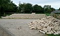 Building the entrance wall - geograph.org.uk - 3193161.jpg 640 × 382; 179 KB
-
 Cattle - please close gate - geograph.org.uk - 3194608.jpg 640 × 427; 238 KB
-
 Cattle pasture near Clapton - geograph.org.uk - 3193126.jpg 640 × 417; 254 KB
-
 Cattle pasture near Clapton - geograph.org.uk - 3193130.jpg 640 × 418; 234 KB
-
 Clapton on the Hill churchyard - geograph.org.uk - 5987055.jpg 640 × 480; 56 KB
-
 Diamond Way - geograph.org.uk - 6406158.jpg 800 × 450; 90 KB
-
 Diamond Way - geograph.org.uk - 6406189.jpg 800 × 450; 96 KB
-
 Diamond Way - geograph.org.uk - 6406196.jpg 800 × 450; 124 KB
-
 Diamond Way - geograph.org.uk - 6406198.jpg 800 × 450; 79 KB
-
 Down the field - geograph.org.uk - 1594620.jpg 640 × 480; 76 KB
-
 Farmland near Clapton-on-the-Hill - geograph.org.uk - 3781110.jpg 1,024 × 680; 233 KB
-
 Footpath approaching Hill Barn - geograph.org.uk - 3013400.jpg 1,024 × 680; 252 KB
-
 Furzehill Wood - geograph.org.uk - 5780335.jpg 4,320 × 3,240; 4.38 MB
-
 Gom's Hole - geograph.org.uk - 5778959.jpg 4,120 × 3,089; 2.58 MB
-
 Headland and field of wheat - geograph.org.uk - 3013407.jpg 1,024 × 680; 228 KB
-
 Lane junction, Clapton-on-the-Hill - geograph.org.uk - 5473019.jpg 640 × 480; 385 KB
-
 Little valley - geograph.org.uk - 916070.jpg 640 × 480; 68 KB
-
 Looking out of the porch - geograph.org.uk - 3193139.jpg 427 × 640; 170 KB
-
 Minor road - geograph.org.uk - 1594896.jpg 640 × 480; 132 KB
-
 Minor road near New Bridge - geograph.org.uk - 1594915.jpg 640 × 480; 141 KB
-
 Monarch's Way towards Bourton - geograph.org.uk - 3193119.jpg 640 × 423; 257 KB
-
 Monarch's Way towards Bourton - geograph.org.uk - 3193124.jpg 640 × 380; 252 KB
-
 Muddy way - geograph.org.uk - 1594609.jpg 640 × 480; 103 KB
-
 On the Monarch's Way footpath - geograph.org.uk - 3193115.jpg 640 × 427; 226 KB
-
 Path leaves the road - geograph.org.uk - 5778508.jpg 4,320 × 3,240; 4.74 MB
-
 Paths diverge - geograph.org.uk - 1593427.jpg 640 × 480; 136 KB
-
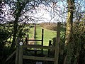
 Please use the stile - geograph.org.uk - 1594624.jpg 640 × 480; 94 KB
-
 Restricted byway - Sabrina Way - geograph.org.uk - 3193173.jpg 640 × 427; 237 KB
-
 River Windrush at New Bridge 1 - geograph.org.uk - 1515251.jpg 640 × 480; 250 KB
-

-
 Seven ways to go (1) - geograph.org.uk - 5778515.jpg 3,933 × 2,950; 2.32 MB
-
 Seven ways to go (2) - geograph.org.uk - 5778946.jpg 4,320 × 3,240; 4.82 MB
-
 Seven ways to go (3) - geograph.org.uk - 5778948.jpg 4,320 × 3,240; 5.31 MB
-
 Seven ways to go (4) - geograph.org.uk - 5778949.jpg 4,320 × 3,240; 4.22 MB
-
 Seven ways to go (5) - geograph.org.uk - 5778952.jpg 3,999 × 2,999; 2.48 MB
-
 Seven ways to go (6) - geograph.org.uk - 5778955.jpg 4,320 × 3,240; 3.06 MB
-
 Seven ways to go (7) - geograph.org.uk - 5778956.jpg 4,320 × 3,240; 4.93 MB
-

-
 Start of the footpath - geograph.org.uk - 1594905.jpg 640 × 480; 125 KB
-

-

-
 The Monarch's Way and the Diamond Way - geograph.org.uk - 387395.jpg 640 × 480; 99 KB
-
 The river Windrush - geograph.org.uk - 257680.jpg 640 × 480; 143 KB
-
 The track to the quarry - geograph.org.uk - 5780331.jpg 3,501 × 2,626; 3.03 MB
-
 Towards Bourton-on-the-Water - geograph.org.uk - 1594931.jpg 640 × 480; 132 KB
-
 Towards Clapton - geograph.org.uk - 3193166.jpg 640 × 428; 218 KB
-
 Track from Clapton-on-the-Hill - geograph.org.uk - 256937.jpg 640 × 480; 146 KB
-
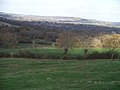 View from Clapton-on-the-Hill - geograph.org.uk - 1594596.jpg 640 × 480; 57 KB
-
 Wet bridleway - geograph.org.uk - 1594921.jpg 640 × 480; 104 KB
-
 Where is the path^ - geograph.org.uk - 1593412.jpg 640 × 480; 99 KB


_-_geograph.org.uk_-_5778487.jpg)


_-_geograph.org.uk_-_5778515.jpg)
_-_geograph.org.uk_-_5778946.jpg)
_-_geograph.org.uk_-_5778948.jpg)
_-_geograph.org.uk_-_5778949.jpg)
_-_geograph.org.uk_-_5778952.jpg)
_-_geograph.org.uk_-_5778955.jpg)
_-_geograph.org.uk_-_5778956.jpg)


