Category:Clouds and blue sky in New Zealand
Media in category "Clouds and blue sky in New Zealand"
The following 162 files are in this category, out of 162 total.
-
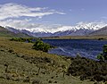
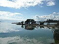
 00 1360 New Zealand - Mirror Lakes.jpg 3,600 × 2,400; 8.11 MB
-
 1959 Ford Thunderbird (16283045745) (cropped).jpg 4,800 × 2,638; 3.39 MB
-
 Adams1.jpg 1,024 × 768; 78 KB
-
 Aoraki (Mount Cook) from Hooker Glacier Lake.jpg 10,467 × 3,962; 10.63 MB
-
 Aoraki Mount Cook.JPG 2,112 × 2,816; 1.66 MB
-
 Aroarokaehe Range 09.jpg 3,963 × 2,027; 5.69 MB
-
 Aroarokaehe Range 10.jpg 4,013 × 1,657; 3.21 MB
-
 Aroarokaehe Range 11.jpg 4,014 × 1,403; 2.85 MB
-
 Aroarokaehe Range 12.jpg 3,175 × 1,726; 2.78 MB
-
 Aroarokaehe Range and Aoraki Mount Cook reflecting in Red Tarn.jpg 4,880 × 2,880; 4.4 MB
-
 Blue Lake in Mount Cook National Park.jpg 4,155 × 2,875; 10.17 MB
-
 Bridge of Remembrance during the sunset, Christchurch, New Zealand.jpg 4,349 × 2,617; 4.9 MB
-
 Bush reflecting in Lake Wilkie.jpg 4,896 × 3,264; 5.54 MB
-
 C Block, City Campus, Ara Institute of Canterbury, Christchurch, New Zealand 17.jpg 5,472 × 3,648; 10.75 MB
-
 Canterbury, South Island banner 2.jpg 14,209 × 2,027; 19.11 MB
-
 Canterbury, South Island banner.jpg 7,071 × 1,009; 6.52 MB
-
 Caradhras.jpg 500 × 375; 96 KB
-
 Cathedral Cove 06.jpg 4,484 × 2,899; 9.29 MB
-
 Christchurch Art Gallery, Christchurch, New Zealand.jpg 12,413 × 5,296; 27.67 MB
-
 Christchurch coast.jpg 1,500 × 984; 353 KB
-
 Christchurch Mosque, New Zealand.jpg 4,013 × 3,247; 5.55 MB
-
 Clouds over Hastings at Sunset2.jpg 2,848 × 2,136; 2.63 MB
-
 Colourful Sky Before Evening Storm, Auckland.jpg 1,600 × 1,200; 866 KB
-
 Common lime during an autumn sunset, Christchurch, New Zealand.jpg 5,052 × 2,842; 16.53 MB
-
 Conical Hill Harris Saddle New Zealand (168706611).jpeg 2,048 × 1,152; 1.28 MB
-
 Crepuscular clouds at Whakatane.JPG 2,032 × 1,524; 422 KB
-
 Deadmans Point Bridge Lake Dunstan Cromwell.jpg 2,592 × 1,944; 2.91 MB
-
 Disappearing Peaks reflecting in Lake Gunn on a calm winter morning.jpg 4,896 × 3,264; 4.59 MB
-
 Driftwood on the beach north of Kaikoura, Canterbury, New Zealand 02.jpg 5,405 × 2,714; 7.12 MB
-
 Eglinton Valley, Fiordland.jpg 1,400 × 800; 450 KB
-
 Evening Clouds (31659900305).jpg 5,184 × 3,456; 5.55 MB
-
 Flickr - brewbooks - i110205 068.jpg 2,592 × 1,944; 1.2 MB
-
 Flickr - JennyHuang - the country of clounds (New Zealand).jpg 3,872 × 2,592; 4.33 MB
-
 Flickr - JennyHuang - Tree and sky in New Zealand (3).jpg 3,872 × 2,592; 9.43 MB
-
 Fog around Lake Heron, Taylor Range, Canterbury, New Zealand.jpg 16,968 × 3,467; 26.18 MB
-
 Franz Josef Glacier 17.jpg 4,023 × 2,682; 8.15 MB
-
 Gloomy Morning (5898790611).jpg 675 × 900; 161 KB
-
 Hakatere River valley, Canterbury, New Zealand.jpg 11,155 × 3,279; 19.82 MB
-
 Hawdon River, Arthur's Pass National Park, New Zealand 03.jpg 5,123 × 3,415; 16.34 MB
-
 Hills in Lindis Pass, New Zealand.jpg 10,014 × 4,156; 17.42 MB
-
 Homer tunnel (8237977179).jpg 2,048 × 1,536; 2.96 MB
-
 Hopua crater lagoon Onehunga.jpg 817 × 519; 262 KB
-
 Jaquemart1.jpg 2,048 × 1,536; 3.46 MB
-
 KiwiRail DXB class Kekerengu.jpg 5,150 × 3,179; 2.41 MB
-
 KiwiRail DXC class Cass.jpg 5,418 × 3,345; 4.15 MB
-
 Kura Tāwhiti, Castle Hill, Canterbury, New Zealand.jpg 8,861 × 3,556; 21.51 MB
-
 Lake Benmore with surrounding hills, New Zealand 02.jpg 11,904 × 3,370; 14.23 MB
-
 Lake Benmore, New Zealand.jpg 11,585 × 3,027; 22.22 MB
-
 Lake Clearwater, Canterbury, New Zealand 15 - cropped.jpg 4,392 × 3,428; 8.92 MB
-
 Lake Clearwater, Canterbury, New Zealand 15.jpg 12,162 × 3,411; 22.83 MB
-
 Lake Manapouri, South Island, New Zealand (6924537770).jpg 1,944 × 2,592; 1.34 MB
-
 Lake Poaka, New Zealand.jpg 11,787 × 2,753; 25.02 MB
-
 Lake Pukaki 18.jpg 3,974 × 1,632; 2.85 MB
-
 Lake Pukaki 23.jpg 4,034 × 2,138; 6.92 MB
-
 Lake Pukaki, Canterbury, New Zealand.jpg 16,887 × 3,760; 20.66 MB
-
 Lake Rotoroa 03.jpg 5,406 × 3,469; 9.67 MB
-
 Lake Rotoroa 04.jpg 4,985 × 2,812; 7.42 MB
-
 Lake Rotoroa 05.jpg 4,785 × 3,160; 10.71 MB
-
 Lake Rotoroa 06.jpg 7,078 × 2,852; 10.41 MB
-
 Lake Rotoroa 07.jpg 4,834 × 2,900; 9.44 MB
-
 Lake Rotoroa 08.jpg 4,497 × 2,553; 6.88 MB
-
 Lake Rotoroa 09.jpg 5,254 × 3,269; 12.96 MB
-
 Lake Rotoroa 10.jpg 5,254 × 3,481; 10.86 MB
-
 Lake Rotoroa 11.jpg 4,479 × 2,986; 8.95 MB
-
 Lake Rotoroa 13.jpg 4,614 × 3,076; 11.23 MB
-
 Lake Rotoroa 14.jpg 5,111 × 3,080; 7.24 MB
-
 Lake Rotoroa 15.jpg 4,380 × 2,920; 12.98 MB
-
 Lake Rotoroa 16.jpg 3,720 × 2,480; 9.76 MB
-
 Lake Rotoroa 17.jpg 4,260 × 2,840; 6.53 MB
-
 Lake Rotoroa 18.jpg 4,397 × 2,772; 7.13 MB
-
 Lake Sylvester during the sunrise, New Zealand.jpg 5,471 × 3,502; 18.68 MB
-
 Lake Taupo.jpg 800 × 551; 100 KB
-
 LakeHeronPanorama.JPG 16,372 × 2,151; 7.34 MB
-
 LakeHeronSwan.jpg 1,920 × 1,200; 1.2 MB
-
 LakeRotorua.jpg 3,072 × 2,304; 2.64 MB
-
 Landscape close to Dun Saddle, Bryant Range, New Zealand.jpg 19,267 × 3,285; 35.69 MB
-
 Len Lye Wind Wand.jpg 1,536 × 2,048; 543 KB
-
 Lyttelton Harbour (Whakaraupō) from Mt Ada, Canterbury, New Zealand.jpg 20,088 × 4,692; 71.05 MB
-
 Main Divide from Yeats Ridge Hut, West Coast Region, New Zealand.jpg 7,386 × 2,902; 14.42 MB
-
 Maniniaro - Angelus Peak, Nelson Lakes National Park, New Zealand.jpg 19,835 × 5,127; 41.48 MB
-
 Marko Several Lakes In McKenzie Basin.jpg 1,800 × 1,200; 1.21 MB
-
 May 2011 Albany, NZ tornado- men in vests.jpg 3,264 × 2,448; 1.26 MB
-
 McKenzie Basin Near The Southern Alps.jpg 1,600 × 1,200; 1.05 MB
-
 Meybille Bay 07.jpg 4,938 × 2,851; 9.28 MB
-
 Mirror Lake - Southland.jpg 3,872 × 2,592; 3.9 MB
-
 Morning clouds above the hills in Hakatere Conservation Park, Canterbury, New Zealand.jpg 4,832 × 2,972; 4.67 MB
-
 Morning clouds in Hakatere Conservation Park, Canterbury, New Zealand.jpg 9,543 × 2,599; 8.12 MB
-
 Morning view, Wanaka.jpg 2,048 × 1,536; 3.22 MB
-

-
 Mount Cook lenticular cloud - panoramio.jpg 3,264 × 2,448; 3.12 MB
-
 Mount Hutt aerial view.jpg 3,296 × 2,100; 4.92 MB
-
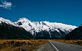 Mt cook road New Zealand (Unsplash).jpg 4,711 × 2,961; 6.72 MB
-
 Mt Misery from northern side, Black Range, New Zealand.jpg 6,278 × 2,751; 13.61 MB
-
 Mt Sefton massif, Aoraki - Mount Cook National Park, New Zealand.jpg 8,699 × 3,034; 17.34 MB
-
 Mt Somers Range from Mt Taylor.jpg 10,578 × 4,510; 31.36 MB
-
 Mt Sugarloaf (1238m) by Lake Heron, New Zealand.jpg 8,240 × 3,153; 13.17 MB
-
 Muriwai Beach - reflections.jpg 3,072 × 2,304; 649 KB
-
 Native bush reflecting in Lake Matheson.jpg 4,896 × 3,264; 4.96 MB
-
 Near Ferry Terminal Near Hahei Beach II.jpg 1,600 × 1,200; 1.17 MB
-
 North from Macraes Road, Otago, New Zealand.jpg 3,872 × 2,592; 5.63 MB
-
 Northern part of Lake Wanaka with surrounding mountains, New Zealand.jpg 14,714 × 2,740; 15.61 MB
-
 Otago sky.jpg 720 × 960; 132 KB
-
 Otira River in Arthur's Pass National Park, New Zealand.jpg 5,220 × 2,907; 9.62 MB
-
 Panorama of northern parts of Christchurch Central City, New Zealand.jpg 18,167 × 4,928; 73.57 MB
-

-
 Phormium tenax in Nga Manu Nature Reserve.jpg 1,024 × 768; 333 KB
-
 Pier by Sabine Hut 16-9, Nelson Lakes National Park, New Zealand.jpg 5,320 × 2,992; 8.43 MB
-
 Pier by Sabine Hut, Nelson Lakes National Park, New Zealand.jpg 5,175 × 3,620; 10.4 MB
-
 Police Boat Deodar III (8424684421).jpg 900 × 600; 127 KB
-
 Porters Pass with Big Ben Range, Torlesse Range, New Zealand.jpg 13,666 × 3,484; 31.31 MB
-
 Queenstown-Lakes 27.jpg 4,180 × 2,692; 6.98 MB
-
 Queenstown-Lakes 28.jpg 4,010 × 2,464; 4.6 MB
-
 Rainy clouds over Wild Mans Brother Range, Canterbury, New Zealand.jpg 5,357 × 2,292; 5.51 MB
-
 Reflections in Lake Te Anau.jpg 2,048 × 1,536; 3.48 MB
-
 RotoKaniere2010.jpg 1,603 × 1,053; 406 KB
-
 RotoTekapo2010.jpg 1,606 × 1,073; 363 KB
-
 Saddle between Junction Peak and Mt Torlesse, Torlesse Range, New Zealand 02.jpg 12,624 × 4,902; 26.96 MB
-
 Sculpture-1120015, Wainuiomata, Wellington, New Zealand.jpg 4,896 × 3,672; 3 MB
-
 Sign-1110858, Wainuiomata, Wellington, New Zealand.jpg 4,896 × 3,672; 8.66 MB
-
 Sky Aglow Over Western Auckland.jpg 1,600 × 1,200; 922 KB
-
 Sky and clouds, The Groynes, Christchurch, New Zealand.jpg 5,472 × 3,648; 7.76 MB
-
 Sky Tower and evening clouds CRW 101 9016.jpg 2,168 × 3,006; 1.12 MB
-
 South Island new banner 1.jpg 12,150 × 1,739; 9.7 MB
-
 Southern Alps from Mt Hutt, NZ4.jpg 3,072 × 2,304; 3.35 MB
-
 State Highway 1 Overbridge, Newmarket.jpg 1,600 × 1,200; 1.14 MB
-
 Stocking Stream Shelter in Hooker Valley in front of Aoraki Mount Cook Range.jpg 4,896 × 3,264; 7.03 MB
-
 Summer skies New Zealand (49548462603).jpg 4,032 × 3,024; 1.64 MB
-
 Sunrise over Benmore Range, New Zealand.jpg 11,647 × 2,412; 9.69 MB
-
 Sunrise over Lake Wanaka from Boundary Creek, New Zealand.jpg 11,944 × 3,536; 28.72 MB
-
 Sunset at Matua (5462764926).jpg 900 × 675; 602 KB
-
 Tasman Lake and Tasman Glacier.jpg 3,498 × 2,684; 6.1 MB
-
 Tasman Lake panorama (03-05-06-07).jpg 6,960 × 2,250; 9.84 MB
-
 Taupo Sailor (6878831979).jpg 675 × 900; 571 KB
-
 Taupo Waterfront (6556084123).jpg 675 × 900; 465 KB
-
 Tekapo-Pukaki canal.jpg 3,072 × 2,304; 1.75 MB
-
 Tongariro02.jpg 14,200 × 2,800; 10.97 MB
-
 Torlesse Range from Mt Torlesse, New Zealand.jpg 11,968 × 3,181; 21.03 MB
-
 Travis Wetland panorama, Christchurch, New Zealand.jpg 22,032 × 3,387; 50.33 MB
-
 Tree Houses for Swamp Dwellers by Julia Morison, Christchurch, New Zealand 03.jpg 5,472 × 3,648; 8.09 MB
-
 Tree Houses for Swamp Dwellers by Julia Morison, Christchurch, New Zealand 04.jpg 5,089 × 2,773; 5.2 MB
-
 TWC Lake Brunner • Stewart Nimmo • MRD 16.jpg 7,788 × 4,228; 19.51 MB
-
 Valley of Tasman River NZ 12.jpg 3,856 × 1,892; 6.81 MB
-
 View from Foggy Peak to Craigieburn Range, New Zealand.jpg 14,209 × 2,979; 21.89 MB
-
 View from Isthmus Peak Trail to Lake Hawea, New Zealand 03.jpg 12,681 × 3,393; 21.61 MB
-
 View from Mt Fyffe, Kaikoura Ranges, New Zealand.jpg 7,025 × 2,962; 13.65 MB
-
 View from Mt Winterslow ridge, Hakatere Conservation Park in Canterbury, New Zealand.jpg 7,965 × 3,385; 17.53 MB
-
 View north from Mt Richardson, New Zealand.jpg 15,821 × 2,843; 32.96 MB
-
 View of Baldy Hill and surrounding ranges, Canterbury, New Zealand.jpg 13,472 × 3,511; 28.87 MB
-
 View of Kaikoura Ranges, New Zealand.jpg 7,071 × 2,886; 16.78 MB
-
 View to Castle Hill Peak from Red Peak, Torlesse Range, New Zealand.jpg 8,176 × 3,256; 15.49 MB
-
 View towards Garnet Peak from Mons Sex Millia, New Zealand.jpg 13,946 × 4,402; 43.99 MB
-
 View towards Mons Sex Millia from Garnet Peak, New Zealand.jpg 14,455 × 4,428; 54.04 MB
-
 Waiau Uwha River, Canterbury, New Zealand 001.jpg 5,472 × 3,373; 13.32 MB
-
 Waihi Beach Reserve 31.jpg 4,607 × 3,071; 9.38 MB
-
 Wainui Bay 20.jpg 4,380 × 2,920; 11.66 MB
-
 Wainui Bay 26.jpg 3,547 × 2,520; 8.15 MB
-
 Waipoua Forest, old fire lookout tower-3.jpg 4,752 × 3,168; 10.95 MB
-
 Wilkin River close to its confluence with Makarora River, New Zealand.jpg 6,195 × 2,985; 10.19 MB
-
 Wilkin River close to its confluence with Makarora River, Otago, New Zealand.jpg 8,324 × 3,532; 19.91 MB
-
 Wilkin River, Otago, New Zealand 06.jpg 3,648 × 4,323; 11.38 MB
-
 Willow in the Red Zone, Christchurch, New Zealand.jpg 5,472 × 3,240; 23.06 MB
-
 Winterslow Range, Canterbury, New Zealand.jpg 10,559 × 3,133; 20.67 MB

_(cropped).jpg)


.jpeg)


.jpg)

.jpg)
.jpg)

.jpg)


.jpg)


.jpg)


_%26_Mount_Tasman_-_Lake_Matheson_(New_Zealand).jpg)


.jpg)


.jpg)


.jpg)
.jpg)

.jpg)
.jpg)


_from_Hooker_Glacier_Lake.jpg)
_from_Mt_Ada,_Canterbury,_New_Zealand.jpg)
_by_Lake_Heron,_New_Zealand.jpg)
.jpg)