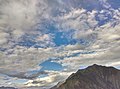
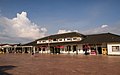
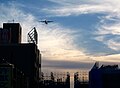
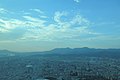
Category:Clouds and blue sky in Taiwan
Countries of Asia: Afghanistan · Armenia‡ · Azerbaijan‡ · Bangladesh · Bhutan · People's Republic of China · Cyprus‡ · East Timor · Egypt‡ · Georgia‡ · India · Indonesia‡ · Iran · Iraq · Israel · Japan · Jordan · Kazakhstan‡ · Laos · Lebanon · Malaysia · Maldives · Mongolia · Myanmar · Nepal · Pakistan · Philippines · Russia‡ · Saudi Arabia · Singapore · South Korea · Sri Lanka · Syria · Thailand · Turkey‡ · Uzbekistan · Vietnam · Yemen
Limited recognition: Taiwan · Northern Cyprus‡
‡: partly located in Asia
Limited recognition: Taiwan · Northern Cyprus‡
‡: partly located in Asia
Media in category "Clouds and blue sky in Taiwan"
The following 200 files are in this category, out of 274 total.
(previous page) (next page)-
 2016年通霄鎮虎頭山公園展望通霄發電廠02.jpg 4,896 × 3,264; 3.44 MB
-
 20171222 KLR 0882 (38572015064).jpg 7,952 × 5,304; 9.19 MB
-
 20171222 KLR 0885 (38572014094).jpg 7,952 × 5,304; 7.84 MB
-
 20171222 KLR 0888 (38402455875).jpg 7,952 × 5,304; 7.91 MB
-
 2018 WanBan Bridge Taipei City 萬板大橋.jpg 6,000 × 4,000; 12.47 MB
-
 2019 La façade de Baozhong Yimin Temple.jpg 6,000 × 4,000; 12.3 MB
-
 207, Taiwan, 新北市萬里區溪底里 - panoramio (1).jpg 4,608 × 3,456; 18.63 MB
-
 208, Taiwan, 新北市金山區重和里 - panoramio (2).jpg 5,472 × 3,648; 11.1 MB
-
 268, Taiwan, 宜蘭縣五結鄉福興村 - panoramio.jpg 5,472 × 3,648; 9.41 MB
-
 306, Taiwan, 新竹縣關西鎮仁安里 - panoramio (27).jpg 6,000 × 4,000; 2.79 MB
-
 306, Taiwan, 新竹縣關西鎮仁安里 - panoramio (32).jpg 6,000 × 4,000; 3.67 MB
-
 336, Taiwan, 桃園市復興區華陵里 - panoramio (79).jpg 3,264 × 2,448; 4.53 MB
-
 367, Taiwan, 苗栗縣三義鄉雙潭村 - panoramio.jpg 6,000 × 4,000; 4.6 MB
-
 555594007 香山溼地.03.jpg 6,000 × 4,000; 8.08 MB
-
 555594007 香山溼地.04.jpg 5,908 × 3,938; 5.84 MB
-
 555594007 香山溼地.05.jpg 5,923 × 3,948; 6.93 MB
-
 555594007 香山溼地.06.jpg 6,000 × 4,000; 6.85 MB
-

-
 A sea of clouds in Mount Daxue 20091007.jpg 2,144 × 1,424; 1.58 MB
-
 Alisan Station 阿里山火車站 - panoramio.jpg 5,831 × 3,887; 6.56 MB
-
 Alishan predawn.JPG 1,280 × 851; 165 KB
-
 Alishan sunrise.JPG 1,280 × 851; 405 KB
-
 Altocumulus clouds over Wuling Farm.jpg 5,520 × 4,140; 5.39 MB
-
 Angelica morrisonicola in Hehuan Mount DSC 1418-2.jpg 5,669 × 4,016; 5.5 MB
-
 Baisha,Penghu.jpg 1,280 × 853; 781 KB
-
 Banqiao, New Taipei Skyline 20100820.jpg 2,048 × 1,949; 1.33 MB
-

-

-
 Big white cloud above Taishan Elementary School in Taishan District, New Taipei.jpg 3,648 × 2,736; 589 KB
-
 Blue Skyin in Taiwan.jpg 960 × 720; 84 KB
-
 BlueSkyInTaiwan.JPG 2,592 × 1,936; 188 KB
-
 Chiang Kai-shek memorial 2 amk.jpg 2,567 × 3,272; 4.16 MB
-
 Chulai Bridge with a tree.jpg 7,360 × 4,912; 17.85 MB
-

-
 Cloud Ocean Taiwan Big Snow Mountain.JPG 2,272 × 1,704; 585 KB
-
 Cloud over Taipei Songshan Airport 20161220.jpg 4,896 × 3,264; 3.05 MB
-
 Clouds 雲 - panoramio.jpg 6,000 × 4,000; 2.74 MB
-
 Cloudy sky over Lantan Lake (cropped).jpg 4,032 × 2,690; 2.26 MB
-
 Cloudy sky over Lantan Lake.jpg 4,032 × 3,021; 2.62 MB
-
 Cloudy sunny sky above Huatan Township Office, as taken on 21 May 2021.jpg 4,000 × 3,000; 2.84 MB
-
 Cumulus humilis clouds (38786085925).jpg 6,016 × 4,016; 10.15 MB
-
 Dalin, Chiayi (Taiwan).jpg 5,090 × 2,863; 3.7 MB
-
 Danshui 080120 7.jpg 653 × 490; 44 KB
-
 Datunshan Navigation Station under white clouds and blue sky on 13th February 2016.jpg 6,000 × 4,000; 22.27 MB
-
 Dawn - panoramio (3).jpg 2,816 × 2,112; 809 KB
-
 Dawn - panoramio (4).jpg 2,816 × 2,112; 785 KB
-
 Deep Blue Sky - panoramio.jpg 1,024 × 768; 360 KB
-
 Devil S Clutches (135792213).jpeg 2,048 × 984; 735 KB
-
 Distant view of National Chi Nan University seen from Kandou Mountain.jpg 4,000 × 3,000; 2.76 MB
-
 DongJi Island (21359619055).jpg 7,308 × 4,877; 3.27 MB
-
 Dongshi Fisherman's Wharf.jpg 4,128 × 3,096; 2.3 MB
-
 Dramatic clouds cover Xiyuping Island, on 26 June 2014.jpg 1,700 × 1,128; 352 KB
-
 DSC00562-永靖-成美館.jpg 5,472 × 3,648; 3.79 MB
-
 DSC09688台南四草濕地夕陽美101777.jpg 4,872 × 3,204; 2.42 MB
-
 East rift valley,Taiwan.jpg 3,264 × 2,448; 928 KB
-
 F1 cloud2 (5020408546).jpg 1,920 × 1,079; 378 KB
-
 FJU MD07.jpg 1,024 × 768; 631 KB
-
 Guanshanling Mountain Trail.jpg 2,980 × 1,888; 2.81 MB
-
 Guanwu WenKueiHo-002.jpg 3,456 × 2,304; 1.55 MB
-
 HeHuanShan Sunset-Taroko National Park.jpg 2,735 × 1,827; 3.65 MB
-
 Hsinchu Plain viewed from Xinfeng.jpg 4,800 × 3,200; 2.09 MB
-
 Hsinchu Plain with sky on a sunny day.jpg 7,360 × 4,912; 4.16 MB
-
 Hsingchien Suspension Bridge, as taken on 1st October 2020.jpg 4,000 × 3,000; 3.36 MB
-
 Huatan Township Office under cloudy sunny sky on 21 May 2021.jpg 4,000 × 3,000; 3.36 MB
-
 IMGP6872-霧峰林家.jpg 4,928 × 3,264; 6.59 MB
-
 Jinde Bridge, Donggang Township, Pingtung County 20060614.jpg 784 × 1,024; 130 KB
-
 Kaohsiung skyline (21765596922).jpg 5,184 × 3,456; 3.36 MB
-
 Kunyang cloud sea+by Yuriy+9287.jpg 4,032 × 3,024; 1.33 MB
-
 Lengshuikeng 冷水坑 - panoramio (5).jpg 6,000 × 4,000; 2.98 MB
-
 Looking north towards Yushan Northern Peak.jpg 3,264 × 2,448; 1.86 MB
-
 Looking west over the coastal plain at Longjing from Dadu Plateau.jpg 2,400 × 2,400; 4.08 MB
-
 Minli Street 民利街 - panoramio.jpg 2,736 × 2,736; 2.17 MB
-
 Motian Collapse in the blue sky with white clouds in the background.jpg 3,968 × 1,959; 4.15 MB
-
 Motor tricycle driving on a beach in Wanggong.jpg 5,520 × 4,140; 7.39 MB
-
 Nanfang'ao Bridge under sunny sky on 28 September 2014.jpg 5,976 × 3,829; 4.27 MB
-
 Nangang, Taipei Skyline.jpg 3,919 × 2,939; 2.51 MB
-
 Neiwan Station with sky.jpg 4,482 × 2,987; 5.4 MB
-
 North Dawu Mountain - Cloudsea.jpg 3,021 × 2,230; 1.21 MB
-
 Outside of Farglory Financial Center top 20170912.jpg 5,184 × 3,456; 8.26 MB
-
 P 20200106 120245 vHDR On.jpg 1,836 × 3,264; 1,013 KB
-
 Penghu MountLin.jpg 5,833 × 3,889; 14.45 MB
-
 Puli Basin seen from the Earthquake Struck Point.jpg 4,000 × 3,000; 1.81 MB
-
 Ruifang District, New Taipei City, Taiwan 224 - panoramio.jpg 5,352 × 3,568; 8.74 MB
-
 S 243449973.jpg 4,032 × 3,024; 1.26 MB
-
 Sanchong Skyline 2017-10-29.jpg 4,608 × 3,456; 4.78 MB
-
 Sanxia Annunciation Church 三峽聖母領報堂 - panoramio.jpg 3,648 × 2,736; 2.86 MB
-
 Scene in Alishan.jpg 1,920 × 1,080; 691 KB
-

-
 Scenic view of the Earthquake Struck Point under cloudy sunny sky on 21st September 2020.jpg 4,000 × 3,000; 4.25 MB
-
 Sea of clouds, Taiwan.jpg 3,453 × 2,531; 1.83 MB
-
 Shei-Pa National Park+Charlotte0000+09.jpg 3,264 × 2,448; 2.06 MB
-
 Shei-Pa National Park+Charlotte0000+20.jpg 3,264 × 2,448; 2.02 MB
-
 Shei-Pa National Park+Charlotte0000+22.jpg 3,264 × 2,448; 2.71 MB
-
 Shei-Pa National Park+Charlotte0000+27.jpg 3,264 × 2,448; 2.15 MB
-
 Side view of Changhong Bridge on 7 May 2011.jpg 2,917 × 1,636; 1.05 MB
-
 Skyline of Banqiao, New Taipei, Taiwan in 2010.jpg 1,920 × 1,080; 850 KB
-
 Skyline view from Dadaocheng Wharf 20090418.jpg 3,039 × 2,014; 3.63 MB
-
 Skyline view from Dadaocheng Wharf 20151109.png 1,680 × 1,120; 10.77 MB
-
 South Penghu Marine National Park banner.jpg 7,308 × 1,044; 2.07 MB
-
 South Songshan District and Bridges across Keelung River 20120816a.jpg 4,000 × 3,000; 6.27 MB
-
 Storm clouds cover Qimei Island, on 26 June 2014.jpg 1,700 × 1,129; 858 KB
-
 Summer Clouds (234060063) (cropped).jpeg 2,047 × 292; 105 KB
-
 Summer Clouds (234060063).jpeg 2,048 × 1,280; 566 KB
-
 Summer Clouds Around Pavilion (251147333).jpeg 2,000 × 1,334; 506 KB
-
 Sun set scenery.jpg 4,288 × 2,193; 4.33 MB
-
 Sunningdale Hill.jpg 2,848 × 2,136; 1.39 MB
-
 Sunset at Kenting National Park, August 2017.jpg 5,184 × 3,456; 4.25 MB
-
 Sunset in Tamsui.jpg 4,000 × 3,000; 5.25 MB
-
 Sunset In Train Station (228098187).jpeg 2,000 × 1,336; 337 KB
-
 Sunset of Gaomei Wetland.JPG 4,288 × 2,848; 5.6 MB
-
 Sunset Susan MingY 1.jpg 2,976 × 3,968; 2.2 MB
-
 Taijiang National Park sunset.jpg 1,706 × 960; 230 KB
-
 Taipei crepuscular rays 臺北雲隙光 2018.jpg 2,000 × 1,200; 1.38 MB
-
 Taipei, Keelung City, Taiwan - panoramio (59).jpg 3,250 × 1,828; 1.91 MB
-
 Taipei, Taiwan sunset skyline from Mt. Tiger 2015.jpg 3,456 × 2,086; 675 KB
-
 Taipei-Beitou-Cumulonimbus calvus.jpg 3,264 × 2,448; 4.46 MB
-
-
 Taiwan-central-cross-highway-cloudsea.jpg 500 × 375; 67 KB
-
 Taiwan,Yilan River.jpg 3,264 × 2,448; 825 KB
-
 Taroko National Park 9287 evan5678 02.jpg 4,896 × 2,752; 4 MB
-
 TAROKOnationalpark-linhsinyi-9287 (15).jpg 4,224 × 3,136; 2.6 MB
-
 The Sky 20120307 - panoramio.jpg 2,560 × 1,920; 1.69 MB
-
 The Sunny Day 20120206 - panoramio.jpg 2,560 × 1,920; 1.18 MB
-
 The Wire with Clouds 20120206 - panoramio.jpg 2,560 × 1,920; 1.39 MB
-
 Towards Sunset I (TAIPEI-TAIWAN-SKY-CLOUDS-SUNSET) (895910102).jpg 2,292 × 2,442; 394 KB
-
 Towards Sunset II (TAIPEI-TAIWAN-SKY-CLOUDS-SUNSET) (895064949).jpg 3,219 × 2,187; 475 KB
-
 Towards Sunset III (TAIPEI-TAIWAN-SKY-CLOUDS-SUNSET) (895066289).jpg 3,201 × 2,307; 617 KB
-
 Towards Sunset IV (TAIPEI-TAIWAN-SKY-CLOUDS-SUNSET) (895914374).jpg 3,264 × 2,160; 576 KB
-
 Towards Sunset V (TAIPEI-TAIWAN-SKY-CLOUDS-SUNSET) (895069543).jpg 3,264 × 2,448; 686 KB
-
 TRA Beihu Station.jpg 682 × 394; 119 KB
-
 TRA Dounan Station 03 (cropped).jpg 1,875 × 1,250; 536 KB
-
 TRA Dounan Station 03.jpg 2,000 × 1,250; 417 KB
-
 TRA Hukou Station 20121229.jpg 4,032 × 3,024; 2.47 MB
-
 TransAsia Airways ATR-72 Landing Down Songshan Airport in Evening 20100703.jpg 3,564 × 2,620; 1.35 MB
-

-
 TW 台灣 Taiwan 台北101觀景台 Taipei City 101 Observatory viewing August 2019 IX2 14.jpg 3,648 × 2,432; 4.2 MB
-
 TW 台灣 Taiwan 台北101觀景台 Taipei City 101 Observatory viewing August 2019 IX2 92.jpg 3,648 × 2,432; 3.6 MB
-

-

-
 View of Kaohsiung harbor skyline 2016.jpg 6,016 × 4,000; 5.79 MB
-
 View of Miaoli on Freeway 1.jpg 2,816 × 2,112; 1.11 MB
-
 View of mountains from Erwanping.jpg 1,920 × 1,080; 775 KB
-
 View of Mt Fenghuang above the sea of clouds from Liulongtou.jpg 6,000 × 4,000; 19.55 MB
-
 White fluffy clouds over Taishan Elementary School in Taishan District, New Taipei.jpg 2,736 × 3,648; 2.21 MB
-
 Yu Shan National Park ansonwu DSC 1719-1s.jpg 3,000 × 2,002; 971 KB
-
 YushanSeaCloud2.jpg 1,280 × 853; 922 KB
-
 YushanSeaCloud3.jpg 1,280 × 853; 838 KB
-
 YushanSeaCloud6.jpg 800 × 600; 39 KB
-
 YushanSunrise1.jpg 1,280 × 853; 871 KB
-

-
 【新北美食】Holly Brown Taiwan (30938095096).jpg 1,800 × 1,200; 442 KB
-
 中正橋吊裝空拍20230227.jpg 5,472 × 3,078; 2.22 MB
-
 五間紫雲寺廟前.jpg 3,264 × 2,448; 2.05 MB
-
 傍晚的阿里山區.jpg 4,096 × 2,299; 2.16 MB
-
 八寶公主廟前墾丁大灣.jpg 3,264 × 2,448; 2.63 MB
-
 北埔慈天宮2.jpg 2,448 × 3,264; 1.71 MB
-
 北投市區 - panoramio.jpg 3,101 × 2,067; 1.54 MB
-
 北湖火車站 (8130765510).jpg 800 × 1,280; 356 KB
-
 南山福德宮 Nanshan Fude Temple - panoramio (1).jpg 3,648 × 2,736; 2.21 MB
-
 南投縣信義鄉 玉山山脈雪景 - panoramio (12).jpg 3,648 × 2,432; 816 KB
-
 南投縣信義鄉 玉山山脈雪景 - panoramio (2).jpg 2,000 × 1,344; 446 KB
-
 台北中正紀念堂 National Chiang Kai-shek Memorial Hall. - panoramio - Tianmu peter (3).jpg 3,072 × 2,304; 1.16 MB
-
 台北街頭 (52197603048).jpg 5,467 × 3,645; 15.45 MB
-
 台灣夏末的雲DSC 7026.jpg 6,016 × 4,000; 1.54 MB
-
 台灣省雲林縣虎尾鎮貯水塔旁與道路-2.JPG 2,304 × 1,728; 1,002 KB
-
 台灣省雲林縣虎尾鎮貯水塔旁與道路.JPG 2,304 × 1,728; 997 KB
-
 台灣阿里山的日出.jpg 1,920 × 1,280; 590 KB
-
 合歡北峰一景.jpg 2,048 × 1,360; 290 KB
-
 合歡山 主峰 - Flickr - skip0925.jpg 5,568 × 3,712; 10.07 MB
-
 喔哇.jpg 3,000 × 4,000; 1.89 MB
-
 嘉義縣大林鎮 農田風景 - panoramio.jpg 3,264 × 2,448; 1.72 MB
-
 嘉義縣大林鎮 運動公園 - panoramio (2).jpg 3,648 × 2,736; 1.06 MB
-
 嘉義縣溪口鄉 - panoramio.jpg 3,264 × 2,448; 1.6 MB
-
 嘉義縣溪口鄉 柴林腳 - panoramio (1).jpg 3,264 × 2,448; 1.33 MB
-
 嘉義縣溪口鄉 柴林腳 - panoramio.jpg 3,264 × 2,448; 1.31 MB
-
 嘉義縣溪口鄉 跨越北港溪的小橋 - panoramio.jpg 3,264 × 2,448; 1.5 MB
-
 埔里台糖廣場前 - panoramio.jpg 4,288 × 2,848; 3.34 MB
-
 基河路 - panoramio.jpg 2,592 × 1,944; 1.04 MB
-
 基隆山雲海IMG 7378.jpg 3,840 × 2,160; 779 KB
-
 外星人的前置作業.jpg 4,000 × 3,000; 1.71 MB
-
 大安國小校門 中興版.jpg 2,048 × 1,365; 3.12 MB
-
 天母遊樂 拍 - panoramio.jpg 3,072 × 2,304; 1.23 MB
-
 天空一朵美麗的白雲 - panoramio.jpg 3,072 × 2,304; 1.24 MB
-
 安平商港北堤.jpg 4,096 × 2,299; 3.97 MB
-
 宜蘭縣雙連埤野生動物重要棲息環境.jpg 2,000 × 3,008; 2.48 MB
-
 富貴角燈塔FUJI9865b.jpg 3,264 × 4,896; 583 KB
-
 富貴角燈塔夕照FUJI9853b.jpg 4,896 × 3,264; 949 KB
-
 小上帝廟.JPG 4,592 × 2,576; 5.38 MB
-
 屏東縣恆春鎮 炙熱的恆春海岸 - panoramio.jpg 3,264 × 2,448; 1.55 MB
-
 山上人家 (62125399).jpeg 2,048 × 1,365; 920 KB
-
 後龍好望角.jpg 3,264 × 2,448; 1.78 MB
-
 後龍好望角展望01.jpg 9,600 × 2,160; 6.49 MB
-
 後龍好望角展望02.jpg 4,896 × 3,264; 6.58 MB
-
 拉拉山 Lala Mountain - panoramio (1).jpg 6,000 × 4,000; 2.9 MB
-
 拔林車站灣道式月台 - panoramio.jpg 3,072 × 2,304; 1.78 MB
-
 拔林車站站內一景 - panoramio (1).jpg 3,072 × 2,304; 2.05 MB
-
 接近後龍高速公路風景 - panoramio - Tianmu peter (1).jpg 3,072 × 2,304; 1.76 MB
-
 接近後龍高速公路風景 - panoramio - Tianmu peter.jpg 3,072 × 1,871; 1.9 MB
-
 操場 20110113 - panoramio.jpg 2,592 × 1,944; 719 KB
-
 支亞干橋-1.jpg 4,032 × 3,024; 3.19 MB

.jpg)
.jpg)
.jpg)


.jpg)
.jpg)

.jpg)
.jpg)
.jpg)


.jpg)


.jpg)
.jpg)


.jpg)
.jpg)

.jpeg)

.jpg)


.jpg)


.jpg)

.jpg)


.jpeg)
.jpeg)


.jpeg)


.jpg)


.jpg)


_(895910102).jpg)
_(895064949).jpg)
_(895066289).jpg)
_(895914374).jpg)
_(895069543).jpg)

.jpg)


.jpg)


.jpg)
.jpg)
.jpg)
.jpg)
.jpg)
.jpg)


.jpg)

.jpg)


.jpeg)


.jpg)

.jpg)
.jpg)


_(cropped).jpeg)