Category:Clyst Hydon
village and civil parish in Devon, United Kingdom  Eglwys Sant Andreas, Clyst Hydon | |||||
| Upload media | |||||
| Instance of | |||||
|---|---|---|---|---|---|
| Location | East Devon, Devon, South West England, England | ||||
| Population |
| ||||
| Area |
| ||||
 | |||||
Media in category "Clyst Hydon"
The following 169 files are in this category, out of 169 total.
-
 Approach road to Peradon Farm - geograph.org.uk - 2609087.jpg 800 × 600; 495 KB
-
 Aunk Cross - geograph.org.uk - 2136424.jpg 640 × 480; 104 KB
-
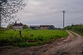
 Aunke Manor Farm (geograph 1787405).jpg 1,024 × 768; 201 KB
-
 Bales, stored near Peradon Farm - geograph.org.uk - 1980140.jpg 1,024 × 768; 213 KB
-
 Bridge over River Clyst - geograph.org.uk - 2609116.jpg 600 × 800; 530 KB
-
 Cattle, Clyst Hydon - geograph.org.uk - 4649949.jpg 1,920 × 1,262; 847 KB
-
 Clump of trees near Roach Farm - geograph.org.uk - 1863373.jpg 640 × 475; 104 KB
-
 Clyst Hydon , Cattle Grazing - geograph.org.uk - 3945365.jpg 3,259 × 2,164; 6.32 MB
-
 Clyst Hydon , Church Entrance - geograph.org.uk - 3945318.jpg 4,288 × 2,848; 6.41 MB
-
 Clyst Hydon , Clyst Hydon Primary School - geograph.org.uk - 3945342.jpg 4,288 × 2,848; 5.43 MB
-
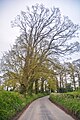
 Clyst Hydon , Country Lane - geograph.org.uk - 3943751.jpg 4,288 × 2,848; 6.4 MB
-
 Clyst Hydon , Country Lane - geograph.org.uk - 3943754.jpg 4,288 × 2,848; 6.91 MB
-
 Clyst Hydon , Country Lane - geograph.org.uk - 3943756.jpg 4,288 × 2,848; 6.35 MB
-
 Clyst Hydon , Country Lane - geograph.org.uk - 3945300.jpg 4,288 × 2,848; 6.33 MB
-
 Clyst Hydon , Grassy Field - geograph.org.uk - 3881412.jpg 4,288 × 2,848; 6.21 MB
-
 Clyst Hydon , Grassy Field ^ Cattle - geograph.org.uk - 3945356.jpg 4,288 × 2,848; 5.59 MB
-
 Clyst Hydon , Small Lane - geograph.org.uk - 3881457.jpg 4,288 × 2,848; 6.06 MB
-
 Clyst Hydon , St Andrew's Church - geograph.org.uk - 3945312.jpg 4,288 × 2,848; 6.16 MB
-
 Clyst Hydon , The Five Bells Inn - geograph.org.uk - 6427733.jpg 6,000 × 4,000; 6.85 MB
-
 Clyst Hydon , The Five Bells Inn - geograph.org.uk - 6427734.jpg 6,000 × 4,000; 5.56 MB
-
 Clyst Hydon , The Old Manor - geograph.org.uk - 3945304.jpg 4,288 × 2,848; 5.67 MB
-
 Clyst Hydon , Three Firs Cross - geograph.org.uk - 3943752.jpg 4,288 × 2,848; 6.23 MB
-
 Clyst Hydon , Village Green - geograph.org.uk - 3945348.jpg 4,288 × 2,848; 6.47 MB
-
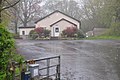 Clyst Hydon , Village Hall - geograph.org.uk - 3943750.jpg 4,288 × 2,848; 6.43 MB
-
 Clyst Hydon , Village Road - geograph.org.uk - 3945343.jpg 4,288 × 2,848; 6.95 MB
-
 Clyst Hydon , Village Road - geograph.org.uk - 3945351.jpg 4,288 × 2,848; 6.18 MB
-
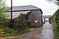 Clyst Hydon , Wright's Farm - geograph.org.uk - 3943755.jpg 4,288 × 2,848; 6.98 MB
-
 Clyst Hydon , Yarde Lane - geograph.org.uk - 3945353.jpg 4,288 × 2,848; 6.75 MB
-
 Clyst Hydon , Yarde Lane - geograph.org.uk - 3945376.jpg 4,288 × 2,848; 5.83 MB
-
 Clyst Hydon , Yarde Lane - geograph.org.uk - 3945379.jpg 4,218 × 2,740; 5.68 MB
-
 Clyst Hydon, entrance to Peradon Farm - geograph.org.uk - 134872.jpg 640 × 427; 167 KB
-
 Clyst Hydon, housing at Little Silver - geograph.org.uk - 134870.jpg 640 × 427; 101 KB
-
 Clyst Hydon, inside the Five Bells - geograph.org.uk - 4200718.jpg 1,600 × 1,213; 301 KB
-
 Clyst Hydon, The Five Bells Inn - geograph.org.uk - 4200711.jpg 1,600 × 1,200; 406 KB
-
 Clyst Hydon, the road from Talaton - geograph.org.uk - 146036.jpg 640 × 427; 202 KB
-
 Cottage near Clyst Hydon - geograph.org.uk - 1863717.jpg 640 × 480; 116 KB
-
 Daffodils near Marsh Cross - geograph.org.uk - 2324174.jpg 465 × 640; 133 KB
-
 East Devon , Auncke Manor Farm - geograph.org.uk - 5767124.jpg 6,000 × 4,000; 6.96 MB
-
 East Devon , Aunk Cross - geograph.org.uk - 5767129.jpg 6,000 × 4,000; 6.36 MB
-
 East Devon , Country Lane - geograph.org.uk - 3881466.jpg 4,288 × 2,848; 6.24 MB
-
 East Devon , Country Lane - geograph.org.uk - 3881472.jpg 4,288 × 2,848; 6.13 MB
-
 East Devon , Country Lane - geograph.org.uk - 3881478.jpg 2,848 × 4,288; 6.32 MB
-
 East Devon , Country Lane - geograph.org.uk - 3885077.jpg 4,288 × 2,848; 5.97 MB
-
 East Devon , Country Lane - geograph.org.uk - 3885078.jpg 4,288 × 2,848; 6.35 MB
-
 East Devon , Country Lane - geograph.org.uk - 3885080.jpg 4,288 × 2,848; 4.87 MB
-
 East Devon , Country Lane - geograph.org.uk - 3943725.jpg 4,188 × 2,688; 5.36 MB
-
 East Devon , Country Lane - geograph.org.uk - 3943727.jpg 4,288 × 2,848; 6.93 MB
-
 East Devon , Country Lane - geograph.org.uk - 3943732.jpg 4,288 × 2,848; 5.51 MB
-
 East Devon , Country Lane - geograph.org.uk - 3943735.jpg 4,288 × 2,848; 5.17 MB
-
 East Devon , Country Lane - geograph.org.uk - 3943742.jpg 2,848 × 4,288; 5.47 MB
-
 East Devon , Country Lane - geograph.org.uk - 3943746.jpg 4,288 × 2,848; 6.48 MB
-
 East Devon , Country Lane - geograph.org.uk - 3943747.jpg 2,848 × 4,288; 6.28 MB
-
 East Devon , Country Lane - geograph.org.uk - 5767096.jpg 6,000 × 4,000; 7.79 MB
-
 East Devon , Country Lane - geograph.org.uk - 5767097.jpg 6,000 × 4,000; 6.41 MB
-
 East Devon , Country Lane - geograph.org.uk - 5767147.jpg 6,000 × 4,000; 7.34 MB
-
 East Devon , Country Lane - geograph.org.uk - 5767149.jpg 4,000 × 6,000; 5.69 MB
-
 East Devon , Country Lane - geograph.org.uk - 5767150.jpg 6,000 × 4,000; 5.9 MB
-
 East Devon , Farm Track - geograph.org.uk - 3943739.jpg 4,288 × 2,848; 5.8 MB
-
 East Devon , Farrantshayes Farm - geograph.org.uk - 5767105.jpg 6,000 × 4,000; 5.95 MB
-
 East Devon , Farrantshayes Farm - geograph.org.uk - 5767106.jpg 6,000 × 4,000; 6.99 MB
-
 East Devon , Grassy Field - geograph.org.uk - 3943729.jpg 4,288 × 2,848; 5.51 MB
-
 East Devon , Grassy Field - geograph.org.uk - 3943737.jpg 4,288 × 2,848; 5.08 MB
-
 East Devon , Grassy Field - geograph.org.uk - 5767080.jpg 6,000 × 4,000; 6.37 MB
-
 East Devon , Grassy Field - geograph.org.uk - 5767107.jpg 6,000 × 4,000; 7.37 MB
-
 East Devon , Grassy Field - geograph.org.uk - 5767130.jpg 6,000 × 4,000; 5.72 MB
-
 East Devon , Grassy Field - geograph.org.uk - 5767139.jpg 6,000 × 4,000; 7.55 MB
-
 East Devon , Grassy Field - geograph.org.uk - 5767152.jpg 6,000 × 4,000; 6.65 MB
-
 East Devon , Grassy Field ^ Gate - geograph.org.uk - 5767118.jpg 6,000 × 4,000; 7.68 MB
-
 East Devon , Grassy Field ^ Sheep - geograph.org.uk - 3943743.jpg 3,429 × 2,275; 6.26 MB
-
 East Devon , Grassy Field ^ Sheep - geograph.org.uk - 5767109.jpg 6,000 × 4,000; 6.58 MB
-
 East Devon , Heathen Hill Farm - geograph.org.uk - 3980763.jpg 4,288 × 2,848; 5.66 MB
-
 East Devon , Heathen Hill Farm - geograph.org.uk - 3980766.jpg 3,979 × 2,642; 4.81 MB
-
 East Devon , Heathen Hill Farm - geograph.org.uk - 3980769.jpg 4,288 × 2,848; 5.14 MB
-
 East Devon , Heathen Hill Farm - geograph.org.uk - 3980771.jpg 4,288 × 2,848; 5.14 MB
-
 East Devon , Heathen Hill Farm - geograph.org.uk - 3980775.jpg 2,848 × 4,288; 6.24 MB
-
 East Devon , Heathen Hill Farm - geograph.org.uk - 3980779.jpg 4,012 × 2,672; 7.71 MB
-
 East Devon , Heathen Hill Farm - geograph.org.uk - 3980781.jpg 4,288 × 2,848; 7.35 MB
-
 East Devon , Heathen Hill Farm - geograph.org.uk - 3980785.jpg 4,288 × 2,848; 5.66 MB
-
 East Devon , Heathen Hill Farm - geograph.org.uk - 3980790.jpg 3,987 × 2,649; 5.59 MB
-
 East Devon , Heathen Hill Farm - geograph.org.uk - 3980794.jpg 1,968 × 2,922; 4.39 MB
-
 East Devon , Heathen Hill Farm ^ Milking Parlour - geograph.org.uk - 3980767.jpg 3,437 × 2,283; 5.34 MB
-
 East Devon , Marsh Close - geograph.org.uk - 5767095.jpg 6,000 × 4,000; 5.65 MB
-
 East Devon , Maypowders Cottage - geograph.org.uk - 5767134.jpg 6,000 × 4,000; 6.73 MB
-
 East Devon , Offlands - geograph.org.uk - 5767103.jpg 6,000 × 4,000; 7.53 MB
-
 East Devon , One Fir Cross - geograph.org.uk - 3943748.jpg 4,288 × 2,848; 6.4 MB
-
 East Devon , Ratclyffe - geograph.org.uk - 5767145.jpg 6,000 × 4,000; 7.1 MB
-
 East Devon , Ratclyffe Lodge - geograph.org.uk - 5767123.jpg 6,000 × 4,000; 6.4 MB
-
 East Devon , Roach Cottage - geograph.org.uk - 3943744.jpg 4,288 × 2,848; 6.31 MB
-
 East Devon , Roach Farm - geograph.org.uk - 3943738.jpg 4,288 × 2,848; 5.15 MB
-
 East Devon , Road Junction - geograph.org.uk - 3885075.jpg 4,288 × 2,848; 6.16 MB
-
 East Devon , Tale Lane - geograph.org.uk - 5767081.jpg 4,000 × 6,000; 6.36 MB
-
 East Devon , Tale Lane - geograph.org.uk - 5767082.jpg 6,000 × 4,000; 7.62 MB
-
 East Devon , Tale Lane - geograph.org.uk - 5767090.jpg 4,000 × 6,000; 6.64 MB
-
 East Devon , Tale Lane - geograph.org.uk - 5767091.jpg 6,000 × 4,000; 5.66 MB
-
 East Devon , Track - geograph.org.uk - 5767085.jpg 6,000 × 4,000; 5.96 MB
-
 East Devon , Track to Ratclyffe - geograph.org.uk - 5767126.jpg 6,000 × 4,000; 7.03 MB
-
 East Devon , Yarde Farm - geograph.org.uk - 3945385.jpg 4,288 × 2,848; 5.38 MB
-
 Entrance to Farrantshayes Farm - geograph.org.uk - 2940241.jpg 640 × 480; 175 KB
-
 Farm road, Marsh Farm - geograph.org.uk - 2324023.jpg 640 × 480; 112 KB
-
 Farrant's Hayes - geograph.org.uk - 2324338.jpg 640 × 480; 108 KB
-
 Farrants Hayes - geograph.org.uk - 2324500.jpg 640 × 410; 70 KB
-
 Field and gateway at Peradon Farm - geograph.org.uk - 2609091.jpg 800 × 600; 403 KB
-

-
 Field south of Peradon Farm - geograph.org.uk - 2323884.jpg 640 × 411; 74 KB
-
 Fields north of Clyst Hydon - geograph.org.uk - 1589140.jpg 640 × 480; 180 KB
-
 Fodder crop near Peradon Farm - geograph.org.uk - 2323774.jpg 640 × 446; 95 KB
-
 Footpath junction at England Cottage - geograph.org.uk - 5932423.jpg 640 × 480; 193 KB
-
 Footpath to Aunk - geograph.org.uk - 2239738.jpg 640 × 480; 339 KB
-

-

-

-
 Gate by Marsh Cross - geograph.org.uk - 2136416.jpg 640 × 480; 116 KB
-
 Gated entrance to a barn area - geograph.org.uk - 1589144.jpg 640 × 480; 166 KB
-
 Gateway into a muddy field - geograph.org.uk - 1589163.jpg 640 × 480; 179 KB
-
 Gateway to Ratclyffe in Aunk - geograph.org.uk - 2240248.jpg 640 × 480; 270 KB
-
 Green lane near Aunk - geograph.org.uk - 2940245.jpg 640 × 480; 213 KB
-
 Hedge and fields near Peradon Farm - geograph.org.uk - 2940237.jpg 640 × 480; 157 KB
-
 Hoop Farm - geograph.org.uk - 1589157.jpg 640 × 480; 130 KB
-

-
 Lane above One Fir - geograph.org.uk - 1863691.jpg 480 × 640; 144 KB
-
 Lane heading towards Talaton - geograph.org.uk - 6439150.jpg 1,600 × 1,200; 786 KB
-
 Lane junction near Sherway Farm - geograph.org.uk - 1863326.jpg 480 × 640; 146 KB
-
 Lane near Clyst Hydon - geograph.org.uk - 1863695.jpg 640 × 434; 136 KB
-
 Lane near Clyst Hydon - geograph.org.uk - 1863706.jpg 480 × 640; 135 KB
-
 Lane near Sherway Farm - geograph.org.uk - 1863318.jpg 640 × 491; 113 KB
-
 Lane past Barrats - geograph.org.uk - 2324323.jpg 640 × 489; 76 KB
-
 Lane to Clyst Hydon - geograph.org.uk - 1863397.jpg 640 × 463; 95 KB
-
 Lane to Peradon Farm - geograph.org.uk - 2940238.jpg 640 × 480; 206 KB
-
 Lane to Tale - geograph.org.uk - 2324285.jpg 480 × 640; 106 KB
-

-
 Marsh Cross - geograph.org.uk - 2324208.jpg 640 × 480; 90 KB
-
 Marsh Cross - geograph.org.uk - 2324226.jpg 640 × 480; 100 KB
-
 Marsh Farm, Clyst Hydon - geograph.org.uk - 2324040.jpg 640 × 480; 126 KB
-
 Meadows near Aunk - geograph.org.uk - 5451965.jpg 1,024 × 871; 240 KB
-
 Minor road north of Hoop Cross - geograph.org.uk - 2609206.jpg 800 × 600; 353 KB
-
 Minor road passing Sherway Farm - geograph.org.uk - 2609209.jpg 800 × 600; 500 KB
-
 Minor road to Talaton - geograph.org.uk - 5451962.jpg 1,024 × 795; 176 KB
-
 Minor road west of Peradon Farm - geograph.org.uk - 2609095.jpg 600 × 800; 495 KB
-
 Oaks by the road from Aunk - geograph.org.uk - 2324585.jpg 480 × 640; 100 KB
-

-

-

-
 Peradon Farm - geograph.org.uk - 2323862.jpg 640 × 480; 115 KB
-
 Ploughed field east of Aunk - geograph.org.uk - 2324613.jpg 640 × 480; 143 KB
-
 Pond near Marsh Farm - geograph.org.uk - 2323998.jpg 640 × 480; 158 KB
-
 Ratclyffe - geograph.org.uk - 2324552.jpg 640 × 480; 52 KB
-
 River Clyst - geograph.org.uk - 2324018.jpg 498 × 640; 124 KB
-
 Road at Aunk - geograph.org.uk - 2324522.jpg 480 × 640; 122 KB
-
 Road junction west of Clyst Hydon - geograph.org.uk - 1589143.jpg 640 × 480; 117 KB
-
 Road near Maypowders Cottage - geograph.org.uk - 2324535.jpg 640 × 480; 78 KB
-
 Road past Peradon Farm - geograph.org.uk - 2136448.jpg 640 × 480; 106 KB
-
 Road south of Marsh Cross - geograph.org.uk - 2609099.jpg 600 × 800; 444 KB
-
 Road to Clyst Hydon - geograph.org.uk - 2940240.jpg 640 × 480; 174 KB
-
 Road to Langford - geograph.org.uk - 1589136.jpg 640 × 480; 192 KB
-
 Road to Langford - geograph.org.uk - 1863721.jpg 480 × 640; 83 KB
-
 Road to Peradon Farm - geograph.org.uk - 1980129.jpg 1,024 × 768; 244 KB
-
 Road to Talaton - geograph.org.uk - 2324602.jpg 500 × 640; 142 KB
-
 Road to Westcott from Aunk - geograph.org.uk - 2240259.jpg 640 × 480; 314 KB
-
 Rookery beside road to Aunk - geograph.org.uk - 2239743.jpg 640 × 480; 277 KB
-
 Rooks near Aunk - geograph.org.uk - 2239745.jpg 640 × 480; 260 KB
-
 Shelter belt east of Aunk - geograph.org.uk - 2324626.jpg 480 × 640; 137 KB
-
 Shelter belt near Aunk - geograph.org.uk - 5451968.jpg 1,024 × 795; 228 KB
-
 Signpost at Hoop Cross - geograph.org.uk - 2609204.jpg 574 × 800; 406 KB
-
 The park at Ratclyffe - geograph.org.uk - 2324566.jpg 640 × 470; 74 KB
-
 Three Firs junction and barn - geograph.org.uk - 2609122.jpg 800 × 600; 478 KB
-
 Track near Peradon Farm - geograph.org.uk - 2323853.jpg 640 × 480; 110 KB
-
 Track to Marsh Farm, a public footpath - geograph.org.uk - 2609107.jpg 600 × 800; 474 KB
-
 Tree sentinals - geograph.org.uk - 1589160.jpg 640 × 480; 239 KB
-
 Trees around pond, Peradon Farm - geograph.org.uk - 2323988.jpg 640 × 480; 93 KB


.jpg)


