Category:Colby, Kansas city hall
| Object location | | View all coordinates using: OpenStreetMap |
|---|
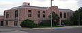
rathaus in Colby, United States of America  | |||||
| Upload media | |||||
| Instance of | |||||
|---|---|---|---|---|---|
| Location | Colby, Thomas County, Kansas | ||||
| Street address |
| ||||
| Architectural style | |||||
| Heritage designation |
| ||||
| Inception |
| ||||
 | |||||
Media in category "Colby, Kansas city hall"
The following 3 files are in this category, out of 3 total.
-
 Colby, Kansas city hall from NW 1.JPG 2,332 × 951; 405 KB
-
 Colby, Kansas city hall from SW 1.JPG 2,200 × 921; 387 KB
-
 Colby, Kansas city hall from W 1.JPG 2,185 × 1,060; 419 KB
