Category:Colinton, Edinburgh
suburb of Edinburgh, Scotland, UK  | |||||
| Upload media | |||||
| Instance of | |||||
|---|---|---|---|---|---|
| Part of |
| ||||
| Location |
| ||||
| Population |
| ||||
 | |||||
Colinton (Scottish Gaelic: Baile Cholgain) is a suburb of Edinburgh, Scotland situated 6 kilometres south west of the city centre. It is bordered by Dreghorn to the south and Craiglockhart to the north-east. To the north-west it extends to Lanark Road (the A70) and to the south-west to the City Bypass.
Subcategories
This category has the following 3 subcategories, out of 3 total.
Media in category "Colinton, Edinburgh"
The following 45 files are in this category, out of 45 total.
-
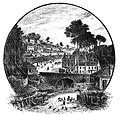 19thC Colinton.jpg 2,051 × 1,972; 2 MB
-
 Approaching the end of Redford Road - geograph.org.uk - 1011280.jpg 452 × 640; 124 KB
-
 Bridge Street, Colinton (c.1980).JPG 2,477 × 1,593; 1.22 MB
-
 Colinton Dell path - geograph.org.uk - 978696.jpg 640 × 480; 135 KB
-
 Colinton Dell, Edinburgh, Feb 1991 (6691400399).jpg 1,752 × 1,176; 2.01 MB
-
 Colinton Dell, Feb 1991 (6025696071).jpg 1,184 × 1,736; 1.66 MB
-
 Colinton Dell, Feb 1991 (6691404449).jpg 771 × 690; 263 KB
-
 Colinton Dell, Feb 1991 (6691407957).jpg 1,748 × 1,180; 1.48 MB
-
 Colinton Dell, Feb 1991 (6691409477).jpg 1,748 × 1,184; 1.46 MB
-
 Colinton Dell, Feb 1991 (6691411947).jpg 1,752 × 1,184; 1.91 MB
-
 Colinton Dell, Feb 1991 (6691413833).jpg 1,748 × 1,176; 1.85 MB
-
 Colinton Manse - geograph.org.uk - 1407531.jpg 640 × 480; 92 KB
-
 Colinton Village - geograph.org.uk - 936261.jpg 640 × 480; 96 KB
-
 Colinton village and bridge, Midlothian, Scotland.jpg 4,896 × 2,752; 4.44 MB
-
 Colinton village.jpg 640 × 427; 141 KB
-
 Colinton War Memorial - geograph.org.uk - 1407537.jpg 640 × 480; 112 KB
-
 Colinton War Memorial - geograph.org.uk - 1407538.jpg 640 × 480; 115 KB
-
 Colinton Yew - geograph.org.uk - 168697.jpg 480 × 640; 140 KB
-
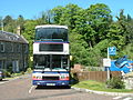 First East Scotland bus 31660 (S929 AKS), 26 May 2012 (1).jpg 1,600 × 1,200; 761 KB
-
 First East Scotland bus 31660 (S929 AKS), 26 May 2012 (2).jpg 1,600 × 1,200; 776 KB
-
 First East Scotland bus 31660 (S929 AKS), 26 May 2012 (3).jpg 1,600 × 1,200; 781 KB
-

-
 Ivy-covered tree at Colinton. 'The Fairy Tree' 2.jpg 820 × 1,024; 1,016 KB
-
 Kates Mill Cottage, Colinton Dell - geograph.org.uk - 1469831.jpg 640 × 426; 345 KB
-
 Lewis Balfour gravestone, Colinton - geograph.org.uk - 1407532.jpg 640 × 480; 105 KB
-
 Norwegian war grave, Colinton - geograph.org.uk - 1407540.jpg 480 × 640; 119 KB
-
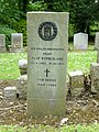 Norwegian war grave, Colinton Village.jpg 1,200 × 1,600; 1.57 MB
-
 Oxgangs Terrrace.JPG 2,576 × 1,932; 1.08 MB
-
 Pentland Avenue, Colinton - geograph.org.uk - 1659143.jpg 640 × 480; 105 KB
-
 Post Office, Colinton - geograph.org.uk - 1469833.jpg 640 × 426; 315 KB
-
 Riverside Path, Colinton dell - geograph.org.uk - 1469845.jpg 640 × 426; 380 KB
-
 Robert Louis Stevenson statue, Colinton, Midlothian, Edinburgh.jpg 4,896 × 2,752; 5.19 MB
-
 Robert Louis Stevenson statue.JPG 3,264 × 2,448; 2.77 MB
-
 Robert Louis Stevenson's Tree detail - geograph.org.uk - 1407536.jpg 480 × 640; 88 KB
-
 Robert Louis Stevenson's Tree, Colinton - geograph.org.uk - 1407534.jpg 480 × 640; 112 KB
-
 Spylaw Bank Road - geograph.org.uk - 936254.jpg 640 × 480; 80 KB
-
 Spylaw Street, Colinton - geograph.org.uk - 1659118.jpg 640 × 480; 69 KB
-
 St Cuthbert's church, Colinton - geograph.org.uk - 3262602.jpg 1,067 × 1,600; 291 KB
-
 St Cuthbert's, Colinton Parish Church, Midlothian, Scotland. View from the village.jpg 4,896 × 2,752; 4.59 MB
-
 Stairway on footpath from Colinton Dell - geograph.org.uk - 1469851.jpg 426 × 640; 432 KB
-
 Statue of Robert Louis Stevenson as a child.JPG 3,264 × 2,448; 2.97 MB
-

-
 Water of Leith from Colinton Bridge, Midlothian, Scotland.jpg 4,896 × 2,752; 6.64 MB
-
 Water of Leith, Colinton Village - geograph.org.uk - 1407542.jpg 480 × 640; 120 KB
-
 Weir Water of Leith, Colinton Dell - geograph.org.uk - 1469822.jpg 640 × 426; 333 KB


.JPG)

.jpg)
.jpg)
.jpg)
.jpg)
.jpg)
.jpg)
.jpg)


,_26_May_2012_(1).jpg)
,_26_May_2012_(2).jpg)
,_26_May_2012_(3).jpg)


