Category:Coltishall
English: Coltishall is a village (population 1405) on the River Bure, west of Wroxham, in the English county of Norfolk, within the Norfolk Broads.
Norsk bokmål: Coltishall er en landsby ved elven Bure i Norfolk. Den ligger vest for Wroxham, i nasjonalparken The Broads.
village in the English county of Norfolk  | |||||
| Upload media | |||||
| Instance of | |||||
|---|---|---|---|---|---|
| Location | Broadland, Norfolk, East of England, England | ||||
| Area |
| ||||
| Said to be the same as | Coltishall (Wikimedia duplicated page, civil parish) | ||||
 | |||||
Subcategories
This category has the following 11 subcategories, out of 11 total.
B
- River Bure in Coltishall (16 F)
C
- Cafés in Coltishall (1 F)
- Coltishall railway station (23 F)
G
R
S
- Shops in Coltishall (4 F)
Media in category "Coltishall"
The following 200 files are in this category, out of 280 total.
(previous page) (next page)-
 'No Turning Area Ahead' and 'No Through Road' - geograph.org.uk - 4557786.jpg 1,024 × 768; 508 KB
-

-

-
 A well-tended garden - geograph.org.uk - 1279070.jpg 640 × 480; 118 KB
-
 Access track - geograph.org.uk - 742920.jpg 480 × 640; 148 KB
-
 Allotment gardens - geograph.org.uk - 1170351.jpg 640 × 480; 115 KB
-
 Allotments in February - geograph.org.uk - 1170399.jpg 640 × 480; 117 KB
-
 Angling platform on the River Bure - geograph.org.uk - 4364005.jpg 640 × 480; 483 KB
-
 Animal barrier on the River Bure - geograph.org.uk - 4364049.jpg 1,024 × 768; 400 KB
-
 Approaching Tunstead Road bridge - geograph.org.uk - 2459267.jpg 2,592 × 3,888; 5.57 MB
-
 Autumnal foliage in spring - geograph.org.uk - 1169591.jpg 526 × 640; 157 KB
-
 B1150 towards North Walsham - geograph.org.uk - 5877275.jpg 1,024 × 684; 271 KB
-
 Barn opposite Church Farm - geograph.org.uk - 2460198.jpg 3,888 × 2,592; 5.52 MB
-
 Barn, The Street, St James - geograph.org.uk - 2460228.jpg 3,888 × 2,592; 5.41 MB
-
 Barnby Road - geograph.org.uk - 538754.jpg 640 × 480; 90 KB
-
 Barton Road - geograph.org.uk - 538708.jpg 640 × 480; 60 KB
-
 Belaugh Green level crossing - geograph.org.uk - 2461538.jpg 3,888 × 2,592; 5.66 MB
-
 Blast walls from the Cold War period - geograph.org.uk - 4164421.jpg 480 × 640; 143 KB
-
 Blocks of flats - geograph.org.uk - 538753.jpg 640 × 480; 57 KB
-

-
 Boats moored on the River Bure - geograph.org.uk - 3133563.jpg 640 × 480; 60 KB
-
 Breaking the wind - geograph.org.uk - 1169514.jpg 640 × 480; 150 KB
-
 Brick and concrete structure in field - geograph.org.uk - 4364017.jpg 640 × 480; 371 KB
-
 Bridge 1295 - detail - geograph.org.uk - 2461406.jpg 2,592 × 3,888; 4.6 MB
-
 Bridge over "The Street" - geograph.org.uk - 2460179.jpg 3,888 × 2,592; 6.02 MB
-
 Bridleway to White Lion Road - geograph.org.uk - 3966706.jpg 640 × 480; 275 KB
-
 Bure Valley Railway and Bure Valley Path - geograph.org.uk - 2458459.jpg 3,888 × 2,592; 5.22 MB
-
 Bure Valley Railway and Bure Valley Path - geograph.org.uk - 2459262.jpg 3,888 × 2,592; 6.52 MB
-
 Bure Valley Railway and Bure Valley Path - geograph.org.uk - 2459263.jpg 3,888 × 2,592; 6.78 MB
-
 Bure Valley Railway and Bure Valley Path - geograph.org.uk - 2459265.jpg 3,888 × 2,592; 5.38 MB
-
 Bure Valley Railway and Bure Valley Path - geograph.org.uk - 2459266.jpg 3,888 × 2,592; 6.04 MB
-
 Bure Valley Railway and Bure Valley Path - geograph.org.uk - 2460116.jpg 3,888 × 2,592; 5.87 MB
-
 Bure Valley Railway and Bure Valley Path - geograph.org.uk - 2460143.jpg 3,888 × 2,592; 6.37 MB
-
 Bure Valley Railway and Bure Valley Path - geograph.org.uk - 2460154.jpg 3,888 × 2,592; 5.37 MB
-
 Bure Valley Railway and Bure Valley Path - geograph.org.uk - 2460773.jpg 3,888 × 2,592; 5.92 MB
-
 Bure Valley Railway and Bure Valley Path - geograph.org.uk - 2461419.jpg 3,888 × 2,592; 6.45 MB
-
 Bure Valley Railway and Bure Valley Path - geograph.org.uk - 2461437.jpg 3,888 × 2,592; 6.22 MB
-
 Bure Valley Railway and Bure Valley Path - geograph.org.uk - 2461448.jpg 2,592 × 3,888; 5.62 MB
-
 Bure Valley Railway and Path - geograph.org.uk - 3680820.jpg 640 × 480; 167 KB
-
 Bure Valley Railway and The Street - geograph.org.uk - 2461398.jpg 3,888 × 2,592; 5.86 MB
-
 Bure Valley Railway at Coltishall Station - geograph.org.uk - 2452451.jpg 3,888 × 2,592; 5.13 MB
-
 Bure Valley Railway at Coltishall Station - geograph.org.uk - 2452920.jpg 3,888 × 2,592; 5.56 MB
-

-
 Bure Valley Railway view - geograph.org.uk - 2452187.jpg 3,888 × 2,592; 2.26 MB
-
 Bure Valley Railway view - geograph.org.uk - 2453632.jpg 3,888 × 2,592; 2.33 MB
-
 Bure Valley Railway view - geograph.org.uk - 2453714.jpg 3,888 × 2,592; 2.52 MB
-
 Bure Valley Railway warning sign - geograph.org.uk - 2459264.jpg 2,592 × 3,888; 5.75 MB
-
 Chapel Lane - geograph.org.uk - 1170381.jpg 640 × 480; 85 KB
-
 Church at Coltishall, Norfolk - geograph.org.uk - 3915070.jpg 800 × 536; 68 KB
-
 Church Farm, The Street, St James - geograph.org.uk - 2460212.jpg 3,888 × 2,592; 4.44 MB
-
 Church Farm, The Street, St James - geograph.org.uk - 2460772.jpg 3,888 × 2,592; 3.39 MB
-
 Church Farm, The Street, St James - geograph.org.uk - 2460774.jpg 3,888 × 2,592; 4.78 MB
-
 Church Room - geograph.org.uk - 1170341.jpg 640 × 480; 107 KB
-
 Church Room - geograph.org.uk - 1170344.jpg 640 × 480; 114 KB
-
 Cold War blast wall - geograph.org.uk - 4164417.jpg 640 × 480; 140 KB
-
 Coltishall Air Rifle Range - Clubhouse - geograph.org.uk - 1169558.jpg 480 × 640; 178 KB
-
 Coltishall Air Rifle Range - geograph.org.uk - 1169549.jpg 640 × 480; 181 KB
-
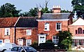
 Coltishall Hall - geograph.org.uk - 2092430.jpg 1,280 × 960; 289 KB
-
 Coltishall Hall, Coltishall - geograph.org.uk - 4557790.jpg 1,024 × 768; 411 KB
-
 Coltishall Recreation Ground - geograph.org.uk - 1170338.jpg 640 × 480; 117 KB
-
 Coltishall Station area - geograph.org.uk - 2453670.jpg 3,888 × 2,592; 3.86 MB
-
 Coltishall Village Hall - geograph.org.uk - 1170340.jpg 640 × 480; 105 KB
-
 Concrete gatepost without gate - geograph.org.uk - 1169959.jpg 480 × 640; 135 KB
-
 Copse in field - geograph.org.uk - 1061680.jpg 640 × 480; 116 KB
-
 Cottage to Let - geograph.org.uk - 1170348.jpg 640 × 568; 141 KB
-
 Cresta and Bank House, High Street, Coltishall - geograph.org.uk - 3790040.jpg 2,057 × 1,267; 1.01 MB
-
 Cromes Place - geograph.org.uk - 538700.jpg 640 × 480; 72 KB
-
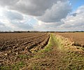
 Cultivated field adjoining farm track - geograph.org.uk - 1169985.jpg 640 × 480; 111 KB
-

-
 Cultivated field by Little Hautbois - geograph.org.uk - 4364010.jpg 640 × 480; 350 KB
-
 Cultivated field by Little Hautbois - geograph.org.uk - 4364014.jpg 640 × 480; 303 KB
-
 Dead sulphur tuft fungi - geograph.org.uk - 4162492.jpg 640 × 480; 244 KB
-
 Derelict military building - geograph.org.uk - 4162426.jpg 640 × 480; 196 KB
-
 Disused track maintenance hut near Tunstead Road bridge - geograph.org.uk - 2459271.jpg 3,888 × 2,592; 6.72 MB
-
 Disused track maintenance hut near Tunstead Road bridge - geograph.org.uk - 2459272.jpg 3,888 × 2,592; 4.36 MB
-

-
 Duck pond at Great Hautbois - geograph.org.uk - 4287762.jpg 640 × 480; 204 KB
-
 Electricity Substation - geograph.org.uk - 547333.jpg 640 × 480; 129 KB
-
 Farm track - geograph.org.uk - 1061600.jpg 480 × 640; 100 KB
-
 Farm track to Potspoon Hole - geograph.org.uk - 1169957.jpg 640 × 480; 119 KB
-
 Farm track to Potspoon Hole - geograph.org.uk - 1170036.jpg 640 × 614; 210 KB
-
 Field adjoining Potspoon Hole - geograph.org.uk - 1169940.jpg 640 × 480; 81 KB
-

-
 Field by Bure Valley Railway - geograph.org.uk - 3678859.jpg 640 × 480; 94 KB
-
 Field in Little Hautbois - geograph.org.uk - 4364012.jpg 640 × 480; 297 KB
-
 Fields by Bridge Farm - geograph.org.uk - 4363975.jpg 640 × 480; 445 KB
-
 Fields by Bridge Farm - geograph.org.uk - 4363980.jpg 640 × 480; 406 KB
-
 Fields by Sco Ruston - geograph.org.uk - 3966765.jpg 640 × 480; 186 KB
-

-
 Footbridge over a drainage ditch - geograph.org.uk - 4364048.jpg 1,024 × 768; 444 KB
-

-
 Footpath along the River Bure - geograph.org.uk - 4364055.jpg 1,024 × 768; 580 KB
-
 Footpath to Little Hautbois - geograph.org.uk - 4363987.jpg 640 × 480; 550 KB
-
 Furrowed field - geograph.org.uk - 3678876.jpg 640 × 480; 104 KB
-
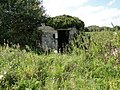 FW3-22 pillbox worse for wear - geograph.org.uk - 4162437.jpg 640 × 480; 202 KB
-
 Gap in hedgerow - geograph.org.uk - 1170008.jpg 640 × 480; 164 KB
-
 Gate beside the Bure Valley Path - geograph.org.uk - 2460159.jpg 3,888 × 2,592; 6.05 MB
-
 Gate without fence - geograph.org.uk - 1169596.jpg 640 × 480; 118 KB
-
 Grange Farm - geograph.org.uk - 2459261.jpg 3,888 × 2,592; 4.61 MB
-
 Hasbro Villas - geograph.org.uk - 1170337.jpg 640 × 480; 117 KB
-
 Hautbois House Residential ^ Activity Centre - geograph.org.uk - 3207252.jpg 3,264 × 1,747; 1.16 MB
-
 Hedge flanking farm track - geograph.org.uk - 1169981.jpg 640 × 480; 107 KB
-
 Horngate Cottage from the Bure Valley Path - geograph.org.uk - 2460170.jpg 3,888 × 2,592; 3.41 MB
-
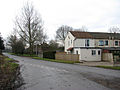
 House at Ling Common - geograph.org.uk - 1169482.jpg 640 × 480; 117 KB
-
 House beside the Bure Valley Railway - geograph.org.uk - 2453652.jpg 3,888 × 2,592; 3.43 MB
-
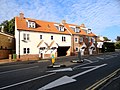
 Houses in Rectory Close - geograph.org.uk - 1170347.jpg 640 × 480; 149 KB
-
 Houses on Rectory Road - geograph.org.uk - 1170328.jpg 640 × 480; 104 KB
-
 Houses on Rollesby Place - geograph.org.uk - 538723.jpg 640 × 480; 90 KB
-
-
 Housing on Hautbois Road - geograph.org.uk - 538685.jpg 640 × 480; 71 KB
-
 Housing on Ormesby Road - geograph.org.uk - 538758.jpg 640 × 480; 103 KB
-
 Housing on Ormesby Road - geograph.org.uk - 538763.jpg 640 × 480; 78 KB
-
 Housing on Ormesby Road - geograph.org.uk - 538766.jpg 640 × 480; 84 KB
-
 Jet engine tester (detail) - geograph.org.uk - 4164413.jpg 640 × 480; 204 KB
-
 Jet engine tester - geograph.org.uk - 4164406.jpg 640 × 480; 146 KB
-
 Jet engine tester - geograph.org.uk - 4164407.jpg 640 × 480; 121 KB
-
 Jet engine tester - geograph.org.uk - 4164410.jpg 640 × 480; 124 KB
-
 Kings Head - geograph.org.uk - 2092439.jpg 1,280 × 960; 311 KB
-
 Kings Head - geograph.org.uk - 3133557.jpg 640 × 480; 76 KB
-
 Lichen-covered branches - geograph.org.uk - 1169978.jpg 480 × 640; 220 KB
-
 Ling Common - geograph.org.uk - 1169466.jpg 640 × 480; 191 KB
-
 Little Hautbois Hall - geograph.org.uk - 278227.jpg 640 × 480; 92 KB
-
 Looking west on Tunstead Road - geograph.org.uk - 615759.jpg 480 × 640; 55 KB
-
 Mallard Duckling - geograph.org.uk - 773013.jpg 640 × 480; 129 KB
-
 Mobile library - geograph.org.uk - 3966712.jpg 640 × 480; 226 KB
-
 Modern supermarket and shop - geograph.org.uk - 742838.jpg 640 × 456; 94 KB
-
 Moorings On The Common - geograph.org.uk - 5685666.jpg 3,599 × 2,399; 1.81 MB
-
 Mud galore - geograph.org.uk - 1061610.jpg 602 × 520; 149 KB
-
 Narrow path beside the River Bure - geograph.org.uk - 4364021.jpg 640 × 480; 528 KB
-
 Neatly cut hedge - geograph.org.uk - 1169570.jpg 424 × 640; 147 KB
-
 New road layout ahead - geograph.org.uk - 4287787.jpg 640 × 480; 113 KB
-
 North Walsham Road - geograph.org.uk - 1169530.jpg 640 × 480; 102 KB
-
 North Walsham Road bridge - geograph.org.uk - 2453662.jpg 3,888 × 2,592; 3.77 MB
-
 Oak trees in hedgerow - geograph.org.uk - 1169952.jpg 640 × 480; 160 KB
-
 Ordnance Survey Cut Mark - geograph.org.uk - 4215223.jpg 640 × 480; 108 KB
-
 Ornate entrance gate - geograph.org.uk - 1061674.jpg 640 × 604; 161 KB
-
 Palm House - detail - geograph.org.uk - 1170355.jpg 500 × 370; 93 KB
-
 Palm House - geograph.org.uk - 1170352.jpg 640 × 480; 108 KB
-
 Path along the River Bure - geograph.org.uk - 4363985.jpg 640 × 480; 483 KB
-
 Path and driveway to Hautbois House - geograph.org.uk - 3207235.jpg 3,264 × 2,448; 2.25 MB
-
 Path following a field boundary - geograph.org.uk - 1169462.jpg 640 × 539; 140 KB
-
 Path through Ling Common - geograph.org.uk - 1169476.jpg 640 × 480; 188 KB
-
 Path to Common Farm - geograph.org.uk - 1169449.jpg 640 × 480; 182 KB
-
 Path to Common Farm - geograph.org.uk - 1169487.jpg 640 × 553; 182 KB
-
 Path to St James - geograph.org.uk - 1170391.jpg 640 × 480; 129 KB
-
 Petrol Station in Coltishall - geograph.org.uk - 5412637.jpg 640 × 480; 95 KB
-
 Pillbox roof - geograph.org.uk - 4162429.jpg 640 × 480; 173 KB
-
 Point House - geograph.org.uk - 742833.jpg 640 × 462; 126 KB
-
 Polytunnels by Grange Farm - geograph.org.uk - 3966714.jpg 640 × 480; 153 KB
-
 Polytunnels by Grange Farm - geograph.org.uk - 3966715.jpg 640 × 480; 155 KB
-
 Polytunnels by Grange Farm - geograph.org.uk - 3966717.jpg 640 × 568; 258 KB
-

-
 Posts without a gate - geograph.org.uk - 1169457.jpg 640 × 480; 169 KB
-
 Potspoon Hole - geograph.org.uk - 1169594.jpg 640 × 480; 148 KB
-
-
 Properties In Church Street Coltishall - geograph.org.uk - 3036254.jpg 1,600 × 1,200; 392 KB
-
 Puddle in field - geograph.org.uk - 1169628.jpg 640 × 480; 117 KB
-
 RAF building beside the perimeter track - geograph.org.uk - 4164402.jpg 640 × 499; 132 KB
-
 Railway over-bridge at Great Hautbois - geograph.org.uk - 4287766.jpg 640 × 480; 168 KB
-

-
 Red-brick house with Dutch gables - geograph.org.uk - 1170376.jpg 640 × 480; 104 KB
-
 Reeds along the footpath of the River Bure - geograph.org.uk - 4364057.jpg 1,024 × 768; 521 KB
-
 River Bure, Coltishall - geograph.org.uk - 5412644.jpg 640 × 480; 68 KB
-

-
 Road closed - geograph.org.uk - 538740.jpg 480 × 640; 118 KB
-
 Rusty gate - geograph.org.uk - 743146.jpg 480 × 640; 146 KB
-
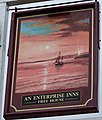 Sign for the Rising Sun, Coltishall - geograph.org.uk - 772992.jpg 543 × 640; 73 KB
-
 Soggy farm track - geograph.org.uk - 743140.jpg 480 × 640; 95 KB
-
 St James - geograph.org.uk - 743120.jpg 480 × 640; 156 KB
-
 St James Old Farm - geograph.org.uk - 1061669.jpg 640 × 480; 95 KB
-
 St James Old Farm Barn - geograph.org.uk - 1061665.jpg 640 × 480; 88 KB
-
 St John the Baptist Church on Church Street, Coltishall - geograph.org.uk - 3207257.jpg 3,264 × 2,448; 1.66 MB
-

-
 Steps to the Bure Valley Path - geograph.org.uk - 2460797.jpg 2,592 × 3,888; 4.88 MB
-
 Sunshine and showers - geograph.org.uk - 1169611.jpg 640 × 480; 131 KB
-
 Tall hedges - geograph.org.uk - 743151.jpg 640 × 480; 200 KB
-
 Terraced cottages - geograph.org.uk - 1170331.jpg 640 × 536; 108 KB
-
 Thai Restaurant and Herbal Spa - geograph.org.uk - 1170361.jpg 480 × 640; 96 KB
-
 The Canal Cut - geograph.org.uk - 5685683.jpg 2,399 × 3,599; 1.52 MB
-
 The Coltishall Island - geograph.org.uk - 742765.jpg 640 × 454; 119 KB
-
 The King's Head, Coltishall - geograph.org.uk - 4363945.jpg 1,023 × 768; 321 KB
-
 The Norfolk Mead Hotel, Coltishall - geograph.org.uk - 2072516.jpg 640 × 480; 92 KB
-
 The Railway Tavern Station Road Coltishall - geograph.org.uk - 3027967.jpg 1,600 × 1,200; 427 KB
-
 The Red Lion Public House Coltishall - geograph.org.uk - 3042272.jpg 1,600 × 1,200; 333 KB
-

-
 The Rising Sun Public House - geograph.org.uk - 4386525.jpg 2,399 × 1,599; 697 KB
-
 The Rising Sun, Coltishall - geograph.org.uk - 772989.jpg 640 × 480; 87 KB
-
 The River Bure - geograph.org.uk - 4363997.jpg 640 × 480; 424 KB
-
 The River Bure - geograph.org.uk - 4364003.jpg 640 × 480; 515 KB
-
 The River Bure as it runs past The Common, Coltishall - geograph.org.uk - 3207263.jpg 3,264 × 2,448; 2.39 MB
-
 The River Bure at Coltishall - geograph.org.uk - 3133567.jpg 640 × 480; 74 KB
-
 The River Bure from the footpath - geograph.org.uk - 4364058.jpg 1,024 × 768; 471 KB
-
 The start of a footpath - geograph.org.uk - 1061591.jpg 640 × 480; 127 KB
-
 The Street past St James Old Farm - geograph.org.uk - 1061658.jpg 640 × 480; 122 KB
-
 The Street, St James - geograph.org.uk - 2460778.jpg 3,888 × 2,592; 4.9 MB
-
 The Street, St James - geograph.org.uk - 2460790.jpg 3,888 × 2,592; 5.4 MB
-
 The Street, St James - geograph.org.uk - 2460793.jpg 2,592 × 3,888; 3.45 MB
-
 The Train to Aylsham - geograph.org.uk - 6264146.jpg 4,608 × 3,456; 7.61 MB
-
 This way to Wroxham - geograph.org.uk - 1279175.jpg 640 × 480; 152 KB
-
 Track across fields - geograph.org.uk - 1169620.jpg 640 × 480; 98 KB


_-_geograph.org.uk_-_4164413.jpg)


