Category:Coneythorpe and Clareton
civil parish in North Yorkshire, England  | |||||
| Upload media | |||||
| Instance of | |||||
|---|---|---|---|---|---|
| Location | Harrogate, North Yorkshire, Yorkshire and the Humber, England | ||||
 | |||||
Subcategories
This category has the following 2 subcategories, out of 2 total.
C
- Clareton, North Yorkshire (1 F)
Media in category "Coneythorpe and Clareton"
The following 45 files are in this category, out of 45 total.
-
 A1(M) - geograph.org.uk - 3040674.jpg 640 × 430; 33 KB
-
 A1(M) in North Yorkshire - geograph.org.uk - 6399752.jpg 800 × 533; 206 KB
-
 A1(M) northbound - geograph.org.uk - 2647848.jpg 640 × 428; 74 KB
-
 Approaching Shortsill Lane - geograph.org.uk - 4300016.jpg 5,184 × 3,456; 5.89 MB
-
 By the parish boundary - geograph.org.uk - 3800709.jpg 3,194 × 1,572; 1.08 MB
-
 Clareton - geograph.org.uk - 253456.jpg 640 × 480; 78 KB
-
 Clareton Land heading towards Arkendale - geograph.org.uk - 5896011.jpg 4,000 × 3,000; 3.41 MB
-
 Clareton Lane heading towards Clareton - geograph.org.uk - 5896003.jpg 4,000 × 3,000; 3.47 MB
-
 Clareton Moor Farm - geograph.org.uk - 3801064.jpg 640 × 480; 53 KB
-
 Claro House - geograph.org.uk - 3823696.jpg 1,500 × 1,125; 1.89 MB
-
 Coneythorpe - geograph.org.uk - 1027097.jpg 640 × 480; 86 KB
-
 Drive to Spring Bank Farm Coneythorpe from Shortsill Lane - geograph.org.uk - 2648611.jpg 3,648 × 2,736; 2.99 MB
-
 Electricity sub station - geograph.org.uk - 3801060.jpg 640 × 480; 68 KB
-
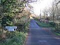 Entering Coneythorpe - geograph.org.uk - 3801066.jpg 640 × 480; 114 KB
-
 Entering Coneythorpe - geograph.org.uk - 4300029.jpg 5,179 × 3,451; 6.83 MB
-
 Farmland east of Moor Lane - geograph.org.uk - 3801057.jpg 640 × 480; 95 KB
-
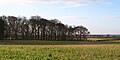
 Farmland, Clareton - geograph.org.uk - 3801059.jpg 640 × 480; 52 KB
-
 Farmland, Clareton - geograph.org.uk - 3801062.jpg 640 × 480; 36 KB
-
 Hay-a-Park Lane - geograph.org.uk - 2931202.jpg 640 × 405; 66 KB
-
 Heavy Plant Crossing - geograph.org.uk - 2631062.jpg 3,264 × 2,448; 1.74 MB
-
 Junction on the A168 to quarry and waste recovery - geograph.org.uk - 5772223.jpg 3,063 × 2,290; 1.78 MB
-
 Knaresborough Round on Clareton Moor Looking East - geograph.org.uk - 4300049.jpg 5,184 × 3,456; 7.74 MB
-
 Knaresborough Round on Clareton Moor Looking West - geograph.org.uk - 4300054.jpg 5,179 × 3,451; 5.27 MB
-
 Lane to Castle Farm - geograph.org.uk - 5852247.jpg 1,600 × 1,200; 604 KB
-
 Lidget Lane leaving Coneythorpe - geograph.org.uk - 5895994.jpg 4,000 × 3,000; 4.1 MB
-
 Moor Lane - geograph.org.uk - 3801063.jpg 640 × 480; 68 KB
-
 Nameless copse at Clareton - geograph.org.uk - 3800712.jpg 3,264 × 1,632; 1.22 MB
-
 Northbound on A168 toward Boroughbridge - geograph.org.uk - 5772214.jpg 2,998 × 2,205; 2.4 MB
-
 Ordnance Survey Cut Mark - geograph.org.uk - 5897027.jpg 3,997 × 2,999; 3.63 MB
-
 Pasture beside Moor Lane - geograph.org.uk - 4300034.jpg 5,179 × 3,451; 6.42 MB
-
 Pump on village green, Coneythorpe - geograph.org.uk - 3801068.jpg 640 × 480; 88 KB
-
 Pumping station on Shortsill Lane - geograph.org.uk - 3801070.jpg 640 × 480; 135 KB
-
 Road to Coneythorpe - geograph.org.uk - 3800722.jpg 2,448 × 2,176; 1.19 MB
-

-
 Shortsill Lane - geograph.org.uk - 2930442.jpg 640 × 415; 73 KB
-
 Shortsill Lane - geograph.org.uk - 3801069.jpg 640 × 480; 96 KB
-
 Spring Bank Farm - geograph.org.uk - 2930476.jpg 640 × 412; 72 KB
-
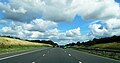 The A1(M) - geograph.org.uk - 5871029.jpg 4,088 × 2,157; 2.65 MB
-
 The green, Coneythorpe - geograph.org.uk - 1027093.jpg 640 × 334; 51 KB
-
 The road to Arkendale - geograph.org.uk - 3800715.jpg 3,264 × 1,632; 1,023 KB
-
 The Tiger Inn at Coneythorpe - geograph.org.uk - 6274526.jpg 1,024 × 768; 202 KB
-

-
 Water Pump, Coneythorpe - geograph.org.uk - 4300024.jpg 5,184 × 3,456; 6.62 MB
-
 Wellies advised - geograph.org.uk - 3802557.jpg 2,448 × 2,176; 1.11 MB
-
 Track beside A1(M) - geograph.org.uk - 214038.jpg 640 × 480; 92 KB
_-_geograph.org.uk_-_3040674.jpg)
_in_North_Yorkshire_-_geograph.org.uk_-_6399752.jpg)
_northbound_-_geograph.org.uk_-_2647848.jpg)


_by_the_A1_north_of_Allerton_Park,_aerial_2016_-_geograph.org.uk_-_5091163.jpg)


_-_geograph.org.uk_-_5871029.jpg)


_in_North_Yorkshire_-_geograph.org.uk_-_6399745.jpg)


_-_geograph.org.uk_-_214038.jpg)