Category:Confluences in Wales
Subcategories
This category has only the following subcategory.
Media in category "Confluences in Wales"
The following 96 files are in this category, out of 96 total.
-
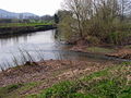
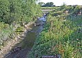
 Aber Ewenni - geograph.org.uk - 4630166.jpg 640 × 480; 105 KB
-
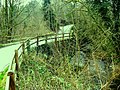
 Abergavenny - geograph.org.uk - 384693.jpg 640 × 480; 178 KB
-

-

-

-
 Afon Mawddach and Rhaiadr Du Confluence.jpg 4,592 × 3,064; 7.48 MB
-
 Afon Rhymni meets the River Severn - geograph.org.uk - 582251.jpg 640 × 480; 75 KB
-

-

-
 Balderton Brook and the River Dee - geograph.org.uk - 388770.jpg 640 × 480; 159 KB
-
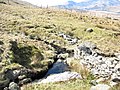
 Beddgelert - 1.jpg 1,280 × 960; 250 KB
-
 Confluence - cymer - geograph.org.uk - 1101588.jpg 640 × 480; 113 KB
-
-

-
 Confluence of Hore and Severn - geograph.org.uk - 1305434.jpg 640 × 480; 93 KB
-
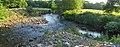
 Confluence of Nant Llech with the Tawe - geograph.org.uk - 1404474.jpg 480 × 640; 151 KB
-

-

-
 Confluence of rivers at Beddgelert - geograph.org.uk - 1801252.jpg 1,600 × 1,200; 841 KB
-
-
 Confluence of Rivers Rhiw and Severn - geograph.org.uk - 1474039.jpg 640 × 480; 80 KB
-

-

-
 Confluence of the Amman with the Loughor - geograph.org.uk - 285104.jpg 640 × 480; 112 KB
-
 Confluence of the Claerwen and the Arban - geograph.org.uk - 1285661.jpg 640 × 426; 117 KB
-

-
-
-
 Confluence of the Elan and the Wye - geograph.org.uk - 902689.jpg 640 × 480; 103 KB
-

-

-

-
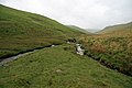
 Confluence of the Rhiwnant and the Dyrys - geograph.org.uk - 1321448.jpg 640 × 426; 128 KB
-
 Confluence of the Rhondda and Taff, Pontypridd - geograph.org.uk - 3450638.jpg 1,024 × 785; 251 KB
-
 Confluence of the Rhonddas, Porth - geograph.org.uk - 2612325.jpg 640 × 480; 128 KB
-
 Confluence of the Sychryd and the Mellte (geograph 2909035).jpg 1,024 × 768; 192 KB
-

-

-

-
 Confluence of the Twrch with the Tawe - geograph.org.uk - 914166.jpg 640 × 480; 105 KB
-
 Confluence of Twrch and Llynfell - geograph.org.uk - 855538.jpg 640 × 480; 92 KB
-

-

-
 Mouth of Nant Cynffig, Aberkenfig - geograph.org.uk - 3384683.jpg 640 × 480; 113 KB
-
 Nant Hirin joining the River Elan - geograph.org.uk - 1521629.jpg 640 × 480; 89 KB
-
 Nant Lluestau meets Afon Twrch - geograph.org.uk - 456824.jpg 640 × 480; 144 KB
-
 Nant Tadarn joins the Afon Tywi, Powys - geograph.org.uk - 1570009.jpg 480 × 640; 145 KB
-
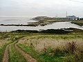
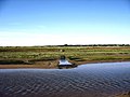
 Picton Point - geograph.org.uk - 496848.jpg 640 × 482; 87 KB
-
 Rheola Bridge, Porth - geograph.org.uk - 2612363.jpg 640 × 437; 80 KB
-
 River confluence - geograph.org.uk - 233011.jpg 640 × 479; 54 KB
-

-
-
 River Rhymney near to Rhymney Cemetery - geograph.org.uk - 696796.jpg 640 × 480; 140 KB
-
 River Severn-Vyrnwy confluence - geograph.org.uk - 347928.jpg 640 × 480; 93 KB
-

-
 Rivers meet at Pontypridd - geograph.org.uk - 866012.jpg 640 × 480; 133 KB
-

-

-
 The Confluence of Afonydd Idwal and Ogwen - geograph.org.uk - 239643.jpg 640 × 480; 146 KB
-

-
-

-
-

-

-
 The meeting of the rivers - geograph.org.uk - 2105398.jpg 1,600 × 1,200; 440 KB
-

-

-
 Confluence of Nant Gwinau and Tywi - geograph.org.uk - 740563.jpg 640 × 479; 69 KB
-
 Tributary entering the Sirhowy River - geograph.org.uk - 486150.jpg 480 × 640; 170 KB
-
 A confluence in Woolpitch Wood - geograph.org.uk - 505047.jpg 640 × 480; 133 KB
-
 A river-cliff at the Pant Afon confluence - geograph.org.uk - 354519.jpg 640 × 480; 143 KB
-

-

-
-
 Angiddy joins the Wye at Abbey Mill - geograph.org.uk - 703319.jpg 640 × 413; 170 KB
-
 Balderton Brook - geograph.org.uk - 1451596.jpg 640 × 457; 453 KB
-
 Balderton Brook and the River Dee - geograph.org.uk - 282253.jpg 480 × 640; 103 KB
-
 Confluence of Gwys Fach and Fawr - geograph.org.uk - 396920.jpg 640 × 480; 96 KB
-

-
-
 Confluence of the Banwy and Vyrnwy rivers - geograph.org.uk - 510415.jpg 640 × 481; 124 KB
-

-

-

-
 Mouth of Railsgate Pill, Laugharne - geograph.org.uk - 596342.jpg 640 × 480; 122 KB
-
 River Confluence - geograph.org.uk - 512410.jpg 640 × 480; 196 KB
-
 Stream confluence - geograph.org.uk - 399189.jpg 640 × 480; 158 KB
-

-

-

-
-

-

-

-


.jpg)


