Category:Cooksbridge
English: Hamsey is a civil parish in the Lewes District of East Sussex, England. It is located three miles (5 km) north of Lewes on the Prime Meridian. The original village, now abandoned apart from the church and a few cottages, lay on an island in the River Ouse; the parish consists of the villages of Hamsey with Offham and Cooksbridge being the main centres of population in the parish.
village in East Sussex, UK | |||||
| Upload media | |||||
| Instance of | |||||
|---|---|---|---|---|---|
| Location | Hamsey, Lewes, East Sussex, South East England, England | ||||
 | |||||
Subcategories
This category has only the following subcategory.
C
- Cooksbridge railway station (4 F)
Media in category "Cooksbridge"
The following 39 files are in this category, out of 39 total.
-
 A275 Resting Oak Hill, Cooksbridge - geograph.org.uk - 2600928.jpg 1,600 × 1,200; 516 KB
-
 Barcombe, dismantled railway line - geograph.org.uk - 223449.jpg 640 × 480; 128 KB
-
 Barns, Overs Farm - geograph.org.uk - 1099820.jpg 640 × 493; 90 KB
-
 Chicken Run - geograph.org.uk - 312580.jpg 640 × 429; 133 KB
-
 Conyboro - geograph.org.uk - 1099817.jpg 479 × 640; 61 KB
-
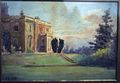 Conyboro1898.jpg 1,363 × 946; 204 KB
-
 Cooksbridge Farm - geograph.org.uk - 1099612.jpg 640 × 503; 69 KB
-
 Cooksbridge House - geograph.org.uk - 1099622.jpg 640 × 479; 127 KB
-
 Cooksbridge sewage works - geograph.org.uk - 2085585.jpg 2,592 × 1,944; 1.78 MB
-
 Cooksbridge, The Malthouse - geograph.org.uk - 223494.jpg 640 × 395; 98 KB
-
 Deadmantree Hill - geograph.org.uk - 1099834.jpg 479 × 640; 80 KB
-
 Entering Cooksbridge on the A275 - geograph.org.uk - 2598906.jpg 1,600 × 1,200; 582 KB
-
 Farm buildings at Cooksbridge Farm - geograph.org.uk - 2085539.jpg 2,592 × 1,944; 1.48 MB
-
 Greenwich Meridian at Cooksbridge sewage works - geograph.org.uk - 2415492.jpg 3,072 × 2,048; 4.11 MB
-
 Greenwich meridian reaching Cooksbridge sewage works - geograph.org.uk - 2450722.jpg 3,072 × 2,048; 4.26 MB
-
 Greenwich Meridian south of Cooksbridge sewage works - geograph.org.uk - 2415469.jpg 1,600 × 1,067; 462 KB
-
 Lower Morley Cottage, Old Cooksbridge - geograph.org.uk - 1099684.jpg 479 × 640; 122 KB
-
 Meridian Line marker - geograph.org.uk - 58617.jpg 640 × 480; 333 KB
-
 Old Cooksbridge - geograph.org.uk - 1099663.jpg 640 × 493; 80 KB
-
 Overs Farm - geograph.org.uk - 1099847.jpg 640 × 479; 63 KB
-
 The A275 in Cooksbridge - geograph.org.uk - 2598926.jpg 1,600 × 1,200; 513 KB
-
 The Pump House, Cooksbridge, East Sussex - geograph.org.uk - 2755074.jpg 1,024 × 752; 177 KB
-
 The Rainbow Inn Cooksbridge - geograph.org.uk - 2085517.jpg 2,592 × 1,944; 1.47 MB
-
 The Rainbow Inn Cooksbridge - geograph.org.uk - 2090957.jpg 2,592 × 1,944; 2.01 MB
-
 The Rainbow Inn, Cooksbridge - geograph.org.uk - 2598919.jpg 1,600 × 1,200; 682 KB
-
 Upper Morley Cottage, Old Cooksbridge - geograph.org.uk - 1099702.jpg 640 × 479; 114 KB
-
 Cooksbridge - geograph.org.uk - 70562.jpg 640 × 479; 151 KB
-
 Cottages, Town Littleworth Road - geograph.org.uk - 311706.jpg 640 × 429; 102 KB
-
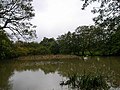 Fishpond, Beechwood Lane, Cooksbridge - geograph.org.uk - 70554.jpg 640 × 479; 185 KB
-
 Hamsey, North End - geograph.org.uk - 223431.jpg 640 × 480; 97 KB
-
 Keepers Cottage, Barcombe Mills Road - geograph.org.uk - 650536.jpg 479 × 640; 97 KB
-

-
 Mount Harry - geograph.org.uk - 70481.jpg 640 × 380; 111 KB
-
 Old Coach House, Barcombe Mills Road - geograph.org.uk - 650541.jpg 640 × 479; 113 KB
-
 Railway Bridge, Beechwood Lane - geograph.org.uk - 70550.jpg 479 × 640; 194 KB
-
 Sewell's Farm - geograph.org.uk - 312565.jpg 640 × 429; 83 KB
-
 Springles Chicken Farm entrance - geograph.org.uk - 312592.jpg 640 × 429; 96 KB
-
 The Rainbow Inn Cooksbridge - geograph.org.uk - 287771.jpg 640 × 479; 118 KB
-
 Turnpike Cottages, Offham - geograph.org.uk - 70580.jpg 640 × 493; 172 KB


