Category:Cornworthy
Main Wikipedia article: Cornworthy.

village in the United Kingdom  | |||||
| Upload media | |||||
| Instance of | |||||
|---|---|---|---|---|---|
| Location | South Hams, Devon, South West England, England | ||||
| Population |
| ||||
 | |||||
Subcategories
This category has the following 6 subcategories, out of 6 total.
A
- Allaleigh (12 F)
E
- East Cornworthy (5 F)
P
- St Peter's Church, Cornworthy (10 F)
- Priory Gatehouse, Cornworthy (4 F)
T
- Tideford, Devon (5 F)
Media in category "Cornworthy"
The following 200 files are in this category, out of 283 total.
(previous page) (next page)-

-
 Abbey Road, Cornworthy (1).jpg 5,152 × 3,864; 10.01 MB
-
 Abbey Road, Cornworthy (2).jpg 5,152 × 3,864; 7.95 MB
-
 Across Dittisham Mill Creek (geograph 5337768).jpg 3,071 × 1,683; 899 KB
-
 Across Dittisham Mill Creek - geograph.org.uk - 5337919.jpg 2,048 × 1,536; 850 KB
-
 Across Dittisham Mill Creek - geograph.org.uk - 5339107.jpg 2,048 × 3,072; 1.3 MB
-
 Across the Wash valley - geograph.org.uk - 3152463.jpg 640 × 370; 52 KB
-
 Across Tuckenhay Creek - geograph.org.uk - 4359822.jpg 1,920 × 1,410; 472 KB
-
 Allaleigh - geograph.org.uk - 4012251.jpg 640 × 427; 101 KB
-
 Allaleigh Lane - geograph.org.uk - 5851110.jpg 2,797 × 3,622; 2.25 MB
-
 Allaleigh Lane - geograph.org.uk - 5851478.jpg 4,288 × 2,848; 2.26 MB
-
 Allaleigh Lane - geograph.org.uk - 5851521.jpg 2,848 × 4,288; 2.04 MB
-
 Allaleigh Lane - geograph.org.uk - 6065649.jpg 4,288 × 2,848; 1.69 MB
-
 Allaleigh Lane - geograph.org.uk - 6182085.jpg 4,288 × 2,848; 1.46 MB
-
 An old lime Kiln - geograph.org.uk - 3192895.jpg 640 × 430; 111 KB
-
 Approach to Lower Washbourne - geograph.org.uk - 2542782.jpg 640 × 480; 466 KB
-
 Arable field near Gitcombe - geograph.org.uk - 3152990.jpg 640 × 440; 64 KB
-
 Arable field, Tideford - geograph.org.uk - 6182093.jpg 4,288 × 2,848; 2.65 MB
-
 Banks of the Dart near Pighole Point - geograph.org.uk - 2444139.jpg 3,969 × 1,947; 2.89 MB
-
 Barberry Water - geograph.org.uk - 4359998.jpg 1,920 × 2,393; 1.86 MB
-
 Barberry Water valley - geograph.org.uk - 1943335.jpg 640 × 437; 101 KB
-
 Barberry Water valley - geograph.org.uk - 5338517.jpg 3,072 × 2,048; 1.59 MB
-
 Barberry Water valley - geograph.org.uk - 5338561.jpg 2,630 × 1,400; 849 KB
-
 Bend in the track east of Broadridge - geograph.org.uk - 4012665.jpg 640 × 427; 94 KB
-
 Blackdown Cross - geograph.org.uk - 3154863.jpg 640 × 480; 124 KB
-
 Blackness Point - geograph.org.uk - 5337670.jpg 3,045 × 1,542; 1,007 KB
-
 Blackness Point from the river - geograph.org.uk - 5973712.jpg 640 × 360; 106 KB
-
 Bow Creek - geograph.org.uk - 130716.jpg 640 × 436; 59 KB
-
 Bow Creek - geograph.org.uk - 160755.jpg 640 × 480; 77 KB
-
 Bow Creek - geograph.org.uk - 1618114.jpg 640 × 480; 66 KB
-
 Bow Creek - geograph.org.uk - 1618121.jpg 640 × 480; 138 KB
-
 Bow Creek - geograph.org.uk - 212926.jpg 640 × 480; 84 KB
-
 Bow Creek - geograph.org.uk - 213005.jpg 480 × 640; 97 KB
-
 Bow Creek - geograph.org.uk - 2472275.jpg 640 × 423; 66 KB
-
 Bow Creek - geograph.org.uk - 3150154.jpg 640 × 480; 59 KB
-
 Bow Creek - geograph.org.uk - 4273666.jpg 1,920 × 1,458; 1.11 MB
-
 Brambletorre Mill, Higher Dittisham - geograph.org.uk - 6337940.jpg 5,184 × 2,920; 6.6 MB
-
 Broadridge Cross - geograph.org.uk - 4012751.jpg 640 × 427; 125 KB
-
 Broadridge Cross at Higher Tideford - geograph.org.uk - 3805824.jpg 1,600 × 1,149; 499 KB
-
 Broadridge Farm - geograph.org.uk - 4020449.jpg 640 × 427; 110 KB
-
 Building near Lower Venice, Allaleigh - geograph.org.uk - 5851464.jpg 4,288 × 2,848; 2.51 MB
-
 Building near Lower Venice, Allaleigh - geograph.org.uk - 5851469.jpg 3,264 × 1,832; 1.41 MB
-

-
 Butts Lane, Cornworthy - geograph.org.uk - 191309.jpg 480 × 640; 154 KB
-
 Capton Bridge and excess water - geograph.org.uk - 3805802.jpg 1,536 × 1,152; 1.28 MB
-
 Capton Mill - geograph.org.uk - 1943256.jpg 640 × 479; 112 KB
-
 Capton Wood - geograph.org.uk - 1943359.jpg 640 × 465; 154 KB
-
 Cattle near Coomery - geograph.org.uk - 3148897.jpg 450 × 640; 121 KB
-

-
 Cattle pasture, Allaleigh - geograph.org.uk - 5851098.jpg 4,284 × 2,630; 1.66 MB
-
 Centre of Allaleigh - geograph.org.uk - 5851193.jpg 4,025 × 2,449; 1.74 MB
-
 Coomery - geograph.org.uk - 4012661.jpg 480 × 640; 71 KB
-
 Cornworthy - geograph.org.uk - 212985.jpg 480 × 640; 102 KB
-
 Cornworthy - geograph.org.uk - 212987.jpg 640 × 480; 123 KB
-
 Cornworthy - geograph.org.uk - 35769.jpg 640 × 480; 121 KB
-
 Cornworthy - geograph.org.uk - 4359872.jpg 1,920 × 1,359; 680 KB
-
 Cornworthy - St Peter's Church - geograph.org.uk - 6337944.jpg 5,184 × 2,920; 5.6 MB
-
 Cornworthy Court and church - geograph.org.uk - 224616.jpg 640 × 480; 92 KB
-
 Cornworthy Cross - geograph.org.uk - 4013059.jpg 640 × 427; 94 KB
-
 Cornworthy Stream - geograph.org.uk - 6336918.jpg 2,848 × 4,288; 2.57 MB
-

-
 Cottages in Cornworthy - geograph.org.uk - 212963.jpg 640 × 480; 100 KB
-
 Creeks at Tuckenhay - geograph.org.uk - 5142752.jpg 3,072 × 2,048; 1.08 MB
-
 Dart Valley Trail on Broadgates Lane - geograph.org.uk - 4359900.jpg 1,920 × 1,440; 898 KB
-
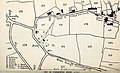
 Devon and Cornwall notes and queries (1920) (14593719268).jpg 2,174 × 3,234; 1.88 MB
-
 Devon and Cornwall notes and queries (1920) (14593728068).jpg 4,224 × 2,580; 1.2 MB
-
 Devon and Cornwall notes and queries (1920) (14593868277).jpg 2,156 × 3,386; 1.69 MB
-
 Dinah's Side - geograph.org.uk - 1943829.jpg 640 × 470; 114 KB
-
 Dinnacombe Lodge - geograph.org.uk - 4013944.jpg 640 × 427; 69 KB
-
 Dittisham - geograph.org.uk - 3151877.jpg 640 × 476; 72 KB
-
 Dittisham Mill - geograph.org.uk - 1943707.jpg 640 × 480; 135 KB
-
 Dittisham Mill Creek - geograph.org.uk - 3195011.jpg 640 × 430; 104 KB
-
 Dittisham Mill Creek - geograph.org.uk - 3195017.jpg 640 × 430; 51 KB
-
 Dittisham Mill Creek - geograph.org.uk - 3805606.jpg 1,536 × 922; 1,005 KB
-
 Door in wall, Allaleigh - geograph.org.uk - 5851570.jpg 4,240 × 2,554; 1.49 MB
-

-
 East Cornworthy - geograph.org.uk - 1943495.jpg 517 × 640; 130 KB
-
 East Cornworthy - geograph.org.uk - 5337888.jpg 2,048 × 1,536; 867 KB
-
 Efford's Close Copse - geograph.org.uk - 224598.jpg 640 × 480; 123 KB
-
 End of the lane past Broadridge Farm - geograph.org.uk - 4020563.jpg 640 × 427; 112 KB
-

-
 Farm building, Allaleigh - geograph.org.uk - 5851197.jpg 4,188 × 2,732; 2.15 MB
-
 Farmland near Cornworthy - geograph.org.uk - 3805349.jpg 1,536 × 1,152; 951 KB
-
 Farmland near Tideford - geograph.org.uk - 6690390.jpg 3,980 × 2,358; 1.8 MB
-
 Field by Hothill Lane - geograph.org.uk - 1516662.jpg 640 × 406; 66 KB
-
 Field by Ridge Lane - geograph.org.uk - 3153142.jpg 640 × 432; 84 KB
-
 Field by Ridge Lane - geograph.org.uk - 3153159.jpg 640 × 407; 52 KB
-
 Field by Ridge Lane - geograph.org.uk - 3153168.jpg 640 × 458; 84 KB
-
 Field near Cornworthy - geograph.org.uk - 1516487.jpg 640 × 400; 68 KB
-
 Field near Tideford - geograph.org.uk - 3153109.jpg 640 × 400; 63 KB
-

-
 Field Outside East Cornworthy - geograph.org.uk - 2354681.jpg 1,024 × 768; 318 KB
-
 Field southwest of Kerswell - geograph.org.uk - 6186585.jpg 4,288 × 2,848; 2 MB
-
 Field southwest of Kerswell - geograph.org.uk - 6186590.jpg 3,895 × 2,193; 2.03 MB
-
 Field with view on Hothill lane - geograph.org.uk - 1516515.jpg 640 × 466; 79 KB
-
 Fields by Allaleigh Lane - geograph.org.uk - 5851121.jpg 4,288 × 2,848; 1.72 MB
-
 Fields by Allaleigh Lane - geograph.org.uk - 5851125.jpg 2,848 × 4,288; 2.2 MB
-
 Fields southwest of Broadridge Farm - geograph.org.uk - 4020450.jpg 640 × 427; 82 KB
-
 Fingals Hotel - geograph.org.uk - 191321.jpg 480 × 640; 127 KB
-

-
 Flooding at Higher Tideford - geograph.org.uk - 3806383.jpg 1,536 × 1,152; 1.08 MB
-

-
 Footpath across fields at Forces Cross - geograph.org.uk - 3806412.jpg 1,024 × 853; 191 KB
-
 Footpath by Bow Creek - geograph.org.uk - 212931.jpg 640 × 480; 127 KB
-

-

-
 Footpath from Furze Cross - geograph.org.uk - 6186570.jpg 4,248 × 2,557; 2.06 MB
-
 Footpath into Cornworthy from Butts Cross - geograph.org.uk - 3805304.jpg 1,536 × 906; 1,000 KB
-
 Footpath sign near Dittisham Mill - geograph.org.uk - 3192883.jpg 640 × 430; 106 KB
-
 Footpath steps and stile, Tideford - geograph.org.uk - 3153129.jpg 480 × 640; 125 KB
-
 Footpath to Coomery - geograph.org.uk - 6186582.jpg 4,288 × 2,848; 2.93 MB
-
 Footpath to Gitcombe - geograph.org.uk - 3152929.jpg 640 × 480; 133 KB
-
 Footpath to Tuckenhay from Cornworthy Cross - geograph.org.uk - 3805273.jpg 1,536 × 1,153; 1.39 MB
-

-
 Furze Cross - geograph.org.uk - 6181190.jpg 4,288 × 2,848; 2.54 MB
-
 Gate by Ridge Lane - geograph.org.uk - 3153180.jpg 640 × 382; 73 KB
-

-
 Gitcombe - geograph.org.uk - 3153015.jpg 640 × 464; 117 KB
-
 Grass fields at Blackdown Farm - geograph.org.uk - 3154902.jpg 640 × 408; 55 KB
-
 Green lane, Butts Cross - geograph.org.uk - 6181767.jpg 4,279 × 2,793; 2.41 MB
-
 Green Oak Barn near Cornworthy - geograph.org.uk - 42377.jpg 640 × 480; 129 KB
-

-
 Hillside north of Broadridge Farm - geograph.org.uk - 4020452.jpg 640 × 427; 74 KB
-
 Hillside pasture east of Coomery - geograph.org.uk - 4012660.jpg 640 × 640; 100 KB
-
 House at Cornworthy - geograph.org.uk - 1618321.jpg 640 × 480; 79 KB
-
 House by Dittisham Mill Creek - geograph.org.uk - 3192896.jpg 640 × 430; 98 KB
-
 House on Dittisham Creek - geograph.org.uk - 1943744.jpg 512 × 640; 107 KB
-
 Houses at Cornworthy - geograph.org.uk - 4359885.jpg 1,920 × 1,267; 465 KB
-
 Hunters Lodge Inn Sign, Cornworthy.jpg 3,864 × 5,152; 6.49 MB
-
 Hunters' Lodge, Cornworthy - geograph.org.uk - 212976.jpg 640 × 480; 110 KB
-

-

-
 Lane at Ridge Lane Cross - geograph.org.uk - 3153200.jpg 640 × 480; 149 KB
-
 Lane past Lampers Head - geograph.org.uk - 6065642.jpg 4,288 × 2,848; 2.46 MB
-

-
 Lane to Capton Bridge - geograph.org.uk - 6690264.jpg 3,595 × 2,088; 1.62 MB
-
 Lane to Coomery - geograph.org.uk - 3152600.jpg 480 × 640; 118 KB
-
 Lane to Cornworthy - geograph.org.uk - 1516497.jpg 480 × 640; 136 KB
-
 Lane to East Cornworthy - geograph.org.uk - 6181884.jpg 2,762 × 3,792; 2.18 MB
-
 Lane to East Cornworthy - geograph.org.uk - 6181928.jpg 2,046 × 2,265; 699 KB
-
 Lane to Lower Washbourne - geograph.org.uk - 2542771.jpg 512 × 640; 489 KB
-
 Lane to Lower Washbourne - geograph.org.uk - 3152428.jpg 480 × 640; 70 KB
-
 Lane to Lower Washbourne - geograph.org.uk - 3152440.jpg 480 × 640; 117 KB
-
 Lane to Ridge Lane Cross - geograph.org.uk - 6688279.jpg 1,727 × 2,182; 425 KB
-
 Lane, Allaleigh - geograph.org.uk - 5846222.jpg 2,848 × 4,288; 2.09 MB
-

-
 Lime kiln, Bow Creek - geograph.org.uk - 6544407.jpg 4,288 × 2,848; 2.1 MB
-
 Lime kiln, Bow Creek - geograph.org.uk - 6544410.jpg 4,200 × 2,772; 2.6 MB
-
 Lime kilns, Bow Creek (geograph 6544394).jpg 4,224 × 2,609; 2.1 MB
-
 Lime kilns, Bow Creek - geograph.org.uk - 224585.jpg 640 × 480; 144 KB
-
 Lime kilns, Bow Creek - geograph.org.uk - 6544402.jpg 4,288 × 2,848; 2.8 MB
-
 Long Stream, River Dart - geograph.org.uk - 5337652.jpg 2,048 × 1,349; 615 KB
-
 Longland Cross - geograph.org.uk - 6065636.jpg 3,813 × 2,165; 1.32 MB
-
 Longland Cross - geograph.org.uk - 6181795.jpg 3,706 × 2,476; 1.56 MB
-
 Longland Cross and signpost - geograph.org.uk - 3805306.jpg 1,161 × 1,536; 1,014 KB
-
 Looking south past Edgecombe Barn - geograph.org.uk - 2544785.jpg 640 × 480; 510 KB
-
 Lower Washbourne Barton - geograph.org.uk - 3152507.jpg 640 × 426; 69 KB
-

-

-

-
 Me and my shadow, overlooking the River Dart - geograph.org.uk - 3805338.jpg 1,536 × 1,152; 986 KB
-
 Millpond Cross - geograph.org.uk - 2544797.jpg 640 × 480; 540 KB
-
 Millpond Cross - geograph.org.uk - 3148884.jpg 640 × 458; 84 KB
-
 Monkey flower near Allaleigh - geograph.org.uk - 5851474.jpg 3,047 × 1,953; 858 KB
-

-

-
 Muddy Footpath - geograph.org.uk - 1618320.jpg 640 × 480; 135 KB
-
 Muddy road at Higher Tideford - geograph.org.uk - 3806368.jpg 1,536 × 1,152; 1.14 MB
-
 Near Bow Creek - geograph.org.uk - 224580.jpg 640 × 480; 102 KB
-

-
 New house, Tideford Park Farm - geograph.org.uk - 4012805.jpg 640 × 427; 102 KB
-

-
 Oak tree by Bow Creek - geograph.org.uk - 212999.jpg 480 × 640; 158 KB
-
 Oak trees beside Bow Creek - geograph.org.uk - 224592.jpg 640 × 480; 87 KB
-
 Oaks by Bow Creek - geograph.org.uk - 4272241.jpg 1,920 × 1,438; 563 KB
-
 Oats near Batpark Linhay - geograph.org.uk - 212990.jpg 480 × 640; 101 KB
-
 Ordnance Survey Cut Mark - geograph.org.uk - 6101117.jpg 1,024 × 846; 299 KB
-
 Ordnance Survey Cut Mark - geograph.org.uk - 6101120.jpg 832 × 1,024; 277 KB
-
 Parting of the Ways - geograph.org.uk - 1618322.jpg 640 × 480; 68 KB
-
 Path reaching Blackdown Cross - geograph.org.uk - 3154867.jpg 640 × 448; 95 KB
-
 Peters Meadow - geograph.org.uk - 6186576.jpg 4,288 × 2,848; 2.05 MB
-
 Pheasant Hunters Transport - geograph.org.uk - 1618133.jpg 640 × 441; 116 KB
-
 Phone Box in Cornworthy.jpg 5,152 × 3,864; 9.7 MB
-
 Poor Bridge - geograph.org.uk - 4359902.jpg 1,920 × 1,440; 1.2 MB
-
 Poor Bridge on Dart Valley Trail near Cornworthy - geograph.org.uk - 6337941.jpg 5,184 × 2,920; 6.66 MB
-
 Poor Bridge, Broadgates Lane - geograph.org.uk - 191312.jpg 640 × 480; 139 KB
-
 Postbox, Allaleigh - geograph.org.uk - 5851562.jpg 2,848 × 4,288; 1,008 KB
-
 Priory View, Cornworthy - geograph.org.uk - 4013764.jpg 640 × 427; 76 KB
-

-

-
 Ridge Lane Cross - geograph.org.uk - 3153188.jpg 640 × 480; 135 KB
-
 River Dart at Bow Creek - geograph.org.uk - 6696521.jpg 3,818 × 1,897; 908 KB
-
 River Dart near Stoke Gabriel - geograph.org.uk - 4083481.jpg 5,190 × 3,461; 7.34 MB
-
 Riverside walk Bow Creek - geograph.org.uk - 1618087.jpg 640 × 480; 153 KB
-
 Road into Cornworthy from Longland Cross - geograph.org.uk - 3805311.jpg 1,536 × 1,152; 1.64 MB
-
 Rollers near Cornworthy - geograph.org.uk - 224607.jpg 640 × 480; 110 KB
-
 Ruined barn, Allaleigh - geograph.org.uk - 5851077.jpg 4,288 × 2,848; 1.57 MB
-
 Ruins of cottage, Bow Creek - geograph.org.uk - 6341362.jpg 4,288 × 2,718; 2.12 MB
-
 Scene at Higher Broadgates Farm - geograph.org.uk - 191311.jpg 640 × 480; 94 KB
-
 Seagull House, Dittisham Mill Creek - geograph.org.uk - 3192899.jpg 640 × 430; 76 KB

.jpg)
.jpg)
.jpg)


_(14593719268).jpg)
_(14593728068).jpg)
_(14593868277).jpg)


.jpg)


