Category:Cottages in the City of Bradford
Media in category "Cottages in the City of Bradford"
The following 98 files are in this category, out of 98 total.
-
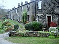
 'Benchmark Cottage', Hollings Farm - geograph.org.uk - 5617868.jpg 1,024 × 684; 136 KB
-
 21 Paradise Fold - geograph.org.uk - 400688.jpg 640 × 429; 271 KB
-
 274-276 Cemetery Road - geograph.org.uk - 490906.jpg 640 × 595; 73 KB
-
 3 and 5 Tong Lane, Tong.jpg 1,024 × 768; 171 KB
-
 9 Tong Lane, Tong.jpg 1,024 × 768; 172 KB
-
 Addingham - Fir Cottage - geograph.org.uk - 369551.jpg 640 × 580; 182 KB
-
 Ancient and Modern (2558739769).jpg 2,560 × 1,920; 3.39 MB
-
 Apperley Bridge to Esholt (33768915054).jpg 6,000 × 4,000; 11.27 MB
-
 Apperley Bridge to Esholt (34481222881).jpg 6,000 × 4,000; 10.43 MB
-
 Back Fold, off Low Lane - geograph.org.uk - 400884.jpg 640 × 429; 255 KB
-
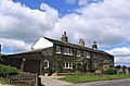
 Barraclough Street, Moor Top, Bradford - geograph.org.uk - 5683980.jpg 1,024 × 702; 203 KB
-
 Bay of Biscay - geograph.org.uk - 371831.jpg 640 × 463; 83 KB
-
 Beckfoot Cottage - geograph.org.uk - 5418194.jpg 1,024 × 768; 1.05 MB
-
 Bridge Cottage - Bradford Road - geograph.org.uk - 1119927.jpg 640 × 480; 261 KB
-
 Broadfolds - geograph.org.uk - 401868.jpg 640 × 521; 280 KB
-
 Broomfields miner's houses.jpg 4,320 × 3,240; 2.69 MB
-
 Canalside Cottages - geograph.org.uk - 5631802.jpg 1,600 × 1,200; 330 KB
-
 Catclough Cottage, Lees Lane - geograph.org.uk - 5621550.jpg 1,024 × 673; 168 KB
-
 Clayton Lane - geograph.org.uk - 392623.jpg 640 × 481; 115 KB
-
 Cottage - Buttershaw Lane - geograph.org.uk - 598515.jpg 640 × 561; 39 KB
-
 Cottage at Broadfolds - geograph.org.uk - 401862.jpg 433 × 640; 288 KB
-
 Cottage at Town End Clayton - geograph.org.uk - 401908.jpg 640 × 429; 231 KB
-
 Cottage behind Eldwick Hall - geograph.org.uk - 622349.jpg 640 × 480; 119 KB
-
 Cottage near Holme House - geograph.org.uk - 391297.jpg 627 × 640; 256 KB
-

-
 Cottage, Holme House - geograph.org.uk - 810390.jpg 1,024 × 683; 150 KB
-
 Cottages - 131-141 Halifax Road - geograph.org.uk - 600236.jpg 640 × 467; 41 KB
-
 Cottages - Beacon Road - geograph.org.uk - 725738.jpg 640 × 480; 75 KB
-

-
 Cottages - Harden Road - geograph.org.uk - 1367975.jpg 640 × 480; 252 KB
-
 Cottages - Haycliffe Lane - geograph.org.uk - 2635416.jpg 640 × 480; 60 KB
-
 Cottages - Main Road - geograph.org.uk - 834948.jpg 640 × 455; 53 KB
-
 Cottages - Smiddles Lane - geograph.org.uk - 649572.jpg 640 × 449; 46 KB
-

-
 Cottages at Crossley Hall, Thornton Old Road, Bradford - geograph.org.uk - 2700281.jpg 2,000 × 1,401; 640 KB
-
 Cottages at New Toftshaw - geograph.org.uk - 5814456.jpg 5,184 × 3,456; 7.19 MB
-
 Cottages at Ousel Hole - geograph.org.uk - 1060207.jpg 640 × 480; 126 KB
-
 Cottages at Town End Clayton - geograph.org.uk - 401918.jpg 640 × 496; 82 KB
-

-
 Cottages in Broadfolds Clayton - geograph.org.uk - 401859.jpg 640 × 429; 239 KB
-

-

-
 Cottages on Greenfield Lane, Great Horton - geograph.org.uk - 1847485.jpg 2,431 × 1,823; 2.33 MB
-
 Cottages on Halifax Road - geograph.org.uk - 3468049.jpg 640 × 480; 77 KB
-
 Cottages on Skinner Lane, Bradford - geograph.org.uk - 1660105.jpg 640 × 480; 61 KB
-
 Cottages on Stony Lane, Eccleshill - geograph.org.uk - 6336717.jpg 1,024 × 768; 142 KB
-
 Cottages on Tong Lane, Tong - geograph.org.uk - 6393123.jpg 800 × 600; 79 KB
-
 Cottages, Brow Lane, Clayton (3620273166).jpg 2,560 × 1,920; 4.54 MB
-

-

-
 Cottages, Horton Bank Top - geograph.org.uk - 182759.jpg 640 × 480; 87 KB
-
 Cottages, Toftshaw, North Bierley - geograph.org.uk - 568044.jpg 640 × 480; 95 KB
-
 Cottages, Whitley Head - geograph.org.uk - 662195.jpg 640 × 480; 78 KB
-
 Cragg Lane, Thornton - geograph.org.uk - 1931444.jpg 2,000 × 1,500; 562 KB
-
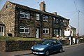
 Cullingworth - 9, Station Road - geograph.org.uk - 369366.jpg 640 × 597; 167 KB
-
 Denton Well Cottage - geograph.org.uk - 4963300.jpg 1,600 × 1,199; 871 KB
-
 Derelict Building - Fagley Lane - geograph.org.uk - 2194350.jpg 640 × 480; 80 KB
-
 Dyehouse Fold - Dyehouse Road - geograph.org.uk - 1462361.jpg 640 × 480; 303 KB
-
 Farriers End, Headley Lane - geograph.org.uk - 1496733.jpg 480 × 640; 63 KB
-
 Faweather Cottage - geograph.org.uk - 410482.jpg 640 × 480; 65 KB
-
 Firth Row - Bierley Lane - geograph.org.uk - 701255.jpg 640 × 418; 50 KB
-
 Flappit Spring - geograph.org.uk - 40350.jpg 640 × 421; 69 KB
-
 Haigh Fold, Eccleshill - geograph.org.uk - 470469.jpg 640 × 477; 134 KB
-
 Hedge Nook - geograph.org.uk - 379781.jpg 640 × 447; 104 KB
-
 Hollingwell Hill (8683290001).jpg 3,222 × 2,779; 9.8 MB
-
 Horse Close Cottages, Royds Hall Lane, Bradford (11072275275).jpg 2,379 × 1,764; 4.95 MB
-
 Hougomont - off Low Lane - geograph.org.uk - 614648.jpg 640 × 495; 35 KB
-
 House, Tong Lane, Tong - geograph.org.uk - 1381818.jpg 640 × 433; 108 KB
-

-
 Lane End - geograph.org.uk - 401821.jpg 640 × 449; 59 KB
-
 Lane End Cottage - in Clayton Lane - geograph.org.uk - 401924.jpg 640 × 429; 272 KB
-
 Lillies 2 Rose - Drakes Fold - geograph.org.uk - 1723441.jpg 640 × 480; 80 KB
-
 Lilycroft Place - Heaton Road - geograph.org.uk - 1173111.jpg 640 × 484; 264 KB
-
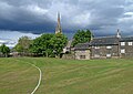 Little Horton - The View from the Boundary (8806159960).jpg 3,823 × 2,720; 6.81 MB
-
 Mistal Cottage - Tong Lane - geograph.org.uk - 2328730.jpg 640 × 480; 45 KB
-
 Newsholme - geograph.org.uk - 390318.jpg 640 × 612; 268 KB
-
 Nursery Road - geograph.org.uk - 400773.jpg 640 × 429; 245 KB
-
 Old and new by the canal - geograph.org.uk - 266103.jpg 640 × 480; 102 KB
-
 Old Harden Grange, St. Ives Estate - geograph.org.uk - 375221.jpg 640 × 480; 111 KB
-
 Old house, Tong Lane, Tong - geograph.org.uk - 1381728.jpg 640 × 467; 110 KB
-
 Old Lane - Thornton - geograph.org.uk - 691865.jpg 640 × 447; 52 KB
-

-
 Olive Terrace, Dubb Lane, Bingley - geograph.org.uk - 386094.jpg 640 × 480; 144 KB
-
 Pollits House - off Dunnock Avenue - geograph.org.uk - 2955846.jpg 640 × 480; 94 KB
-
 Ramsden Place, Clayton - geograph.org.uk - 392876.jpg 640 × 569; 114 KB
-
 Royds Hall Lane - geograph.org.uk - 399500.jpg 464 × 640; 133 KB
-

-
 Single Storey Building on Little Horton Lane, Bradford - geograph.org.uk - 5430868.jpg 5,184 × 3,456; 6.88 MB
-

-

-
 Squirrel Farm Cottages - geograph.org.uk - 358767.jpg 640 × 464; 119 KB
-
 Squirrel Farm Cottages, Thornton - geograph.org.uk - 2273747.jpg 2,000 × 1,373; 682 KB
-
 Squirrel Lane, Thornton - geograph.org.uk - 1931432.jpg 2,000 × 1,497; 731 KB
-
 Squirrel Lane, Thornton - geograph.org.uk - 358773.jpg 640 × 479; 125 KB
-
 Walnut Tree Cottage & Farmhouse, Bolton Lane - geograph.org.uk - 5664745.jpg 1,600 × 1,200; 266 KB
-
 Waterloo Crescent, Apperley Bridge - geograph.org.uk - 4462831.jpg 2,265 × 1,381; 824 KB
-
 Thornton Road, Leaventhorpe - geograph.org.uk - 392906.jpg 640 × 457; 121 KB
-


.jpg)
.jpg)
.jpg)


_-_geograph.org.uk_-_87467.jpg)


.jpg)


.jpg)
.jpg)


.jpg)


_and_its_outbuilding_-_geograph.org.uk_-_4713347.jpg)