Category:Cound
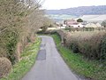
English: Cound is a residential village and civil parish on the west bank of the River Severn in the English county of Shropshire, 6.7 miles (10.8 kilometres) south east of the county town Shrewsbury. Once a busy and industrious river port Cound has now reverted back to a quiet rural community and dormitory village, for commuters to the commercial centres of Shrewsbury and Telford.
village and civil parish in Shropshire, United Kingdom  | |||||
| Upload media | |||||
| Instance of | |||||
|---|---|---|---|---|---|
| Location | Shropshire, West Midlands, England | ||||
| Located in or next to body of water | |||||
 | |||||
Subcategories
This category has the following 4 subcategories, out of 4 total.
C
- St Peter's church, Cound (3 F)
- Cound War Memorial (1 F)
- Cound Cricket Club (3 F)
H
- Cound Hall (1 F)
Media in category "Cound"
The following 141 files are in this category, out of 141 total.
-
 A closer look at Bullhill Brook ford - geograph.org.uk - 740338.jpg 640 × 480; 129 KB
-
 A458 at Black Barn - geograph.org.uk - 2867310.jpg 640 × 480; 42 KB
-
 A458 at Leasowes - geograph.org.uk - 2867267.jpg 640 × 480; 48 KB
-
 A458 at the junction for Cound - geograph.org.uk - 2867309.jpg 640 × 480; 60 KB
-
 A458 at The Riverside Inn - geograph.org.uk - 2867276.jpg 640 × 480; 50 KB
-
 A458 near Black Barn - geograph.org.uk - 6110151.jpg 800 × 600; 136 KB
-
 A458 near Cound Cottage - geograph.org.uk - 2867300.jpg 640 × 480; 40 KB
-
 A458 near Cound Hall - geograph.org.uk - 2867304.jpg 640 × 480; 41 KB
-
 A458 towards Black Barn farm - geograph.org.uk - 4313098.jpg 1,306 × 979; 402 KB
-
 A458 towards Shrewsbury - geograph.org.uk - 6110094.jpg 800 × 600; 124 KB
-
 A458 towards Shrewsbury - geograph.org.uk - 6110148.jpg 800 × 548; 118 KB
-
 Along the lane towards Harnage Grange - geograph.org.uk - 2953534.jpg 979 × 734; 369 KB
-
 Barns at Glebe Farm - geograph.org.uk - 4306684.jpg 1,142 × 857; 488 KB
-
 Barns, Golding Farm.jpg 1,142 × 857; 306 KB
-
 Bee swarm in hawthorn tree - geograph.org.uk - 2953524.jpg 734 × 979; 334 KB
-
 Beehives on the hillside above Bull Farm - geograph.org.uk - 2953519.jpg 1,142 × 857; 352 KB
-
 Bend in the Severn, behind the Riverside Inn, Cound - geograph.org.uk - 4484739.jpg 3,264 × 2,448; 1.8 MB
-
 Bridge over Brook - geograph.org.uk - 383079.jpg 640 × 480; 99 KB
-
 Bridge over Cound Brook. - geograph.org.uk - 716353.jpg 640 × 480; 118 KB
-
 Bridge over the Coundmoor Brook - geograph.org.uk - 4305804.jpg 1,142 × 857; 515 KB
-
 Bridge over the Coundmoor Brook - geograph.org.uk - 4306703.jpg 1,142 × 857; 582 KB
-
-
 Bullhill Brook Ford - geograph.org.uk - 4018955.jpg 3,872 × 2,592; 4.83 MB
-
 Cound Brook bridge, A458 - geograph.org.uk - 2867306.jpg 640 × 480; 80 KB
-
 Cound Farm - geograph.org.uk - 4309022.jpg 1,142 × 857; 339 KB
-
 Cound Hall Gates.jpg 640 × 480; 54 KB
-
 Cound Stank Bridge and Cound Brook. - geograph.org.uk - 711840.jpg 640 × 480; 82 KB
-
 Cound Stank Bridge. - geograph.org.uk - 711837.jpg 640 × 480; 104 KB
-
 Cound SY5, UK - panoramio.jpg 3,264 × 2,448; 2.34 MB
-
 Coundmoor - geograph.org.uk - 4303885.jpg 1,142 × 857; 349 KB
-
 Country road passing Bull Farm - geograph.org.uk - 5799185.jpg 1,024 × 680; 335 KB
-

-
 Crop field, Cound - geograph.org.uk - 6110090.jpg 800 × 600; 125 KB
-

-

-
 Down the lane to Cound. - geograph.org.uk - 716358.jpg 640 × 480; 120 KB
-
 Eytonrock from The River Severn - geograph.org.uk - 2003255.jpg 4,224 × 3,168; 6.39 MB
-

-
 Farmland gateway - geograph.org.uk - 5006839.jpg 800 × 600; 135 KB
-
 Farmland north of Black Barn - geograph.org.uk - 4313103.jpg 1,142 × 857; 357 KB
-
 Flat field near Black Barn - geograph.org.uk - 6110150.jpg 800 × 600; 114 KB
-
 Footpath and a field near Williams Wood - geograph.org.uk - 2953537.jpg 1,142 × 857; 279 KB
-
 Ford at Coundmoor - geograph.org.uk - 4018933.jpg 3,872 × 2,592; 4.64 MB
-
 Freshly laid hedge near Woodside - geograph.org.uk - 2953989.jpg 1,142 × 857; 267 KB
-
 Front Car Park of The Riverside Inn - geograph.org.uk - 2003343.jpg 4,224 × 3,168; 6.22 MB
-
 Grazing near the Cound Brook - geograph.org.uk - 6110147.jpg 800 × 600; 202 KB
-
 Harnage Farm - geograph.org.uk - 4306741.jpg 1,142 × 857; 423 KB
-
 Harnage Grange - geograph.org.uk - 2953540.jpg 1,142 × 857; 306 KB
-
 Harnage hamlet - geograph.org.uk - 4306732.jpg 1,142 × 857; 523 KB
-
 Highlands Farm from above - geograph.org.uk - 4282264.jpg 979 × 734; 390 KB
-

-
 Lane junction at Cound Stank - geograph.org.uk - 4313078.jpg 1,142 × 857; 389 KB
-
 Lane past Fenwyatt - geograph.org.uk - 4303696.jpg 1,142 × 857; 386 KB
-
 Mixed crop fields - geograph.org.uk - 6110092.jpg 800 × 536; 78 KB
-
 Narrow lane at Bullhill Brook - geograph.org.uk - 4282271.jpg 979 × 734; 429 KB
-
 New hedges along the lane into Upper Cound - geograph.org.uk - 4313051.jpg 1,142 × 857; 401 KB
-
 No missing that - geograph.org.uk - 4313108.jpg 1,142 × 857; 440 KB
-
 Not well kept at all - geograph.org.uk - 4306746.jpg 857 × 1,142; 596 KB
-

-

-
 On the lane into Upper Cound - geograph.org.uk - 4306680.jpg 1,142 × 857; 395 KB
-
 OS benchmark - Cound Farm - geograph.org.uk - 4309020.jpg 857 × 1,142; 445 KB
-
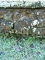
 OS benchmark - Cound Stank Bridge - geograph.org.uk - 4313062.jpg 857 × 1,142; 619 KB
-
 OS benchmark - Coundmoor, bridge - geograph.org.uk - 4303893.jpg 857 × 1,142; 613 KB
-
 OS benchmark - Coundmoor, letterbox - geograph.org.uk - 4303704.jpg 857 × 1,142; 615 KB
-
 OS benchmark - Golding, cottage at entrance - geograph.org.uk - 4305784.jpg 1,102 × 1,469; 548 KB
-

-
 OS benchmark - Venusbank railway bridge - geograph.org.uk - 4313112.jpg 857 × 1,142; 560 KB
-
 OS rivet ^ cutmark, Bullhill Brook bridge - geograph.org.uk - 4282279.jpg 857 × 1,142; 505 KB
-
 Outbuildings at Moreton Farm - geograph.org.uk - 4303692.jpg 1,142 × 857; 421 KB
-
 Redevelopment at Cound Lodge Garage - geograph.org.uk - 4313129.jpg 1,142 × 857; 335 KB
-
 River Severn - geograph.org.uk - 1956141.jpg 800 × 533; 109 KB
-
 River Severn - geograph.org.uk - 1956168.jpg 800 × 523; 84 KB
-
 River Severn at Coundlane - geograph.org.uk - 5444292.jpg 640 × 427; 57 KB
-
 River Severn in Cound, Shropshire, England.jpg 640 × 480; 83 KB
-
 River Severn near Cound - geograph.org.uk - 2003262.jpg 4,224 × 3,168; 6.16 MB
-
 Riverside Inn, Cound - geograph.org.uk - 151189.jpg 640 × 480; 69 KB
-
 Road junction north of Coundmoor - geograph.org.uk - 4303699.jpg 857 × 1,142; 346 KB
-
 Sharp right on the lane into Upper Cound - geograph.org.uk - 4306677.jpg 1,142 × 857; 422 KB
-
 Sheep grazing near Stonewall Wood - geograph.org.uk - 2953529.jpg 1,142 × 857; 340 KB
-
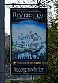 Sign for the Riverside Inn, Cound - geograph.org.uk - 6110089.jpg 568 × 800; 117 KB
-
 Sleeping cat in the beer garden - geograph.org.uk - 1956221.jpg 800 × 550; 211 KB
-
 Snowdrops around Coundmoor Brook - geograph.org.uk - 1725308.jpg 2,112 × 2,816; 2.42 MB
-
 Snowdrops beside a woodland path - geograph.org.uk - 688792.jpg 640 × 480; 143 KB
-
 Stevenshill hillfort - geograph.org.uk - 4305826.jpg 1,142 × 857; 449 KB
-
 Swans in a field opposite Cound Hall - geograph.org.uk - 4313118.jpg 1,306 × 979; 476 KB
-

-
 The bridleway below Fetch Hill - geograph.org.uk - 2953513.jpg 1,142 × 857; 263 KB
-
 The Cound Brook - geograph.org.uk - 6110146.jpg 800 × 600; 253 KB
-
 The new postbox - geograph.org.uk - 4306755.jpg 857 × 1,142; 503 KB
-
 The old school, Cound - geograph.org.uk - 4306772.jpg 1,142 × 857; 317 KB
-
 The Riverside Inn (pub sign) - geograph.org.uk - 1956210.jpg 683 × 1,024; 138 KB
-
 The Riverside Inn - geograph.org.uk - 1956199.jpg 1,024 × 675; 159 KB
-
 The Riverside Inn - geograph.org.uk - 252079.jpg 640 × 486; 86 KB
-
 The Riverside Inn from The River - geograph.org.uk - 2003305.jpg 4,224 × 3,168; 5.88 MB
-
 The Riverside Inn, Cound - geograph.org.uk - 2495703.jpg 3,479 × 2,337; 2.79 MB
-
 The Riverside Inn, Cound - geograph.org.uk - 4484737.jpg 3,264 × 2,448; 1.87 MB
-
 The Riverside Inn, Cound - geograph.org.uk - 6110087.jpg 800 × 570; 133 KB
-
 The Riverside Inn. - geograph.org.uk - 716340.jpg 640 × 480; 85 KB
-
 The Severn at Cound, Shropshire - geograph.org.uk - 877919.jpg 640 × 287; 52 KB
-
 The Severn at Eyton - geograph.org.uk - 3028570.jpg 1,077 × 808; 319 KB
-
 Tilled and ready for planting. - geograph.org.uk - 716359.jpg 640 × 480; 83 KB
-
 Upper Cound - geograph.org.uk - 4306699.jpg 1,142 × 857; 332 KB
-
 Venus Pool - western bank - geograph.org.uk - 4313096.jpg 1,142 × 857; 327 KB
-
 View across the River Severn - geograph.org.uk - 1956155.jpg 800 × 533; 98 KB
-
 Vote Leave - geograph.org.uk - 5006820.jpg 1,024 × 768; 150 KB
-
 Waterfowl at Venus Pool - geograph.org.uk - 4321631.jpg 2,583 × 1,780; 1.25 MB
-
 Welcome to Coundmoor - geograph.org.uk - 739765.jpg 640 × 480; 76 KB
-
 Wheat field near Cound - geograph.org.uk - 5006833.jpg 1,024 × 768; 260 KB
-
 Woodside Cottages - geograph.org.uk - 2953997.jpg 1,142 × 857; 295 KB
-
 Woodside cottages across the fields - geograph.org.uk - 2953993.jpg 1,142 × 857; 332 KB
-
 A stroll in the country - geograph.org.uk - 690173.jpg 640 × 480; 117 KB
-
 Betton Abbots Landfill - geograph.org.uk - 382343.jpg 640 × 480; 81 KB
-
 Bridleway to The Gippols - geograph.org.uk - 740870.jpg 640 × 480; 84 KB
-
 Bullhill Brook ford - geograph.org.uk - 740328.jpg 640 × 480; 145 KB
-

-
 Disused Railway - geograph.org.uk - 669500.jpg 640 × 425; 104 KB
-
 Electrified stile - well, almost - geograph.org.uk - 740835.jpg 640 × 480; 104 KB
-
 Entrance to Black Barn - geograph.org.uk - 727163.jpg 640 × 480; 58 KB
-
 Farm buildings at Harnage. - geograph.org.uk - 711847.jpg 640 × 480; 69 KB
-
 Farm buildings at The Glebe. - geograph.org.uk - 716362.jpg 640 × 480; 86 KB
-
 Farm track and field boundary - geograph.org.uk - 723397.jpg 640 × 480; 90 KB
-
 Farmland, Kenley, Shropshire - geograph.org.uk - 631694.jpg 640 × 442; 135 KB
-
 Field at Coundmoor - geograph.org.uk - 740758.jpg 640 × 480; 83 KB
-
 Field by Merrishaw Farm - geograph.org.uk - 740864.jpg 640 × 480; 58 KB
-
 Flood gauge by Riverside Inn - geograph.org.uk - 507326.jpg 635 × 510; 84 KB
-
 Footpath across a field of Barley - geograph.org.uk - 740292.jpg 640 × 480; 98 KB
-
 Grazing Land near Harley, Shropshire - geograph.org.uk - 631588.jpg 640 × 449; 101 KB
-
 House in the Row Brook valley. - geograph.org.uk - 711835.jpg 640 × 480; 64 KB
-
 Junction at Harnage Grange - geograph.org.uk - 740305.jpg 640 × 480; 65 KB
-
 Lakeside track - geograph.org.uk - 688793.jpg 640 × 480; 71 KB
-
 Lane beside Lord's Coppice - geograph.org.uk - 740859.jpg 640 × 480; 91 KB
-
 Lane past Cressage House. - geograph.org.uk - 711852.jpg 640 × 480; 36 KB
-
 Lane past Woodside Cottages - geograph.org.uk - 740297.jpg 640 × 480; 98 KB
-
 Lane through Park Coppice - geograph.org.uk - 740284.jpg 640 × 480; 110 KB
-
 Large field - geograph.org.uk - 288208.jpg 640 × 480; 93 KB
-
 Lower Springs - geograph.org.uk - 480589.jpg 640 × 480; 95 KB
-
 Moreton Cottage - geograph.org.uk - 288201.jpg 480 × 640; 140 KB
-

-
 River Severn - geograph.org.uk - 507315.jpg 640 × 427; 127 KB
-
 River Severn in flood - geograph.org.uk - 507318.jpg 640 × 427; 118 KB


_-_geograph.org.uk_-_1956210.jpg)


