Category:Countryside in Scotland
Subcategories
This category has the following 31 subcategories, out of 31 total.
A
- Countryside in Aberdeen (45 F)
- Countryside in Angus (42 F)
- Countryside in Argyll and Bute (106 F)
C
- Countryside in Clackmannanshire (10 F)
D
- Countryside in Dumfries and Galloway (128 F)
E
- Countryside in East Ayrshire (21 F)
- Countryside in East Lothian (16 F)
- Countryside in Edinburgh (3 F)
F
G
- Countryside in Glasgow (8 F)
H
- Countryside in Highland council area (439 F)
I
- Countryside in Inverclyde (10 F)
M
- Countryside in Midlothian (2 F)
- Countryside in Moray (100 F)
N
O
P
- Countryside in Perth and Kinross (97 F)
R
S
- Countryside in the Scottish Borders (176 F)
- Countryside in South Ayrshire (35 F)
- Countryside in South Lanarkshire (62 F)
W
- Countryside in West Lothian (5 F)
Media in category "Countryside in Scotland"
The following 43 files are in this category, out of 43 total.
-
 A Corn Kiln - geograph.org.uk - 798682.jpg 640 × 426; 180 KB
-
 A Highland Cow - geograph.org.uk - 172355.jpg 640 × 480; 269 KB
-
 A View from the Strath Conon Road - geograph.org.uk - 208164.jpg 640 × 480; 300 KB
-
 Ardgay and Bonar Bridge - geograph.org.uk - 57495.jpg 640 × 480; 94 KB
-
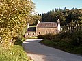
 Burnside Cottage - geograph.org.uk - 281093.jpg 640 × 480; 180 KB
-
 Countryside in St. Andrew's.jpg 2,816 × 1,880; 3.35 MB
-
 Deer Fence - geograph.org.uk - 874334.jpg 640 × 480; 108 KB
-
 Deer fence, Kinveachy - geograph.org.uk - 986602.jpg 640 × 480; 132 KB
-
 Deer fence, Lundie - geograph.org.uk - 1722760.jpg 640 × 359; 99 KB
-
 Deer fence... - geograph.org.uk - 1184932.jpg 640 × 426; 93 KB
-
 Deer fences, Achnasheen Plantation - geograph.org.uk - 624604.jpg 640 × 480; 109 KB
-
 Dwellings at Ordbreck. - geograph.org.uk - 253747.jpg 640 × 426; 68 KB
-
 Field and house near Newmills - geograph.org.uk - 663605.jpg 640 × 426; 78 KB
-
 Finniness Plantation (Wood Hill) - geograph.org.uk - 546477.jpg 640 × 427; 133 KB
-
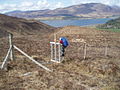
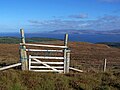
 Gate in deer fence - geograph.org.uk - 408860.jpg 640 × 480; 105 KB
-
 Gate in the deer fence - geograph.org.uk - 1539193.jpg 640 × 480; 94 KB
-
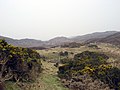
 Heading for Scroggs - geograph.org.uk - 699721.jpg 640 × 480; 52 KB
-
 Inveraray Castle - geograph.org.uk - 434122.jpg 640 × 427; 79 KB
-
 Kircram - deer fence - geograph.org.uk - 846640.jpg 640 × 429; 107 KB
-
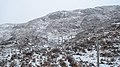
 Laigh Kenmure (geograph 2136745).jpg 640 × 480; 73 KB
-
 Lethen Mill House - geograph.org.uk - 266468.jpg 640 × 480; 166 KB
-
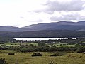 Loch Migdale - geograph.org.uk - 42790.jpg 640 × 480; 58 KB
-
 Looking down towards the River Conon - geograph.org.uk - 208178.jpg 640 × 480; 274 KB
-

-
 Looking Towards Ardgay and Loch migdale - geograph.org.uk - 104584.jpg 640 × 480; 107 KB
-
 Mouswald countryside in the fog - geograph.org.uk - 697424.jpg 640 × 480; 36 KB
-
 New deer fence - geograph.org.uk - 1568715.jpg 640 × 480; 141 KB
-
 Old deer fence - geograph.org.uk - 1271136.jpg 640 × 427; 64 KB
-
 Old Deer Fence - geograph.org.uk - 261149.jpg 640 × 480; 94 KB
-

-
 Road, bridge and woodland at Rereach - geograph.org.uk - 661645.jpg 640 × 426; 156 KB
-
 RobroystonCountryside.jpg 3,072 × 2,045; 1.1 MB
-
 RobroystonFields3.jpg 3,072 × 2,304; 6.39 MB
-
 Sheep and river - geograph.org.uk - 543245.jpg 640 × 480; 71 KB
-

-
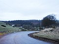
 The Achandunie Road - geograph.org.uk - 61480.jpg 640 × 480; 122 KB
-
 The Luggie - geograph.org.uk - 519298.jpg 640 × 480; 71 KB
-
 The View from close to Moy Bridge - geograph.org.uk - 208134.jpg 640 × 480; 290 KB
-

-
 Track at Newhouse (geograph 6805928).jpg 3,120 × 3,306; 2.94 MB
-
 Valley of the River Nairn in Autumn - geograph.org.uk - 281530.jpg 640 × 215; 202 KB
-
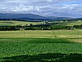
 View over farmland to Moray Firth - geograph.org.uk - 344433.jpg 640 × 288; 39 KB
-
 View to High Palacecraig (geograph 6805827).jpg 3,120 × 3,305; 3.37 MB


_-_geograph.org.uk_-_546477.jpg)


.jpg)


.jpg)

.jpg)