Category:County of Burgundy
Internationalization
English: County of Burgundy
Français : Comté de Bourgogne
countship   | |||||
| Upload media | |||||
| Instance of | |||||
|---|---|---|---|---|---|
| Location |
| ||||
| Capital | |||||
| Inception |
| ||||
| Dissolved, abolished or demolished date |
| ||||
 | |||||
Subcategories
This category has the following 3 subcategories, out of 3 total.
C
G
Media in category "County of Burgundy"
The following 34 files are in this category, out of 34 total.
-
 1716 Homann Map of Burgundy, France - Geographicus - Burgundiae-homan-1716.jpg 4,000 × 4,759; 4.58 MB
-
 AltaYBajaBorgoñaSiglosIXX.svg 1,002 × 1,014; 1.17 MB
-
 Arelat New.png 674 × 920; 189 KB
-
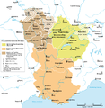
 Bourgogne in XI-XII century.png 931 × 647; 294 KB
-
 Burgundies 3.png 479 × 487; 128 KB
-
 Carte-Royaume-dArles.png 1,500 × 1,529; 412 KB
-
 Duché et Comté de Bourgogne au XIVe siecle-es.svg 829 × 639; 63 KB
-
 Duché et Comté de Bourgogne au XIVe siecle-pt.svg 829 × 639; 63 KB
-
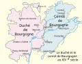 Duché et Comté de Bourgogne au XIVe siecle.svg 829 × 639; 53 KB
-
 Franche-Comte fin XVe.jpg 1,756 × 1,984; 702 KB
-
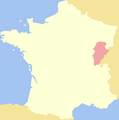 Free County of Burgundy.png 891 × 899; 23 KB
-
 Karte Hoch Niederburgund-FR.png 2,000 × 2,126; 549 KB
-
 Karte Hoch und Niederburgund EN.png 2,000 × 2,126; 538 KB
-
 Karte Hoch und Niederburgund-el.png 1,310 × 1,338; 200 KB
-
 Karte Hoch- und Niederburgund.png 2,000 × 2,126; 549 KB
-
 Karte Königreich Arelat DE.png 1,500 × 1,529; 414 KB
-
 La Bourgogne aux XI et XIIe siècles-es.svg 1,050 × 1,450; 515 KB
-
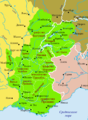
 La Bourgogne aux XI et XIIe siècles.svg 1,050 × 1,450; 302 KB
-
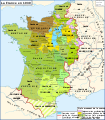
 Map France 1030-br.svg 989 × 1,126; 741 KB
-
 Map France 1030-ca.svg 1,053 × 1,199; 4.9 MB
-
 Map France 1030-de.svg 988 × 1,124; 1.49 MB
-
 Map France 1030-es.svg 1,053 × 1,199; 4.12 MB
-
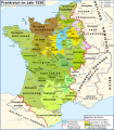
 Map France 1030-fr.svg 989 × 1,126; 718 KB
-
 Map France 1030-ru.svg 988 × 1,124; 789 KB
-
 Map France 1030-uk.svg 988 × 1,124; 789 KB
-
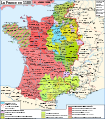
 Map France 1180-br.svg 988 × 1,124; 1.9 MB
-
 Map France 1180-de.svg 988 × 1,124; 1.94 MB
-
 Map France 1180-es.svg 988 × 1,124; 1.97 MB
-
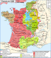
 Map France 1180-fr.svg 988 × 1,124; 1.88 MB
-
 Map France 1180-ru.svg 988 × 1,124; 1.88 MB
-
 Map France 1180-uk.svg 988 × 1,124; 1.68 MB
-
 Map Kingdom Arelat AR.png 1,454 × 1,485; 856 KB
-
 Map Kingdom Arelat EN.png 1,310 × 1,338; 209 KB
-
 Map Kingdom Arelat-el.png 1,310 × 1,338; 227 KB


