Category:Coupar Angus (civil parish)
Scottish parish in Perth and Kinross, Scotland, UK | |||||
| Upload media | |||||
| Instance of | |||||
|---|---|---|---|---|---|
| Named after | |||||
| Location |
| ||||
| Population |
| ||||
| Area |
| ||||
 | |||||
Subcategories
This category has the following 2 subcategories, out of 2 total.
A
- Ardler, Perth and Kinross (10 F)
K
- Kinloch, Coupar Angus (1 F)
Media in category "Coupar Angus (civil parish)"
The following 177 files are in this category, out of 177 total.
-
 A94 near Arthurstone - geograph.org.uk - 3871224.jpg 640 × 360; 192 KB
-
 A94, Coupar Angus - geograph.org.uk - 3148135.jpg 640 × 480; 242 KB
-
 A94, Longleys - geograph.org.uk - 4406673.jpg 800 × 533; 156 KB
-
 A94, Wester Denhead - geograph.org.uk - 3871256.jpg 640 × 480; 248 KB
-
 Aberbothrie Bridge - geograph.org.uk - 6789002.jpg 5,184 × 3,888; 4.82 MB
-
 Arable field near Coupar Angus - geograph.org.uk - 2641779.jpg 640 × 480; 93 KB
-

-
 Arable land near Arthurstone - geograph.org.uk - 1554634.jpg 640 × 480; 127 KB
-
 Arable land, Cronan - geograph.org.uk - 3870875.jpg 640 × 360; 179 KB
-
 Ardler Cemetery - geograph.org.uk - 5416964.jpg 640 × 480; 62 KB
-
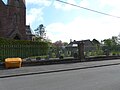
 Ardler Church - geograph.org.uk - 1987759.jpg 534 × 800; 213 KB
-
 Ardler Church - geograph.org.uk - 5416960.jpg 480 × 640; 69 KB
-
 Ardler Church and Spire - geograph.org.uk - 5398758.jpg 5,184 × 3,888; 4.17 MB
-
 Arthurstone Tower - geograph.org.uk - 5728776.jpg 5,184 × 3,888; 6.74 MB
-
 Assembly Room - geograph.org.uk - 3148148.jpg 640 × 480; 262 KB
-
 Barley, Strathmore - geograph.org.uk - 4119044.jpg 640 × 480; 283 KB
-
 Barn and windbreak, Bankhead of Kinloch - geograph.org.uk - 1987719.jpg 800 × 534; 156 KB
-
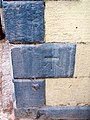
 Bench Mark, Coupar Angus - geograph.org.uk - 1849626.jpg 480 × 640; 157 KB
-
 Bench Mark, Couper Angus - geograph.org.uk - 1854340.jpg 480 × 640; 139 KB
-
 Bench Mark, St Anne's Church - geograph.org.uk - 1845667.jpg 480 × 640; 180 KB
-
 Bendochy Parish Kirk - geograph.org.uk - 863022.jpg 640 × 480; 83 KB
-
 Bogside Road, Coupar Angus - geograph.org.uk - 5945862.jpg 1,024 × 683; 325 KB
-
 Brassica crop, Coupar Angus - geograph.org.uk - 3146948.jpg 640 × 480; 282 KB
-
 Bridge of Couttie, Coupar Angus - geograph.org.uk - 2693536.jpg 640 × 480; 75 KB
-
 Bridge of Couttie, Coupar Angus - geograph.org.uk - 2693555.jpg 640 × 481; 97 KB
-
 Bridge of Couttie, Coupar Angus - geograph.org.uk - 5816790.jpg 640 × 480; 97 KB
-
 Bridge over the River Isla - geograph.org.uk - 1901757.jpg 640 × 480; 104 KB
-
 Bridge, Bardmony - geograph.org.uk - 2630613.jpg 640 × 480; 67 KB
-
 BS Crighton - geograph.org.uk - 3148121.jpg 640 × 480; 294 KB
-
 Butterybank Road - geograph.org.uk - 5770612.jpg 5,184 × 3,888; 5.34 MB
-
 Caddam Road joining the B948 in Coupar Angus - geograph.org.uk - 6322062.jpg 4,000 × 3,000; 3.21 MB
-
 Caddam Road, Coupar Angus - geograph.org.uk - 5945878.jpg 1,024 × 683; 440 KB
-
 Carving, Masonic Lodge - geograph.org.uk - 3297260.jpg 640 × 480; 304 KB
-
 Causewayend - geograph.org.uk - 3148157.jpg 640 × 480; 250 KB
-
 Co-op, Coupar Angus - geograph.org.uk - 6267986.jpg 1,024 × 683; 249 KB
-
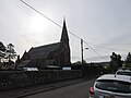
 Coupar Angus Church - geograph.org.uk - 3930996.jpg 1,024 × 682; 141 KB
-
 Coupar Angus Community Fire Station - geograph.org.uk - 5770606.jpg 5,184 × 3,888; 4.53 MB
-
 Cronan - geograph.org.uk - 3870879.jpg 640 × 360; 175 KB
-
 Cronan - geograph.org.uk - 4025951.jpg 640 × 360; 234 KB
-
 Crops under black polythene - geograph.org.uk - 3871229.jpg 640 × 360; 214 KB
-
 Cumberland Barracks - geograph.org.uk - 2729149.jpg 640 × 480; 66 KB
-
 Cumberland Barracks - geograph.org.uk - 6708544.jpg 1,600 × 978; 744 KB
-
 Cumberland or Yeomanry Barracks in Coupar Angus - geograph.org.uk - 6361825.jpg 1,024 × 683; 140 KB
-
 Dairy cattle near Coupar Angus - geograph.org.uk - 1987786.jpg 800 × 533; 113 KB
-
 Damp road, Main Plantation - geograph.org.uk - 5770627.jpg 5,184 × 3,888; 4.75 MB
-
 Dirt track near Arthurstone - geograph.org.uk - 3870881.jpg 640 × 360; 208 KB
-
 Dirt track near Arthurstone - geograph.org.uk - 4025948.jpg 640 × 360; 210 KB
-
 Dismantling the Caledonian Railway - geograph.org.uk - 6505820.jpg 697 × 1,024; 154 KB
-
 Dog Agility Centre - geograph.org.uk - 5416974.jpg 640 × 480; 132 KB
-
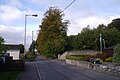
 Entrance to Coupar Angus - geograph.org.uk - 2948447.jpg 640 × 456; 48 KB
-
 Entrance to Coupar Angus - geograph.org.uk - 4710071.jpg 640 × 480; 87 KB
-
 Factory, Coupar Angus - geograph.org.uk - 1992294.jpg 640 × 427; 46 KB
-
 Farm track leading to Mains of Keithick - geograph.org.uk - 6322052.jpg 4,000 × 3,000; 3.51 MB
-
 Farmland near Woodside - geograph.org.uk - 3264584.jpg 1,200 × 797; 388 KB
-
 Fence and trees separating arable fields - geograph.org.uk - 6322057.jpg 4,000 × 3,000; 4.29 MB
-
 Field, Longleys - geograph.org.uk - 4406672.jpg 800 × 533; 199 KB
-
 Field, Longleys - geograph.org.uk - 4408011.jpg 800 × 533; 166 KB
-
 Fields at Cronan, near Coupar Angus - geograph.org.uk - 1987707.jpg 800 × 533; 104 KB
-
 Fields at Cronan, near Coupar Angus - geograph.org.uk - 1987710.jpg 800 × 534; 273 KB
-
 Fields at Keithick, south of Coupar Angus - geograph.org.uk - 3400798.jpg 1,024 × 682; 185 KB
-
 Fields near Longleys - geograph.org.uk - 1987740.jpg 800 × 533; 113 KB
-
 Fields south of Coupar Angus - geograph.org.uk - 1004500.jpg 640 × 426; 71 KB
-
 Floods along the Isla at Bardmony bridge - geograph.org.uk - 3289402.jpg 1,024 × 682; 148 KB
-
 Floods along the Isla at Bardmony, near Alyth - geograph.org.uk - 3802801.jpg 1,024 × 682; 125 KB
-
 Floods at Bardmony Bridge, near Alyth - geograph.org.uk - 3802796.jpg 1,024 × 681; 181 KB
-
 Floods beside the Isla at Bardmony - geograph.org.uk - 2498124.jpg 800 × 534; 181 KB
-
 Former Barracks in Coupar Angus - geograph.org.uk - 4630317.jpg 640 × 480; 57 KB
-
 Former drill hall in Coupar Angus - geograph.org.uk - 4624242.jpg 640 × 480; 46 KB
-
 Fruit farm, Kinloch of Bankhead - geograph.org.uk - 1987721.jpg 640 × 426; 51 KB
-
 Fungus on a log, Coupar Angus - geograph.org.uk - 2742456.jpg 613 × 1,024; 251 KB
-
 Gateposts for Kinloch House, Longleys - geograph.org.uk - 1987728.jpg 800 × 534; 248 KB
-
 George Street - geograph.org.uk - 3148112.jpg 640 × 480; 248 KB
-
 George Street, Coupar Angus - geograph.org.uk - 6267987.jpg 1,024 × 683; 253 KB
-
 Grazing lands at Couttie - geograph.org.uk - 1901765.jpg 640 × 480; 53 KB
-
 Harrowing fields at Cronan, near Coupar Angus - geograph.org.uk - 3404409.jpg 1,024 × 681; 117 KB
-
 Harrowing fields at Cronan, near Coupar Angus - geograph.org.uk - 3412917.jpg 1,024 × 681; 175 KB
-
 Harvested Field Near Longleys - geograph.org.uk - 5212195.jpg 4,608 × 3,456; 6.51 MB
-
 Hay Street, Coupar Angus - geograph.org.uk - 3148151.jpg 480 × 640; 76 KB
-
 Housing in Coupar Angus - geograph.org.uk - 1901789.jpg 640 × 480; 59 KB
-
 Isla flood plain - geograph.org.uk - 3871245.jpg 640 × 480; 216 KB
-
 Isla floodplain - geograph.org.uk - 3871241.jpg 640 × 480; 227 KB
-
 Kemphill Trig Pillar - geograph.org.uk - 5770621.jpg 5,184 × 3,888; 4.64 MB
-
 Kinloch House - geograph.org.uk - 5728773.jpg 5,184 × 3,888; 6.26 MB
-
 Kinloch Mausoleum, Longleys - geograph.org.uk - 1987735.jpg 800 × 534; 177 KB
-
 Kinloch, Longleys - geograph.org.uk - 1987726.jpg 800 × 534; 270 KB
-
 Larghan Victory Park, Coupar Angus - geograph.org.uk - 2742446.jpg 1,024 × 613; 131 KB
-
 Level crossing, Queen Street Coupar Angus - geograph.org.uk - 6505817.jpg 697 × 1,024; 156 KB
-
 Looking back out of village - geograph.org.uk - 5416978.jpg 640 × 480; 85 KB
-
 Main Plantation - geograph.org.uk - 3148161.jpg 640 × 480; 361 KB
-
 Main Plantation - geograph.org.uk - 3148468.jpg 640 × 480; 344 KB
-
 Main Plantation - geograph.org.uk - 3148470.jpg 640 × 480; 330 KB
-
 Manicured fields, Cronan, near Coupar Angus - geograph.org.uk - 3412921.jpg 1,024 × 681; 131 KB
-
 Masonic Lodge, Coupar Angus - geograph.org.uk - 3006293.jpg 3,008 × 2,000; 2.37 MB
-
 Milestone, Arthurstone - geograph.org.uk - 1849487.jpg 480 × 640; 228 KB
-
 Milestone, Arthurstone - geograph.org.uk - 1849565.jpg 640 × 480; 155 KB
-
 Minor road crossing the vale of the River Isla - geograph.org.uk - 4803144.jpg 1,024 × 683; 217 KB
-
 Minor road near Campmuir - geograph.org.uk - 3264637.jpg 1,200 × 797; 561 KB
-
 Minor road, Main Plantation - geograph.org.uk - 3148163.jpg 640 × 480; 293 KB
-
 New Care home at Coupar Angus - geograph.org.uk - 3061729.jpg 3,264 × 2,448; 3.83 MB
-
 New gates on the road to Bardmony Bridge - geograph.org.uk - 4288481.jpg 1,024 × 682; 130 KB
-

-
 Old milestone - geograph.org.uk - 6665548.jpg 600 × 800; 201 KB
-

-

-
 Old railway bridge - geograph.org.uk - 5770678.jpg 5,184 × 3,888; 4.89 MB
-
 Old railway bridge over River Isla - geograph.org.uk - 3966608.jpg 800 × 600; 88 KB
-
 Ordnance Surcey Cut Mark with Bolt - geograph.org.uk - 6345691.jpg 4,000 × 3,000; 4.19 MB
-

-
 Plastic-covered field, Cronan, near Ardler - geograph.org.uk - 3933493.jpg 1,024 × 682; 273 KB
-
 Play park, Larghan Victory Park, Coupar Angus - geograph.org.uk - 2742443.jpg 1,024 × 613; 170 KB
-
 Polytunnel frames near Arthurstone - geograph.org.uk - 1849541.jpg 640 × 480; 140 KB
-
 Polytunnels, Wester Denhead - geograph.org.uk - 4025957.jpg 640 × 480; 320 KB
-
 Poplars at Bankhead of Kinloch - geograph.org.uk - 5728784.jpg 5,184 × 3,888; 5.46 MB
-
 Postbox, Ardler - geograph.org.uk - 1845739.jpg 480 × 640; 121 KB
-
 Potatoes, Arthurstone, near Coupar Angus - geograph.org.uk - 1992270.jpg 800 × 534; 249 KB
-
 Queen Street (A923) in Coupar Angus - geograph.org.uk - 6322080.jpg 4,000 × 3,000; 2.98 MB
-
 Red House Hotel - geograph.org.uk - 3063250.jpg 3,264 × 2,448; 4 MB
-
 Remains of Cupar Abbey - geograph.org.uk - 1901835.jpg 640 × 480; 121 KB
-
 Remains of Cupar Abbey, Coupar Angus - geograph.org.uk - 3931001.jpg 681 × 1,024; 279 KB
-
 Remains of former Cistercian Abbey - geograph.org.uk - 4630323.jpg 640 × 480; 67 KB
-

-
 Remains of the Abbey at Coupar Angus - geograph.org.uk - 5398771.jpg 5,184 × 3,888; 6.66 MB
-
 Remains of the Abbey Gatehouse - geograph.org.uk - 6708571.jpg 1,600 × 1,086; 813 KB
-
 Residential area, Coupar Angus - geograph.org.uk - 1854392.jpg 640 × 480; 110 KB
-
 River Isla - geograph.org.uk - 4119060.jpg 640 × 480; 263 KB
-
 River Isla at Bardmony at dusk - geograph.org.uk - 3412907.jpg 1,024 × 682; 140 KB
-
 River Isla at Bardmony at dusk - geograph.org.uk - 3412909.jpg 1,024 × 682; 109 KB
-
 River Isla near Leitfie - geograph.org.uk - 2630655.jpg 640 × 480; 71 KB
-
 River Isla near Leitfie - geograph.org.uk - 2630679.jpg 640 × 480; 77 KB
-

-
 River Isla, Bardmony - geograph.org.uk - 3870871.jpg 640 × 360; 180 KB
-
 River Isla, Coupar Angus - geograph.org.uk - 2693477.jpg 640 × 481; 72 KB
-
 River Isla, Coupar Angus - geograph.org.uk - 2693561.jpg 640 × 480; 75 KB
-
 River Isla, Coupar Angus - geograph.org.uk - 3867225.jpg 640 × 480; 343 KB
-
 Road beside North Plantation near to North Lodge - geograph.org.uk - 6322047.jpg 4,000 × 3,000; 4.38 MB
-
 Road junction near Campmuir - geograph.org.uk - 3264657.jpg 1,200 × 797; 395 KB
-
 Road out of Ardler - geograph.org.uk - 1987754.jpg 800 × 534; 205 KB
-

-
 Road to Arthurbank - geograph.org.uk - 5728789.jpg 5,184 × 3,888; 4.99 MB
-
-
 Roadside phonebox, Longleys - geograph.org.uk - 1987724.jpg 800 × 534; 146 KB
-
 Seat with a view, Couper Angus - geograph.org.uk - 1854424.jpg 640 × 480; 169 KB
-

-
 St.Anne's Episcopal Church - geograph.org.uk - 5770600.jpg 5,184 × 3,888; 4.99 MB
-
 Stack, Mains of Keithick - geograph.org.uk - 3146941.jpg 640 × 480; 260 KB
-
 Strathmore - geograph.org.uk - 3870866.jpg 640 × 360; 200 KB
-
 Strathmore - geograph.org.uk - 3871249.jpg 640 × 480; 248 KB
-
 Strathmore agriculture - geograph.org.uk - 3871260.jpg 640 × 480; 250 KB
-
 Strathmore arable land - geograph.org.uk - 3871216.jpg 640 × 360; 183 KB
-
 Strathmore Hotel - geograph.org.uk - 3148141.jpg 640 × 480; 247 KB
-
 Strawberry field, Denhead - geograph.org.uk - 3871237.jpg 640 × 399; 222 KB
-
 Stubble and woodland - geograph.org.uk - 4118616.jpg 640 × 480; 267 KB
-
 Stubble field with trig point and tree - geograph.org.uk - 3352702.jpg 1,500 × 1,125; 2.04 MB
-
 Sunlight in Main Plantation - geograph.org.uk - 5770629.jpg 5,184 × 3,888; 5 MB
-
 Sunset over the River Isla at Bardmony - geograph.org.uk - 3412905.jpg 1,024 × 681; 91 KB
-
 The Former Royal Hotel, Couper Angus - geograph.org.uk - 1854332.jpg 640 × 480; 105 KB
-

-
 The Tavern, Ardler - geograph.org.uk - 1845747.jpg 640 × 481; 95 KB
-
 The Tavern, Ardler - geograph.org.uk - 1987757.jpg 800 × 534; 162 KB
-
 The Tavern, Ardler - geograph.org.uk - 5416958.jpg 640 × 480; 56 KB
-

-
 Track near Caddam, Coupar Angus - geograph.org.uk - 3400506.jpg 1,024 × 682; 209 KB
-
 Tractor at Cronan, near Coupar Angus - geograph.org.uk - 3412928.jpg 1,024 × 682; 165 KB
-
 Triangulation Pillar, Coupar Angus - geograph.org.uk - 1854414.jpg 640 × 480; 131 KB
-
 Union Street in Coupar Angus - geograph.org.uk - 6322078.jpg 4,000 × 3,000; 2.7 MB
-
 Union Street, Coupar Angus - geograph.org.uk - 3148129.jpg 640 × 480; 260 KB
-
 Union Street, Coupar Angus - geograph.org.uk - 3867215.jpg 640 × 480; 269 KB
-

-

-
 Watch House Abbey Church Coupar Angus - geograph.org.uk - 6369786.jpg 1,024 × 683; 176 KB
-
 Water treatment works, Coupar Angus - geograph.org.uk - 3867228.jpg 640 × 480; 289 KB
-
 Wester Balgersho, Coupar Angus - geograph.org.uk - 3400795.jpg 1,024 × 681; 124 KB
-
 Wheatfield, Balbrogie, near Coupar Angus - geograph.org.uk - 1992279.jpg 800 × 534; 216 KB
-
 Wildflowers at Coupar Angus - geograph.org.uk - 3063244.jpg 3,264 × 2,448; 5.99 MB
-
 Winter crop and winter trees by the A94 - geograph.org.uk - 4803136.jpg 1,024 × 683; 115 KB
-
 Wood near Longleys - geograph.org.uk - 4408202.jpg 800 × 533; 330 KB
-
 Yew tree and churchyard, Bendochy Kirk - geograph.org.uk - 863041.jpg 480 × 640; 139 KB


_in_Coupar_Angus_-_geograph.org.uk_-_6322080.jpg)


