Category:Coupland, Northumberland
village in Northumberland, England, UK  | |||||
| Upload media | |||||
| Instance of |
| ||||
|---|---|---|---|---|---|
| Location | Ewart, Northumberland, North East England, England | ||||
 | |||||
English: Category:Villages in Northumberland
Media in category "Coupland, Northumberland"
The following 15 files are in this category, out of 15 total.
-
 Akeld - geograph.org.uk - 409755.jpg 640 × 480; 105 KB
-
 Embankment to east of A697, near Akeld - geograph.org.uk - 409762.jpg 640 × 480; 115 KB
-
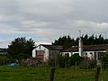
 Lodge near Coupland (1) - geograph.org.uk - 2169526.jpg 640 × 432; 165 KB
-
 Lodge near Coupland (2) - geograph.org.uk - 2169611.jpg 640 × 446; 225 KB
-
 The track to Gleadscleugh - geograph.org.uk - 779120.jpg 640 × 480; 82 KB
-
 Buildings at East Fenton Farm - geograph.org.uk - 390055.jpg 640 × 480; 104 KB
-
 Burn, Coupland - geograph.org.uk - 411778.jpg 640 × 480; 120 KB
-
 Cleared area, near to Akeld - geograph.org.uk - 411301.jpg 640 × 480; 75 KB
-
 Coupland - geograph.org.uk - 411281.jpg 640 × 480; 88 KB
-
 Craggy summit - geograph.org.uk - 444995.jpg 640 × 480; 95 KB
-
 Farmland northwest of Nesbit - geograph.org.uk - 390057.jpg 640 × 480; 92 KB
-
 Gate Ornament at ex RAF Milfield - geograph.org.uk - 623695.jpg 640 × 480; 83 KB
-
 Old RAF Buildings - Milfield - geograph.org.uk - 623696.jpg 640 × 480; 60 KB
-
 Public footpath to Commonburn House - geograph.org.uk - 444989.jpg 474 × 615; 107 KB
-


_-_geograph.org.uk_-_2169526.jpg)
_-_geograph.org.uk_-_2169611.jpg)


