Category:Cour au Chantre
| Object location | | View all coordinates using: OpenStreetMap |
|---|
 | |||||
| Upload media | |||||
| Location |
| ||||
|---|---|---|---|---|---|
| Street address |
| ||||
| Heritage designation | |||||
 | |||||
Subcategories
This category has only the following subcategory.
P
Media in category "Cour au Chantre"
The following 11 files are in this category, out of 11 total.
-
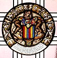 Armoiries de la famille de Joffrey.jpg 2,610 × 2,644; 4.61 MB
-
 Vevey - Cour au Chantre - 01.jpg 4,928 × 3,264; 9.04 MB
-
 Vevey - Cour au Chantre - 02.jpg 4,687 × 3,104; 7.39 MB
-
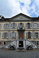 Vevey - Cour au Chantre - 03.jpg 3,157 × 4,766; 7.02 MB
-
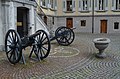 Vevey - Cour au Chantre - 04.jpg 4,928 × 3,264; 11.27 MB
-
 Vevey - Cour au Chantre - 05.jpg 4,928 × 3,264; 10.64 MB
-
 Vevey - Cour au Chantre - 06.jpg 4,928 × 3,264; 10.56 MB
-
 Vevey - Cour au Chantre - 2022-06-23 - 01.jpg 4,592 × 2,583; 8.48 MB
-
 Vevey - Cour au Chantre - 2022-09-07 - 01.jpg 3,220 × 4,830; 9.36 MB
-
 Vevey - Cour au Chantre - 2022-09-07 - 02.jpg 3,517 × 5,276; 10.41 MB
-
 Vevey - Cour au chantre.jpg 3,072 × 2,304; 1.51 MB


