Category:Coves
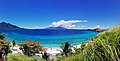
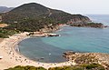
English: A cove is a small type of bay or coastal inlet. They usually have narrow, restricted entrances, are often circular or oval, and are often inside a larger bay. Small, narrow, sheltered bays, inlets, creeks, or recesses in a coast are often considered coves. Colloquially, the term can be used to describe a sheltered bay.
Català: En anglès, cove és una cala o petita badia. Per a les coves vegeu Category:Caves
type of small bay or coastal inlet  | |||||
| Upload media | |||||
| Subclass of | |||||
|---|---|---|---|---|---|
| Different from | |||||
| |||||
Subcategories
This category has the following 5 subcategories, out of 5 total.
A
- Ardlea Cove, Inishbofin (2 F)
Media in category "Coves"
The following 51 files are in this category, out of 51 total.
-
 Fig lulworth formation.png 524 × 188; 5 KB
-
 2nd panorama island.jpg 6,016 × 3,072; 5.25 MB
-
 83230 Bormes-les-Mimosas, France - panoramio (219).jpg 3,072 × 1,728; 1.68 MB
-
 A cove below Tantallon - geograph.org.uk - 352025.jpg 640 × 480; 188 KB
-
 A cove.JPG 3,648 × 2,736; 3.04 MB
-
 Alonissos cove.JPG 3,072 × 2,304; 948 KB
-
 Baia di Torre Chia - panoramio.jpg 5,022 × 3,216; 6.38 MB
-
 Beach Area at Willow Beach (0f5a7668-c962-4515-a260-8f8d67de631f).jpg 5,173 × 3,451; 17.53 MB
-
 Britannia Bay, Mustique - panoramio.jpg 2,454 × 1,587; 1.02 MB
-
 Bromélia nativa.jpg 1,600 × 898; 291 KB
-
 Cove & cliff.jpg 896 × 704; 205 KB
-
 Cove - panoramio (1642).jpg 3,648 × 2,736; 1.05 MB
-
 Cove and trees at South Cove (b684b12d-ca0c-4a24-b08c-f864c7390056).jpg 5,184 × 3,456; 7.02 MB
-
 Cove at Echo Bay (640b344f-67d1-4607-a74b-f892189daff9).jpg 5,184 × 3,456; 5.41 MB
-
 Cove at South Cove (77817c46-1008-4def-b824-371f4216a32f).jpg 5,184 × 3,456; 7.67 MB
-
 Cove on Penguin Island.JPG 4,320 × 3,240; 5.47 MB
-
 DuncansPoint3265.jpg 1,863 × 885; 1.1 MB
-
 Empty stony beach - panoramio (1).jpg 11,102 × 3,215; 7.65 MB
-
 Famous caves (3309346938).jpg 800 × 533; 153 KB
-
 Fishing at Government Point Cove (f1866a68-2ed8-4e6d-80ba-7e09ad716160).jpg 5,184 × 3,888; 6.54 MB
-
 Government Point Cove (10a6520b-4866-44d7-9c4c-e923f3d4d536).jpg 5,184 × 3,888; 9.22 MB
-
 Government Point Cove (32822b60-298e-41c6-af4b-e9ca32857933).jpg 5,184 × 3,888; 8.32 MB
-
 Government Point Cove (6fe6ff38-947a-4aaa-a677-f5d3b7923260).jpg 5,184 × 3,888; 8.03 MB
-
 Government Point Cove (f2e0c914-225d-4c3b-a846-8b0f38a31d87).jpg 5,184 × 3,888; 9.18 MB
-
 Government Point Cove (fc52a385-7dd0-43ac-9eea-6e089eb1ebf5).jpg 5,184 × 3,888; 8.08 MB
-
 Greatoceanroad2.JPG 5,184 × 3,456; 3.91 MB
-
 KatherineCoveFog.jpg 2,592 × 1,936; 903 KB
-
 Katy's Cove (3708273588).jpg 3,982 × 876; 979 KB
-

-

-
 Montserrat Museum Mir Enchanted Cove.jpg 2,740 × 2,100; 4.23 MB
-
 Montserrat Museum Mir St Vincenç's Cove.jpg 2,920 × 2,036; 4.08 MB
-
 Noosa Heads Trail Walk.jpg 3,024 × 4,032; 4.85 MB
-
 Paradise Cove King George Island.JPG 1,600 × 1,200; 540 KB
-
 Playa de Puerto Vallarta, México.jpg 1,280 × 959; 520 KB
-
 Porto Frailis - panoramio (1).jpg 2,855 × 1,890; 3.27 MB
-
 Porto Frailis - panoramio.jpg 2,835 × 1,890; 3.33 MB
-
 Pula (Italy) - Torre del Coltellazzo (03).JPG 5,184 × 3,456; 7.92 MB
-
 Quintay cove.jpg 4,000 × 3,000; 3.96 MB
-
 Sea and beach.jpg 3,264 × 1,836; 1.39 MB
-
 Sheep Cove.jpg 5,963 × 3,975; 11.86 MB
-
 Sphinx Hill.JPG 488 × 400; 38 KB
-
 St Jean Beach, St Barths, Oct 2014 (15716806155).jpg 2,816 × 2,112; 1.72 MB
-
 Starr 030828-0212 Boerhavia sp..jpg 1,632 × 1,224; 963 KB
-
 Staszek Cove and Sphinx Hill.JPG 1,600 × 1,200; 438 KB
-
 Tugawe Cove, Caramoan.jpg 4,032 × 3,024; 3.91 MB
-
 Ucluelet, He-Tin-Kis Lodge.jpg 2,080 × 1,560; 947 KB
-
 View from el Tesoro - panoramio.jpg 3,072 × 2,304; 2.9 MB
-
 View to Playa Bejucco from Kobelts Propertiy - panoramio.jpg 2,592 × 1,944; 1.05 MB
-
 Winter Cove (7604531908).jpg 1,024 × 768; 139 KB
-
 Новый Свет. Голубая бухта. - panoramio (1).jpg 2,592 × 1,944; 3.04 MB

.jpg)


.jpg)


.jpg)
.jpg)
.jpg)
.jpg)


.jpg)
.jpg)
.jpg)
.jpg)
.jpg)
.jpg)
.jpg)


_julesvernex2.jpg)
_julesvernex2.jpg)


.jpg)

_-_Torre_del_Coltellazzo_(03).JPG)


.jpg)


.jpg)
.jpg)
.jpg)
.jpg)