Category:Cowra Shire
Deutsch: Cowra Shire ist ein lokales Verwaltungsgebiet (LGA) im australischen Bundesstaat New South Wales. Das Gebiet ist 2.810 km² groß und hat etwa 12.150 Einwohner. (→Cowra Shire)
English: The Cowra Shire is a local government area in the Central West region of New South Wales, Australia. The Shire is located adjacent to the Lachlan River, the Mid-Western Highway and the Lachlan Way. (→Cowra Shire)
Français : Le comté de Cowra est une zone d'administration locale dans l'est de la Nouvelle-Galles du Sud en Australie. (→Comté de Cowra)
Italiano: La Contea di Cowra è una Local Government Area che si trova nel Nuovo Galles del Sud. Essa si estende su di una superficie di 2.810 chilometri quadrati ed ha una popolazione di 12.957 abitanti. La sede del consiglio si trova a Cowra. (→Contea di Cowra)
Nederlands: Cowra Shire Council is een Local Government Area (LGA) in de Australische deelstaat Nieuw-Zuid-Wales. (→Cowra Shire Council)
local government area in New South Wales, Australia  | |||||
| Upload media | |||||
| Instance of | |||||
|---|---|---|---|---|---|
| Location | New South Wales, AUS | ||||
| Capital | |||||
| Inception |
| ||||
| Population |
| ||||
| Area |
| ||||
| Elevation above sea level |
| ||||
| Replaces |
| ||||
| official website | |||||
 | |||||
Subcategories
This category has the following 7 subcategories, out of 7 total.
Media in category "Cowra Shire"
The following 2 files are in this category, out of 2 total.
-
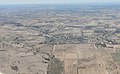 Woodstock, NSW from 5500ft.jpg 4,000 × 2,477; 4.61 MB
-
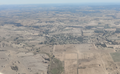 Woodstock, NSW from 5500ft.png 4,000 × 2,477; 10.94 MB

