Category:Coxhoe
English: Coxhoe is a village in County Durham, England. It is situated between Bowburn and Cornforth, a few miles south of Durham.
town in County Durham, England  | |||||
| Upload media | |||||
| Instance of | |||||
|---|---|---|---|---|---|
| Location | County Durham, North East England, England | ||||
 | |||||
Subcategories
This category has the following 4 subcategories, out of 4 total.
C
- Coxhoe Hall (4 F)
- Coxhoe War Memorial (2 F)
Q
- Quarrington Hill (19 F)
Media in category "Coxhoe"
The following 78 files are in this category, out of 78 total.
-

-
 A1(M) heading north - geograph.org.uk - 3229427.jpg 640 × 480; 56 KB
-
 A1(M) northbound - geograph.org.uk - 3107517.jpg 640 × 480; 53 KB
-
 A1(M) northbound - geograph.org.uk - 3107519.jpg 640 × 480; 38 KB
-
 A1(M) west of Coxhoe - geograph.org.uk - 5831311.jpg 1,024 × 738; 93 KB
-
 A177 bridge over the A1(M) - geograph.org.uk - 2575118.jpg 640 × 430; 59 KB
-
 Beechfield Rise, Coxhoe - geograph.org.uk - 3229446.jpg 640 × 480; 60 KB
-
 Bogma Hall Farm, Coxhoe - geograph.org.uk - 3526650.jpg 3,648 × 2,736; 3.18 MB
-
 Buildings at Avenue Farm - geograph.org.uk - 6026689.jpg 1,500 × 970; 1.49 MB
-
 Cassop Primary School - geograph.org.uk - 5631437.jpg 640 × 480; 66 KB
-
 Church Street, Coxhoe - geograph.org.uk - 3229435.jpg 640 × 480; 57 KB
-
 Cornforth Lane, Coxhoe (top end) - geograph.org.uk - 155956.jpg 640 × 480; 72 KB
-
 Cottage beside the A177 - geograph.org.uk - 3526728.jpg 3,648 × 2,736; 3.35 MB
-
 Coxhoe Beck - geograph.org.uk - 6053597.jpg 1,024 × 768; 290 KB
-
 Coxhoe Primary School - geograph.org.uk - 6372273.jpg 2,000 × 1,265; 1.93 MB
-
 Coxhoe Quarry Wood - geograph.org.uk - 2538243.jpg 3,888 × 2,592; 6.17 MB
-
 Coxhoe Tip - geograph.org.uk - 2540223.jpg 1,792 × 1,184; 467 KB
-
 Coxhoe ^ District W.M.C. ^ Institute - geograph.org.uk - 3229430.jpg 1,600 × 968; 364 KB
-
 Cycle track - geograph.org.uk - 5631435.jpg 640 × 480; 51 KB
-
 Dead tree beside Coxhoe beck - geograph.org.uk - 6095406.jpg 1,024 × 768; 201 KB
-
 Disused Railway - geograph.org.uk - 2540263.jpg 1,792 × 1,184; 511 KB
-
 Entrance to Quarrington Hill - geograph.org.uk - 5631433.jpg 640 × 480; 59 KB
-
 Farmland towards the A1(M) - geograph.org.uk - 3229425.jpg 640 × 480; 64 KB
-
 Farmland, Coxhoe - geograph.org.uk - 2540252.jpg 1,792 × 1,184; 470 KB
-
 Footbridge over Coxhoe Beck - geograph.org.uk - 2990864.jpg 3,648 × 2,736; 2.64 MB
-
 Grange Farm, Coxhoe - geograph.org.uk - 3526635.jpg 3,648 × 2,736; 3.02 MB
-
 Graveyard at Quarrington Hill - geograph.org.uk - 6039667.jpg 2,000 × 1,137; 1.88 MB
-
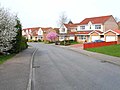
 House on Beechfield Rise, Coxhoe - geograph.org.uk - 3229445.jpg 640 × 480; 73 KB
-
 Houses on the B6291 - geograph.org.uk - 3229450.jpg 640 × 391; 45 KB
-

-
 Looking north along the B6291 at Coxhoe - geograph.org.uk - 3526638.jpg 3,648 × 2,736; 3.18 MB
-
 Looking north from Coxhoe bank top - geograph.org.uk - 3526702.jpg 3,648 × 2,736; 2.78 MB
-
 Looking north from the path to Raisby Quarry - geograph.org.uk - 3531058.jpg 3,648 × 2,736; 3.47 MB
-
 Looking north up Cornforth Lane, Coxhoe - geograph.org.uk - 3726325.jpg 4,608 × 3,456; 6.38 MB
-
 Looking towards East Pasture House - geograph.org.uk - 3726312.jpg 4,608 × 3,456; 5.04 MB
-
 Northbound A1(M) near to Cornforth - geograph.org.uk - 6456111.jpg 800 × 533; 219 KB
-
 Northbound A1(M), County Durham - geograph.org.uk - 6456114.jpg 800 × 533; 245 KB
-
 Old bridge deck near Coxhoe - geograph.org.uk - 6053576.jpg 1,024 × 768; 372 KB
-
 Park Avenue, Parkhill - geograph.org.uk - 156444.jpg 640 × 480; 63 KB
-
 Path north of cemetery at Quarrington Hill - geograph.org.uk - 6040058.jpg 1,600 × 1,068; 676 KB
-
 Pharmacy in Coxhue - geograph.org.uk - 3229431.jpg 640 × 375; 43 KB
-
 Pond beside the road to Raisby Quarry - geograph.org.uk - 3531051.jpg 2,625 × 1,874; 1.1 MB
-
 Pond near former Lime works - geograph.org.uk - 6182113.jpg 1,024 × 768; 273 KB
-
 Public Footpath to Cassop Hill and beyond - geograph.org.uk - 2987870.jpg 3,648 × 2,736; 2.4 MB
-
 Road entering Quarrington from the south-east - geograph.org.uk - 6040070.jpg 1,600 × 1,068; 688 KB
-
 Rusted footbridge - geograph.org.uk - 6095403.jpg 768 × 1,024; 267 KB
-
 Shops on the B6291 - geograph.org.uk - 3229448.jpg 640 × 480; 54 KB
-
 Snow covered lane, Coxhoe - geograph.org.uk - 2540234.jpg 1,184 × 1,792; 532 KB
-
 St Mary's church, Coxhoe - geograph.org.uk - 3526673.jpg 3,648 × 2,736; 3.16 MB
-
 Steps for footpath to Coxhoe Bank Plantation - geograph.org.uk - 2990018.jpg 3,648 × 2,736; 2.64 MB
-
 Sunrise in Coxhoe - panoramio.jpg 3,648 × 2,141; 4.48 MB
-
 The A1(M) southbound - geograph.org.uk - 3763945.jpg 2,642 × 1,861; 1.39 MB
-
 The Avenue (B6291) towards Roman Road in Coxhoe - geograph.org.uk - 2993926.jpg 3,648 × 2,736; 2.16 MB
-
 The Avenue - geograph.org.uk - 4728835.jpg 640 × 480; 77 KB
-
 The Clarence Railway beneath the A1 (M) - geograph.org.uk - 6095409.jpg 1,024 × 768; 184 KB
-
 The Corner House pub, Coxhoe - geograph.org.uk - 3229432.jpg 1,600 × 1,048; 244 KB
-
 Thinford Road (A177) - geograph.org.uk - 3229426.jpg 640 × 480; 65 KB
-
 Track to Crow Trees Nature Reserve - geograph.org.uk - 6023763.jpg 1,024 × 768; 299 KB
-
 Track to Heugh Hall Farm - geograph.org.uk - 240434.jpg 640 × 480; 123 KB
-
 UK Coxhoe.jpg 901 × 1,453; 334 KB
-
 View over farmland to the SE of Coxhoe - geograph.org.uk - 5906803.jpg 1,024 × 768; 246 KB
-
 View south from the path to Bogma Hall Farm - geograph.org.uk - 3526658.jpg 3,648 × 2,736; 3.22 MB
-
 Village shops in Coxhoe - geograph.org.uk - 3526689.jpg 3,648 × 2,736; 3.26 MB
-
 West Terrace, Coxhoe - geograph.org.uk - 3526629.jpg 3,648 × 2,736; 3.42 MB
-
 Wintry Coxhoe - geograph.org.uk - 2581017.jpg 1,792 × 1,184; 464 KB
-
 Accident clearance on the A1M - geograph.org.uk - 1099710.jpg 640 × 418; 41 KB
-
 Beechfield Rise, Coxhoe - geograph.org.uk - 155976.jpg 640 × 480; 64 KB
-
 Bowburn Hall Hotel - geograph.org.uk - 150130.jpg 515 × 386; 85 KB
-
 Cornforth Lane, Coxhoe - geograph.org.uk - 155954.jpg 640 × 480; 64 KB
-

-
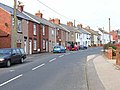
 Coxhoe village centre (B6291) - geograph.org.uk - 155974.jpg 640 × 480; 61 KB
-

-
 Footpath at Old Quarrington - geograph.org.uk - 150129.jpg 480 × 640; 188 KB
-
 Overgrown footpath off Harrap Road - geograph.org.uk - 155985.jpg 640 × 480; 103 KB
-
 Public Footpath over fields. - geograph.org.uk - 419424.jpg 640 × 480; 77 KB
-
 Road beside the A1M to a disused quarry - geograph.org.uk - 412806.jpg 640 × 480; 121 KB
-
 The Kicking Cuddy, Parkhill - geograph.org.uk - 156443.jpg 640 × 480; 58 KB
-
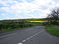 The road over Cassop Moor. - geograph.org.uk - 419425.jpg 640 × 480; 80 KB

_heading_north_-_geograph.org.uk_-_3229427.jpg)
_northbound_-_geograph.org.uk_-_3107517.jpg)
_northbound_-_geograph.org.uk_-_3107519.jpg)
_west_of_Coxhoe_-_geograph.org.uk_-_5831311.jpg)
_-_geograph.org.uk_-_2575118.jpg)


_-_geograph.org.uk_-_155956.jpg)


_-_geograph.org.uk_-_3229425.jpg)


_near_to_Cornforth_-_geograph.org.uk_-_6456111.jpg)
,_County_Durham_-_geograph.org.uk_-_6456114.jpg)


_southbound_-_geograph.org.uk_-_3763945.jpg)
_towards_Roman_Road_in_Coxhoe_-_geograph.org.uk_-_2993926.jpg)

_-_geograph.org.uk_-_6095409.jpg)

_-_geograph.org.uk_-_3229426.jpg)


_-_geograph.org.uk_-_155974.jpg)


