Category:Craig, Angus
Scottish parish in Angus, Scotland, UK | |||||
| Upload media | |||||
| Instance of | |||||
|---|---|---|---|---|---|
| Location |
| ||||
| Population |
| ||||
| Area |
| ||||
 | |||||
Subcategories
This category has the following 3 subcategories, out of 3 total.
Media in category "Craig, Angus"
The following 200 files are in this category, out of 565 total.
(previous page) (next page)-
 "The Spindle on the Rock" Usan - geograph.org.uk - 4611107.jpg 992 × 1,404; 356 KB
-
 'The Cotton' rail bridge, between Lunan Bay and Montrose - geograph.org.uk - 4593115.jpg 4,608 × 3,456; 3.15 MB
-
 A bend in the road - geograph.org.uk - 3717309.jpg 640 × 480; 111 KB
-
 A lawn and picnic table - geograph.org.uk - 4594022.jpg 4,608 × 3,456; 3.26 MB
-
 A multiple-unit diesel train negotiating railway points - geograph.org.uk - 4593129.jpg 4,608 × 3,456; 3.22 MB
-
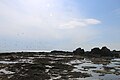
 A pebble beach south of Scurdie Ness Lighthouse - geograph.org.uk - 6505241.jpg 5,414 × 3,610; 4.88 MB
-

-
 A sculpted stone Eagle - geograph.org.uk - 4593885.jpg 4,608 × 3,456; 3.34 MB
-
 A skene of Canada geese at Scurdie Ness - geograph.org.uk - 6501599.jpg 5,472 × 3,648; 2.88 MB
-

-
 A92, Dysart - geograph.org.uk - 4196507.jpg 800 × 389; 251 KB
-
 A934 approaching Rossie Mills - geograph.org.uk - 5636902.jpg 5,184 × 3,888; 6.77 MB
-
 A934. Rossie Mills - geograph.org.uk - 4541014.jpg 800 × 533; 373 KB
-
 Abandoned, small settlement of Chapel Mill - geograph.org.uk - 6268770.jpg 5,331 × 3,553; 4.72 MB
-
 An ecological, succession of vegetation - geograph.org.uk - 6238651.jpg 5,472 × 3,648; 6.22 MB
-
 An old navigation aid - geograph.org.uk - 4584159.jpg 4,608 × 3,456; 3.18 MB
-

-
 Angus Coastal Path - geograph.org.uk - 4584034.jpg 4,608 × 3,456; 3.3 MB
-
 Another old navigation aid - geograph.org.uk - 4584194.jpg 4,608 × 3,456; 3.19 MB
-
 Arable field growing barley near the old Manse of Craig - geograph.org.uk - 6702232.jpg 5,472 × 3,648; 4.96 MB
-
 Arable land, Rossie - geograph.org.uk - 4196481.jpg 800 × 600; 422 KB
-
 Arable land, Rossie - geograph.org.uk - 4196485.jpg 800 × 600; 383 KB
-
 Artillery emplacement on the banks of the River South Esk - geograph.org.uk - 6237792.jpg 5,472 × 3,648; 5.98 MB
-
 At Montrose Basin - geograph.org.uk - 5987868.jpg 640 × 430; 97 KB
-
 Bale Store - geograph.org.uk - 3165142.jpg 640 × 427; 312 KB
-
 Balgove Farm Steading, Craig - geograph.org.uk - 5846831.jpg 3,264 × 2,448; 2.29 MB
-
 Balkellie viewed from Craig Road by Dunninald - geograph.org.uk - 6715477.jpg 5,472 × 3,648; 5.86 MB
-
 Balkiellie - geograph.org.uk - 3717312.jpg 640 × 480; 96 KB
-
 Banks of the River South Esk - geograph.org.uk - 5345050.jpg 3,264 × 2,448; 2.81 MB
-

-
 Barley fields by the site of old, Rossie Castle - geograph.org.uk - 6709945.jpg 5,026 × 3,351; 2.95 MB
-

-
 Barley straw, Usan - geograph.org.uk - 6605800.jpg 1,024 × 578; 160 KB
-
 Barley stubble between Usan and Boddin - geograph.org.uk - 6605789.jpg 1,024 × 684; 300 KB
-
 Barley stubble, Boddin - geograph.org.uk - 6605780.jpg 1,024 × 684; 260 KB
-
 Barley stubble, Dunninald - geograph.org.uk - 6605719.jpg 1,024 × 684; 360 KB
-
 Barns of Craig - geograph.org.uk - 4592797.jpg 4,608 × 3,456; 3.35 MB
-
 Beach below Usan - geograph.org.uk - 1968500.jpg 640 × 480; 91 KB
-
 Beach beside the Elephant Rock - geograph.org.uk - 5248363.jpg 3,264 × 2,448; 3.22 MB
-
 Beach, Montrose - geograph.org.uk - 6612678.jpg 1,024 × 683; 178 KB
-
 Beach, Scurdie Ness - geograph.org.uk - 6612160.jpg 1,024 × 683; 282 KB
-
 Beacon on the beach by the estuary of the River South Esk - geograph.org.uk - 6498149.jpg 5,472 × 3,648; 4.09 MB
-
 Biological weathering of rocks at Scurdie Ness - geograph.org.uk - 5409433.jpg 3,264 × 2,448; 2.65 MB
-
 Bird perched on stack at Broad Rock, Usan - geograph.org.uk - 6188820.jpg 5,472 × 3,648; 5.73 MB
-
 Black cattle grazing near Chapel Mill - geograph.org.uk - 6258129.jpg 5,223 × 3,482; 2.99 MB
-
 Black cattle grazing pasture on a raised beach near Usan - geograph.org.uk - 6506562.jpg 5,472 × 3,648; 3.44 MB
-
 Black Rock near Fishtown of Usan - geograph.org.uk - 6176146.jpg 3,264 × 2,448; 2.57 MB
-
 Blowhole at Black Jack, Lunan Bay - geograph.org.uk - 3434055.jpg 1,024 × 719; 254 KB
-
 Boat ME16 sailing on the estuary of the River South Esk - geograph.org.uk - 6724113.jpg 5,472 × 3,648; 4.45 MB
-
 Boat on the River South Esk by Ferryden - geograph.org.uk - 6239786.jpg 5,472 × 3,648; 6.46 MB
-
 Boat winch by Mains of Usan - geograph.org.uk - 6608318.jpg 1,024 × 683; 247 KB
-
 Boddin Farm - geograph.org.uk - 4494582.jpg 640 × 480; 49 KB
-
 Boddin Farm - geograph.org.uk - 4545724.jpg 4,463 × 2,444; 1.41 MB
-
 Boddin Harbour - geograph.org.uk - 6605756.jpg 1,024 × 684; 297 KB
-
 Boddin Lime Kiln - geograph.org.uk - 3464655.jpg 1,194 × 772; 131 KB
-
 Boddin Point - geograph.org.uk - 1978336.jpg 640 × 480; 87 KB
-
 Boddin Point Lime Kiln - geograph.org.uk - 3480726.jpg 1,375 × 958; 345 KB
-
 Boddin Point Lime Kiln Erosion - geograph.org.uk - 3482262.jpg 796 × 1,390; 365 KB
-
 Boddin point.jpg 8,256 × 5,504; 7.6 MB
-
 Brassica crop under cover near Mains of Usan Farm - geograph.org.uk - 6508602.jpg 5,472 × 3,648; 3.25 MB
-
 Brick Shed - geograph.org.uk - 5810543.jpg 4,272 × 2,848; 1.51 MB
-
 Broad Rock at high tide, Fishtown of Usan - geograph.org.uk - 6365053.jpg 3,167 × 2,328; 4.13 MB
-
 Broad Rock, Fishtown of Usan - geograph.org.uk - 5273713.jpg 3,264 × 2,448; 2.34 MB
-
 Buildings ^ coastline at Boddin near Montrose - geograph.org.uk - 5231673.jpg 5,184 × 2,920; 1.89 MB
-
 Burnside Place, Ferryden - geograph.org.uk - 4634143.jpg 800 × 600; 385 KB
-
 Bus Stop at the Crossroads - geograph.org.uk - 5969217.jpg 640 × 480; 85 KB
-
 Cairn at Scurdie Ness - geograph.org.uk - 5411722.jpg 10,200 × 13,600; 7.47 MB
-
 Capstan and lighthouse at Scurdie Ness - geograph.org.uk - 6709296.jpg 1,600 × 1,200; 1 MB
-
 Capstan at Johnny Main's Harbour - geograph.org.uk - 6173445.jpg 2,559 × 1,918; 2.28 MB
-
 Car park at the eastern end of Ferryden - geograph.org.uk - 6725521.jpg 3,264 × 2,448; 1.59 MB
-
 Carrots - geograph.org.uk - 4196500.jpg 800 × 600; 446 KB
-
 Cattle grazing at Mains of Usan - geograph.org.uk - 3301458.jpg 1,024 × 444; 82 KB
-
 Cattle grazing at Mains of Usan - geograph.org.uk - 5975497.jpg 3,264 × 2,448; 2.39 MB
-

-

-
 Chapel Entrance - geograph.org.uk - 1918414.jpg 480 × 640; 208 KB
-
 Chapel Mill ruins, Mains of Usan - geograph.org.uk - 6608319.jpg 1,024 × 683; 245 KB
-
 Chapel Mill ruins, Mains of Usan - geograph.org.uk - 6608320.jpg 1,024 × 1,024; 492 KB
-
 Chapel Mill ruins, Mains of Usan - geograph.org.uk - 6608322.jpg 1,024 × 683; 367 KB
-
 Chapel of St Skae burial ground - geograph.org.uk - 5236284.jpg 3,264 × 2,448; 3.03 MB
-
 Chapel of St Skae burial ground by the Elephant Rock - geograph.org.uk - 5237744.jpg 3,264 × 2,448; 3.24 MB
-
 Chapel of St Skae Burial Ground, Boddin - geograph.org.uk - 5250399.jpg 3,264 × 2,448; 2.75 MB
-

-
 Cliff face adjacent to the Elephant Rock, Angus - geograph.org.uk - 4609776.jpg 1,390 × 973; 633 KB
-
 Cliff top grave, Boddin near Montrose - geograph.org.uk - 5231664.jpg 5,184 × 2,920; 5.32 MB
-
 Cliffs and a beach near Boddin Point, Angus - geograph.org.uk - 3333003.jpg 1,024 × 732; 313 KB
-
 Clifftop view across the harbour at Usan toward Broad Rock - geograph.org.uk - 6375822.jpg 5,127 × 3,418; 5.01 MB
-
 Clifftop view of a boat in the harbour at Fishtown of Usan - geograph.org.uk - 6372283.jpg 3,128 × 2,345; 3.69 MB
-

-
 Coast and boats at Usan - geograph.org.uk - 2414065.jpg 640 × 446; 51 KB
-
 Coast at Mains of Usan - geograph.org.uk - 6608316.jpg 1,024 × 683; 231 KB
-
 Coast at Scurdie Ness - geograph.org.uk - 5401732.jpg 3,264 × 2,448; 2.74 MB
-
 Coast south of Usan - geograph.org.uk - 6605788.jpg 1,024 × 684; 318 KB
-
 Coastal erosion and deposition at Scurdie Ness - geograph.org.uk - 5397268.jpg 3,264 × 2,448; 2.68 MB
-
 Coastal erosion and deposition at Scurdie Ness - geograph.org.uk - 5416591.jpg 3,264 × 2,448; 2.67 MB
-
 Coastal Field near Usan - geograph.org.uk - 6231001.jpg 1,024 × 752; 115 KB
-
 Coastal track to Scurdieness - geograph.org.uk - 4638699.jpg 640 × 480; 51 KB
-
 Coastline at Boddin - geograph.org.uk - 2917578.jpg 2,520 × 1,680; 367 KB
-
 Country road towards Ferryden - geograph.org.uk - 3717306.jpg 480 × 640; 110 KB
-
 Country road towards Ferryden - geograph.org.uk - 3717351.jpg 640 × 480; 122 KB
-
 Cow and calf in a gateway - geograph.org.uk - 6605823.jpg 1,024 × 683; 258 KB
-
 Craig Manse and Craig Parish Church - geograph.org.uk - 3347899.jpg 1,024 × 717; 183 KB
-
 Craig Manse by Montrose - geograph.org.uk - 3451654.jpg 1,204 × 777; 152 KB
-
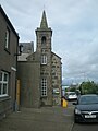
 Craig Parish Church, Angus - geograph.org.uk - 3333019.jpg 1,024 × 591; 228 KB
-
 Craig Road - geograph.org.uk - 2704527.jpg 640 × 480; 119 KB
-
 Craig Road and lodge at Duninald Castle - geograph.org.uk - 6612706.jpg 1,024 × 683; 298 KB
-
 Craig Road entering Ferryden with Montrose Port beyond - geograph.org.uk - 5231696.jpg 2,920 × 5,184; 5.03 MB
-
 Creels by Usan - geograph.org.uk - 5818141.jpg 4,272 × 2,848; 2.25 MB
-
 Creels near the eastern end of River Street, Ferryden - geograph.org.uk - 6725333.jpg 3,264 × 2,448; 1.23 MB
-
 Crop covers at Scurdie Ness - geograph.org.uk - 6063244.jpg 5,472 × 3,648; 5.97 MB
-
 Crop field at Boddin - geograph.org.uk - 5235170.jpg 3,264 × 2,448; 2.41 MB
-
 Croquet lawn and bench seat - geograph.org.uk - 4593606.jpg 4,608 × 3,456; 3.08 MB
-
 Cultivating, Balkiellie - geograph.org.uk - 6612710.jpg 1,024 × 683; 203 KB
-
 Daymark and lighthouse, Scurdie Ness - geograph.org.uk - 6612655.jpg 1,024 × 683; 216 KB
-
 Denhead Grassland - geograph.org.uk - 1866688.jpg 3,456 × 2,304; 1.67 MB
-
 Derelict building at Chapel Mill by Usan - geograph.org.uk - 6267780.jpg 5,472 × 3,648; 6.94 MB
-
 Derelict buildings at Chapel Mill by Mains of Usan - geograph.org.uk - 6267751.jpg 5,472 × 3,648; 7.41 MB
-
 Diamond Lil's - geograph.org.uk - 6376615.jpg 1,024 × 699; 146 KB
-
 Disused Limekiln on Boddin Point - geograph.org.uk - 4488097.jpg 640 × 480; 45 KB
-

-
 Down line East Coast Main Line - geograph.org.uk - 4593051.jpg 4,608 × 3,456; 3.1 MB
-
 Drive to Balstout - geograph.org.uk - 5969221.jpg 640 × 480; 84 KB
-
 Dropping down into Ferryden - geograph.org.uk - 3717355.jpg 640 × 526; 110 KB
-
 Dunninald Castle - geograph.org.uk - 4593598.jpg 4,608 × 3,456; 2.93 MB
-
 Dunninald Castle - geograph.org.uk - 4593666.jpg 3,456 × 4,608; 4.07 MB
-
 Dunninald Mains - geograph.org.uk - 1511807.jpg 640 × 480; 123 KB
-
 East coast main line - geograph.org.uk - 1918435.jpg 480 × 640; 189 KB
-
 East Coast Railway Line at Usan - geograph.org.uk - 6531857.jpg 5,184 × 3,888; 5.24 MB
-
 East coast railway, Boddin - geograph.org.uk - 6605727.jpg 1,024 × 1,024; 309 KB
-
 East entrance to Dunninald Castle and Gardens - geograph.org.uk - 4593173.jpg 4,608 × 3,456; 4.42 MB
-
 East-facing edge of Broad Rock, Fishtown of Usan - geograph.org.uk - 5275833.jpg 3,264 × 2,448; 2.94 MB
-
 Eastward view of coastal rocks with a rod and line fisher - geograph.org.uk - 6726071.jpg 3,106 × 2,330; 3.79 MB
-
 Eastward view of Scurdie Ness Lighthouse - geograph.org.uk - 6502588.jpg 5,363 × 3,575; 4.14 MB
-
 Eastward view toward an end point of Scurdie Ness headland - geograph.org.uk - 6733817.jpg 3,095 × 2,333; 1.56 MB
-
 Elephant Rock - geograph.org.uk - 6605765.jpg 1,024 × 684; 368 KB
-
 Elephant Rock and wave cut platform - geograph.org.uk - 5246383.jpg 3,264 × 2,448; 2.57 MB
-
 Elephant Rock from Boddin Point - geograph.org.uk - 4488110.jpg 480 × 640; 56 KB
-
 Elephant Rock near Boddin by Montrose - geograph.org.uk - 3302878.jpg 1,024 × 713; 225 KB
-
 Elephant Rock viewed from Boddin Point - geograph.org.uk - 3335294.jpg 1,024 × 383; 101 KB
-
 Elephant Rock, (natural arch) Boddin near Montrose - geograph.org.uk - 5231667.jpg 5,184 × 2,920; 5.42 MB
-
 Elephant Rock, Boddin - geograph.org.uk - 5191824.jpg 5,184 × 3,888; 3.88 MB
-
 Entering Ferryden - geograph.org.uk - 3717364.jpg 640 × 407; 75 KB
-
 Entrance to Dunninald Walled Garden - geograph.org.uk - 4593685.jpg 4,608 × 3,456; 3.19 MB
-
 Entrance to greenhouse - geograph.org.uk - 4594045.jpg 3,456 × 4,608; 4.35 MB
-
-
 Eroded, north facing coast of Broad Rock, Usan - geograph.org.uk - 6193466.jpg 5,472 × 3,648; 7.04 MB
-
 Esk Mouth - geograph.org.uk - 5810532.jpg 4,272 × 2,848; 1.59 MB
-
 Estuary and mouth of the River South Esk - geograph.org.uk - 5346444.jpg 3,264 × 2,448; 2.41 MB
-
 Estuary Light - geograph.org.uk - 5810548.jpg 4,272 × 2,848; 2.15 MB
-
 Estuary of the South Esk at Montrose - geograph.org.uk - 4584014.jpg 4,397 × 3,297; 3.51 MB
-

-
 Farm buildings at Ferryden Farm - geograph.org.uk - 5948793.jpg 3,264 × 2,448; 2.59 MB
-
 Farm track at Mains of Usan - geograph.org.uk - 5976416.jpg 3,264 × 2,448; 2.38 MB
-
 Farm track, Usan - geograph.org.uk - 6605815.jpg 1,024 × 683; 245 KB
-
 Farm track, Usan - geograph.org.uk - 6605821.jpg 1,024 × 683; 261 KB
-
 Farmland near Ferryden - geograph.org.uk - 3717363.jpg 640 × 503; 92 KB
-
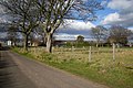
 Farmland towards Kirkton of Craig - geograph.org.uk - 3717317.jpg 640 × 480; 86 KB
-
 Farmland towards the Montrose Basin - geograph.org.uk - 3717357.jpg 640 × 480; 80 KB
-
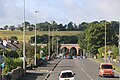
 Ferrydean Viaduct - geograph.org.uk - 5817757.jpg 640 × 480; 89 KB
-
 Ferryden - geograph.org.uk - 3639737.jpg 640 × 427; 310 KB
-
 Ferryden Farm - geograph.org.uk - 1204167.jpg 640 × 426; 100 KB
-
 Ferryden houses by the estuary of the River South Esk - geograph.org.uk - 5343533.jpg 3,264 × 2,448; 2.5 MB
-
 Ferryden Infant School - geograph.org.uk - 5810526.jpg 2,438 × 3,659; 1.6 MB
-
 Ferryden Infant School - geograph.org.uk - 6169294.jpg 2,448 × 3,264; 3.89 MB
-
 Ferryden Infant School viewed from the west - geograph.org.uk - 6244290.jpg 5,472 × 3,648; 5.84 MB
-
-
 Ferryden, Ancient Monuments by the Lighthouse Road - geograph.org.uk - 4584178.jpg 4,608 × 3,456; 3.13 MB
-
 Field above Maryton - geograph.org.uk - 5969204.jpg 640 × 480; 104 KB
-
 Field above Rossie Mills - geograph.org.uk - 4873333.jpg 640 × 480; 99 KB
-

-
 Field of flowering potatoes at Fishtown of Usan - geograph.org.uk - 6377168.jpg 4,906 × 3,272; 4.91 MB
-
 Field of flowering potatoes at Usan - geograph.org.uk - 6377844.jpg 5,325 × 3,551; 5.37 MB
-
 Field of ripening barley at Kirkton of Craig - geograph.org.uk - 5826975.jpg 5,472 × 3,648; 7.16 MB
-
 Field of ripening barley near East Mains of Dysart - geograph.org.uk - 5206687.jpg 3,264 × 2,448; 2.29 MB
-
 Field of wheat - geograph.org.uk - 5487363.jpg 5,184 × 3,888; 5.55 MB
-
 Field, Rossie Mills - geograph.org.uk - 4541015.jpg 800 × 533; 362 KB
-
 Fish shed at Fishtown of Usan - geograph.org.uk - 6368217.jpg 3,264 × 2,448; 2.37 MB
-
 Fishing off the rocks with a rod and line - geograph.org.uk - 6726043.jpg 5,472 × 3,648; 5.04 MB
-
 Fishtown of Usan - geograph.org.uk - 2106003.jpg 640 × 419; 53 KB
-
 Fishtown of Usan beach and harbour - geograph.org.uk - 6367007.jpg 3,199 × 2,399; 4.35 MB
-
 Follow the Country Code sign at Mains of Usan Farm - geograph.org.uk - 6270714.jpg 5,472 × 3,648; 7.41 MB
-
 Foreshore rocks at Scurdie Ness - geograph.org.uk - 5378529.jpg 3,264 × 2,448; 3.13 MB
-
 Former Craig Parish Church - geograph.org.uk - 5323066.jpg 5,472 × 3,648; 4.99 MB
-
 Former Craig Parish Church - geograph.org.uk - 5636830.jpg 5,184 × 3,888; 4.28 MB
-
 Former Craig Parish Church as seen from Balgove - geograph.org.uk - 6702317.jpg 5,472 × 3,648; 7.3 MB
-
 Former Craig Parish Church, Kirkton of Craig - geograph.org.uk - 5823569.jpg 5,472 × 3,648; 6.62 MB
-
 Former Craig Primary School converted to a house - geograph.org.uk - 6696769.jpg 5,472 × 3,648; 6.89 MB
-

-

-
 Geese at Usan - geograph.org.uk - 3489181.jpg 1,194 × 796; 228 KB
-
 Gightyburn Farm - geograph.org.uk - 2508621.jpg 3,456 × 2,304; 1.09 MB
-
 Grain drying furnace^ Chapel Mill - geograph.org.uk - 6608321.jpg 1,024 × 683; 378 KB
-
 Grassed over site of the former Rossie Castle by Montrose - geograph.org.uk - 6707750.jpg 5,472 × 3,648; 5.34 MB
-
 Grave to George James Ramsey at Boddin near Montrose - geograph.org.uk - 5231659.jpg 5,184 × 2,920; 7.14 MB
-

-
 Gravestones - geograph.org.uk - 1918409.jpg 640 × 480; 203 KB
-
 Grazing and woodland - geograph.org.uk - 3717305.jpg 640 × 480; 109 KB
-
 Greenhouse and cold frames - geograph.org.uk - 4594035.jpg 4,608 × 3,456; 3.06 MB
-
 GSK, Montrose - geograph.org.uk - 6612665.jpg 1,024 × 683; 163 KB
-
 Gulls flying at the easterly edge of Broad Rock - geograph.org.uk - 6197880.jpg 5,472 × 3,648; 5.29 MB


_Boddin_near_Montrose_-_geograph.org.uk_-_5231667.jpg)


