Category:Cranbourne, Basingstoke
Media in category "Cranbourne, Basingstoke"
The following 20 files are in this category, out of 20 total.
-
 'Semis' in Cranbourne Lane - geograph.org.uk - 1212710.jpg 640 × 464; 48 KB
-
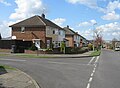
 Corner of Wallis and Cliddesden roads - geograph.org.uk - 772581.jpg 640 × 477; 83 KB
-
 Crossing point on The Harrow Way - geograph.org.uk - 774757.jpg 640 × 480; 134 KB
-
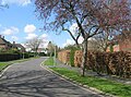
 Frithmead Close - geograph.org.uk - 2781451.jpg 639 × 474; 51 KB
-
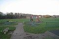 Kingsmill Road Play Area - geograph.org.uk - 2781457.jpg 639 × 429; 49 KB
-
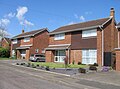 Modern homes - Ferguson Close - geograph.org.uk - 775933.jpg 640 × 475; 77 KB
-
 Morley Road - geograph.org.uk - 775907.jpg 640 × 470; 59 KB
-

-
 Neville Close - geograph.org.uk - 775274.jpg 640 × 480; 98 KB
-
 Neville Close - geograph.org.uk - 776067.jpg 640 × 480; 82 KB
-
 Neville Close - geograph.org.uk - 776079.jpg 640 × 475; 110 KB
-
 Neville Close - geograph.org.uk - 776093.jpg 640 × 475; 86 KB
-
 Neville Close - geograph.org.uk - 776099.jpg 640 × 474; 89 KB
-
 Neville Close - geograph.org.uk - 776103.jpg 640 × 479; 70 KB
-
 Neville Close - geograph.org.uk - 776106.jpg 640 × 472; 78 KB
-

-
 Open area in Cranbourne - geograph.org.uk - 2781455.jpg 640 × 480; 57 KB
-

-
 Sheppard Road housing - geograph.org.uk - 775906.jpg 640 × 476; 82 KB
-
 The Harrow Way - geograph.org.uk - 775041.jpg 640 × 480; 94 KB


_-_Grove_Road_-_geograph.org.uk_-_819805.jpg)


