Category:Cranford, Northamptonshire
civil parish in Northamptonshire, England | |||||
| Upload media | |||||
| Instance of | |||||
|---|---|---|---|---|---|
| Location |
| ||||
 | |||||
Subcategories
This category has the following 2 subcategories, out of 2 total.
C
Media in category "Cranford, Northamptonshire"
The following 20 files are in this category, out of 20 total.
-
 A14 near Cranford St John - geograph.org.uk - 5082601.jpg 640 × 481; 50 KB
-
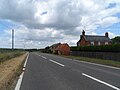
 A605 closed ahead - geograph.org.uk - 3580333.jpg 640 × 480; 49 KB
-
 Cranford Hall - geograph.org.uk - 533901.jpg 640 × 427; 91 KB
-
 Cranford parkland - geograph.org.uk - 4106499.jpg 1,024 × 683; 229 KB
-
 Cranford station site geograph-3327955-by-Ben-Brooksbank.jpg 2,400 × 1,473; 2.94 MB
-
 Cranford Village sign - geograph.org.uk - 1179252.jpg 480 × 640; 151 KB
-
 Dumped shed near the Cranfords - geograph.org.uk - 1179167.jpg 640 × 480; 116 KB
-
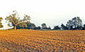
 Fields near Grafton Underwood - geograph.org.uk - 3271718.jpg 2,592 × 1,944; 2.14 MB
-
 House and barns on the A510 - geograph.org.uk - 4543384.jpg 4,320 × 3,240; 2.88 MB
-
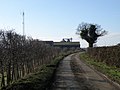 Looking towards Lodge farm - geograph.org.uk - 1179177.jpg 640 × 480; 72 KB
-
 Muddy Track, Muddy Road - geograph.org.uk - 1179202.jpg 640 × 480; 130 KB
-
 Parkland at the Cranfords - geograph.org.uk - 1179955.jpg 640 × 480; 74 KB
-
 Reading Room - geograph.org.uk - 1179728.jpg 640 × 480; 96 KB
-
 Rectory Hill - geograph.org.uk - 3645730.jpg 640 × 480; 79 KB
-
 Team Plebs - Iron Run at Cranford - geograph.org.uk - 4628981.jpg 640 × 480; 150 KB
-
 The lane to Cranford - geograph.org.uk - 3271712.jpg 2,592 × 1,944; 2.45 MB
-
 The road to Grafton - geograph.org.uk - 3271707.jpg 2,592 × 1,944; 1.81 MB
-
 Top Dysons - geograph.org.uk - 4103332.jpg 1,024 × 683; 320 KB
-
 Westbound A14 near Cranford St John - geograph.org.uk - 3819807.jpg 640 × 480; 235 KB
-
 Herd of cows at pasture - geograph.org.uk - 234099.jpg 640 × 422; 64 KB


