Category:Crathie and Braemar
Scottish parish in Aberdeenshire, Scotland, UK | |||||
| Upload media | |||||
| Instance of | |||||
|---|---|---|---|---|---|
| Named after | |||||
| Location |
| ||||
| Population |
| ||||
| Area |
| ||||
 | |||||

Subcategories
This category has the following 10 subcategories, out of 10 total.
A
- Auchallater, Aberdeenshire (27 F)
B
C
G
- Garbh Allt Shiel footbridge (11 F)
- Girnock Burn (16 F)
I
- Invercauld Bridge (9 F)
L
- Littlemill, Aberdeenshire (31 F)
M
O
- Old Invercauld Bridge (5 F)
Media in category "Crathie and Braemar"
The following 200 files are in this category, out of 4,534 total.
(previous page) (next page)-

-
 "Window" at Newbigging - geograph.org.uk - 4337581.jpg 640 × 800; 458 KB
-
 'Deer Management Group' notice - geograph.org.uk - 2288784.jpg 2,736 × 3,648; 1.4 MB
-
 'Gibby' atop Black Hillock above the River Gairn - geograph.org.uk - 4844649.jpg 3,264 × 2,448; 2.1 MB
-
 'Hamewith' cottage - geograph.org.uk - 2288781.jpg 3,648 × 2,736; 1.2 MB
-
 'The debt we owe' - geograph.org.uk - 3469149.jpg 2,736 × 3,648; 2.27 MB
-
 'The Queen's Golden Jubilee' plaque - geograph.org.uk - 2288731.jpg 3,648 × 2,736; 1.56 MB
-
 1715 and all that - 'Add Glory to the Day' it proclaims - geograph.org.uk - 3997883.jpg 3,456 × 4,608; 3.08 MB
-
 53 miles from Aberdeen - geograph.org.uk - 2282366.jpg 1,600 × 1,200; 583 KB
-
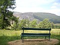 A bench with a view - geograph.org.uk - 3566128.jpg 1,824 × 1,368; 927 KB
-
 A bend in Cluniebank Road - geograph.org.uk - 3568336.jpg 1,368 × 1,824; 1.06 MB
-
 A bend in the river just south of Fraser's Bridge - geograph.org.uk - 3031916.jpg 3,648 × 2,736; 1.28 MB
-
 A bend in the track - geograph.org.uk - 4105766.jpg 1,000 × 664; 271 KB
-
 A bleak moorland scene - geograph.org.uk - 2340526.jpg 625 × 640; 118 KB
-
 A boulder field in the Cairngorms - geograph.org.uk - 3177686.jpg 640 × 480; 230 KB
-
 A branch in the Lui Water - geograph.org.uk - 4529801.jpg 1,024 × 751; 178 KB
-
 A burn is born - geograph.org.uk - 1300905.jpg 480 × 640; 101 KB
-
 A by-way in Auchendryne - geograph.org.uk - 1562109.jpg 640 × 480; 74 KB
-
 A cairn beneath Culardoch - geograph.org.uk - 3119085.jpg 640 × 360; 215 KB
-
 A camp by Lochbuilg Lodge - geograph.org.uk - 5689162.jpg 1,024 × 736; 176 KB
-

-
 A Croft between The Dee and the B976 - geograph.org.uk - 3029989.jpg 3,648 × 2,736; 2.75 MB
-

-
 A detached clump of trees - geograph.org.uk - 3569501.jpg 3,648 × 2,736; 2.98 MB
-

-

-
 A February spate - geograph.org.uk - 2290535.jpg 1,824 × 1,368; 1,009 KB
-
 A footpath fingerpost direction indicator - geograph.org.uk - 3566928.jpg 1,215 × 987; 306 KB
-
 A ford - geograph.org.uk - 6549130.jpg 4,032 × 2,733; 6.83 MB
-
 A former church - geograph.org.uk - 2288718.jpg 3,648 × 2,736; 1.02 MB
-
 A garden 'annexe' by The Girnock - geograph.org.uk - 3029722.jpg 3,648 × 2,736; 2.3 MB
-

-

-
 A good going burn on the Ben Avon plateau - geograph.org.uk - 4868129.jpg 1,024 × 716; 178 KB
-
 A good long way down - geograph.org.uk - 3691888.jpg 1,142 × 857; 408 KB
-
 A grassy knoll with trees - geograph.org.uk - 3031925.jpg 3,648 × 2,736; 1.14 MB
-
 A gravel-grading sieve - geograph.org.uk - 1562365.jpg 640 × 385; 63 KB
-
 A house near The Girnock - geograph.org.uk - 3029733.jpg 1,824 × 1,368; 1.11 MB
-
 A junction in the glen - geograph.org.uk - 3971741.jpg 1,000 × 667; 273 KB
-

-
 A Millennium bench near Thistledae - geograph.org.uk - 2288727.jpg 2,736 × 3,648; 1.61 MB
-
 A nigh waterless pond bed - geograph.org.uk - 3566894.jpg 1,824 × 1,368; 1.26 MB
-
 A pair of ptarmigan - geograph.org.uk - 1300500.jpg 640 × 480; 102 KB
-
 A path west from Braemar Reservoir compound - geograph.org.uk - 3566877.jpg 1,824 × 1,368; 1.04 MB
-
 A path WNW towards Alltaclair - geograph.org.uk - 3566718.jpg 1,368 × 1,824; 1.3 MB
-
 A peaceful glen - geograph.org.uk - 919120.jpg 640 × 412; 62 KB
-
 A public bench seat - geograph.org.uk - 3567060.jpg 1,824 × 1,368; 1.41 MB
-
 A puddle in the track - geograph.org.uk - 2586580.jpg 3,648 × 2,736; 4.93 MB
-
 A quiet River Dee hides its destructive power - geograph.org.uk - 4806089.jpg 1,024 × 660; 150 KB
-

-
 A rest by a burn on the Ben Avon plateau - geograph.org.uk - 4868085.jpg 1,024 × 751; 196 KB
-
 A rough track alongside Allt Dourie - geograph.org.uk - 3635351.jpg 640 × 427; 331 KB
-
 A ruin in Glen Ey - geograph.org.uk - 3127901.jpg 640 × 480; 279 KB
-

-
 A Sheepfold in the Gairn valley - geograph.org.uk - 6549095.jpg 4,032 × 3,024; 6.12 MB
-

-
 A skein of geese flying north-west towards Derry Cairngorm - geograph.org.uk - 2888766.jpg 4,608 × 3,456; 5.51 MB
-
 A small corrie on Creag an Lochain - geograph.org.uk - 3134537.jpg 480 × 640; 62 KB
-
 A solitary tree in Glen Ey - geograph.org.uk - 3143819.jpg 600 × 800; 98 KB
-
 A stable on the hill - geograph.org.uk - 3967825.jpg 1,000 × 667; 236 KB
-
 A stand of Scot pines above Balnagower Cottage - geograph.org.uk - 3705816.jpg 1,142 × 857; 508 KB
-
 A steady slog up Meikle Pap - geograph.org.uk - 4401582.jpg 751 × 1,024; 209 KB
-
 A still Ey Burn - geograph.org.uk - 6295348.jpg 5,184 × 3,888; 7.24 MB
-

-
 A subterranean adit - geograph.org.uk - 1560226.jpg 640 × 480; 80 KB
-
 A track east of Culardoch - geograph.org.uk - 3111260.jpg 640 × 360; 209 KB
-
 A track junction - geograph.org.uk - 3566700.jpg 1,824 × 1,368; 1,017 KB
-
 A tributary of the Caochanan Ruadha - geograph.org.uk - 3672129.jpg 857 × 1,142; 401 KB
-
 A tributary of the Fèith Mhòr Bhàin - geograph.org.uk - 3697814.jpg 857 × 1,142; 382 KB
-
 A water pipeline control installation - geograph.org.uk - 3566905.jpg 1,824 × 1,368; 1.07 MB
-
 A welcome break below Devil's Point - geograph.org.uk - 5559990.jpg 1,024 × 751; 160 KB
-
 A winter day on Ben Macdui - geograph.org.uk - 4787997.jpg 1,024 × 683; 162 KB
-
 A wood ant nest - geograph.org.uk - 3705812.jpg 1,142 × 857; 665 KB
-
 A wooden bothy by the Clunie - geograph.org.uk - 2288899.jpg 1,824 × 1,368; 974 KB
-
 A93 - geograph.org.uk - 6385850.jpg 1,024 × 683; 244 KB
-
 A93 approaching Alltamhait - geograph.org.uk - 3032079.jpg 3,648 × 2,736; 1.71 MB
-
 A93 below Meall Alvie - geograph.org.uk - 3064010.jpg 640 × 480; 92 KB
-
 A93 below Meall Alvie - geograph.org.uk - 3954849.jpg 1,600 × 1,067; 380 KB
-
 A93 down Glen Clunie - geograph.org.uk - 3031384.jpg 1,824 × 1,368; 633 KB
-
 A93 up Glen Clunie - geograph.org.uk - 3032026.jpg 1,824 × 1,368; 773 KB
-
 A93 west of Carn na Greine - geograph.org.uk - 4676158.jpg 1,200 × 639; 1.08 MB
-
 A93, Glen Clunie - geograph.org.uk - 4507206.jpg 800 × 450; 129 KB
-
 A93, Inver - geograph.org.uk - 6385877.jpg 1,024 × 683; 313 KB
-
 Abandoned farmland - geograph.org.uk - 6386514.jpg 1,024 × 683; 250 KB
-
 Abandoned Settlement of Tomnamoine - geograph.org.uk - 5331203.jpg 640 × 480; 387 KB
-
 Abergeldie and Micras - after the flood - geograph.org.uk - 4793469.jpg 1,200 × 800; 584 KB
-
 Abergeldie Castle after the flood - geograph.org.uk - 4801604.jpg 1,200 × 801; 600 KB
-
 Abergeldie Castle after the flood - geograph.org.uk - 4801607.jpg 640 × 427; 98 KB
-
 Abergeldie Castle below Lochnagar - geograph.org.uk - 4902516.jpg 1,200 × 801; 451 KB
-
 Above Coire an Lochan Uaine - geograph.org.uk - 5408088.jpg 800 × 600; 203 KB
-
 Above Coire Kander - geograph.org.uk - 3434888.jpg 4,608 × 3,456; 5.14 MB
-
 Above Duncan Grey's Burn - geograph.org.uk - 2524629.jpg 640 × 480; 99 KB
-
 Above Mar Lodge - geograph.org.uk - 5782171.jpg 1,024 × 683; 366 KB
-
 Above the Dee - geograph.org.uk - 5785408.jpg 1,024 × 683; 470 KB
-
 Above the Falls - geograph.org.uk - 2495174.jpg 2,382 × 2,539; 5.22 MB
-
 Access gate to Cairn Ledchan - geograph.org.uk - 3029867.jpg 3,648 × 2,736; 2.17 MB
-
 Access lane to Balhalloch - geograph.org.uk - 3029668.jpg 3,648 × 2,736; 1.74 MB
-
 Access road to Baddoch and Coirenalarig - geograph.org.uk - 6011307.jpg 1,600 × 1,034; 462 KB
-
 Access road to Moorfield House Hotel - geograph.org.uk - 3566059.jpg 1,824 × 1,368; 889 KB
-
 Access to Ballachlaggan - geograph.org.uk - 2288051.jpg 1,824 × 1,368; 943 KB
-
 Access to Keiloch car park - geograph.org.uk - 2288801.jpg 1,824 × 1,368; 924 KB
-
 Access to Tullochcoy - geograph.org.uk - 2288039.jpg 1,719 × 1,263; 745 KB
-
 Ach'eerie or Auchelie - geograph.org.uk - 5504367.jpg 1,024 × 751; 185 KB
-
 Across the Allt Coire Bhearnaist - geograph.org.uk - 861578.jpg 640 × 480; 75 KB
-
 Across the Bynack Burn - geograph.org.uk - 3692185.jpg 1,142 × 857; 418 KB
-

-
 Across the northern slopes of Carn na Drochaide - geograph.org.uk - 3698287.jpg 1,142 × 857; 403 KB
-
 Across the River Dee - geograph.org.uk - 6208595.jpg 2,592 × 1,944; 1.26 MB
-
 Across the River Dee - geograph.org.uk - 6208599.jpg 2,592 × 1,944; 1.25 MB
-
 Across the steep southern slope of Meikle Elrick - geograph.org.uk - 3702684.jpg 1,142 × 857; 506 KB
-
 Across the valley of the Bynack Burn - geograph.org.uk - 3670231.jpg 1,142 × 857; 403 KB
-
 Across two glens - geograph.org.uk - 1301483.jpg 640 × 480; 103 KB
-
 Aged larch above Glen Feardar - geograph.org.uk - 5650637.jpg 1,024 × 629; 114 KB
-

-

-
 Aircraft wreckage, Carn an t-Sagairt Mòr - geograph.org.uk - 3360897.jpg 640 × 360; 181 KB
-
 All terrain vehicle track, An Socach - geograph.org.uk - 5599563.jpg 1,024 × 576; 399 KB
-
 All terrain vehicle track, Glen Geldie - geograph.org.uk - 3490928.jpg 640 × 360; 229 KB
-
 Allanmore cottage - geograph.org.uk - 3705997.jpg 1,142 × 857; 421 KB
-
 Allanmore from the east - geograph.org.uk - 6362405.jpg 1,600 × 974; 298 KB
-
 Allanmore on the track to Linn of Quoich - geograph.org.uk - 2080893.jpg 2,592 × 1,944; 1.32 MB
-
 Allanmore, near Braemar - geograph.org.uk - 4294884.jpg 1,024 × 681; 239 KB
-
 Allt a Chaorainn - geograph.org.uk - 1813145.jpg 2,848 × 2,136; 1.69 MB
-
 Allt a' Chaoraine - geograph.org.uk - 1366227.jpg 640 × 480; 270 KB
-
 Allt a' Chlair - geograph.org.uk - 860590.jpg 640 × 480; 80 KB
-
 Allt a' Choire Dhuibh - geograph.org.uk - 6782525.jpg 3,024 × 4,032; 4.96 MB
-
 Allt a' Choire Dhuibh - geograph.org.uk - 6782531.jpg 4,608 × 3,456; 6.34 MB
-
 Allt a' Choire Dhuibh - geograph.org.uk - 6782538.jpg 4,608 × 3,456; 3.81 MB
-
 Allt a' Gharbh Choire - geograph.org.uk - 6279931.jpg 1,024 × 768; 220 KB
-

-
 Allt an Dubh-ghlinne - geograph.org.uk - 2312932.jpg 1,500 × 988; 551 KB
-
 Allt an Dubh-ghlinne - geograph.org.uk - 5792878.jpg 1,024 × 683; 408 KB
-
 Allt an Dubh-ghlinne - geograph.org.uk - 5792991.jpg 1,024 × 683; 356 KB
-
 Allt an Eas Bhig - geograph.org.uk - 6548928.jpg 4,032 × 3,024; 7.21 MB
-
 Allt an Eas Bhig - geograph.org.uk - 6548936.jpg 3,024 × 3,422; 6.56 MB
-
 Allt an Eas Bhig - geograph.org.uk - 6548943.jpg 3,024 × 4,032; 3.81 MB
-
 Allt an Eas Bhig valley erosion - geograph.org.uk - 6548951.jpg 4,032 × 3,024; 7.16 MB
-
 Allt an Eas Bhig waterfalls - geograph.org.uk - 6548946.jpg 3,024 × 4,032; 7.78 MB
-
 Allt an Eas Mhòir - geograph.org.uk - 6013672.jpg 4,032 × 3,024; 6.53 MB
-
 Allt an Eas Mhòir - geograph.org.uk - 6013677.jpg 4,032 × 3,024; 5.24 MB
-
 Allt an Gharbh-Coire - geograph.org.uk - 6244993.jpg 1,024 × 768; 270 KB
-
 Allt an Loch ^ Jocks Road - geograph.org.uk - 3020261.jpg 600 × 450; 98 KB
-
 Allt an Stuic Ghiubhais - geograph.org.uk - 3130883.jpg 640 × 360; 196 KB
-
 Allt an t-Seilich - geograph.org.uk - 862470.jpg 640 × 480; 74 KB
-
 Allt an t-Seilich - geograph.org.uk - 862472.jpg 640 × 359; 63 KB
-
 Allt an t-Slugain - geograph.org.uk - 2080693.jpg 2,592 × 1,944; 2.21 MB
-
 Allt an t-Slugain in Invercauld Estate - geograph.org.uk - 6146291.jpg 4,000 × 3,000; 3.13 MB
-
 Allt Bad a' Mhonaidh - geograph.org.uk - 6013658.jpg 4,032 × 3,024; 4.94 MB
-
 Allt Bad a' Mhonaidh - geograph.org.uk - 6013666.jpg 4,032 × 3,024; 5.23 MB
-
 Allt Boruiche - geograph.org.uk - 5599554.jpg 1,024 × 767; 328 KB
-
 Allt Boruiche - geograph.org.uk - 5599559.jpg 1,024 × 1,024; 655 KB
-
 Allt Cac Dubh - geograph.org.uk - 5599530.jpg 1,024 × 576; 268 KB
-
 Allt Cac Dubh and Loch nan Eun - geograph.org.uk - 2777271.jpg 1,600 × 1,200; 519 KB
-
 Allt Carn a' Mhaim - geograph.org.uk - 2434884.jpg 640 × 427; 357 KB
-
 Allt Carn Bhathaich - geograph.org.uk - 1904937.jpg 640 × 480; 117 KB
-
 Allt Clais an t-Sabhail - geograph.org.uk - 1932637.jpg 1,000 × 667; 612 KB
-
 Allt Clais Mhadaidh - geograph.org.uk - 3737482.jpg 640 × 480; 296 KB
-
 Allt Coire an t-Saighdeir - geograph.org.uk - 6488724.jpg 1,024 × 768; 110 KB
-
 Allt Coire an t-Seilich - geograph.org.uk - 1813197.jpg 2,848 × 2,136; 1.65 MB
-
 Allt Coire an t-Seilich - geograph.org.uk - 3477320.jpg 640 × 360; 236 KB
-
 Allt Coire Cath nam Fionn - geograph.org.uk - 3027860.jpg 1,600 × 1,200; 641 KB
-
 Allt Coire Fhearneasg - geograph.org.uk - 1301469.jpg 640 × 480; 105 KB
-
 Allt Coire Fhearneasg - geograph.org.uk - 1301478.jpg 640 × 360; 104 KB
-
 Allt Coire Fhearneasg - geograph.org.uk - 5596633.jpg 1,024 × 683; 395 KB
-
 Allt Coire Fionn - geograph.org.uk - 2978151.jpg 2,560 × 1,920; 2.18 MB
-
 Allt Coire Ruairidh - geograph.org.uk - 6492211.jpg 1,024 × 768; 253 KB
-
 Allt Connie - geograph.org.uk - 5498210.jpg 800 × 533; 67 KB
-
 Allt Connie - geograph.org.uk - 5499151.jpg 800 × 533; 102 KB
-
 Allt Connie - geograph.org.uk - 861021.jpg 480 × 640; 114 KB
-
 Allt Connie - geograph.org.uk - 861031.jpg 640 × 480; 86 KB
-
 Allt Connie - geograph.org.uk - 864494.jpg 480 × 640; 89 KB
-
 Allt Connie - geograph.org.uk - 864500.jpg 640 × 480; 87 KB
-
 Allt Connie - geograph.org.uk - 864504.jpg 640 × 480; 65 KB
-
 Allt Connie glen - geograph.org.uk - 5499154.jpg 800 × 533; 79 KB
-
 Allt Connie meets the Ey Burn - geograph.org.uk - 439314.jpg 640 × 480; 148 KB
-
 Allt Connie, Gleann Eidh - geograph.org.uk - 2952905.jpg 4,320 × 3,240; 2.89 MB
-
 Allt Cristie Beag - geograph.org.uk - 2526436.jpg 1,600 × 1,200; 743 KB
-
 Allt Cristie Mòr - geograph.org.uk - 2524683.jpg 640 × 480; 114 KB
-
 Allt Cristie Mòr - geograph.org.uk - 865035.jpg 640 × 480; 70 KB
-
 Allt Cristie Mòr - geograph.org.uk - 865042.jpg 640 × 480; 81 KB
-
 Allt Cùl - geograph.org.uk - 2192510.jpg 640 × 480; 100 KB
-
 Allt Cùl - geograph.org.uk - 2192513.jpg 640 × 480; 87 KB
-
 Allt Cùl - geograph.org.uk - 2930660.jpg 4,608 × 3,456; 5.86 MB
-
 Allt Cùl - geograph.org.uk - 6270160.jpg 1,024 × 683; 259 KB
-
 Allt Cùl - geograph.org.uk - 6270163.jpg 1,024 × 683; 283 KB
-
 Allt Daimhidh Beag - geograph.org.uk - 3487366.jpg 640 × 360; 241 KB
-
 Allt Daimhidh Mòr - geograph.org.uk - 3489322.jpg 640 × 360; 256 KB
-
 Allt Daimhidh Mòr - geograph.org.uk - 3492083.jpg 640 × 360; 247 KB
-
 Allt Dhaidh Beag - geograph.org.uk - 4729661.jpg 1,600 × 1,200; 820 KB
-
 Allt Dhaidh Beag - geograph.org.uk - 4729666.jpg 1,600 × 1,200; 582 KB
-
 Allt Dhaidh Mor - geograph.org.uk - 2982735.jpg 4,320 × 3,240; 2.9 MB
-
 Allt Dhàidh Mòr - geograph.org.uk - 3028783.jpg 1,600 × 1,200; 661 KB
-
 Allt Dhàidh Mòr - geograph.org.uk - 4758131.jpg 1,600 × 1,200; 597 KB
-
 Allt Dhàidh Mòr - geograph.org.uk - 4758133.jpg 1,600 × 1,200; 684 KB
-
 Allt Dhàidh Mòr - geograph.org.uk - 4758136.jpg 1,600 × 1,200; 672 KB
-
 Allt Dhàidh Mòr - geograph.org.uk - 4758138.jpg 1,600 × 1,200; 955 KB
-
 Allt Dhàidh Mòr - geograph.org.uk - 4758144.jpg 1,600 × 1,200; 660 KB
-
 Allt Dhàidh Mòr - geograph.org.uk - 4758148.jpg 1,600 × 1,200; 930 KB
-
 Allt Dhàidh Mòr - geograph.org.uk - 4758153.jpg 1,600 × 1,200; 849 KB
-
 Allt Dourie - geograph.org.uk - 5337827.jpg 640 × 427; 462 KB


