Category:Crawfordsburn
English: Crawfordsburn is a small picturesque village in County Down, Northern Ireland. The village, which is now effectively a commuter suburb, lies between Holywood and Bangor to the north of the A2 road, about 4km west of Bangor town centre. Bounded to the north and north east by Crawfordsburn Country Park, the village attracts many visitors. It had a population of 531 people in the 2001 Census. It is in the Borough of North Down.
Nederlands: Crawfordsburn is een plaats in het Noord-Ierse graafschap County Down. De plaats telt 531 inwoners.
village in the United Kingdom _-_geograph.org.uk_-_524223.jpg) | |||||
| Upload media | |||||
| Instance of | |||||
|---|---|---|---|---|---|
| Location | Ards and North Down, Northern Ireland | ||||
 | |||||
Subcategories
This category has the following 2 subcategories, out of 2 total.
C
- Crawfordsburn Viaduct (14 F)
Media in category "Crawfordsburn"
The following 200 files are in this category, out of 282 total.
(previous page) (next page)-

-
 Approaching Carnalea station - geograph.org.uk - 221601.jpg 640 × 426; 168 KB
-
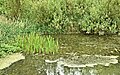
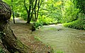
 Autumn in Crawfordsburn Glen (1) - geograph.org.uk - 607765.jpg 640 × 428; 119 KB
-
 Autumn in Crawfordsburn Glen (2) - geograph.org.uk - 607790.jpg 640 × 406; 128 KB
-
 Autumn leaves by the Crawfordsburn - geograph.org.uk - 1544686.jpg 640 × 376; 126 KB
-
 Autumn, Crawfordsburn Glen - geograph.org.uk - 1544576.jpg 578 × 431; 129 KB
-

-

-
 Ballyrobert Road, Crawfordsburn - geograph.org.uk - 869268.jpg 640 × 480; 353 KB
-
 Big Gun, Grey Point Fort - geograph.org.uk - 776505.jpg 640 × 480; 393 KB
-
 Bridge Road near Crawfordsburn - geograph.org.uk - 869269.jpg 640 × 480; 412 KB
-
 Bridge Road South, Crawfordsburn - geograph.org.uk - 217901.jpg 640 × 426; 165 KB
-
 Carved sculpture, Crawfordsburn - geograph.org.uk - 1176830.jpg 418 × 640; 455 KB
-
 Carved sculpture, Crawfordsburn - geograph.org.uk - 1176832.jpg 480 × 640; 387 KB
-
 Cattle near Bangor - geograph.org.uk - 2168193.jpg 640 × 325; 98 KB
-

-
 Chambers Coach Ireland coach, Crawfordsburn, 19 May 2011.jpg 176 × 181; 36 KB
-

-
 Clandeboye Avenue near Bangor (1) - geograph.org.uk - 2069772.jpg 622 × 371; 119 KB
-
 Clandeboye Avenue near Bangor (2) - geograph.org.uk - 2069800.jpg 640 × 326; 84 KB
-
 Clandeboye Avenue near Bangor (3) - geograph.org.uk - 2167955.jpg 622 × 383; 131 KB
-
 Clandeboye Avenue near Bangor (4) - geograph.org.uk - 2167991.jpg 578 × 370; 140 KB
-
 Clandeboye Avenue, Helen's Bay (6) - geograph.org.uk - 2167173.jpg 640 × 429; 179 KB
-
 Covid sign, Bangor - geograph.org.uk - 6756294.jpg 1,280 × 720; 814 KB
-
 Crawfordsburn Country Park - geograph.org.uk - 245059.jpg 640 × 427; 176 KB
-
 Crawfordsburn Country Park - geograph.org.uk - 5991.jpg 640 × 375; 64 KB
-
 Crawfordsburn Country Park.JPG 2,592 × 1,944; 2.35 MB
-
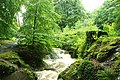
 Crawfordsburn Glen (16) - geograph.org.uk - 965495.jpg 640 × 410; 119 KB
-
 Crawfordsburn Glen near Bangor (7) - geograph.org.uk - 472075.jpg 640 × 427; 101 KB
-
 Crawfordsburn Glen near Bangor (8) - geograph.org.uk - 436014.jpg 640 × 428; 51 KB
-
 Crawfordsburn Road, Clandeboye (1) - geograph.org.uk - 754774.jpg 640 × 517; 163 KB
-
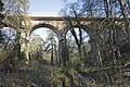
 Crawfordsburn viaduct (summer) - geograph.org.uk - 1366222.jpg 609 × 408; 117 KB
-
 Crawfordsburn, Co Down - geograph.org.uk - 193448.jpg 640 × 426; 150 KB
-
 CrawfordsburnDownMeadow.JPG 4,000 × 3,000; 4.7 MB
-

-
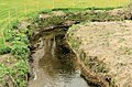
 Culvert, Ballygilbert near Bangor - geograph.org.uk - 2167290.jpg 592 × 392; 121 KB
-
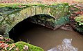
 Culvert, Crawfordsburn - geograph.org.uk - 3121533.jpg 640 × 431; 116 KB
-
 Culvert, near Bangor (1) - geograph.org.uk - 2173584.jpg 640 × 396; 109 KB
-
 D1403~061~A (13735288285).jpg 2,021 × 1,445; 1.36 MB
-
 Dead badger near Crawfordsburn - geograph.org.uk - 3860857.jpg 640 × 424; 188 KB
-
 Derelict house near Bangor - geograph.org.uk - 2173629.jpg 640 × 376; 133 KB
-
 Direction signs near Bangor - geograph.org.uk - 3861074.jpg 640 × 298; 59 KB
-
 Dog rose Crawfordsburn (June 2019) - geograph.org.uk - 6196412.jpg 801 × 621; 108 KB
-
 Downhill Avenue, Carnalea - geograph.org.uk - 1445598.jpg 640 × 480; 115 KB
-
 Fallen tree, Crawfordsburn Glen (2) - geograph.org.uk - 913150.jpg 640 × 428; 115 KB
-
 Fallen tree, Crawfordsburn glen - geograph.org.uk - 664934.jpg 640 × 429; 122 KB
-
 Fallen trees, Crawfordsburn Glen - geograph.org.uk - 655214.jpg 640 × 428; 141 KB
-
 Ferns near Crawfordsburn - geograph.org.uk - 2068863.jpg 562 × 448; 130 KB
-
-
 Field gate near Crawfordsburn - geograph.org.uk - 3860683.jpg 640 × 382; 97 KB
-
-
 Field near Bangor - geograph.org.uk - 2069814.jpg 640 × 333; 91 KB
-
 Field near Crawfordsburn (2) - geograph.org.uk - 2167222.jpg 640 × 315; 84 KB
-
 Field, Ballygilbert near Bangor (1) - geograph.org.uk - 2075182.jpg 640 × 363; 82 KB
-
 Field, Ballygilbert near Bangor (2) - geograph.org.uk - 2075213.jpg 640 × 329; 77 KB
-
 Field, Crawfordsburn - geograph.org.uk - 2076572.jpg 640 × 375; 93 KB
-
-
-
 Fields and trees near Bangor - geograph.org.uk - 2168091.jpg 640 × 331; 99 KB
-
 Fields, Ballygilbert near Bangor - geograph.org.uk - 2273624.jpg 640 × 394; 96 KB
-
 Floral tubs, Crawfordsburn - geograph.org.uk - 2835864.jpg 640 × 440; 101 KB
-
 Foamball, Crawfordsburn Glen - geograph.org.uk - 976921.jpg 640 × 403; 68 KB
-
 Footbridge, Crawfordsburn (1) - geograph.org.uk - 2916614.jpg 640 × 400; 127 KB
-
 Footbridge, Crawfordsburn (2) - geograph.org.uk - 2916667.jpg 640 × 390; 136 KB
-
 Footbridge, Crawfordsburn Glen (3) - geograph.org.uk - 1690285.jpg 640 × 422; 159 KB
-

-
 Former Crawfordsburn Country Club - geograph.org.uk - 2916569.jpg 640 × 382; 88 KB
-
-

-

-

-
 Foxglove, Crawfordsburn Glen - geograph.org.uk - 904683.jpg 640 × 408; 44 KB
-
 Foxgloves, Crawfordsburn (June 2019) - geograph.org.uk - 6196379.jpg 800 × 710; 123 KB
-
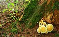
 Fungi, Helen's Bay (8) - geograph.org.uk - 959059.jpg 607 × 386; 93 KB
-
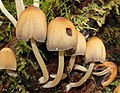
 Fungus Crawfordsburn Glen (33) - geograph.org.uk - 1544675.jpg 581 × 514; 97 KB
-
 Fungus near Bangor - geograph.org.uk - 2069008.jpg 800 × 402; 125 KB
-
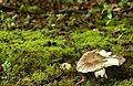
 Fungus near Crawfordsburn - geograph.org.uk - 2068906.jpg 535 × 403; 109 KB
-
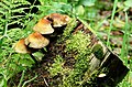
 Fungus, Crawfordsburn Glen (10) - geograph.org.uk - 913051.jpg 601 × 378; 98 KB
-
 Fungus, Crawfordsburn Glen (11) - geograph.org.uk - 913085.jpg 640 × 410; 66 KB
-
 Fungus, Crawfordsburn Glen (12) - geograph.org.uk - 913191.jpg 640 × 364; 57 KB
-
 Fungus, Crawfordsburn Glen (13) - geograph.org.uk - 913243.jpg 618 × 444; 108 KB
-
 Fungus, Crawfordsburn Glen (15) - geograph.org.uk - 937601.jpg 620 × 415; 100 KB
-
 Fungus, Crawfordsburn Glen (16) - geograph.org.uk - 937894.jpg 640 × 549; 110 KB
-
 Fungus, Crawfordsburn Glen (17) - geograph.org.uk - 937916.jpg 640 × 454; 84 KB
-
 Fungus, Crawfordsburn Glen (18) - geograph.org.uk - 965657.jpg 570 × 394; 100 KB
-
 Fungus, Crawfordsburn Glen (19) - geograph.org.uk - 965683.jpg 640 × 401; 101 KB
-
 Fungus, Crawfordsburn Glen (2) - geograph.org.uk - 904492.jpg 640 × 426; 92 KB
-
 Fungus, Crawfordsburn Glen (20) - geograph.org.uk - 965713.jpg 640 × 404; 95 KB
-
 Fungus, Crawfordsburn Glen (21) - geograph.org.uk - 965747.jpg 580 × 340; 97 KB
-
 Fungus, Crawfordsburn Glen (22) - geograph.org.uk - 976846.jpg 640 × 432; 90 KB
-
 Fungus, Crawfordsburn Glen (23) - geograph.org.uk - 977058.jpg 640 × 377; 99 KB
-
 Fungus, Crawfordsburn Glen (24) - geograph.org.uk - 1477820.jpg 501 × 387; 109 KB
-
 Fungus, Crawfordsburn Glen (25) - geograph.org.uk - 1477863.jpg 639 × 496; 91 KB
-
 Fungus, Crawfordsburn Glen (26) - geograph.org.uk - 1477883.jpg 598 × 559; 87 KB
-
 Fungus, Crawfordsburn Glen (27) - geograph.org.uk - 1502123.jpg 548 × 432; 102 KB
-
 Fungus, Crawfordsburn Glen (28) - geograph.org.uk - 1502159.jpg 599 × 453; 101 KB
-
 Fungus, Crawfordsburn Glen (29) - geograph.org.uk - 1502188.jpg 626 × 368; 88 KB
-
 Fungus, Crawfordsburn Glen (3) - geograph.org.uk - 904519.jpg 558 × 395; 99 KB
-
 Fungus, Crawfordsburn Glen (30) - geograph.org.uk - 1544603.jpg 595 × 456; 107 KB
-
 Fungus, Crawfordsburn Glen (31) - geograph.org.uk - 1544624.jpg 640 × 622; 131 KB
-
 Fungus, Crawfordsburn Glen (32) - geograph.org.uk - 1544656.jpg 613 × 505; 110 KB
-
 Fungus, Crawfordsburn Glen (4) - geograph.org.uk - 904536.jpg 640 × 415; 82 KB
-
 Fungus, Crawfordsburn Glen (5) - geograph.org.uk - 904565.jpg 640 × 420; 109 KB
-
 Fungus, Crawfordsburn Glen (6) - geograph.org.uk - 904597.jpg 640 × 419; 134 KB
-
 Fungus, Crawfordsburn Glen (7) - geograph.org.uk - 904616.jpg 640 × 430; 124 KB
-
 Fungus, Crawfordsburn Glen (8) - geograph.org.uk - 904628.jpg 596 × 395; 103 KB
-
 Fungus, Crawfordsburn Glen (9) - geograph.org.uk - 904645.jpg 546 × 467; 100 KB
-
 Fungus, Helen's Bay (12) - geograph.org.uk - 2636606.jpg 640 × 389; 89 KB
-
 Fungus, Helen's Bay (13) - geograph.org.uk - 2636611.jpg 640 × 526; 107 KB
-
 Fungus, Helen's Bay (2012-2) - geograph.org.uk - 3106129.jpg 640 × 447; 132 KB
-
 Fungus, Helen's Bay (2012-3) - geograph.org.uk - 3106149.jpg 640 × 493; 111 KB
-
 Gate near Bangor - geograph.org.uk - 2168026.jpg 640 × 313; 76 KB
-
 Gate near Helen's Bay - geograph.org.uk - 2167204.jpg 640 × 495; 122 KB
-
 Gate, Crawfordsburn - geograph.org.uk - 1160087.jpg 640 × 380; 99 KB
-
 Gate, Crawfordsburn Country Park - geograph.org.uk - 1160020.jpg 618 × 381; 98 KB
-
 Glencraig sign 2017.jpg 2,448 × 3,264; 2.29 MB
-
 Hedge and gate near Crawfordsburn - geograph.org.uk - 2075092.jpg 640 × 354; 79 KB
-
 Honeysuckle berries near Bangor - geograph.org.uk - 2070005.jpg 514 × 596; 107 KB
-
 House with dovecot - geograph.org.uk - 4552781.jpg 4,320 × 3,240; 4.48 MB
-
 Lamppost, Crawfordsburn - geograph.org.uk - 1160136.jpg 640 × 477; 33 KB
-
 Leaning trees, Crawfordsburn Glen - geograph.org.uk - 655227.jpg 640 × 413; 115 KB
-

-
 Meadow Way near Helen's Bay (1) - geograph.org.uk - 2075249.jpg 640 × 359; 117 KB
-
 Meadow Way near Helen's Bay (2) - geograph.org.uk - 2076379.jpg 640 × 366; 132 KB
-
 Meadow Way near Helen's Bay (3) - geograph.org.uk - 2076424.jpg 581 × 389; 103 KB
-
 Meadow Way near Helen's Bay (4) - geograph.org.uk - 2076463.jpg 640 × 372; 117 KB
-
 Meadow Way near Helen's Bay (5) - geograph.org.uk - 2076486.jpg 640 × 400; 115 KB
-
 Meadow Way near Helen's Bay (6) - geograph.org.uk - 2076538.jpg 640 × 370; 111 KB
-
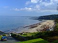
 Near Crawfordsburn beach - panoramio.jpg 2,504 × 1,629; 2.74 MB
-

-

-
 Old mill pond, Crawfordsburn (June 2019) - geograph.org.uk - 6196397.jpg 800 × 499; 244 KB
-
 Old Windmill Road, Crawfordsburn - geograph.org.uk - 1768721.jpg 640 × 370; 216 KB
-
 Orange Hall, Crawfordsburn - geograph.org.uk - 4552785.jpg 4,320 × 3,240; 4.54 MB
-
 Overhead lines, Crawfordsburn - geograph.org.uk - 3121456.jpg 640 × 485; 121 KB
-
 Path near Bangor (1) - geograph.org.uk - 2069837.jpg 640 × 332; 103 KB
-
 Path, Crawfordsburn Glen (1) - geograph.org.uk - 784972.jpg 581 × 389; 109 KB
-
 Path, Crawfordsburn Glen (2) - geograph.org.uk - 784984.jpg 570 × 410; 101 KB
-
 Path, Crawfordsburn Glen (3) - geograph.org.uk - 784998.jpg 606 × 372; 104 KB
-
 Path, Crawfordsburn Glen (4) - geograph.org.uk - 785003.jpg 600 × 386; 98 KB
-
 Pillar box, Crawfordsburn - geograph.org.uk - 1160123.jpg 640 × 423; 98 KB
-
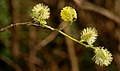 Pussy willow, Crawfordsburn - geograph.org.uk - 767747.jpg 640 × 377; 39 KB
-

-
 Railway bridge, Crawfordsburn Glen - geograph.org.uk - 1502010.jpg 607 × 387; 104 KB
-
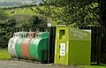 Recycling bins, Crawfordsburn - geograph.org.uk - 3121506.jpg 640 × 413; 100 KB
-
-
 Road and path, Crawfordsburn Glen - geograph.org.uk - 937623.jpg 640 × 410; 108 KB
-

-
 Road, Crawfordsburn Country Park - geograph.org.uk - 784960.jpg 581 × 356; 82 KB
-
-
 Rose hips - geograph.org.uk - 548025.jpg 640 × 459; 74 KB
-

-
 Saxifrage, Crawfordsburn - geograph.org.uk - 767779.jpg 567 × 381; 88 KB
-
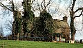
 Sharman Manor near Crawfordsburn - geograph.org.uk - 767265.jpg 640 × 503; 361 KB
-
 Sheep, Crawfordsburn (2) - geograph.org.uk - 2916642.jpg 640 × 484; 111 KB
-
 Sheugh near Bangor - geograph.org.uk - 2173554.jpg 581 × 389; 142 KB
-
 Sign, Crawfordsburn Glen - geograph.org.uk - 1366151.jpg 640 × 416; 100 KB
-
 Slipway at Crawfordsburn Country Park - geograph.org.uk - 5994.jpg 640 × 348; 72 KB
-
 Snowberries, Crawfordsburn - geograph.org.uk - 3121650.jpg 640 × 509; 61 KB
-
 Solar panel near Bangor - geograph.org.uk - 2068970.jpg 640 × 436; 89 KB
-
 Springtime, Crawfordsburn Country Park - geograph.org.uk - 784957.jpg 561 × 435; 122 KB
-
 St. Helens Bridge, Crawfords Burn (25307701068).jpg 2,000 × 1,530; 1.84 MB
-
 Steps, Crawfordsburn Glen - geograph.org.uk - 1366105.jpg 574 × 385; 122 KB
-
 Straw bales near Bangor - geograph.org.uk - 2097411.jpg 640 × 407; 139 KB
-
 Straw bales near Bangor - geograph.org.uk - 2097413.jpg 640 × 376; 86 KB
-
 Stream, Crawfordsburn Glen (4) - geograph.org.uk - 913104.jpg 640 × 424; 133 KB
-
 Stream, Crawfordsburn Glen (5) - geograph.org.uk - 1160764.jpg 620 × 415; 132 KB
-
 Tea Room at the Crawfordsburn Inn (13735600424).jpg 2,084 × 1,416; 1.06 MB
-
 Telecoms mast near Bangor - geograph.org.uk - 2173649.jpg 946 × 619; 94 KB
-

-

-

-
 The Ballyrobert Road near Bangor - geograph.org.uk - 271433.jpg 640 × 426; 205 KB
-
-

-
 The Coothall Road near Bangor - geograph.org.uk - 3860975.jpg 640 × 395; 110 KB
-
 The Coothall Road near Crawfordsburn - geograph.org.uk - 3860664.jpg 640 × 351; 112 KB
-

-
 The Crawfordsburn in flood (1) - geograph.org.uk - 904432.jpg 640 × 408; 98 KB
-
 The Crawfordsburn in flood (2) - geograph.org.uk - 904453.jpg 640 × 399; 106 KB
-
 The Crawfordsburn in flood (3) - geograph.org.uk - 912992.jpg 640 × 422; 112 KB
-
 The Crawfordsburn in flood (4) - geograph.org.uk - 913010.jpg 632 × 419; 109 KB
-
 The Crawfordsburn near Crawfordsburn - geograph.org.uk - 435972.jpg 640 × 426; 180 KB
-
-

-

-
 The Old Inn (1) - geograph.org.uk - 4552792.jpg 4,320 × 3,240; 4.77 MB
-
 The Old Inn (2) - geograph.org.uk - 4552794.jpg 4,320 × 3,240; 4.83 MB
-
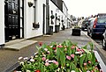
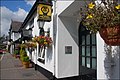
 The Old Inn, Crawfordsburn (1) - geograph.org.uk - 524223.jpg 640 × 426; 87 KB
-
 The Old Inn, Crawfordsburn (2) - geograph.org.uk - 524260.jpg 640 × 426; 82 KB
-
 Track near Bangor - geograph.org.uk - 2069980.jpg 640 × 316; 102 KB
-
 Train approaching Crawfordsburn Viaduct - 1985 (geograph 3753015).jpg 886 × 637; 577 KB
-

-

-
 Trees in mist near Crawfordsburn - geograph.org.uk - 869267.jpg 640 × 480; 389 KB
-
 Trees near Bangor (1) - geograph.org.uk - 2173544.jpg 620 × 387; 118 KB
-
 Trees near Bangor (2) - geograph.org.uk - 2173562.jpg 640 × 338; 103 KB
-
 Trees near Crawfordsburn - geograph.org.uk - 628543.jpg 480 × 640; 110 KB
-
 Trees, Ballygilbert near Bangor - geograph.org.uk - 2167275.jpg 620 × 415; 142 KB
-
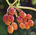
 Tutsan berries, Crawfordsburn Glen - geograph.org.uk - 965545.jpg 640 × 473; 68 KB


_-_geograph.org.uk_-_607765.jpg)
_-_geograph.org.uk_-_607790.jpg)


_-_geograph.org.uk_-_2273585.jpg)
_-_geograph.org.uk_-_2273597.jpg)


_-_geograph.org.uk_-_2069772.jpg)
_-_geograph.org.uk_-_2069800.jpg)
_-_geograph.org.uk_-_2167955.jpg)
_-_geograph.org.uk_-_2167991.jpg)
_-_geograph.org.uk_-_2167173.jpg)


_-_geograph.org.uk_-_965495.jpg)
_-_geograph.org.uk_-_472075.jpg)
_-_geograph.org.uk_-_436014.jpg)
_-_geograph.org.uk_-_754774.jpg)
_-_geograph.org.uk_-_1366222.jpg)


_-_geograph.org.uk_-_5662450.jpg)


_-_geograph.org.uk_-_2173584.jpg)
.jpg)


_-_geograph.org.uk_-_6196412.jpg)

_-_geograph.org.uk_-_913150.jpg)


_-_geograph.org.uk_-_2167222.jpg)
_-_geograph.org.uk_-_2075182.jpg)
_-_geograph.org.uk_-_2075213.jpg)


_-_geograph.org.uk_-_5257899.jpg)


_-_geograph.org.uk_-_2916614.jpg)
_-_geograph.org.uk_-_2916667.jpg)
_-_geograph.org.uk_-_1690285.jpg)
_-_geograph.org.uk_-_5258412.jpg)

_-_geograph.org.uk_-_6010030.jpg)
_-_geograph.org.uk_-_5976787.jpg)
_-_geograph.org.uk_-_6195471.jpg)
_-_geograph.org.uk_-_6195483.jpg)

_-_geograph.org.uk_-_6196379.jpg)
_-_geograph.org.uk_-_959059.jpg)
_-_geograph.org.uk_-_1544675.jpg)


_-_geograph.org.uk_-_913051.jpg)
_-_geograph.org.uk_-_913085.jpg)
_-_geograph.org.uk_-_913191.jpg)
_-_geograph.org.uk_-_913243.jpg)
_-_geograph.org.uk_-_937601.jpg)
_-_geograph.org.uk_-_937894.jpg)
_-_geograph.org.uk_-_937916.jpg)
_-_geograph.org.uk_-_965657.jpg)
_-_geograph.org.uk_-_965683.jpg)
_-_geograph.org.uk_-_904492.jpg)
_-_geograph.org.uk_-_965713.jpg)
_-_geograph.org.uk_-_965747.jpg)
_-_geograph.org.uk_-_976846.jpg)
_-_geograph.org.uk_-_977058.jpg)
_-_geograph.org.uk_-_1477820.jpg)
_-_geograph.org.uk_-_1477863.jpg)
_-_geograph.org.uk_-_1477883.jpg)
_-_geograph.org.uk_-_1502123.jpg)
_-_geograph.org.uk_-_1502159.jpg)
_-_geograph.org.uk_-_1502188.jpg)
_-_geograph.org.uk_-_904519.jpg)
_-_geograph.org.uk_-_1544603.jpg)
_-_geograph.org.uk_-_1544624.jpg)
_-_geograph.org.uk_-_1544656.jpg)
_-_geograph.org.uk_-_904536.jpg)
_-_geograph.org.uk_-_904565.jpg)
_-_geograph.org.uk_-_904597.jpg)
_-_geograph.org.uk_-_904616.jpg)
_-_geograph.org.uk_-_904628.jpg)
_-_geograph.org.uk_-_904645.jpg)
_-_geograph.org.uk_-_2636606.jpg)
_-_geograph.org.uk_-_2636611.jpg)
_-_geograph.org.uk_-_3106129.jpg)
_-_geograph.org.uk_-_3106149.jpg)


.jpg)
_-_geograph.org.uk_-_2075249.jpg)
_-_geograph.org.uk_-_2076379.jpg)
_-_geograph.org.uk_-_2076424.jpg)
_-_geograph.org.uk_-_2076463.jpg)
_-_geograph.org.uk_-_2076486.jpg)
_-_geograph.org.uk_-_2076538.jpg)

_-_geograph.org.uk_-_6010051.jpg)
_-_geograph.org.uk_-_5501754.jpg)
_-_geograph.org.uk_-_6196397.jpg)


_-_geograph.org.uk_-_2069837.jpg)
_-_geograph.org.uk_-_784972.jpg)
_-_geograph.org.uk_-_784984.jpg)
_-_geograph.org.uk_-_784998.jpg)
_-_geograph.org.uk_-_785003.jpg)


_-_geograph.org.uk_-_2416625.jpg)


_-_geograph.org.uk_-_5501716.jpg)


_-_geograph.org.uk_-_5501665.jpg)


_-_geograph.org.uk_-_2916642.jpg)


.jpg)


_-_geograph.org.uk_-_913104.jpg)
_-_geograph.org.uk_-_1160764.jpg)
.jpg)

_-_geograph.org.uk_-_3862075.jpg)


_-_geograph.org.uk_-_3861120.jpg)
_-_geograph.org.uk_-_5631009.jpg)


_-_geograph.org.uk_-_904432.jpg)
_-_geograph.org.uk_-_904453.jpg)
_-_geograph.org.uk_-_912992.jpg)
_-_geograph.org.uk_-_913010.jpg)

_-_geograph.org.uk_-_3121543.jpg)
_-_geograph.org.uk_-_3121557.jpg)

_-_geograph.org.uk_-_4552792.jpg)
_-_geograph.org.uk_-_4552794.jpg)
_-_geograph.org.uk_-_524260.jpg)

.jpg)
_-_geograph.org.uk_-_5501689.jpg)


_-_geograph.org.uk_-_2173544.jpg)
_-_geograph.org.uk_-_2173562.jpg)


