Category:Crayford Marshes
Subcategories
This category has the following 4 subcategories, out of 4 total.
D
- Dartford Creek Barrier (24 F)
H
- Howbury Farm (4 F)
Media in category "Crayford Marshes"
The following 40 files are in this category, out of 40 total.
-
 A summer's morning at Crayford Marsh - geograph.org.uk - 1957240.jpg 1,280 × 960; 616 KB
-
 Crayford Marsh - geograph.org.uk - 1888500.jpg 1,280 × 960; 655 KB
-
 Crayford Marsh - geograph.org.uk - 1945173.jpg 1,280 × 960; 625 KB
-
 Crayford Marsh - geograph.org.uk - 1947688.jpg 1,280 × 960; 629 KB
-
 Crayford Marsh from Moat Lane - geograph.org.uk - 1945150.jpg 1,280 × 960; 655 KB
-
 Crayford Marshes - geograph.org.uk - 3204472.jpg 4,288 × 3,216; 6.08 MB
-
 Crayford Marshes - geograph.org.uk - 3766604.jpg 640 × 430; 58 KB
-
 Crayford Marshes - geograph.org.uk - 3766614.jpg 640 × 430; 53 KB
-
 Crayford Marshes - geograph.org.uk - 3772088.jpg 640 × 430; 45 KB
-
 Crayford Marshes - geograph.org.uk - 3772099.jpg 640 × 430; 74 KB
-
 Crayford Marshes - geograph.org.uk - 3772101.jpg 640 × 430; 81 KB
-
 Crayford Marshes - geograph.org.uk - 3772108.jpg 640 × 430; 67 KB
-
 Crayford Marshes - geograph.org.uk - 4114098.jpg 640 × 427; 102 KB
-
 Crayford Marshes - geograph.org.uk - 69812.jpg 640 × 425; 84 KB
-
 Crayford Marshes and the Darent Industrial Estate - geograph.org.uk - 3865218.jpg 4,000 × 3,000; 3.98 MB
-
 Crayford Marshes from the Thames Path - geograph.org.uk - 3687615.jpg 4,000 × 3,000; 4.38 MB
-
 Crayford Marshes from the Thames Path - geograph.org.uk - 3865209.jpg 4,000 × 3,000; 4.15 MB
-
 Crayford Marshes seen from Moat Lane - geograph.org.uk - 3401570.jpg 4,000 × 3,000; 3.89 MB
-
 Crayford Marshes seen from Moat Lane - geograph.org.uk - 3401575.jpg 4,000 × 3,000; 4.05 MB
-
 Drainage ditch, Crayford Marsh - geograph.org.uk - 198187.jpg 640 × 480; 58 KB
-
 Embankment, Crayford Marshes - geograph.org.uk - 3772093.jpg 640 × 430; 57 KB
-
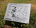 Information Board at Crayford Marshes.jpg 4,438 × 3,412; 15.48 MB
-
 Landfill on Crayford Marshes - geograph.org.uk - 198180.jpg 640 × 480; 44 KB
-
 London Loop Signage in Crayford Marshes.jpg 3,392 × 4,517; 9.89 MB
-
 Looking across Crayford Marsh - geograph.org.uk - 1957230.jpg 1,280 × 960; 625 KB
-
 Path on Crayford Marshes - geograph.org.uk - 3646958.jpg 640 × 360; 80 KB
-
 Path through the Crayford Marshes.jpg 4,592 × 3,448; 16.7 MB
-

-

-

-
 Restricted byway across Crayford Marshes - geograph.org.uk - 3772112.jpg 640 × 430; 104 KB
-
 River Cray, Crayford Creek - geograph.org.uk - 715180.jpg 640 × 480; 94 KB
-
 River Darent running through Crayford Marshes.jpg 4,592 × 3,448; 14.24 MB
-
 Signage in Crayford Marshes (01).jpg 4,592 × 3,448; 7.5 MB
-
 Sunset from Crayford Marshes - 2020-09-27 (1).jpg 4,048 × 3,036; 7.12 MB
-
 Sunset from Crayford Marshes - 2020-09-27 (2).jpg 4,048 × 3,036; 10.08 MB
-
 Timber Posts in the Thames off of Crayford Marshes.jpg 4,592 × 3,448; 11.12 MB
-
 Track through the Crayford Marshes.jpg 4,592 × 3,448; 13.04 MB
-
 View over Crayford Marshes - geograph.org.uk - 4522525.jpg 3,912 × 2,516; 1.89 MB
-


.jpg)
.jpg)
.jpg)


