Category:Crowan
village in the west of Cornwall, UK  Eglwys Sant Crewenna, Crowan | |||||
| Upload media | |||||
| Instance of | |||||
|---|---|---|---|---|---|
| Location | Cornwall, South West England, England | ||||
| Population |
| ||||
 | |||||
English: Crowan (Cornish: Egloskrowenn) is a village and civil parish in Cornwall, United Kingdom. The village is four miles (6.5 km) south of Camborne. Crowan Churchtown is not the largest settlement: there are villages at Praze-an-Beeble, Nancegollan, Bolitho and Leedstown and a hamlet at Black Rock (on the B3280 road four miles (6.5 km) south of Camborne and five miles (8 km) north of Helston
Subcategories
This category has the following 10 subcategories, out of 10 total.
C
- Carwynnen (2 F)
D
- Drym (2 F)
H
- Horsedowns (2 F)
L
N
P
- Paul's Green (2 F)
R
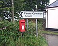
- Releath (2 F)
S
- St Crewenna's Church, Crowan (2 F)
T
- Townshend, Cornwall (5 F)
Media in category "Crowan"
The following 200 files are in this category, out of 211 total.
(previous page) (next page)-
 A daffodil field - geograph.org.uk - 6140298.jpg 1,024 × 680; 218 KB
-
 A little-used footpath at Paul's Green - geograph.org.uk - 3485415.jpg 480 × 640; 135 KB
-
 A winding section of the B3280 - geograph.org.uk - 2260139.jpg 640 × 480; 58 KB
-
 Agricultural premises at Fraddam - geograph.org.uk - 5190495.jpg 640 × 480; 49 KB
-

-
 Approaching Binnerton Manor - geograph.org.uk - 2839787.jpg 640 × 427; 85 KB
-
 B3280 towards Black Rock - geograph.org.uk - 5462662.jpg 640 × 480; 90 KB
-
 B3280 towards Redruth - geograph.org.uk - 5462682.jpg 640 × 480; 48 KB
-
 B3280 towards Redruth - geograph.org.uk - 5462687.jpg 640 × 480; 53 KB
-
 B3280, Black Rock - geograph.org.uk - 5462674.jpg 640 × 480; 67 KB
-
 B3280, Tremayne - geograph.org.uk - 5462660.jpg 640 × 480; 88 KB
-
 B3302 east of Binnerton Manor - geograph.org.uk - 3188939.jpg 2,601 × 2,035; 992 KB
-
 B3302 enters Leedstown - geograph.org.uk - 3188954.jpg 2,791 × 2,048; 619 KB
-
 B3302 is Fraddam Road - geograph.org.uk - 3188965.jpg 3,648 × 2,048; 1.02 MB
-
 B3302 northwest of Sunny Corner - geograph.org.uk - 3188944.jpg 2,677 × 2,048; 713 KB
-
 Barripper cricket field - geograph.org.uk - 2257285.jpg 640 × 480; 60 KB
-
 Barripper Village Hall - geograph.org.uk - 2257278.jpg 640 × 480; 80 KB
-
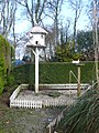 Bird house and doves, Clowance Estate - geograph.org.uk - 3379558.jpg 1,500 × 2,000; 1.35 MB
-
 Boat house and tree house, Clowance Estate - geograph.org.uk - 3377157.jpg 2,000 × 1,464; 1.17 MB
-
 Boat house and tree house, Clowance Estate - geograph.org.uk - 3377160.jpg 2,000 × 1,488; 1.15 MB
-
 Bridge over the Roseworthy Stream - geograph.org.uk - 2260065.jpg 640 × 480; 71 KB
-
 Bridle path near Cargenwen - geograph.org.uk - 2326235.jpg 640 × 427; 115 KB
-
 Bridlepath lined with bluebells - geograph.org.uk - 2381052.jpg 640 × 427; 151 KB
-
 Bridlepath west of Trenoweth - geograph.org.uk - 2381033.jpg 427 × 640; 137 KB
-
 Buildings at Tremayne - geograph.org.uk - 2082529.jpg 640 × 427; 96 KB
-
 Bunkers Hill towards Townshend - geograph.org.uk - 5466477.jpg 640 × 480; 80 KB
-
 Byway towards Truthwell Farm - geograph.org.uk - 5462621.jpg 640 × 480; 107 KB
-
 Cargenwen Farm and reservoir - geograph.org.uk - 2071939.jpg 640 × 427; 72 KB
-
 Cargenwen reservoir from the steps - geograph.org.uk - 2071929.jpg 640 × 427; 80 KB
-
 Cargenwen Reservoirs - geograph.org.uk - 2260059.jpg 640 × 480; 85 KB
-
 Carwynnen Woods - geograph.org.uk - 4187174.jpg 480 × 640; 138 KB
-
 Cattle near Cargenwyn Croft - geograph.org.uk - 5462684.jpg 640 × 480; 68 KB
-
 Central Garage, Leedstown - geograph.org.uk - 3377148.jpg 2,000 × 1,500; 657 KB
-
 Clowance House - geograph.org.uk - 3377167.jpg 2,000 × 1,468; 707 KB
-
 Coach house, Clowance Estate - geograph.org.uk - 3379575.jpg 2,000 × 1,396; 942 KB
-
 Cornish country road - geograph.org.uk - 6140953.jpg 1,024 × 680; 240 KB
-
 Cornish stile, Praze an Beeble - geograph.org.uk - 3379613.jpg 1,496 × 2,000; 1.12 MB
-
 Cottages at Townshend - geograph.org.uk - 184046.jpg 640 × 480; 101 KB
-
 Country house bell, Clowance - geograph.org.uk - 3377163.jpg 1,500 × 2,000; 399 KB
-
 Country road near Leedstown - geograph.org.uk - 6140956.jpg 1,024 × 680; 269 KB
-
 Crop field towards Chyryn - geograph.org.uk - 5462679.jpg 640 × 480; 71 KB
-
 Crossroad in Townshend - geograph.org.uk - 5384850.jpg 4,000 × 3,000; 2.67 MB
-
 Crowan , The B3303 - geograph.org.uk - 6352431.jpg 6,000 × 4,000; 7.7 MB
-
 Crowan , The B3303 - geograph.org.uk - 6352469.jpg 6,000 × 4,000; 6.22 MB
-
 Crowan Beacon - geograph.org.uk - 2260090.jpg 640 × 480; 57 KB
-
 Crowan Beacon triangulation point - geograph.org.uk - 5416169.jpg 1,600 × 1,200; 214 KB
-
 Crowan Mill - geograph.org.uk - 3379655.jpg 2,000 × 1,500; 891 KB
-
 Crowan Primary School, Praze an Beeble - geograph.org.uk - 3379724.jpg 2,000 × 1,424; 699 KB
-
 Crowan Village Hall - geograph.org.uk - 2342917.jpg 640 × 427; 67 KB
-
 Cut grass field, Black Rock - geograph.org.uk - 5462667.jpg 640 × 480; 64 KB
-
 Daffodil field at Black Rock - geograph.org.uk - 2260105.jpg 640 × 480; 85 KB
-
 Daffodil field near Whistling Winds Farm - geograph.org.uk - 2326206.jpg 640 × 427; 105 KB
-
 Daffodils at Little Carvolth - geograph.org.uk - 2286174.jpg 640 × 427; 78 KB
-
 Daffodils in the mist - geograph.org.uk - 2396454.jpg 640 × 427; 44 KB
-
 Daffodils near Whistling Winds Farm - geograph.org.uk - 2316072.jpg 640 × 427; 98 KB
-
 Datestone on the Old Schoolhouse, Crowan - geograph.org.uk - 3379664.jpg 2,000 × 1,500; 946 KB
-
 Dead tree on Polcrebo Downs - geograph.org.uk - 2342965.jpg 640 × 427; 64 KB
-

-
 Direction Sign – Signpost - geograph.org.uk - 6594662.jpg 687 × 1,024; 169 KB
-
 Direction Sign – Signpost - geograph.org.uk - 6594719.jpg 690 × 1,024; 185 KB
-

-
 Domed shelter and games, Clowance House - geograph.org.uk - 3377169.jpg 2,000 × 1,481; 1.09 MB
-
 Elizabeth II postbox, Blackrock - geograph.org.uk - 5465249.jpg 640 × 509; 126 KB
-
 Entrance to Carvolth Farm - geograph.org.uk - 2286165.jpg 640 × 427; 106 KB
-

-
 Farm track at Paul's Green - geograph.org.uk - 3485402.jpg 640 × 480; 94 KB
-
 Farm track off Bunkers Hill - geograph.org.uk - 5466476.jpg 640 × 480; 115 KB
-
 Field at Gernick - geograph.org.uk - 4187181.jpg 480 × 640; 65 KB
-

-
 Field near Clowance Wood - geograph.org.uk - 6140952.jpg 1,024 × 680; 211 KB
-
 Field opposite Clowance Wood - geograph.org.uk - 6140950.jpg 1,024 × 680; 234 KB
-
 Finger post and country road - geograph.org.uk - 5415975.jpg 1,600 × 1,199; 326 KB
-
 Fish pond, Clowance House - geograph.org.uk - 3377173.jpg 2,000 × 1,500; 1.52 MB
-

-
 Football field at Praze-an-Beeble - geograph.org.uk - 2260014.jpg 640 × 480; 78 KB
-
 Footbridge at Vellanewson - geograph.org.uk - 3379805.jpg 2,000 × 1,478; 1.42 MB
-
 Footbridge by tree - geograph.org.uk - 2839779.jpg 640 × 427; 109 KB
-
 Footbridge over watery ditch - geograph.org.uk - 2839783.jpg 640 × 427; 126 KB
-
 Footpath near Nancegollan - geograph.org.uk - 196865.jpg 480 × 640; 138 KB
-
 Footpath through daffodils - geograph.org.uk - 2277051.jpg 640 × 427; 100 KB
-
 Footpath towards Burnt Downs - geograph.org.uk - 5462639.jpg 640 × 480; 69 KB
-
 Ford by Kirthen Wood Haven - geograph.org.uk - 231732.jpg 640 × 480; 155 KB
-
 Former mill, Vellanewson - geograph.org.uk - 3379817.jpg 2,000 × 1,500; 1.08 MB
-
 Former shop, Crowan - geograph.org.uk - 3379673.jpg 2,000 × 1,380; 636 KB
-
 Fraddam, postbox № TR27 131 - geograph.org.uk - 3832752.jpg 480 × 640; 122 KB
-
 Fraddam, red telephone box - geograph.org.uk - 3832750.jpg 640 × 480; 111 KB
-
 Glebe Farmhouse and gate piers, Crowan - geograph.org.uk - 3379694.jpg 2,000 × 1,539; 1 MB
-
 Grazing, North Tremayne - geograph.org.uk - 5462658.jpg 640 × 480; 53 KB
-
 Green energy on a house in Leedstown - geograph.org.uk - 2695558.jpg 640 × 427; 53 KB
-
 Heathland on Polcrebo Downs - geograph.org.uk - 2342979.jpg 640 × 427; 70 KB
-
 Heathland, Crowan - geograph.org.uk - 6144437.jpg 1,024 × 768; 228 KB
-
 Herb garden, Clowance Estate - geograph.org.uk - 3379562.jpg 2,000 × 1,473; 1.26 MB
-
 Holiday lodges, Clowance Estate - geograph.org.uk - 3377174.jpg 2,000 × 1,500; 1.02 MB
-

-
 House on Praze Road (B3280) - geograph.org.uk - 5462652.jpg 640 × 480; 75 KB
-
 House on the junction, Black Rock - geograph.org.uk - 5462671.jpg 640 × 480; 54 KB
-
 House, Vellanewson - geograph.org.uk - 3379809.jpg 2,000 × 1,381; 932 KB
-
 Houses on Bosence Road, Townshend - geograph.org.uk - 5466489.jpg 640 × 480; 59 KB
-
 Houses on Chapel Road, Leedstown - geograph.org.uk - 5462632.jpg 640 × 480; 51 KB
-

-

-
 Leedstown Cricket Club - Entrance - geograph.org.uk - 2589821.jpg 1,600 × 1,200; 241 KB
-
 Leedstown Cricket Club - geograph.org.uk - 2589813.jpg 1,600 × 1,200; 264 KB
-

-

-
 Lower Binnerton Farm - geograph.org.uk - 2686933.jpg 419 × 640; 121 KB
-
 Lower Binnerton Farm - geograph.org.uk - 2686941.jpg 640 × 425; 88 KB
-
 Manor Mill and Leat - geograph.org.uk - 5709811.jpg 2,399 × 3,599; 1.35 MB
-
 Marker for old mine shaft - geograph.org.uk - 196772.jpg 640 × 480; 151 KB
-
 Milestone at Botetoe Bridge - geograph.org.uk - 2257259.jpg 640 × 480; 141 KB
-
 Molesworth-St. Aubyn grave - geograph.org.uk - 2082516.jpg 640 × 427; 126 KB
-
 Nine Maidens Cross.jpg 996 × 787; 141 KB
-

-

-

-

-

-
 Old Milestone by the B3302 in Leedstown - geograph.org.uk - 5623291.jpg 640 × 480; 159 KB
-

-

-
 Old Mine Chimney on Polcrebo Downs - geograph.org.uk - 5921540.jpg 4,000 × 3,000; 2.86 MB
-
 Old mine shaft - geograph.org.uk - 196768.jpg 640 × 480; 97 KB
-
 Old railway bridge - geograph.org.uk - 192451.jpg 480 × 640; 129 KB
-

-
 Old railway bridge near Crowan - geograph.org.uk - 2341120.jpg 427 × 640; 87 KB
-
 Old railway cutting at Nancegollan - geograph.org.uk - 2396448.jpg 640 × 427; 101 KB
-
 Ordnance Survey Flush Bracket 1804 - geograph.org.uk - 5430040.jpg 4,000 × 3,000; 3.86 MB
-
 Ordnance Survey Flush Bracket 1806 - geograph.org.uk - 5432490.jpg 3,756 × 2,817; 2.91 MB
-
 Outbuildings at Polglase Farm - geograph.org.uk - 2830750.jpg 640 × 427; 105 KB
-
 Over the dismantled railway - geograph.org.uk - 2082502.jpg 640 × 427; 139 KB
-
 Pasture, Crowan - geograph.org.uk - 6144431.jpg 1,024 × 768; 271 KB
-
 Pasture, Crowan - geograph.org.uk - 6144441.jpg 1,024 × 768; 284 KB
-

-
 Praze Road (B3280) - geograph.org.uk - 5462643.jpg 640 × 480; 52 KB
-
 Praze-an-Beeble , Clowance Estate Entrance - geograph.org.uk - 6352471.jpg 6,000 × 4,000; 6.57 MB
-
 Praze-an-Beeble GP Surgery - geograph.org.uk - 2277277.jpg 640 × 427; 86 KB
-
 Praze-an-Beeble, entrance to the village from the south - geograph.org.uk - 4910506.jpg 1,600 × 1,412; 477 KB
-
 Praze-an-Beeble, postbox № TR14 121 - geograph.org.uk - 3706313.jpg 480 × 640; 98 KB
-
 Praze-an-Beeble, red telephone box - geograph.org.uk - 3706314.jpg 480 × 640; 72 KB
-
 Praze-an-Beeble, the post office - geograph.org.uk - 3706311.jpg 640 × 480; 103 KB
-

-
 Public bridleway on Polcrebo Downs - geograph.org.uk - 2343001.jpg 640 × 427; 58 KB
-

-
 Public byway near Trenoweth - geograph.org.uk - 2381019.jpg 640 × 427; 126 KB
-
 Purple ^ Yellow flowers brighten up a September morning - geograph.org.uk - 5921552.jpg 4,000 × 3,000; 3.62 MB
-
 Road (B3280) to Leedstown - geograph.org.uk - 5382070.jpg 4,000 × 3,000; 3.61 MB
-
 Road approaching the B3280 - geograph.org.uk - 6140958.jpg 1,024 × 680; 187 KB
-
 Road junction at Carvolth - geograph.org.uk - 2286186.jpg 640 × 427; 93 KB
-
 Road junction at Crenver Grove - geograph.org.uk - 2695696.jpg 640 × 427; 89 KB
-
 Road junction beside Grenver Grove - geograph.org.uk - 6140299.jpg 1,024 × 680; 248 KB
-
 Road signs ancient and modern - geograph.org.uk - 2260022.jpg 640 × 480; 75 KB
-
 Road towards Clowance Wood from B3280 - geograph.org.uk - 5382076.jpg 4,000 × 3,000; 3.89 MB
-
 Roadside stile at Nancegollan - geograph.org.uk - 2396435.jpg 427 × 640; 94 KB
-
 Rough grazing - geograph.org.uk - 6140946.jpg 1,024 × 680; 246 KB
-
 Screen on a watercourse - geograph.org.uk - 3379585.jpg 2,000 × 1,500; 1.4 MB
-
 Sheep pasture at Praze-an-Beeble - geograph.org.uk - 2260036.jpg 640 × 480; 95 KB
-
 Short green lane - geograph.org.uk - 3690689.jpg 800 × 450; 242 KB
-
 St Aubyns Arms, Praze-an-Beeble - geograph.org.uk - 5462655.jpg 640 × 480; 66 KB
-
 St James mission church in Leedstown - geograph.org.uk - 4714227.jpg 720 × 540; 122 KB
-
 Statue, Clowance Estate - geograph.org.uk - 3377179.jpg 1,485 × 2,000; 1.08 MB
-
 Stile at Gernick - geograph.org.uk - 4187178.jpg 480 × 640; 137 KB
-
 Surgery, Praze an Beeble - geograph.org.uk - 3379577.jpg 2,000 × 1,448; 705 KB
-
 The B3303 south of Barripper, Cornwall - geograph.org.uk - 2374451.jpg 1,600 × 1,200; 678 KB
-
 The Duke of Leeds - geograph.org.uk - 3188961.jpg 3,648 × 2,048; 1.03 MB
-

-
 The Duke of Leeds public house, Leedstown, Cornwall - geograph.org.uk - 2374454.jpg 1,600 × 1,200; 393 KB
-
 The Duke of Leeds, Leedstown - geograph.org.uk - 3377151.jpg 2,000 × 1,500; 700 KB
-
 The entrance to Crenver Grove - geograph.org.uk - 2695690.jpg 640 × 427; 117 KB
-
 The lodge, Clowance Estate - geograph.org.uk - 3377176.jpg 2,000 × 1,428; 977 KB
-
 The lodge, Clowance Estate - geograph.org.uk - 3377177.jpg 2,000 × 1,347; 978 KB
-
 The old road, Praze an Beeble - geograph.org.uk - 3379610.jpg 2,000 × 1,500; 1.4 MB
-
 The Old Schoolhouse, Crowan - geograph.org.uk - 3379662.jpg 2,000 × 1,500; 879 KB
-
 The Old Schoolhouse, Crowan - geograph.org.uk - 3379667.jpg 2,000 × 1,500; 1,002 KB
-
 The Orangery, Clowance House - geograph.org.uk - 3377172.jpg 2,000 × 1,500; 888 KB
-
 The road to Crowan - geograph.org.uk - 2343026.jpg 640 × 427; 54 KB
-

-
 Top reservoir at Cargenwen - geograph.org.uk - 2071915.jpg 640 × 427; 68 KB
-
 Townshend chapel - geograph.org.uk - 4720283.jpg 605 × 721; 120 KB
-
 Townshend Village Hall - geograph.org.uk - 5466481.jpg 640 × 433; 64 KB
-
 Townshend Wesleyan Chapel - geograph.org.uk - 5466485.jpg 480 × 640; 81 KB
-
 Track (footpath) off the B3280 - geograph.org.uk - 5462661.jpg 640 × 480; 85 KB
-
 View across daffodils to Crowan Beacon - geograph.org.uk - 2326219.jpg 640 × 427; 110 KB
-

-
 View to Gernick - geograph.org.uk - 2277044.jpg 640 × 427; 71 KB
-

-
 War Memorial, Praze-an-Beeble - geograph.org.uk - 5462653.jpg 640 × 480; 82 KB
-
 Water wheel, Crowan Mill - geograph.org.uk - 3379658.jpg 2,000 × 1,510; 875 KB
-
 Wesleyan Chapel, Leedstown - geograph.org.uk - 3052933.jpg 2,112 × 2,816; 1.23 MB
-
 Woodland in Crenver Grove - geograph.org.uk - 2695625.jpg 427 × 640; 148 KB
-

-
 Across the Valley below Releath - geograph.org.uk - 172915.jpg 640 × 427; 97 KB
-
 Blackberry blossom - geograph.org.uk - 196861.jpg 640 × 480; 101 KB
-
 Cargenwen - geograph.org.uk - 173387.jpg 640 × 427; 97 KB
-
 Crenver Grove - geograph.org.uk - 196840.jpg 480 × 640; 136 KB
-
 Entrance to Crenver Grove - geograph.org.uk - 196835.jpg 480 × 640; 110 KB
-
 Farmland and Heathland - geograph.org.uk - 172957.jpg 640 × 444; 95 KB
-
 Fields near Nancegollan - geograph.org.uk - 196855.jpg 640 × 480; 89 KB
-
 Fork in the road - geograph.org.uk - 748368.jpg 640 × 480; 57 KB
-
 Honeysuckle near Tregear - geograph.org.uk - 190508.jpg 640 × 480; 170 KB
-
 Looking towards Clowance woods - geograph.org.uk - 190507.jpg 640 × 480; 129 KB


_towards_Highdowns_-_geograph.org.uk_-_5462685.jpg)


_-_geograph.org.uk_-_5462652.jpg)


_-_geograph.org.uk_-_5462643.jpg)


_to_Leedstown_-_geograph.org.uk_-_5382070.jpg)


_off_the_B3280_-_geograph.org.uk_-_5462661.jpg)


_-_geograph.org.uk_-_5462641.jpg)


