Category:Cuerden
English: Cuerden is a village and civil parish of the Borough of Chorley, in Lancashire, England. It is situated between Bamber Bridge and Leyland, and has a population of 77. The name comes from the Welsh cerdin, the plural of cerdinen, "rowan". (→Cuerden)
Nederlands: Cuerden is een plaats en civil parish in het bestuurlijke gebied Chorley, in het Engelse graafschap Lancashire met 77 inwoners. (→Cuerden)
Polski: Cuerden – wieś w Anglii, w hrabstwie Lancashire, w dystrykcie Chorley. Leży 39 km na północny zachód od miasta Manchester i 299 km na północny zachód od Londynu. W 2001 miejscowość liczyła 77 mieszkańców. (→Cuerden)
village in the United Kingdom  | |||||
| Upload media | |||||
| Instance of | |||||
|---|---|---|---|---|---|
| Location | Chorley, Lancashire, North West England, England | ||||
 | |||||
Subcategories
This category has the following 3 subcategories, out of 3 total.
C
- Cuerden Hall (13 F)
- Cuerden Valley Park (22 F)
S
- St Saviours Church, Cuerden (6 F)
Media in category "Cuerden"
The following 44 files are in this category, out of 44 total.
-
 A path beside the River Lostock in Cuerden Valley - geograph.org.uk - 1971142.jpg 2,804 × 2,087; 1.79 MB
-
 A seat beside the track - geograph.org.uk - 3403527.jpg 3,892 × 2,852; 2.2 MB
-
 A triangle of paths - geograph.org.uk - 1971120.jpg 3,072 × 2,304; 2.27 MB
-
 Approaching a junction on the A49 - geograph.org.uk - 2028163.jpg 1,761 × 1,374; 513 KB
-
 BT2966.jpg 3,024 × 4,032; 5.06 MB
-
 Clock House Farm - geograph.org.uk - 4615278.jpg 640 × 480; 410 KB
-
 Clock House Farm - geograph.org.uk - 78639.jpg 640 × 480; 130 KB
-
 Cows Grazing at Clock House Farm - geograph.org.uk - 4615280.jpg 640 × 481; 439 KB
-
 St Saviours, Church Road, BB.JPG 1,878 × 1,458; 760 KB
-
 Cuerden Park, Bridge over River Lostock - geograph.org.uk - 4615212.jpg 640 × 481; 749 KB
-
 Cuerden Valley Park - geograph.org.uk - 4615196.jpg 640 × 480; 516 KB
-
 Cuerden Valley Park, River Lostock - geograph.org.uk - 4615216.jpg 640 × 481; 722 KB
-
 Entrance to Clock House Farm - geograph.org.uk - 4615282.jpg 640 × 481; 467 KB
-
 Field beside the M6 - geograph.org.uk - 2026330.jpg 2,761 × 2,052; 1.38 MB
-
 Footbridge over the M6 seen from below - geograph.org.uk - 2028156.jpg 3,072 × 2,304; 1.85 MB
-
 Glimpses of the pond in Cuerden Valley - geograph.org.uk - 3403519.jpg 3,984 × 2,978; 2.82 MB
-
 J29 overbridge, M6 - geograph.org.uk - 4510658.jpg 640 × 403; 38 KB
-
 Lydiate Head Cottage - geograph.org.uk - 5741830.jpg 3,264 × 1,836; 3.01 MB
-
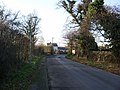
 Lydiate Lane - geograph.org.uk - 2280598.jpg 640 × 480; 133 KB
-
 M6 motorway bridge over the A49 - geograph.org.uk - 2026218.jpg 2,063 × 1,541; 603 KB
-
 M6 Motorway passing over Wigan Road - geograph.org.uk - 4615272.jpg 640 × 483; 575 KB
-
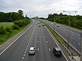 M6 motorway Preston England.jpg 1,600 × 1,200; 549 KB
-

-

-
 M6 Motorway, southbound - geograph.org.uk - 260504.jpg 640 × 480; 88 KB
-
 M6, J29 - geograph.org.uk - 4510652.jpg 640 × 412; 35 KB
-
 Path in Cuerden Valley Park - geograph.org.uk - 4615226.jpg 640 × 480; 641 KB
-
 Reflections in a pond - geograph.org.uk - 1971133.jpg 2,560 × 1,920; 1.19 MB
-
 River Lostock in Cuerden Valley - geograph.org.uk - 1971138.jpg 2,365 × 1,712; 1.54 MB
-
 Shady Lane and the junction with Berkeley Drive - geograph.org.uk - 2026197.jpg 3,042 × 2,262; 1.56 MB
-
 Shady Lane approaching the A49 - geograph.org.uk - 2026206.jpg 2,463 × 1,793; 1.24 MB
-
 Stoney Lane - geograph.org.uk - 4615275.jpg 640 × 481; 490 KB
-
 The "new" bridge over the River Lostock - geograph.org.uk - 1971154.jpg 2,122 × 1,536; 1.24 MB
-
 The sun catches a cow field - geograph.org.uk - 5473154.jpg 1,280 × 960; 311 KB
-
 The track from the car park to the River Lostock - geograph.org.uk - 3403501.jpg 4,000 × 3,000; 2.5 MB
-
 Track to the River Lostock - geograph.org.uk - 3403534.jpg 3,978 × 2,970; 2.53 MB
-
 Traffic lights at the junction of A49 and the A5083 - geograph.org.uk - 2026156.jpg 1,897 × 1,325; 661 KB
-
 Victorian walled footpath - geograph.org.uk - 1298218.jpg 640 × 480; 119 KB
-
 Views towards the River Lostock - geograph.org.uk - 3403509.jpg 4,000 × 3,000; 1.78 MB
-
 Welcome to Chorley - geograph.org.uk - 5956137.jpg 640 × 514; 61 KB
-
 Where Shady Lane joins the A49 - geograph.org.uk - 140725.jpg 640 × 480; 102 KB
-

-
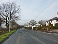
 Fletcher Road, Leyland - geograph.org.uk - 635630.jpg 640 × 480; 196 KB
-
 Motorway - geograph.org.uk - 260605.jpg 640 × 480; 64 KB


