Category:Culebra Range
English: A subrange of the Sangre de Cristo Mountains in the U.S. The Culebra Range extends from La Veta Pass in Colorado southward to Costilla Creek, just south of Big Costilla Peak in New Mexico.
Media in category "Culebra Range"
The following 27 files are in this category, out of 27 total.
-
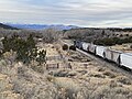
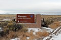 Alamosa National Wildlife Refuge.JPG 4,419 × 2,956; 10.43 MB
-
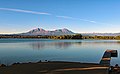
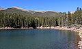 Bear Lake (Huerfano County, Colorado).JPG 5,933 × 3,567; 18.5 MB
-
 Blue Lake (Huerfano County, Colorado)—2.JPG 5,944 × 3,770; 17.43 MB
-
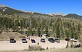 Blue Lake Day Use Area.JPG 5,814 × 3,713; 15.29 MB
-
 Cuchara Valley Airport at La Veta.JPG 5,959 × 2,864; 11.74 MB
-
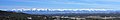 Culebra Peak panorama.jpg 4,272 × 727; 1.57 MB
-
 Culebra Range of Sangre de Cristo Mountains (49805983753).jpg 2,400 × 3,600; 4.34 MB
-
 Culebra Range of Sangre de Cristo Mountains 2 (49806535526).jpg 3,600 × 2,400; 4.5 MB
-
 Culebra Range of Sangre de Cristo Mountains 3 (49805984138).jpg 3,600 × 2,400; 4.39 MB
-
-
 Detroit Photographic Company (0241).jpg 1,536 × 1,148; 309 KB
-
 Horseshoe Lake at Lathrop State Park (Huerfano County, Colorado).JPG 4,288 × 2,662; 12 MB
-
 La Veta from above.JPG 4,896 × 3,019; 9.02 MB
-
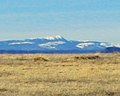 Little Costilla Peak.jpg 300 × 240; 21 KB
-

-
 Navajo Trail road sign.JPG 5,076 × 3,651; 13.1 MB
-
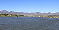
 North Lake (Las Animas County, Colorado).JPG 5,654 × 3,280; 11.3 MB
-
 Red flag warning.JPG 3,474 × 1,803; 3.47 MB
-
 Spring Creek Fire burn scar.JPG 5,937 × 2,817; 10.34 MB
-
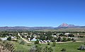
 Torres, Colorado.JPG 6,000 × 3,308; 10.24 MB
-
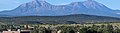
 Trinchera Peak.jpg 4,272 × 1,991; 4.33 MB
-
 Variable-message road sign in Huerfano County.JPG 3,650 × 1,924; 3.64 MB
-
 Wahatoya Lake Reservoir.JPG 5,881 × 2,988; 9.86 MB
-
 Walsenburg and the Spanish Peaks (cropped) (cropped).JPG 1,367 × 196; 323 KB
-
 Walsenburg and the Spanish Peaks (cropped).JPG 1,709 × 477; 977 KB
-
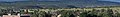
 Walsenburg and the Spanish Peaks.JPG 2,719 × 1,616; 4.39 MB
-
 Walsenburg Banner.JPG 1,709 × 244; 562 KB

.JPG)
%E2%80%942.JPG)


.jpg)
.jpg)
.jpg)

.jpg)
.JPG)


.JPG)


_(cropped).JPG)
.JPG)