Category:Cycle barriers

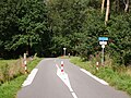
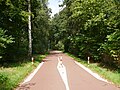
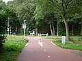
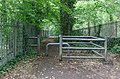
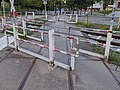
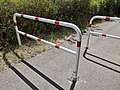
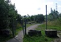
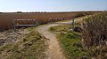
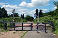
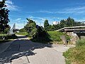
English: While Category:Pedestrian barriers are barriers to pedestrians, cycle barriers are, perhaps counterintuitively, sometimes intended to permit access by cyclists to cycle routes while denying access to other (usually larger) vehicles. However, not all cycles are able to pass through them. In the United Kingdom, this problem is recognised in policy guidelines Para 8.14.
Alternately, these barriers positioned along paths, footways, cycleways or tracks may also be intended to either slow cycle access or prevent it entirely depending on spacing and layout.
See also https://wiki.openstreetmap.org/wiki/Key:cycle_barrier
Subcategories
This category has the following 2 subcategories, out of 2 total.
A
- A-frame cycle barriers (14 F)
C
Media in category "Cycle barriers"
The following 71 files are in this category, out of 71 total.
-
 2021-09-19 MaasWaalpad Bosweg (1).jpg 4,592 × 3,448; 8.04 MB
-
 2021-09-19 MaasWaalpad Bosweg (5).jpg 4,592 × 3,448; 8.19 MB
-
 2021-09-19 MaasWaalpad kruising Groesbeekseweg.jpg 4,592 × 3,448; 8.11 MB
-
 Access from Low Road - geograph.org.uk - 593445.jpg 640 × 427; 69 KB
-
 Aire de Jeux Jacques Cartier à Élancourt le 5 juillet 2017 - 06.jpg 5,184 × 3,456; 11.95 MB
-
 Barriers at Bromborough road entrance.jpg 5,032 × 3,295; 28.19 MB
-
 Barriers at Port Sunlight entrance.jpg 3,462 × 5,198; 23.73 MB
-
 Barrière anti-2 roues motorisées, La Défense.jpg 4,032 × 3,024; 6.48 MB
-
 Barrière du jardin de la mairie de Conflans-sur-Anille le 6 janvier 2020.jpg 6,000 × 4,000; 11.64 MB
-
 Barrière à vélo sur le boulevard du Docteur Gigon à Saint-Calais le 18 avril 2018.jpg 6,000 × 4,000; 11.2 MB
-
 Bicycle barrier 2.JPG 4,000 × 3,000; 5.42 MB
-
 Bicycle barrier.JPG 4,000 × 3,000; 6.87 MB
-
 Brookfield Park - geograph.org.uk - 616233.jpg 640 × 480; 76 KB
-
 Bushaltestellen Parower Chaussee 2023-11-24.jpg 5,472 × 3,648; 7.46 MB
-
 Cycle barrier at a railway crossing 2.jpg 4,000 × 3,000; 3.05 MB
-
 Cycle barrier at a railway crossing.jpg 4,000 × 3,000; 3.77 MB
-
 Cycle barrier fixed.jpg 3,000 × 4,000; 3.72 MB
-
 Cycle barrier IMG 20200322 160450467 HDR smial wp.jpg 3,024 × 4,032; 6.86 MB
-
 Cycle barrier railway crossing colour-edited.jpg 4,000 × 3,000; 4.47 MB
-
 Cycle barrier railway crossing detailed view.jpg 3,000 × 4,000; 4.68 MB
-
 Cycle barrier railway crossing.jpg 4,000 × 3,000; 4.48 MB
-
 Cycle barrier removable 1.jpg 4,000 × 3,000; 3.56 MB
-
 Cycle barrier removable 2.jpg 4,000 × 3,000; 5.11 MB
-
 Cycle barrier removable close view.jpg 3,968 × 2,976; 6.61 MB
-
 Cycle barrier removable detail.jpg 4,000 × 3,000; 4.69 MB
-
 Cycle barrier removable total view.jpg 3,968 × 2,976; 6.88 MB
-
 Cycle barrier single removable detail.jpg 3,024 × 3,000; 2.87 MB
-
 Cycle barrier single removable.jpg 4,000 × 3,000; 4.63 MB
-
 Cycle path at Hardy Farm, Hardy Lane - geograph.org.uk - 447383.jpg 640 × 426; 135 KB
-
 Cycle path crosses a back road - geograph.org.uk - 68990.jpg 640 × 469; 102 KB
-
 Cycle route along an old railway line - geograph.org.uk - 255491.jpg 640 × 480; 75 KB
-
 Cycleway along Által-ér stream 06.jpg 4,000 × 3,000; 6.51 MB
-
 Cycleway at Higher Ferry - geograph.org.uk - 288604.jpg 480 × 640; 203 KB
-
 Cykelchikane 2.jpg 4,000 × 3,000; 6.72 MB
-
 Cykelchikane.jpg 4,000 × 3,000; 5.96 MB
-

-
 Entrance to Halebank Park on Halebank Road.jpg 5,184 × 3,456; 9.51 MB
-
 Entrance to the Brampton Valley Way - geograph.org.uk - 223423.jpg 640 × 480; 86 KB
-
 Fietsbarrière - panoramio.jpg 2,592 × 1,456; 2 MB
-
 Footbridge over M60 at Denton - geograph.org.uk - 1485107.jpg 640 × 449; 120 KB
-
 Fußgängerunterführung Parkstraße (Freising).jpg 4,032 × 3,024; 5.09 MB
-
 Greystone Road rail bridge 1.jpg 5,082 × 3,804; 8.73 MB
-
 Greystone Road rail bridge 2.jpg 4,524 × 3,510; 7.28 MB
-
 Haswell to Hart cycle track - geograph.org.uk - 1436850.jpg 640 × 441; 85 KB
-

-

-
 Hertford Union Canal - geograph.org.uk - 112860.jpg 640 × 480; 110 KB
-
 Kniepertor mit Durchblick auf die Knieperstraße 2023-11-24.jpg 5,472 × 3,648; 6.47 MB
-
 Lakolksti bomme.jpg 1,920 × 1,080; 931 KB
-
 Le Creusot bramka rowerowa.jpg 5,184 × 3,456; 8.92 MB
-
 Limours le 12 août 2016 - 04.jpg 5,184 × 3,456; 8.73 MB
-
 Lydiate Lane bridge 2.jpg 5,152 × 3,864; 7.38 MB
-
-
 NCR 5 access at St. Johns Close - geograph.org.uk - 1439305.jpg 425 × 640; 136 KB
-
 New cycle track, Brixham - geograph.org.uk - 1283547.jpg 640 × 468; 115 KB
-
 Okell Drive entrance to Halewood Park Triangle.jpg 5,022 × 3,516; 8.98 MB
-
 Parc des Coudrays à Élancourt le 4 juillet 2017 - 55.jpg 5,184 × 3,456; 9.39 MB
-
 Parkstraße Höhe Fußgängerunterführung (Freising).jpg 4,032 × 3,024; 4.16 MB
-
 Passerelle du bv Alexandre-Ier, Vichy - dispositif anti 2 roues.jpg 4,032 × 1,960; 2.88 MB
-
 Path at Haymeads Lane - geograph.org.uk - 954644.jpg 640 × 480; 63 KB
-
 Path from Halewood Park Triangle to Okell Drive.jpg 4,656 × 3,654; 8.28 MB
-
 Rückseite Kniepertor von der Knieperstraße aus Bild 1 2023-11-24.jpg 5,472 × 3,648; 5.63 MB
-
 Rückseite Kniepertor von der Knieperstraße aus Bild 2 2023-11-24.jpg 5,472 × 3,648; 7.12 MB
-
 South from Ellon - geograph.org.uk - 508875.jpg 480 × 640; 72 KB
-
 Square Jean Moulin de Limours le 12 août 2016 - 18.jpg 5,184 × 3,456; 8.38 MB
-

-

-

-

-
 Track and public footpath - geograph.org.uk - 626092.jpg 640 × 359; 123 KB
-
 Žernosecká, Ďáblický háj, vstup od Svornosti.jpg 5,184 × 3,888; 7.59 MB
.jpg)
.jpg)


.jpg)


.jpg)


_at_Pont_Berw_-_geograph.org.uk_-_515170.jpg)


