Category:Cycling infrastructure in London
Most populous urban areas of the world: Barcelona [ES] · Kuala Lumpur [MY] · London [GB] · Moscow [RU] · Nagoya [JP] · Paris [FR] · Saint Petersburg [RU] · Santiago [CL] · Singapore [SG] · Tehran [IR] · Tokyo [JP]
Subcategories
This category has the following 8 subcategories, out of 8 total.
Media in category "Cycling infrastructure in London"
The following 40 files are in this category, out of 40 total.
-
 Bicycle-storage-Kennington.jpg 6,500 × 5,533; 9.55 MB
-
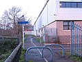
 Cycle entrance to Pages Walk - geograph.org.uk - 1405301.jpg 640 × 480; 129 KB
-
 Cycle lane on Blackwall Road - geograph.org.uk - 1572222.jpg 640 × 480; 111 KB
-
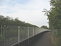
 Cycle path alongside Elmstead Lane - geograph.org.uk - 1655626.jpg 640 × 480; 359 KB
-
 Cycle path Hyde Park - geograph.org.uk - 976172.jpg 500 × 375; 84 KB
-

-
 Cycle Path Near the Millennium Dome - geograph.org.uk - 1467215.jpg 640 × 428; 80 KB
-
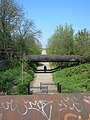
 Cycle path under the DLR viaduct - geograph.org.uk - 1496078.jpg 640 × 480; 298 KB
-
 Cycle path, Lower Sydenham - geograph.org.uk - 1633883.jpg 640 × 480; 79 KB
-
 Cycle Route going under Lea Bridge Road - geograph.org.uk - 403566.jpg 480 × 640; 112 KB
-
 Cycle superhighway, Westminster Bridge.jpg 5,248 × 3,936; 6.08 MB
-
 Cycle Track in Friary Park - geograph.org.uk - 71920.jpg 640 × 480; 91 KB
-
 Cycle Track, Bramley Road, Enfield - geograph.org.uk - 735336.jpg 640 × 426; 152 KB
-
 Cycle Track, Bramley Road, London N14 - geograph.org.uk - 943614.jpg 640 × 429; 85 KB
-

-
 Cycle Track, Slades Hill, Enfield - geograph.org.uk - 732331.jpg 421 × 640; 97 KB
-
 Cycle Track, Slades Hill, Enfield - geograph.org.uk - 732339.jpg 640 × 426; 136 KB
-
 Cycleway alongside the A2 at Eltham - geograph.org.uk - 1297340.jpg 640 × 480; 77 KB
-
 Cycling Along the Dollis Valley - geograph.org.uk - 1071117.jpg 640 × 427; 177 KB
-
 Cycling over blue at Harmood Street 2.jpg 3,359 × 2,624; 2.87 MB
-
 Cyclist traffic light at the oval.jpg 1,335 × 3,592; 1.02 MB
-
 Cykelbox London.jpg 1,136 × 852; 248 KB
-
 Eastern City of London 08.03.2013 16-09-13.JPG 3,648 × 2,736; 4.15 MB
-
 Edith Nesbit Walk, Eltham - geograph.org.uk - 1297367.jpg 640 × 480; 152 KB
-
 Finsbury Park Bus Station - geograph.org.uk - 3042736.jpg 640 × 482; 95 KB
-

-
 IslandBusStop-CycleSuperhighwayStratford-London-P1300681.JPG 3,648 × 2,736; 2.94 MB
-
 IslandBusStop-CycleSuperhighwayStratford-London-P1300688.JPG 4,320 × 3,240; 5.4 MB
-
 IslandBusStop-CycleSuperhighwayStratford-London-P1300692.JPG 3,648 × 2,736; 2.97 MB
-
 IslandBusStop-CycleSuperhighwayStratford-London-P1300696.JPG 3,648 × 2,736; 2.84 MB
-
 Leytonstone to Redbridge Cycle Path - geograph.org.uk - 574007.jpg 640 × 480; 95 KB
-
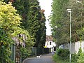
 Meadow Road SW8 (1) - geograph.org.uk - 165881.jpg 640 × 480; 130 KB
-
 New cycle path for the A2 on Blackheath - geograph.org.uk - 1540532.jpg 640 × 480; 107 KB
-
 Pool River and National Cycle Route 21 - geograph.org.uk - 96626.jpg 640 × 480; 125 KB
-
 Ryder Drive, South Bermondsey - geograph.org.uk - 1449536.jpg 640 × 480; 147 KB
-

-
 St Mark's Church, North Downham - geograph.org.uk - 406269.jpg 640 × 383; 31 KB
-
 The Ornamental Canal, Wapping - geograph.org.uk - 945195.jpg 640 × 480; 146 KB
-
 TUCANCrossing.jpg 800 × 479; 50 KB
-
 Underneath the arches - geograph.org.uk - 1017258.jpg 640 × 480; 109 KB


_-_geograph.org.uk_-_165881.jpg)


